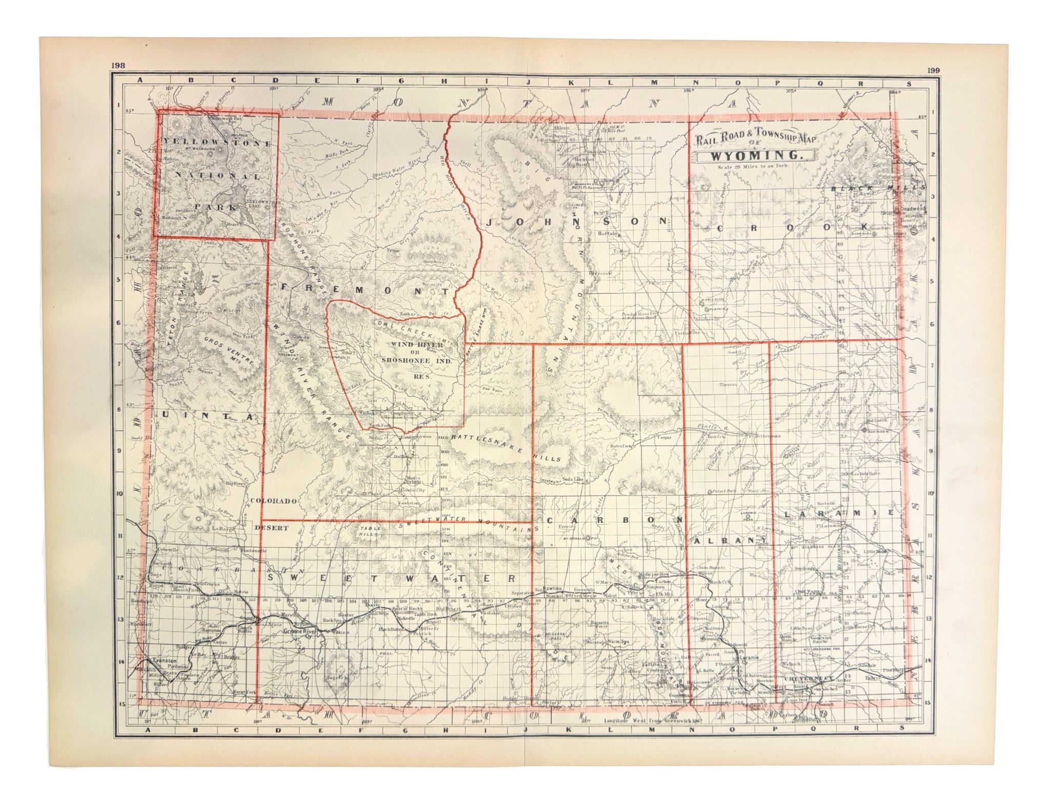
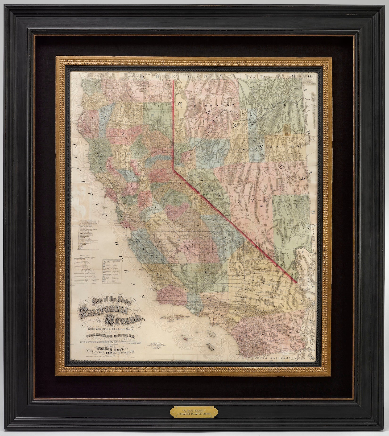
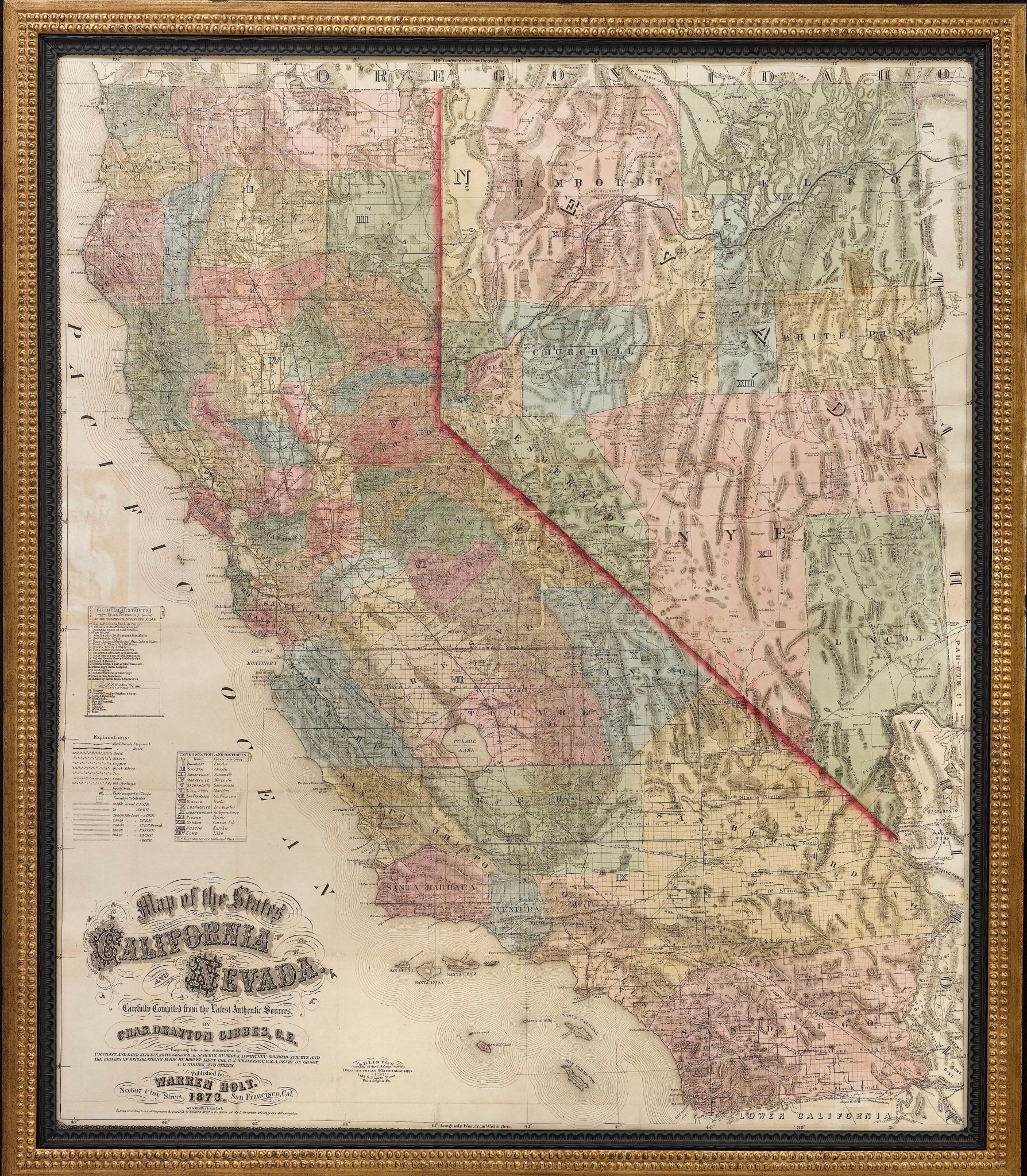
1885 "Rail Road and Township Map of Wyoming" by George Cram
Sale price$900.00
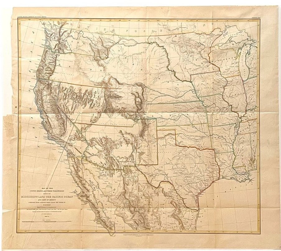
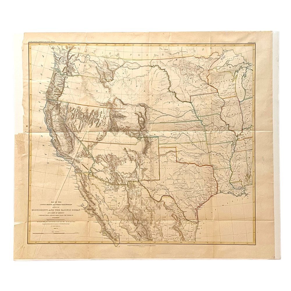
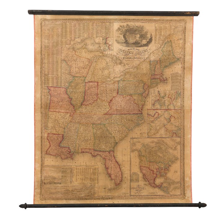
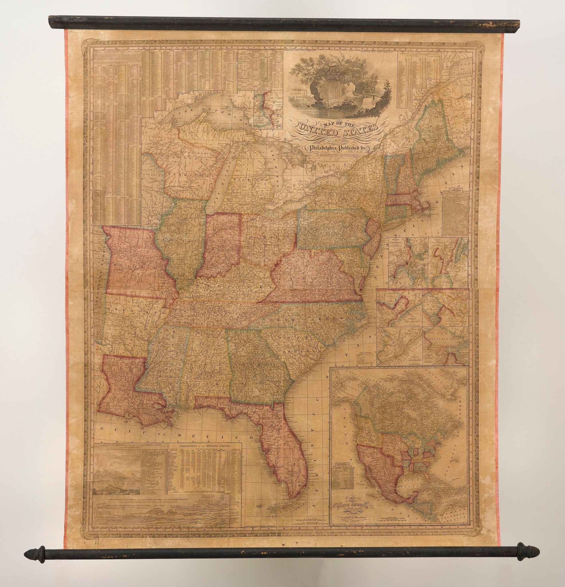
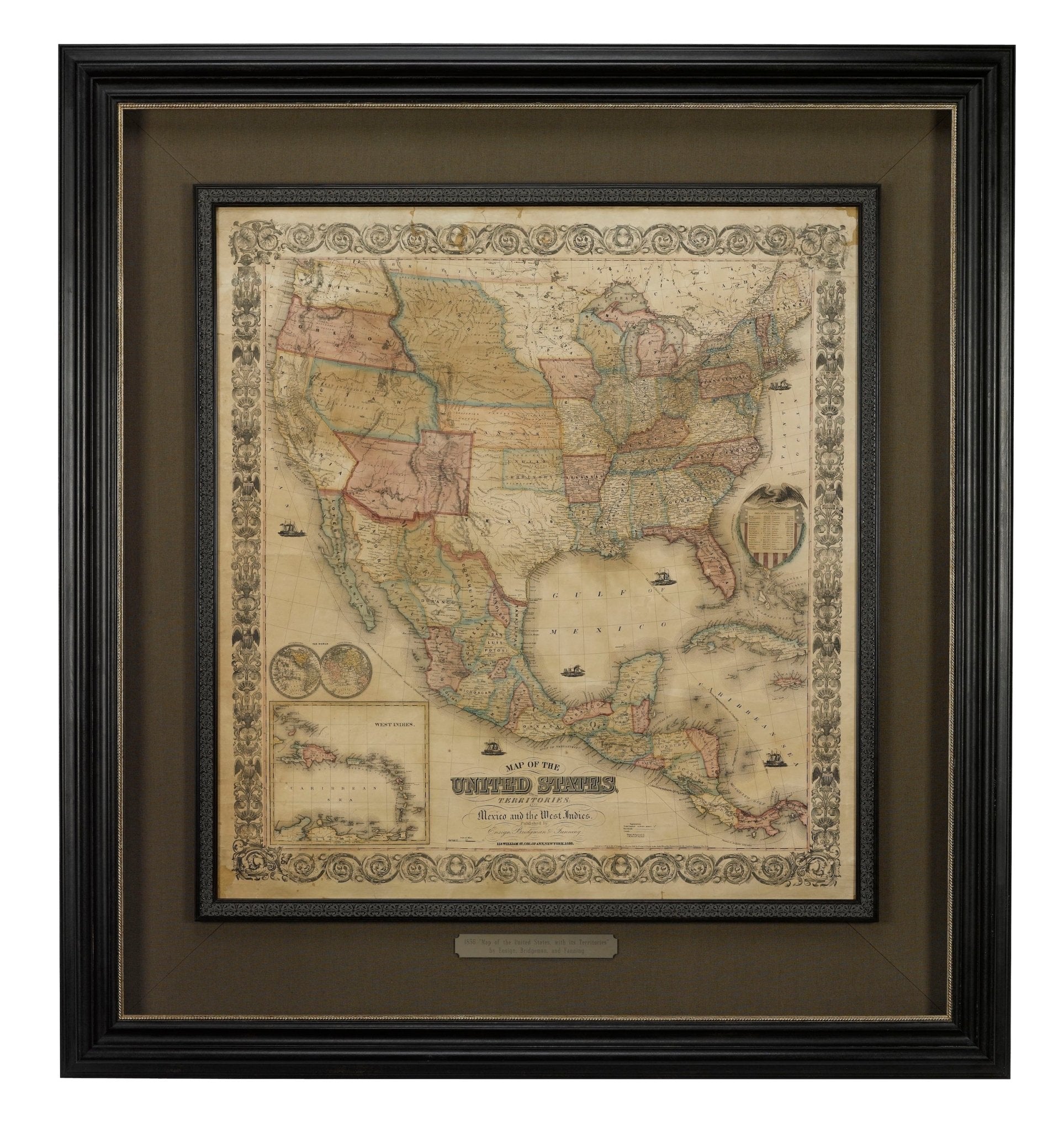
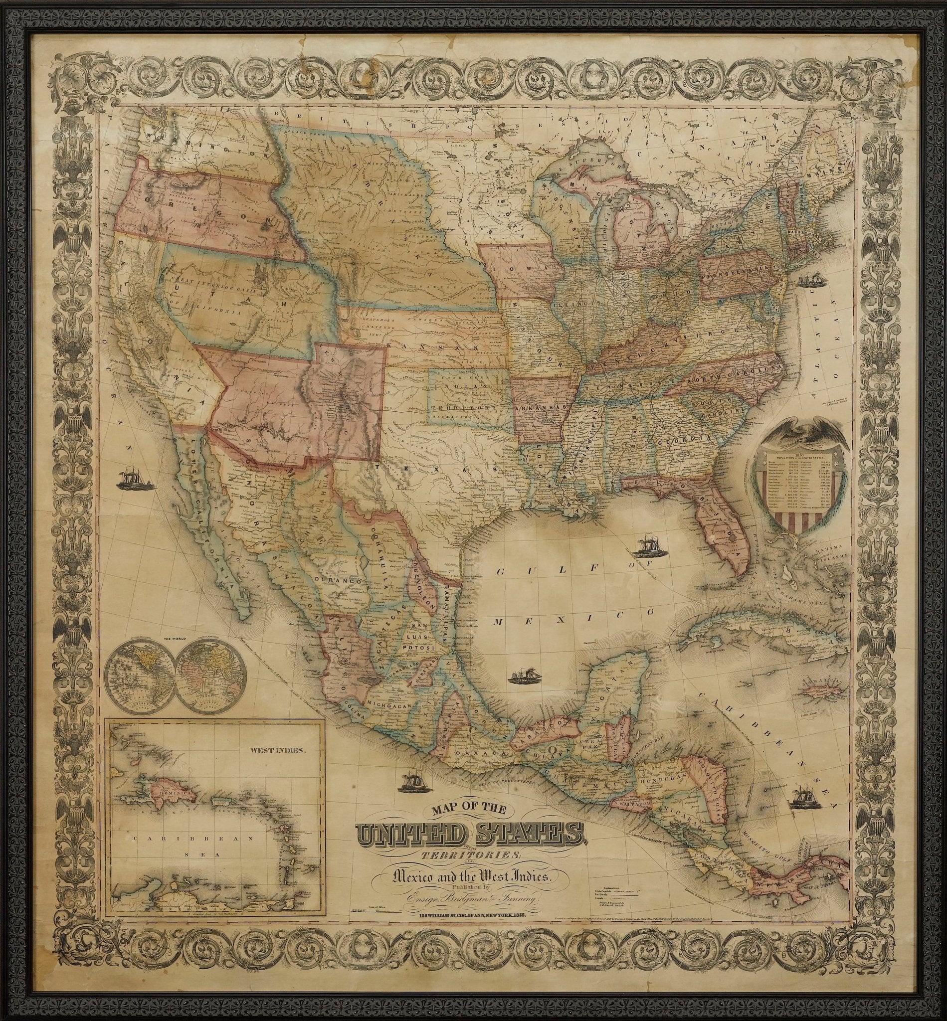
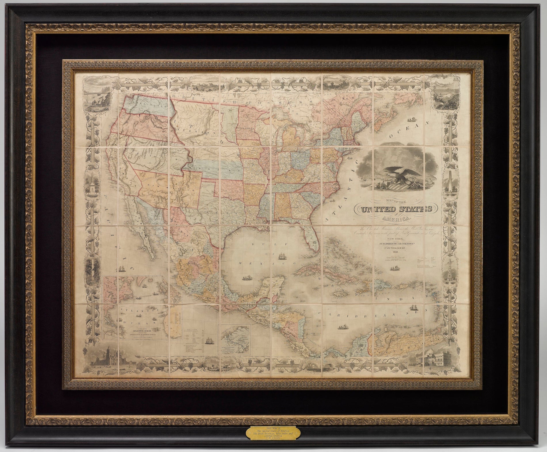
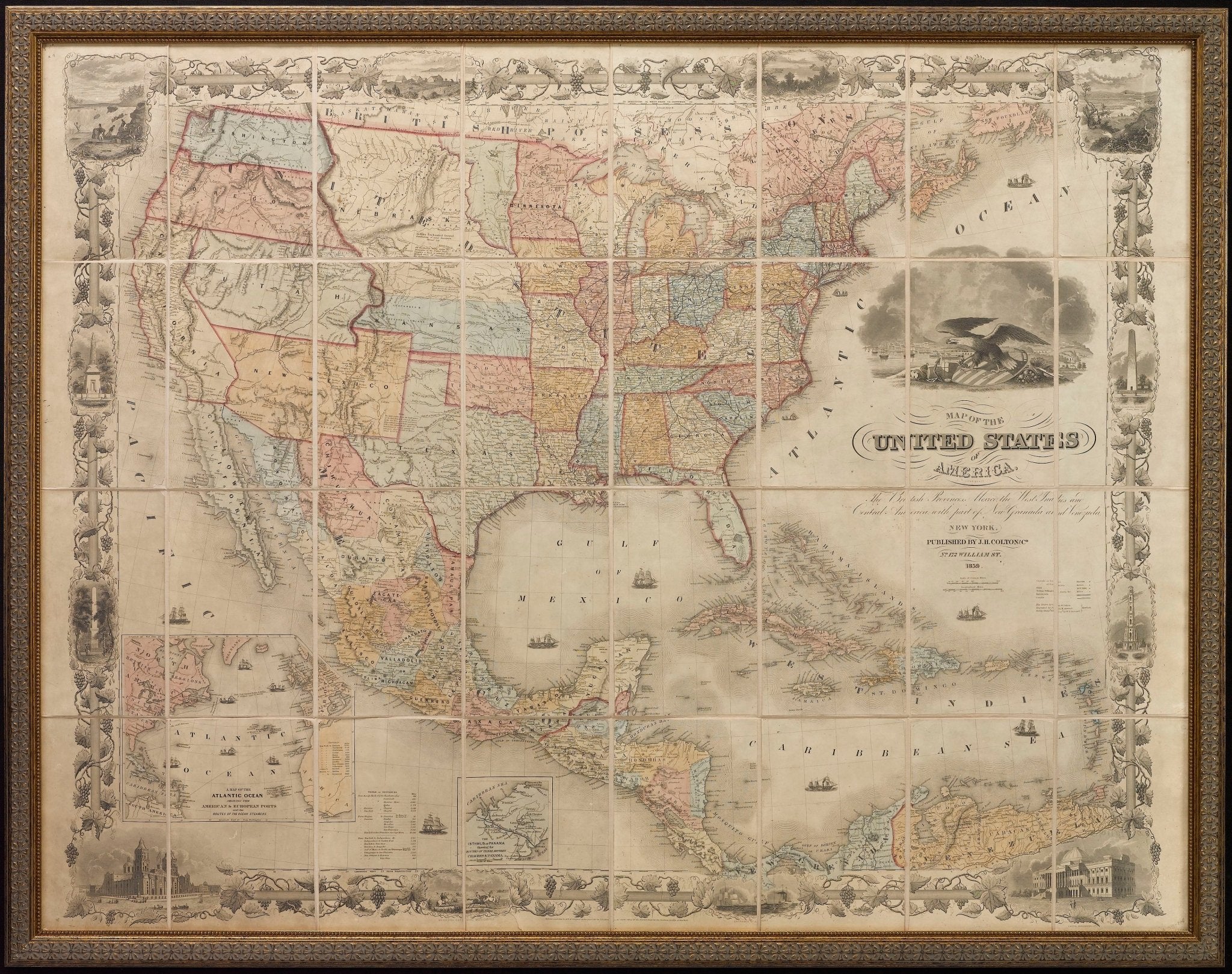
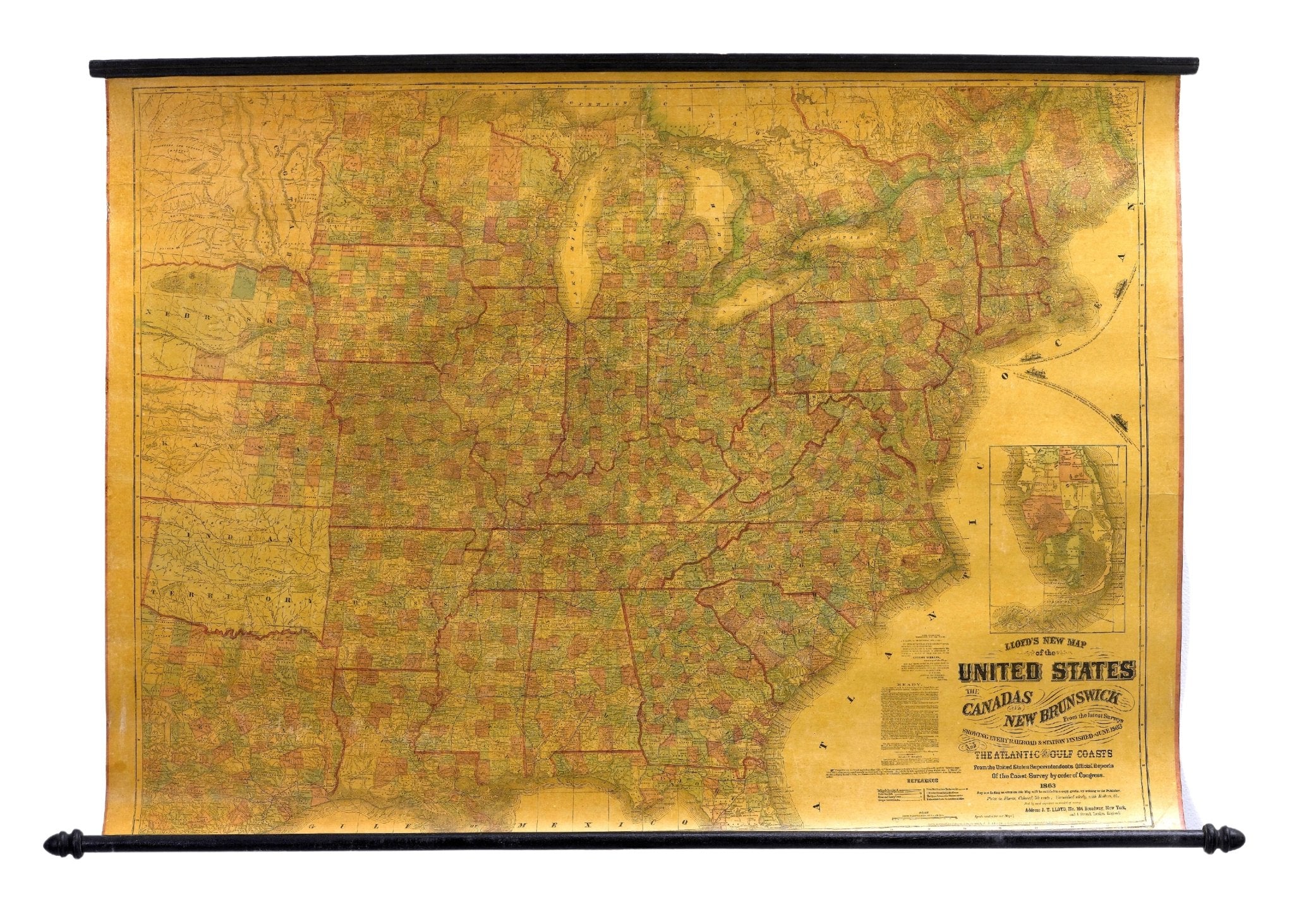
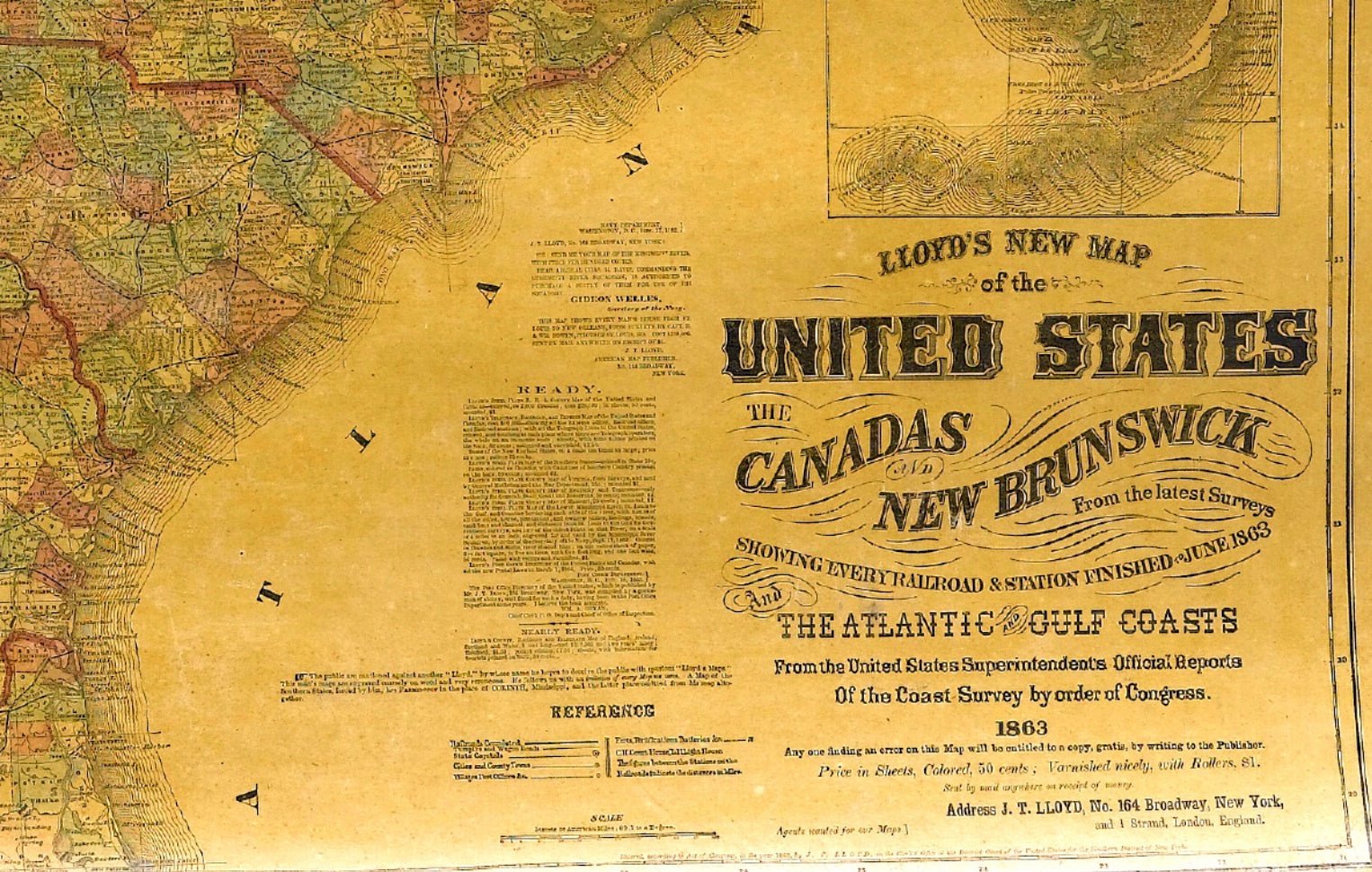
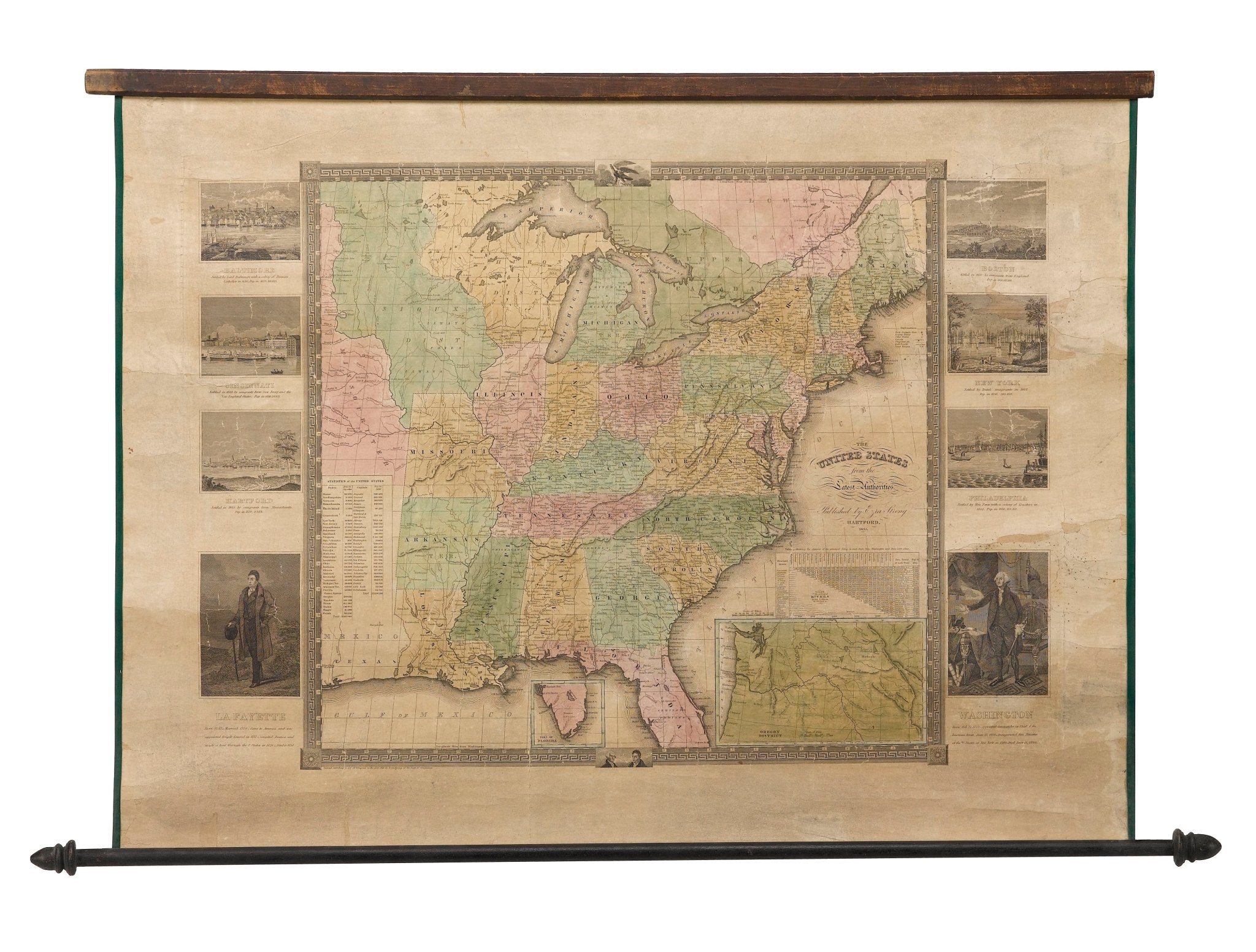
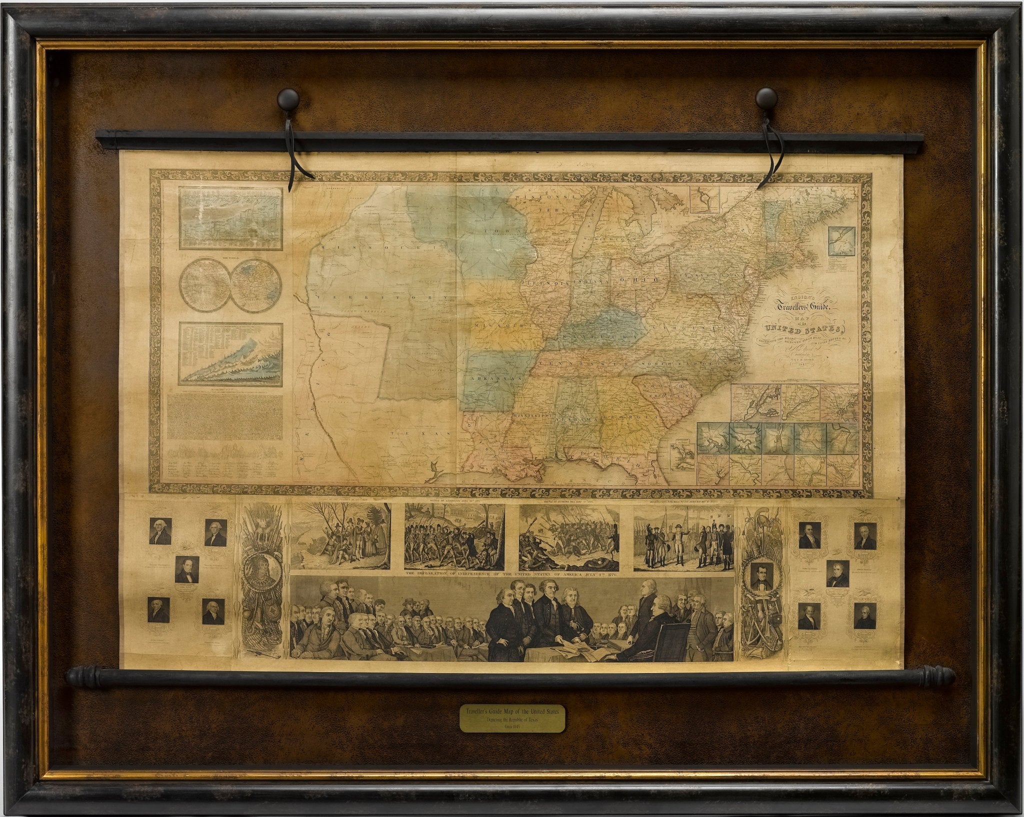
"Map of the United States and Their Territories" by Thomas Jekyll, 1857-8
Sale price$2,250.00
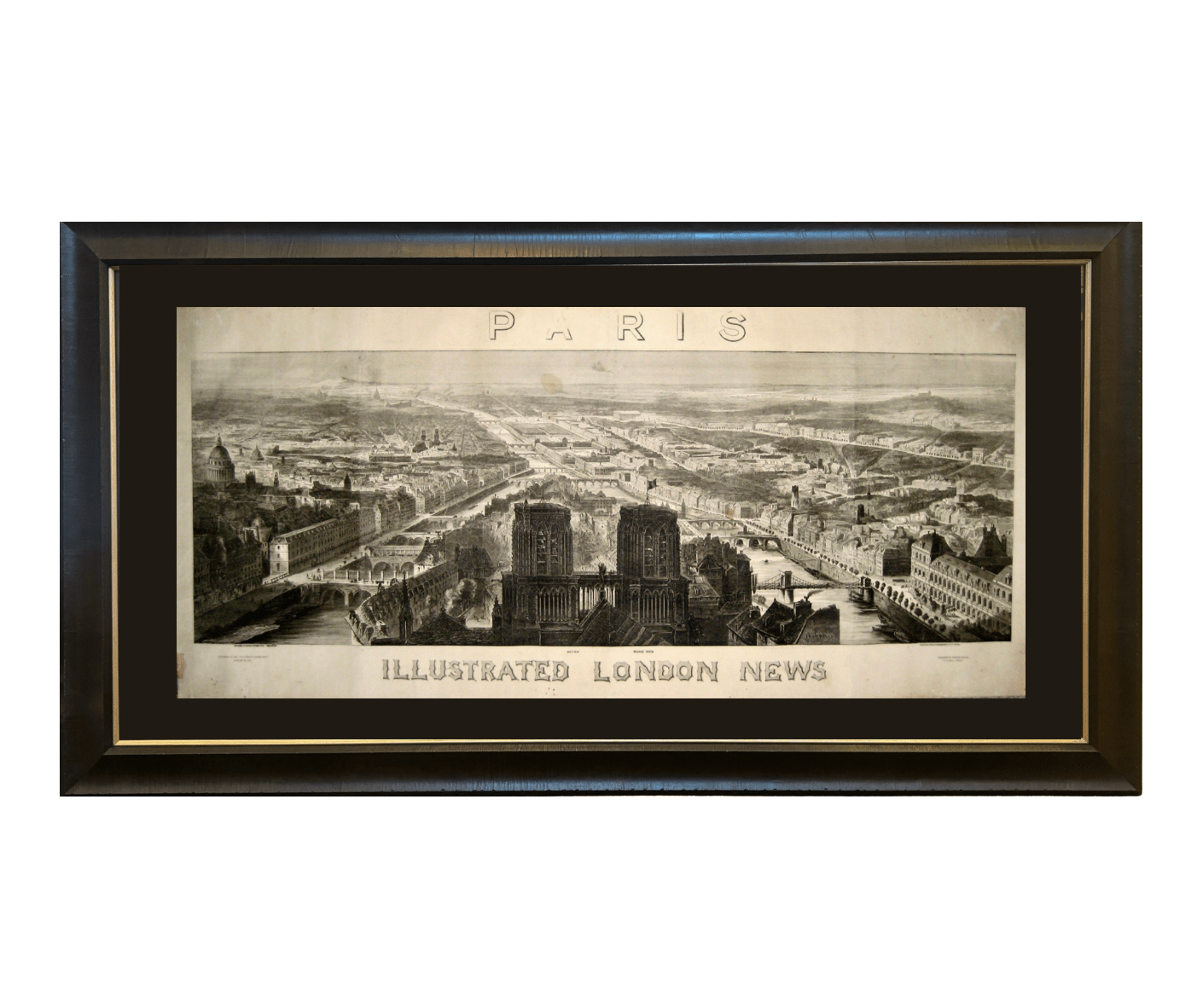

1848 "Paris" Bird's Eye View, Published by the Illustrated London News
Sale price$3,750.00
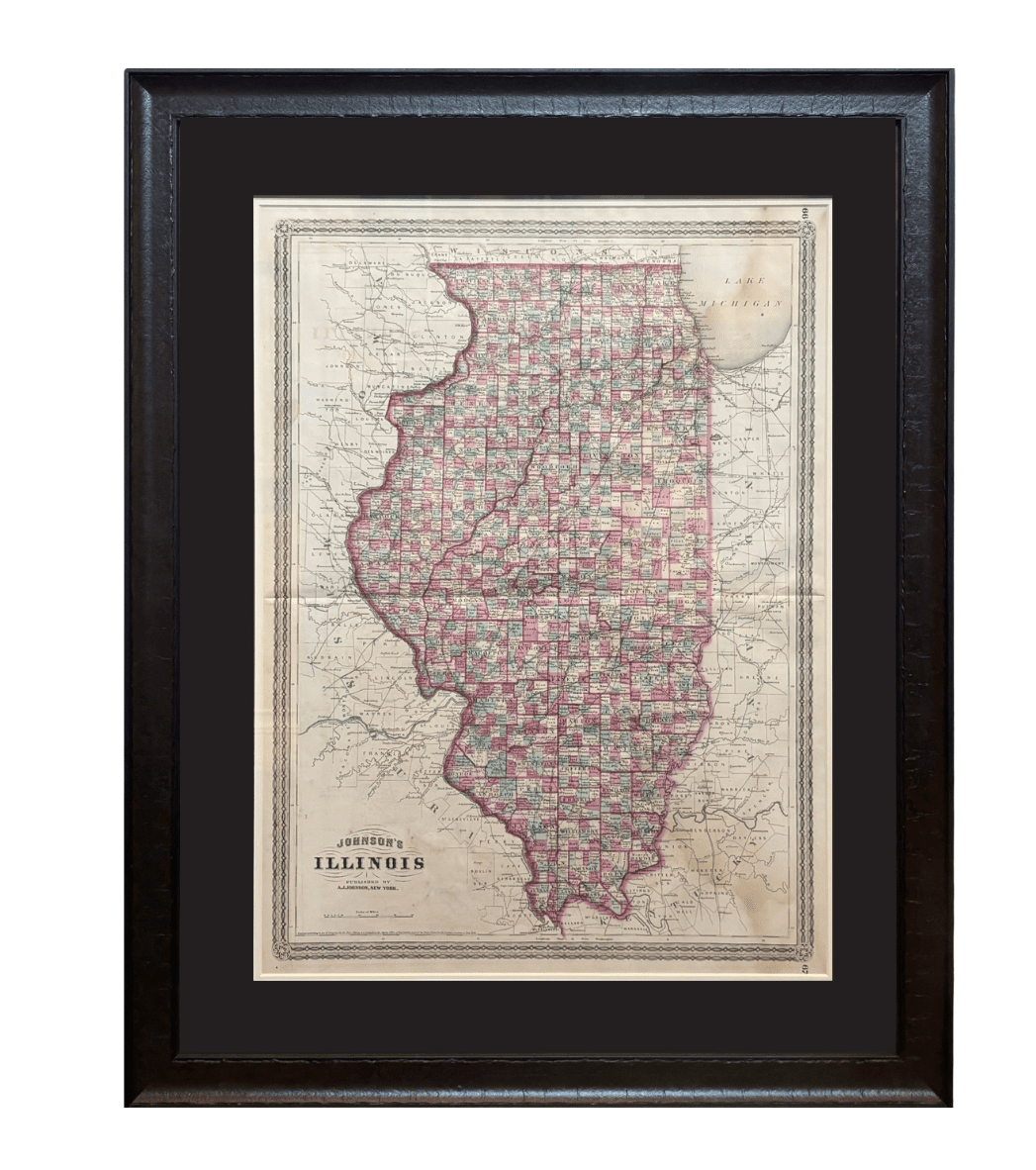

1870 "Johnson's Illinois" Map Published by A. J. Johnson
Sale price$1,500.00

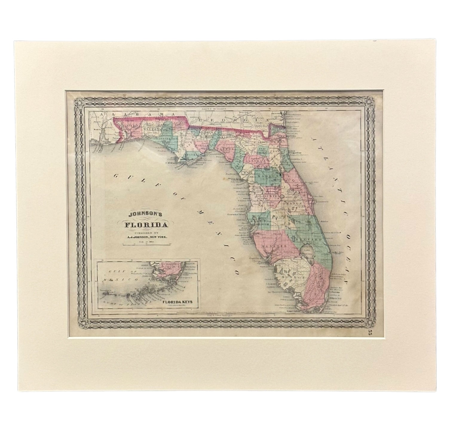

1870 "Johnson's Florida" Map Published by A. J. Johnson
Sale price$750.00


1870 "Johnson's Europe" Map Published by A. J. Johnson
Sale price$1,250.00
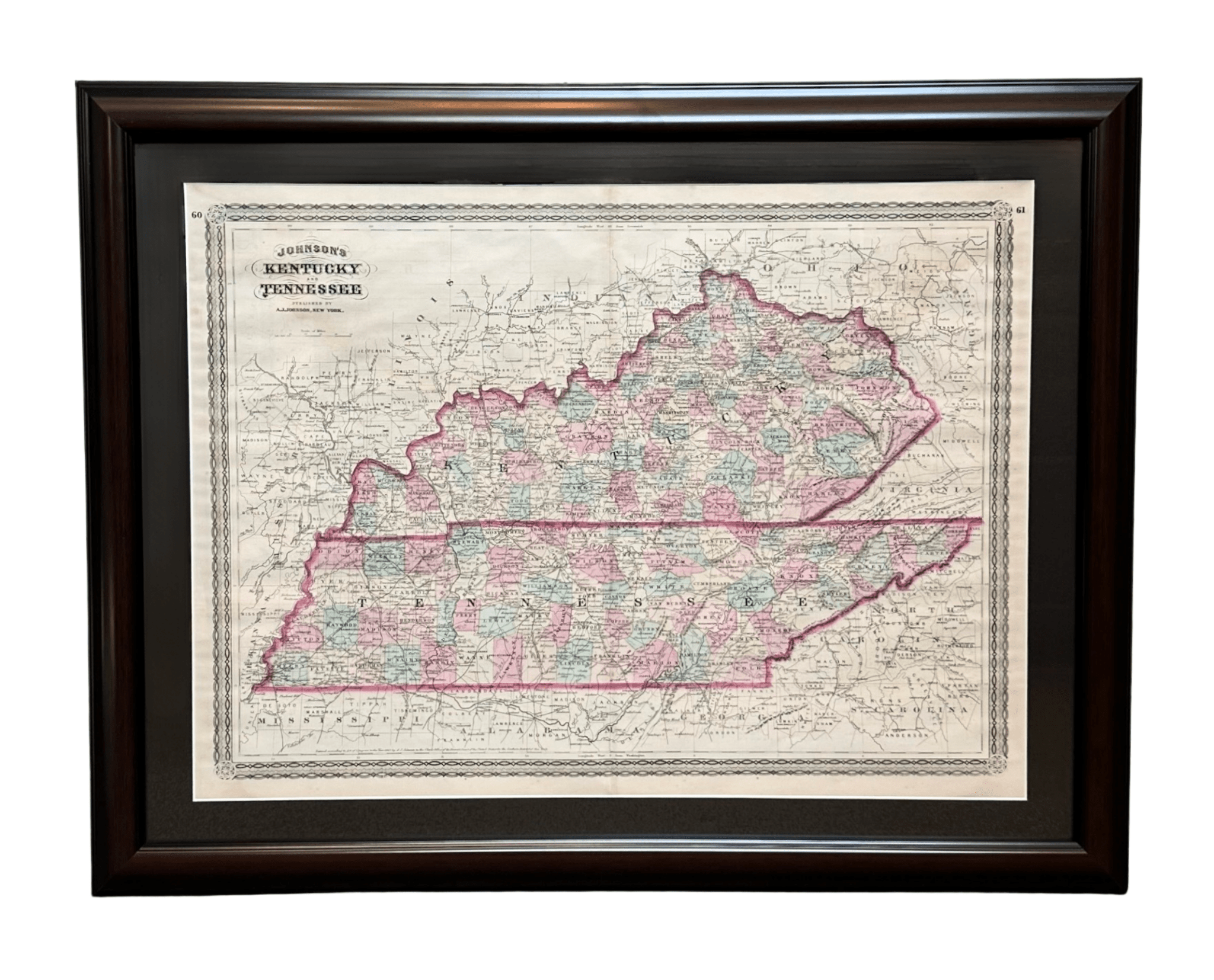
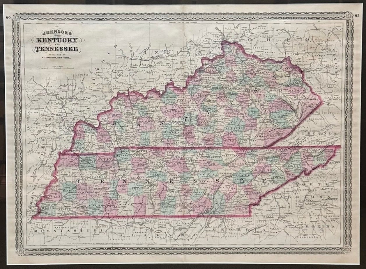
1870 "Johnson's Kentucky and Tennessee" Published by A. J. Johnson
Sale price$995.00
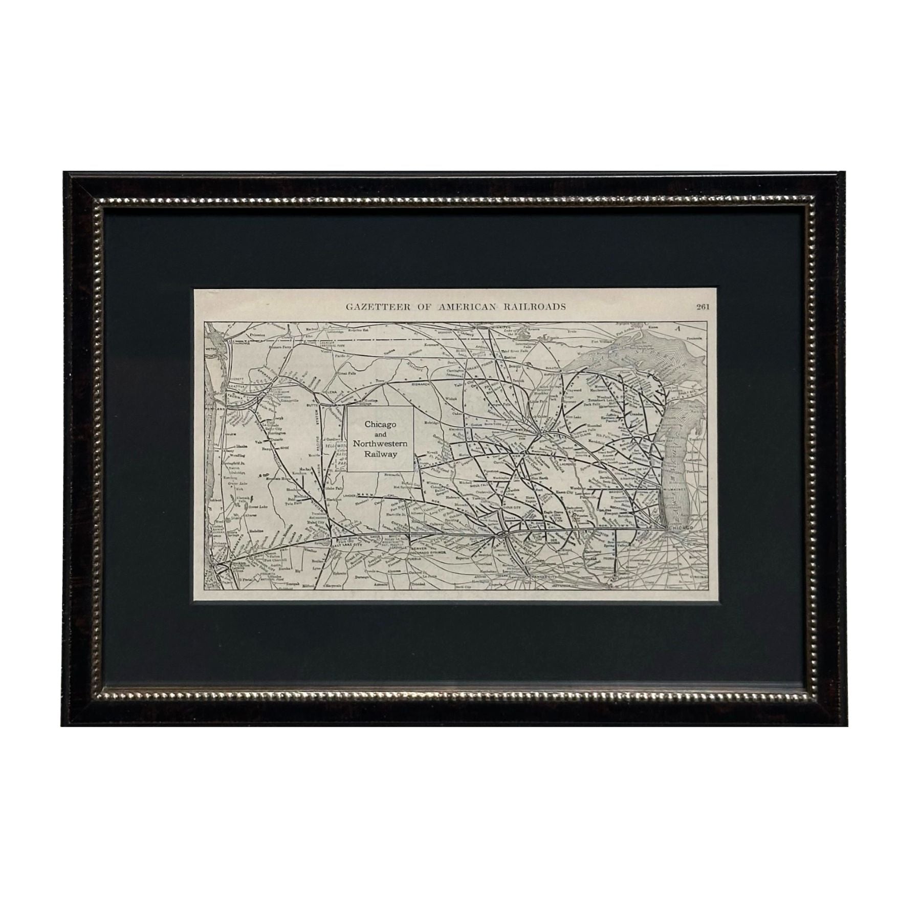
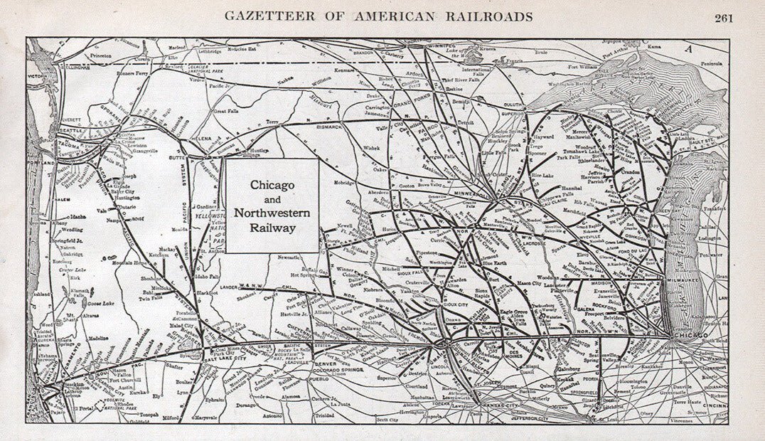
1919 "Chicago and Northwestern Railway" Map by P. F. Collier & Son
Sale price$550.00
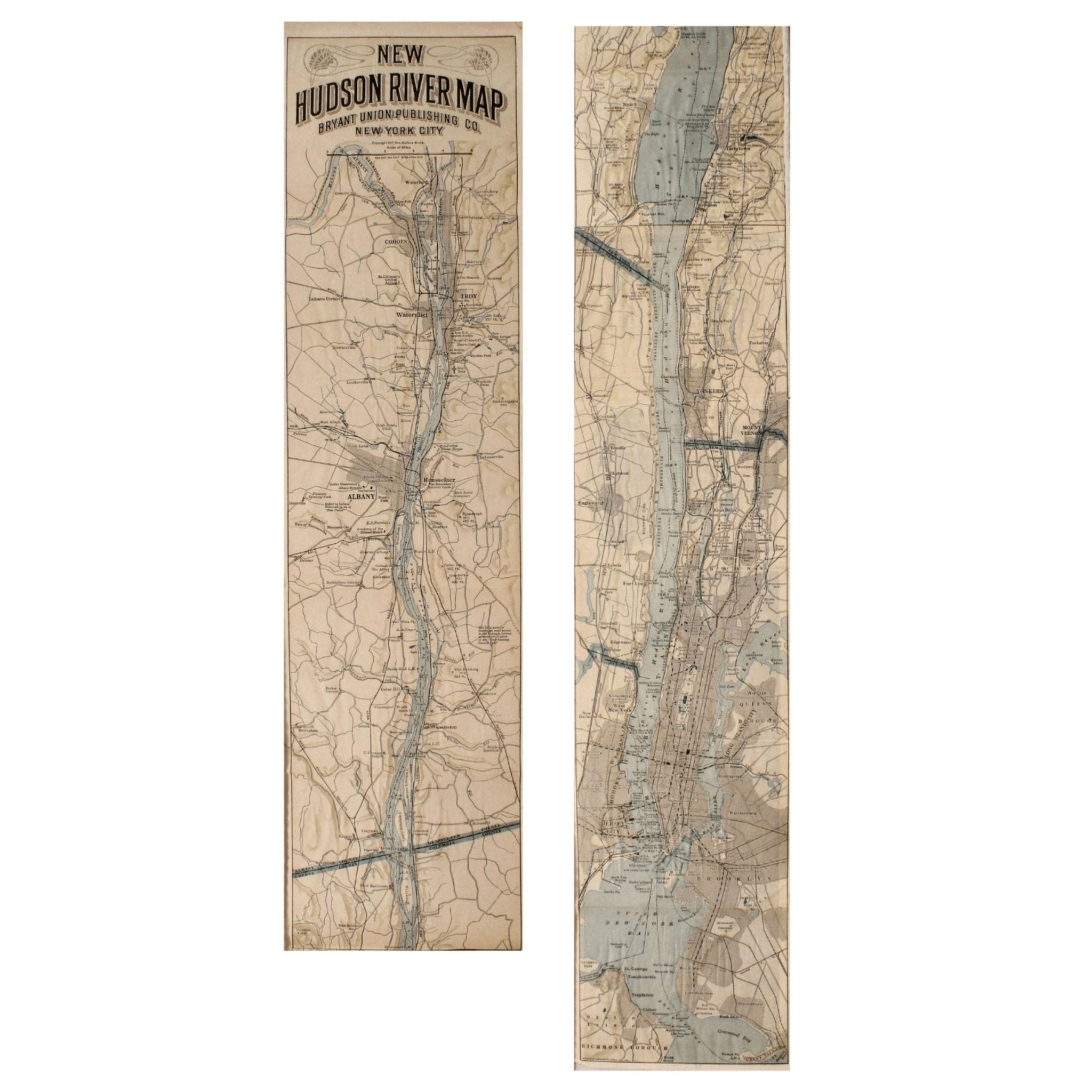
1917 "New Hudson River Map" by Wallace Bruce, Later Edition
Sale price$550.00
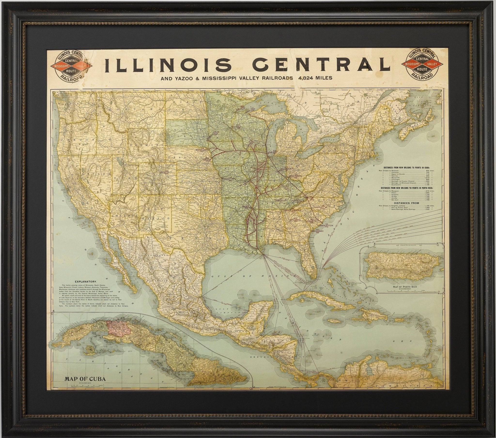
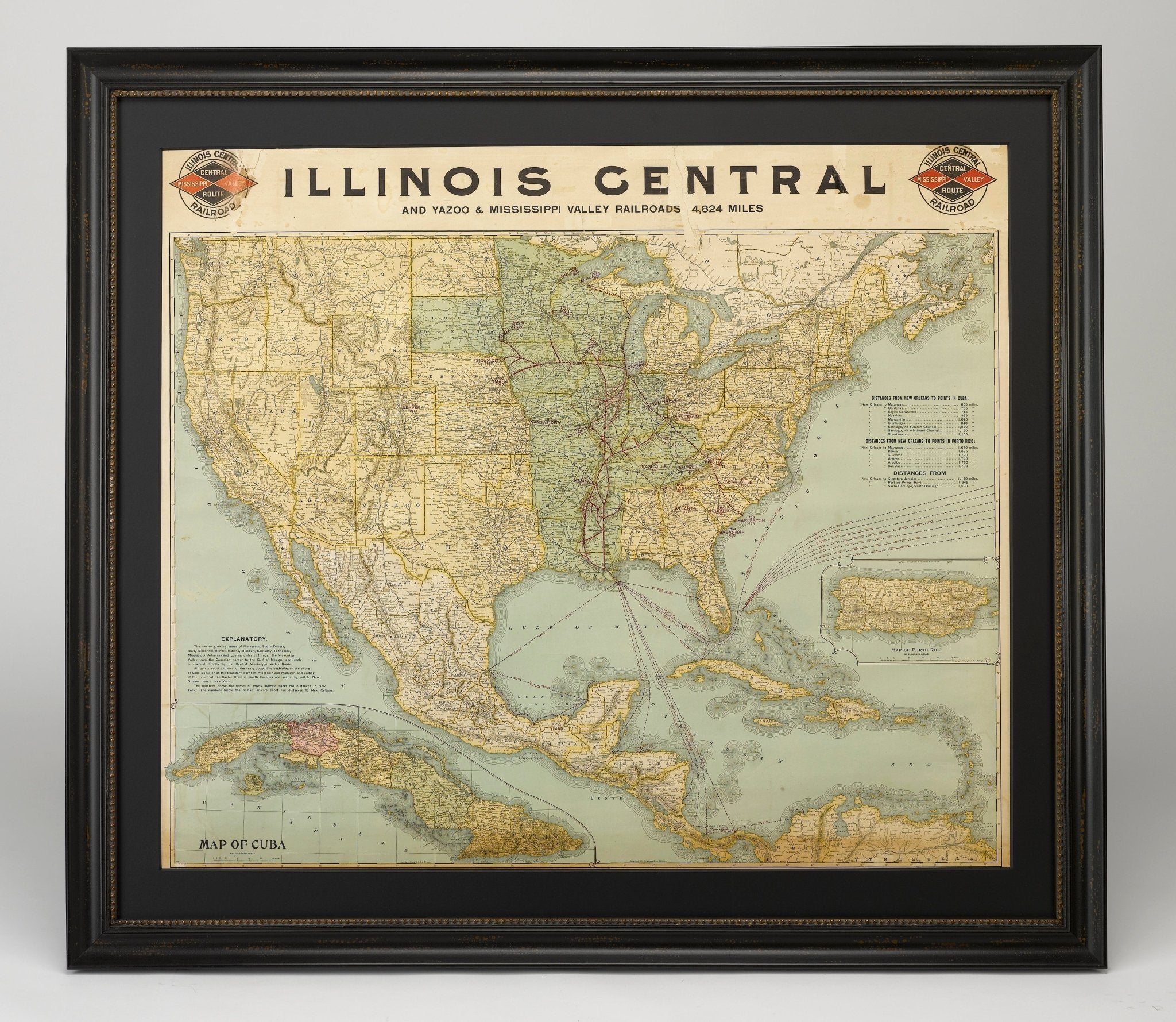
1899 Poole Brothers Railroad Map of the Illinois Central Railroad
Sale price$7,950.00
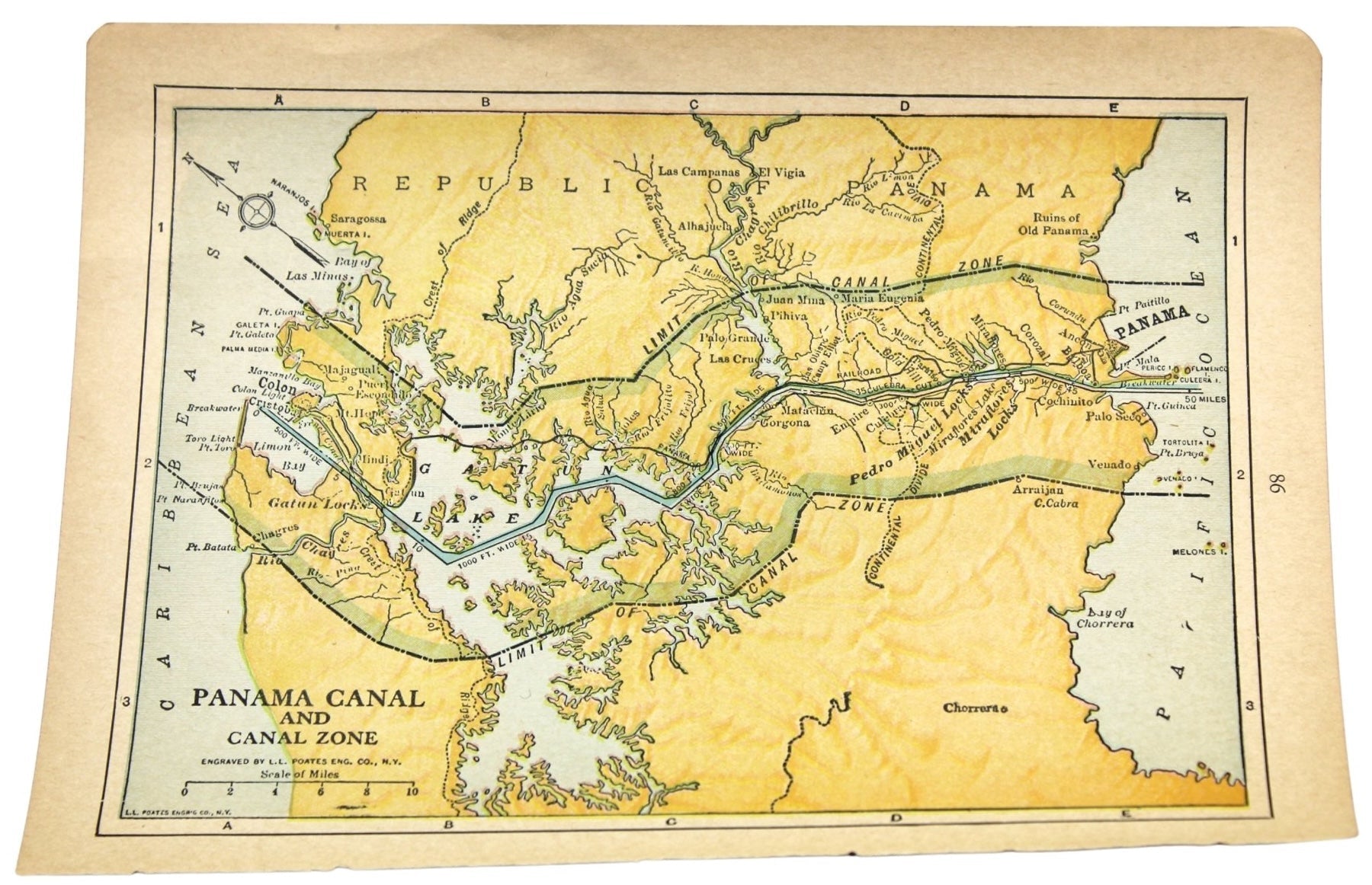
1936 "Panama Canal and Canal Zone" Map, Engraved by L.L. Poates
Sale price$425.00
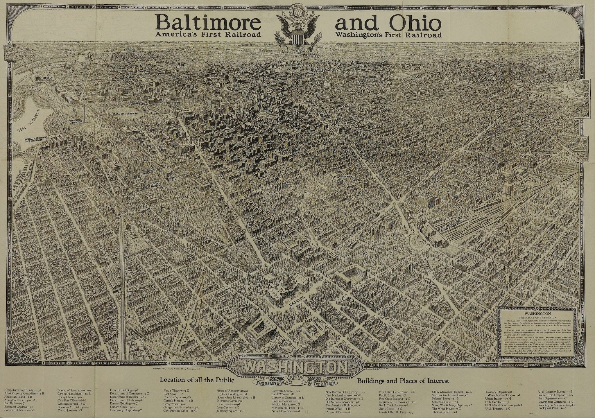
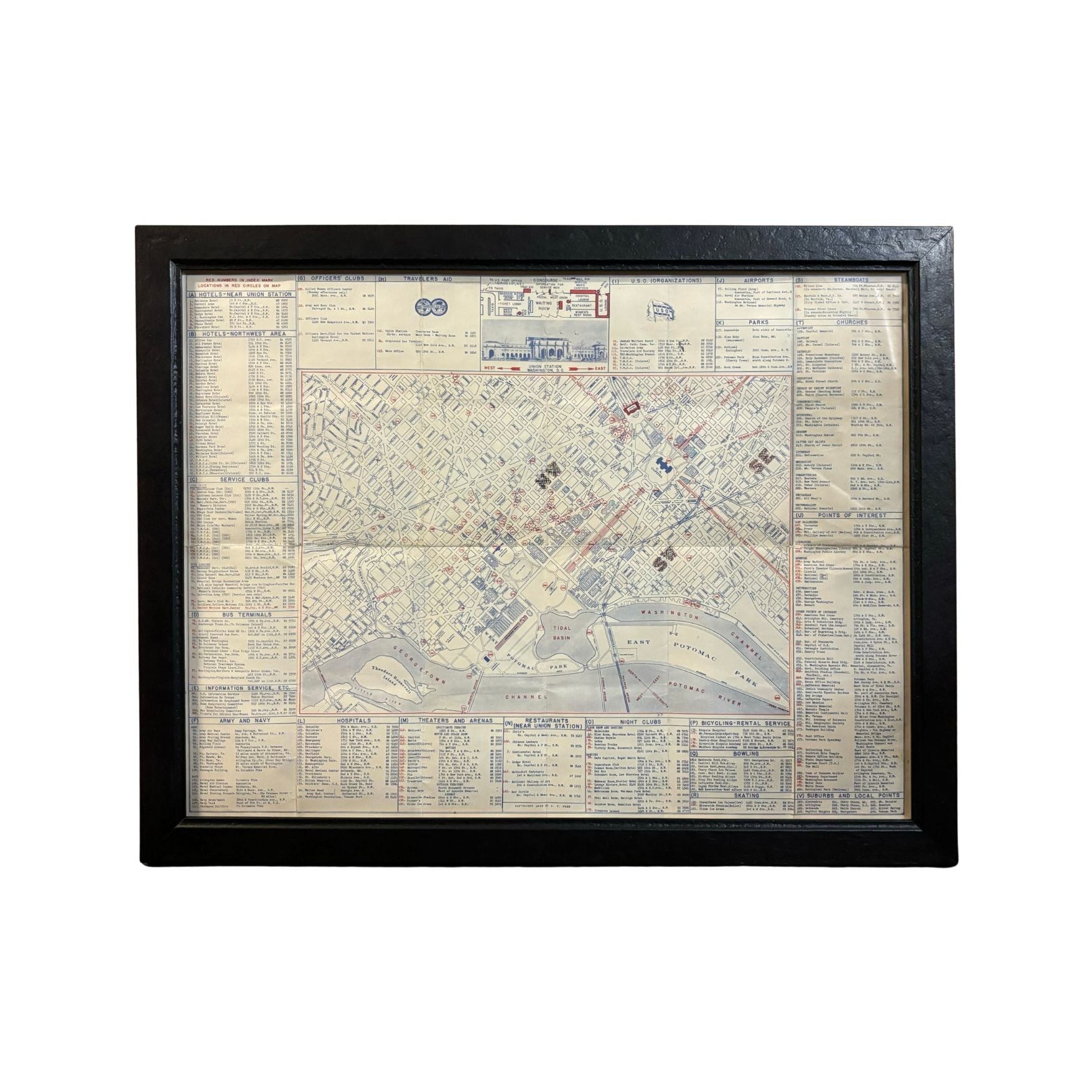
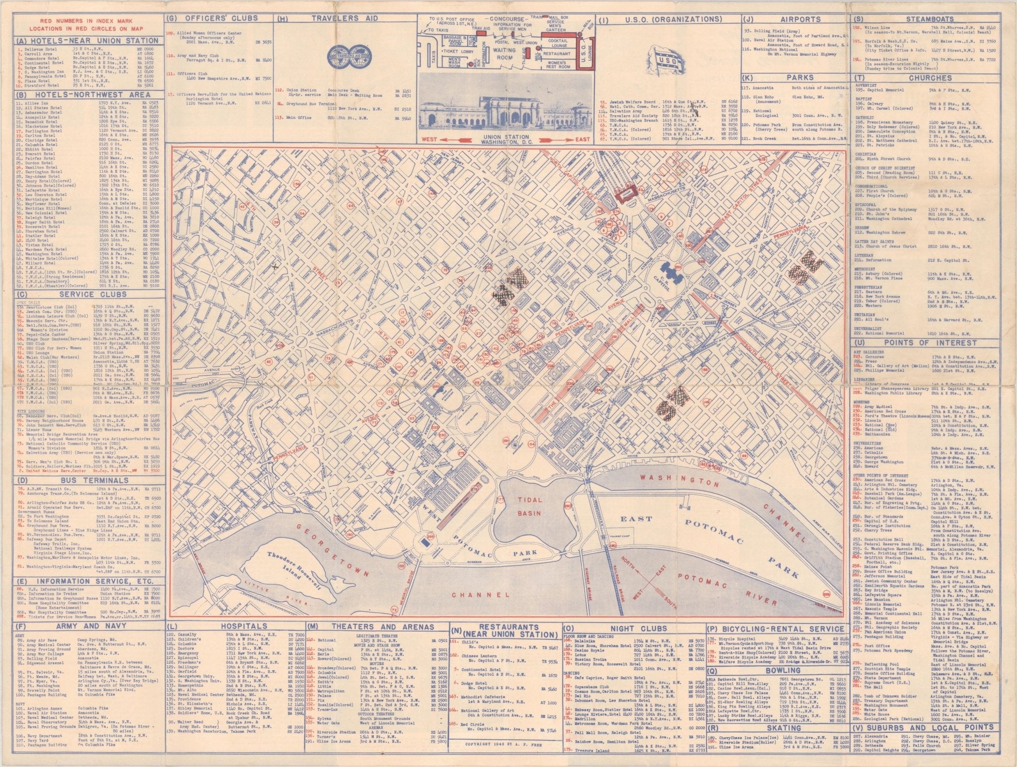
1943 "USO Map Guide to Washington"
Sale price$1,750.00

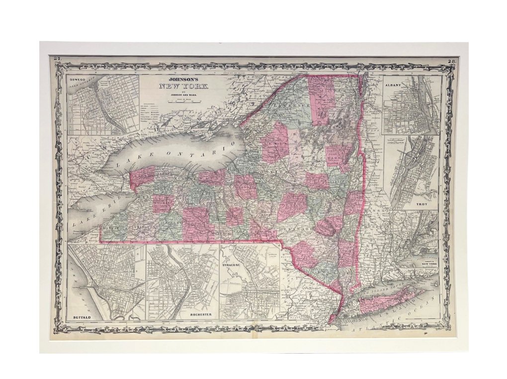
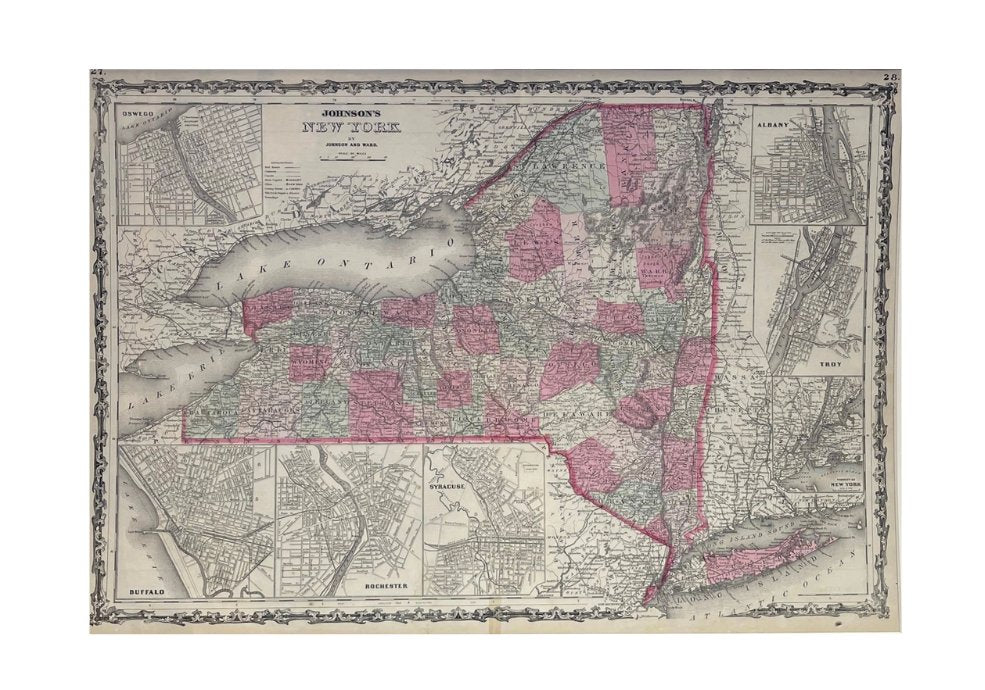
1865 "Johnson's New York" Map by Johnson and Ward
Sale price$650.00
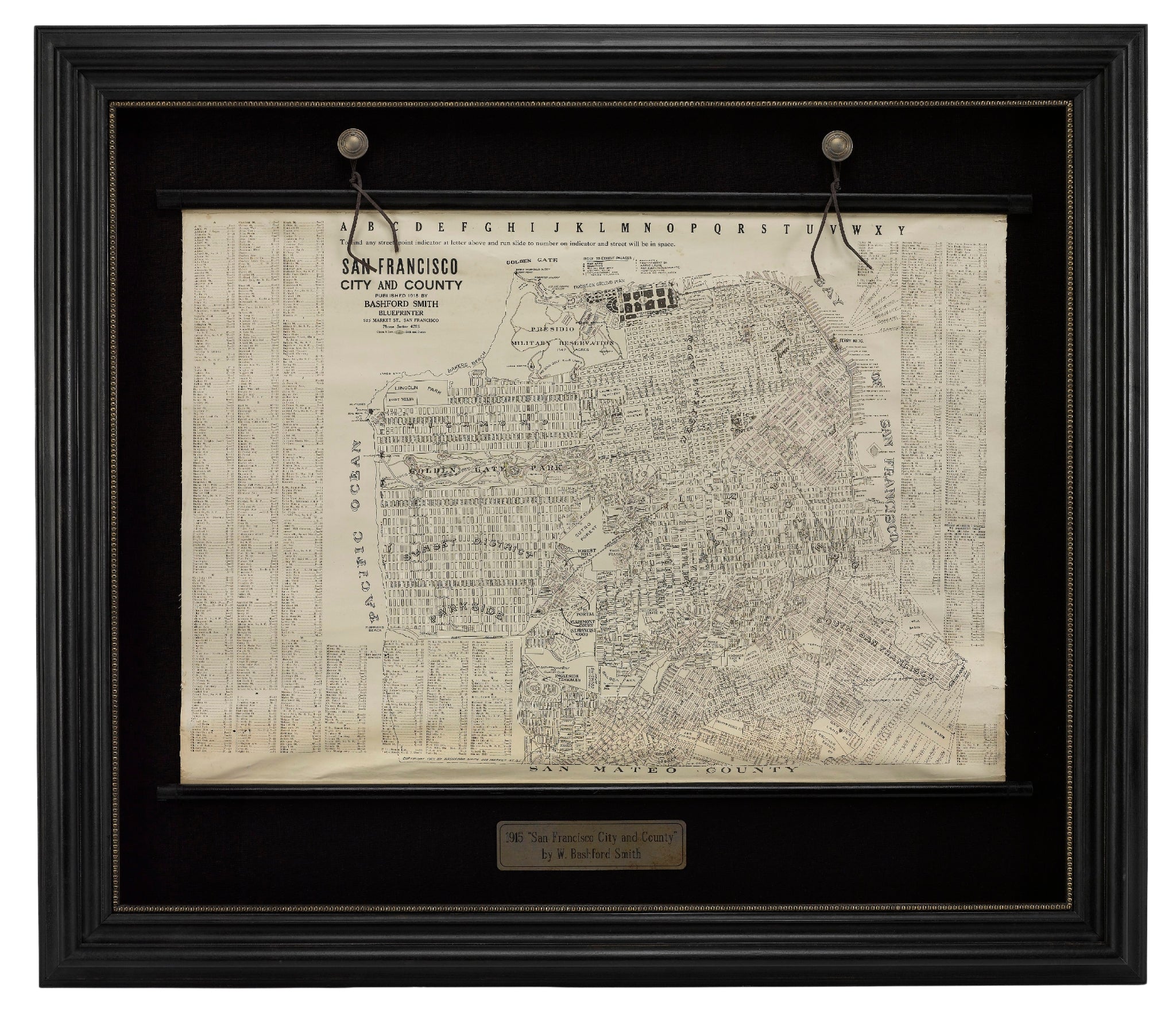
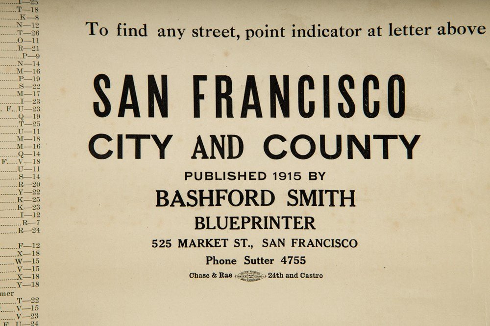
1915 "San Francisco City and County" Hanging Map by W. Bashford Smith
Sale price$5,950.00
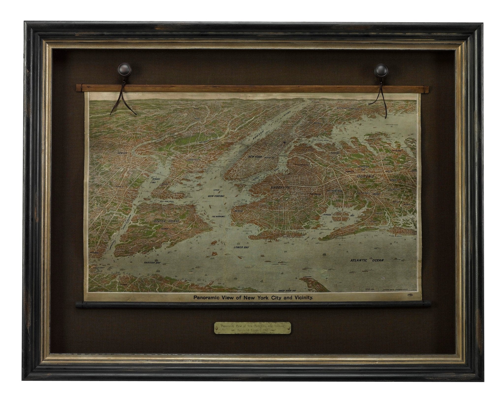
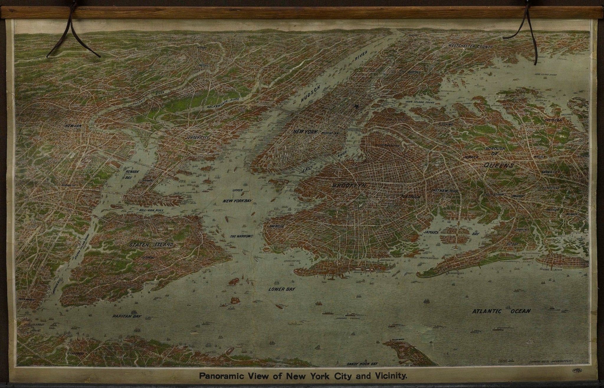
1912 "Panoramic View of New York City and Vicinity" Map by Jacob Ruppert
Sale price$8,500.00
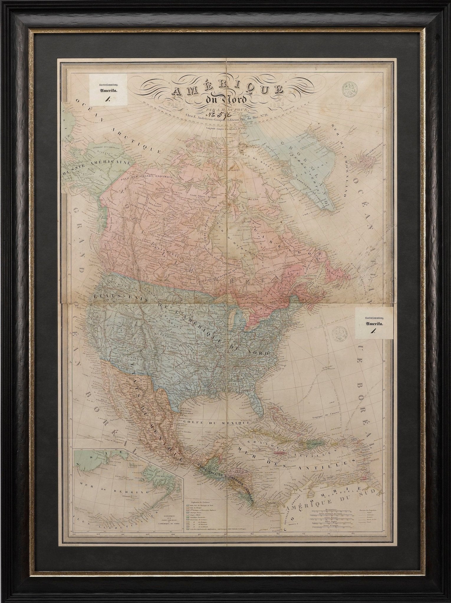
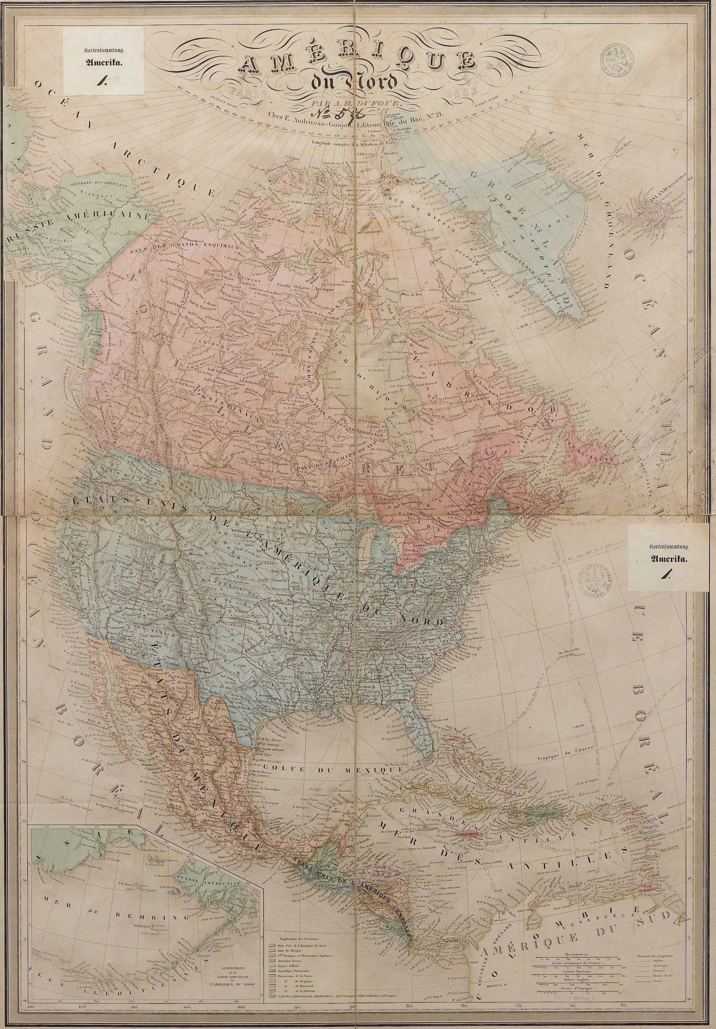
1864 "Amerique du Nord" by Adolphe Hippolyte Dufour
Sale price$4,500.00

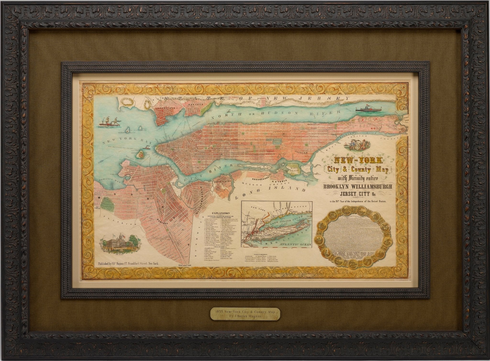
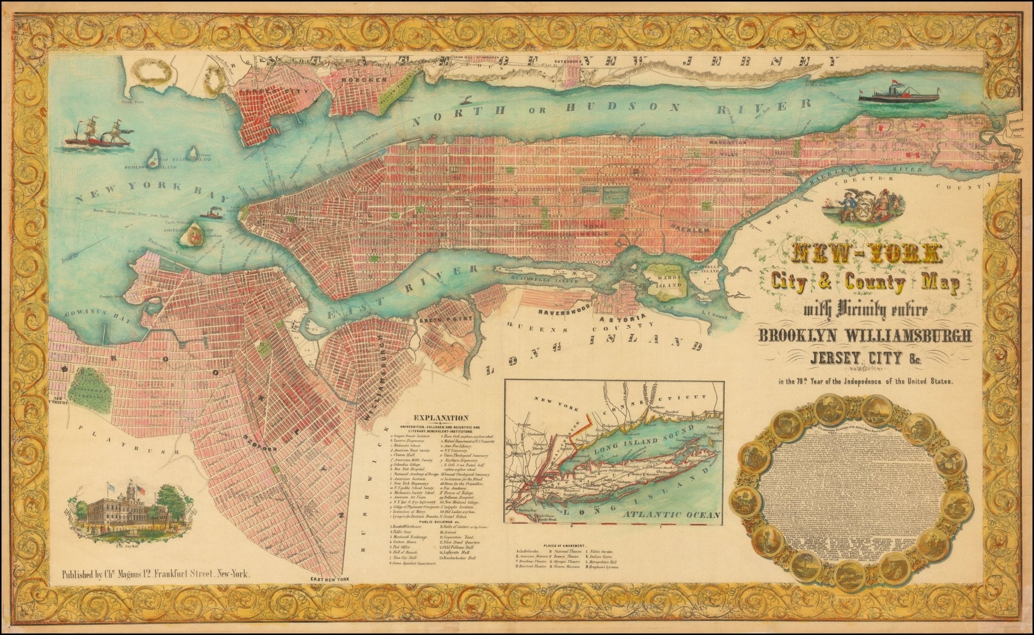
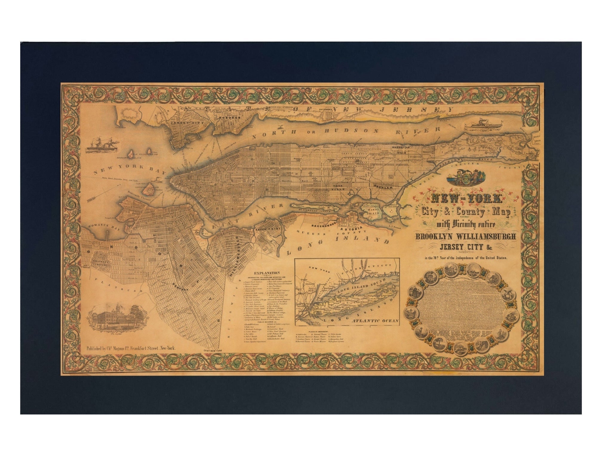
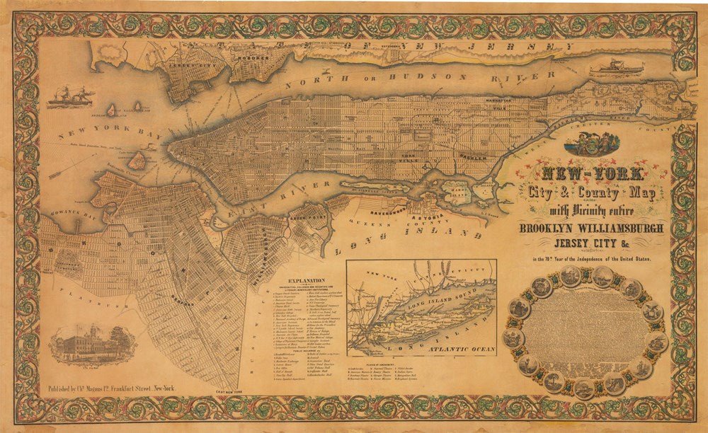
1855 "New-York City & County Map with Vicinity entire Brooklyn Wiliamsburgh Jersey City &c." Map by Charles Magnus
Sale price$7,950.00
Regular price$9,500.00
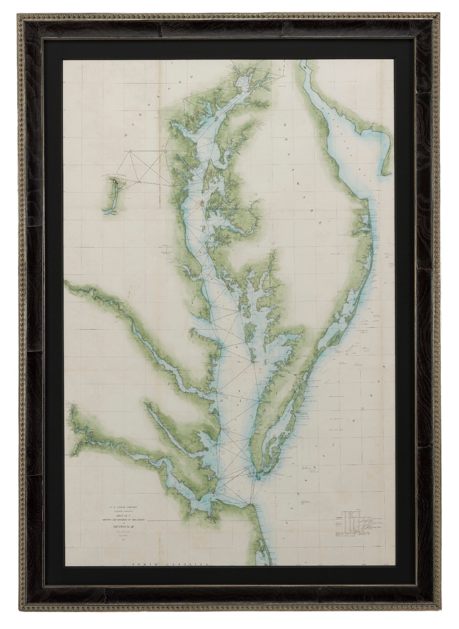
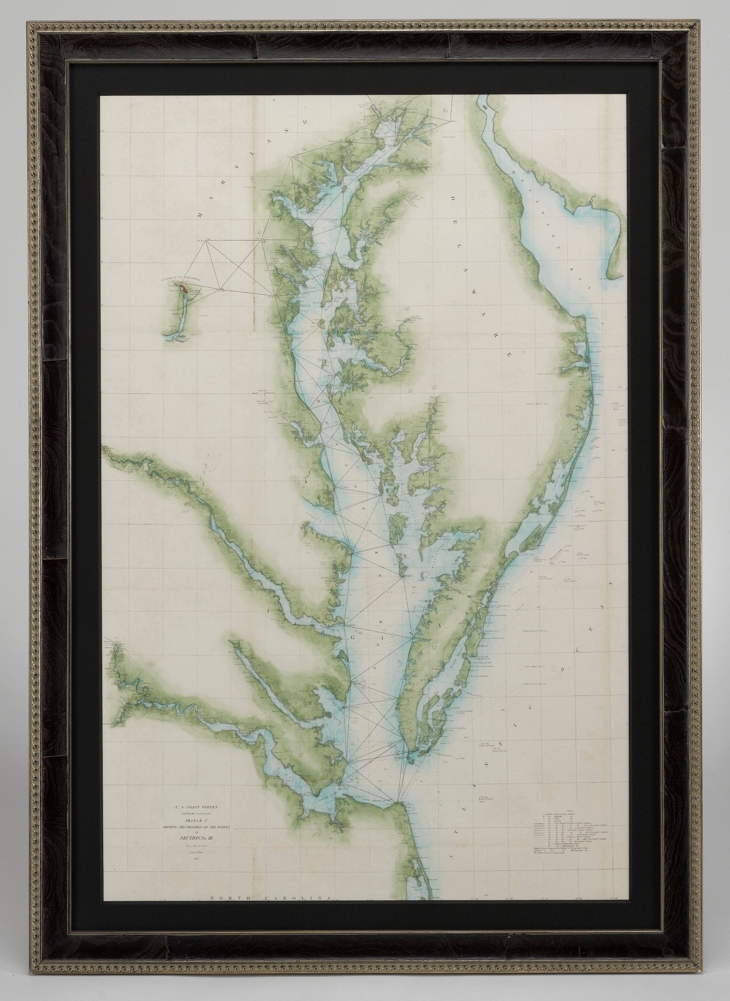
1856 "U.S. Coast Survey Map of Chesapeake Bay and Delaware Bay" by A. D. Bache.
Sale price$4,250.00
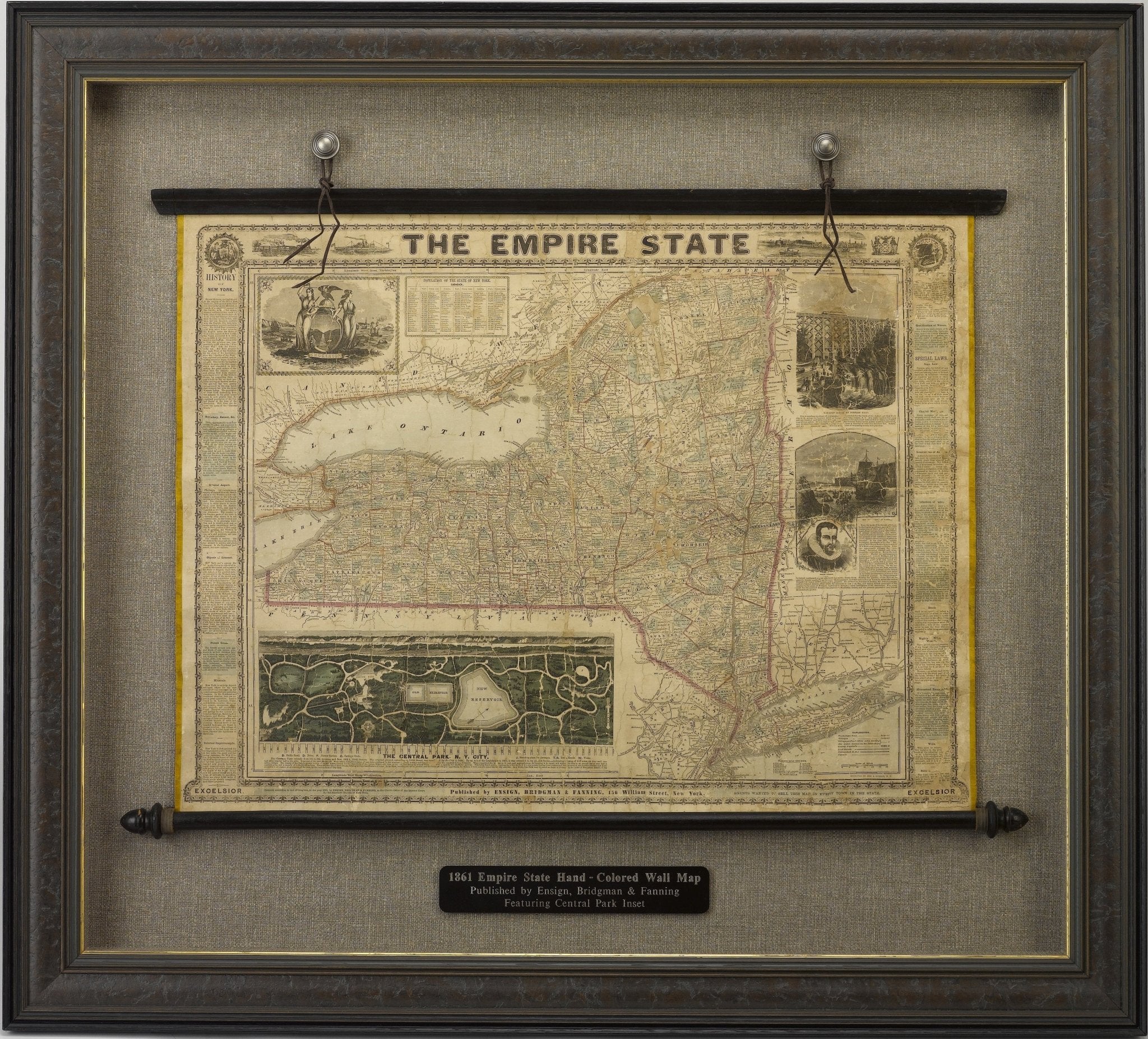
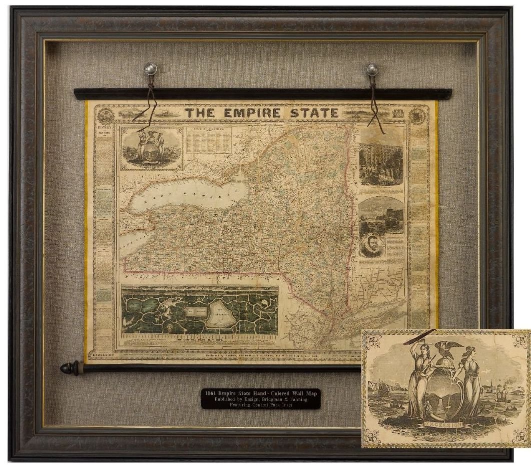
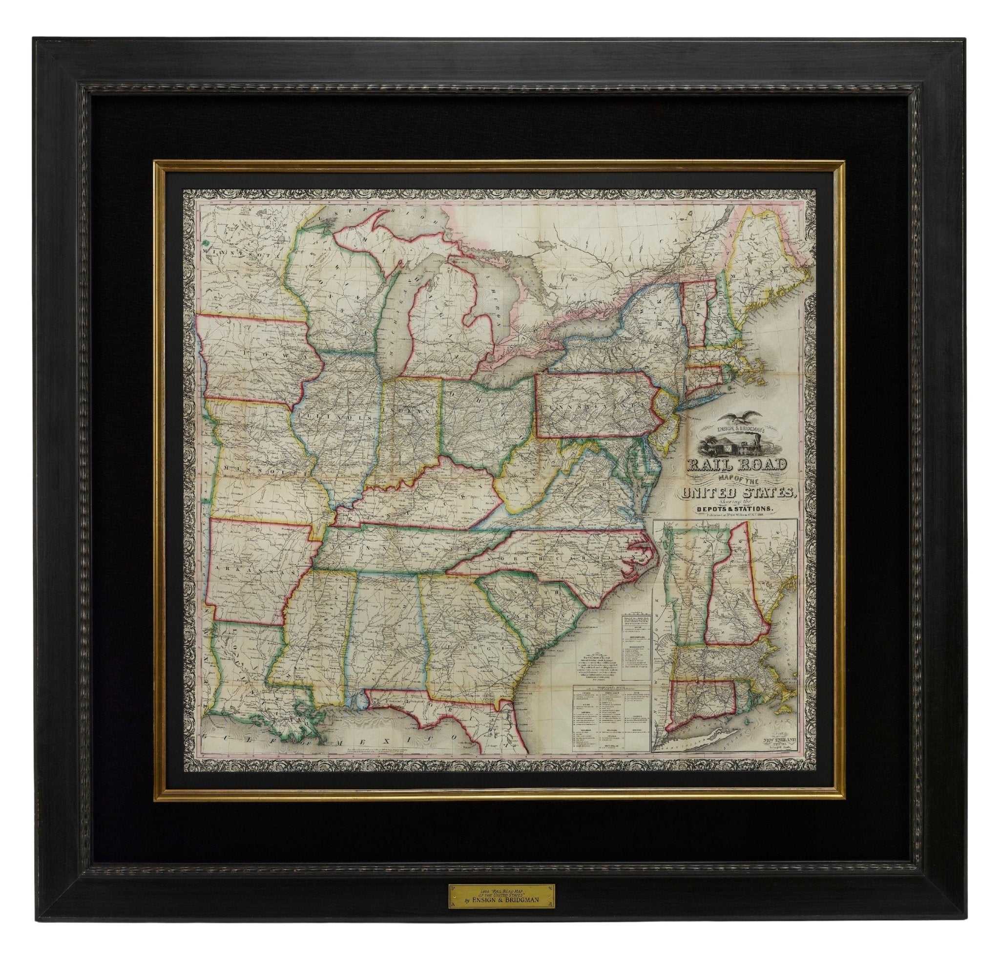
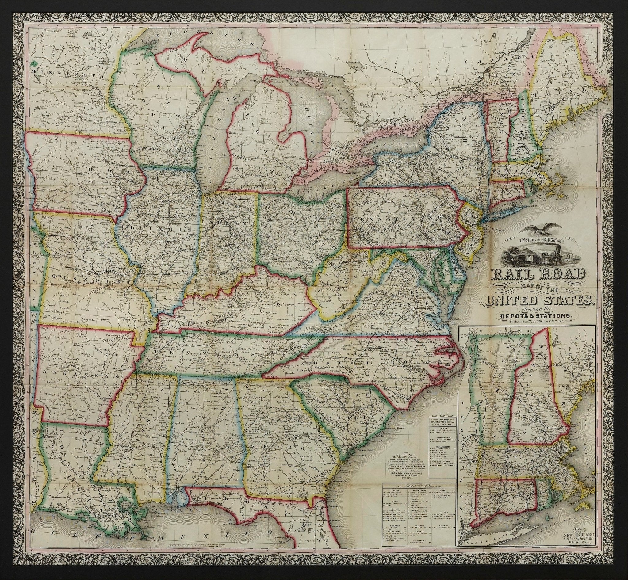
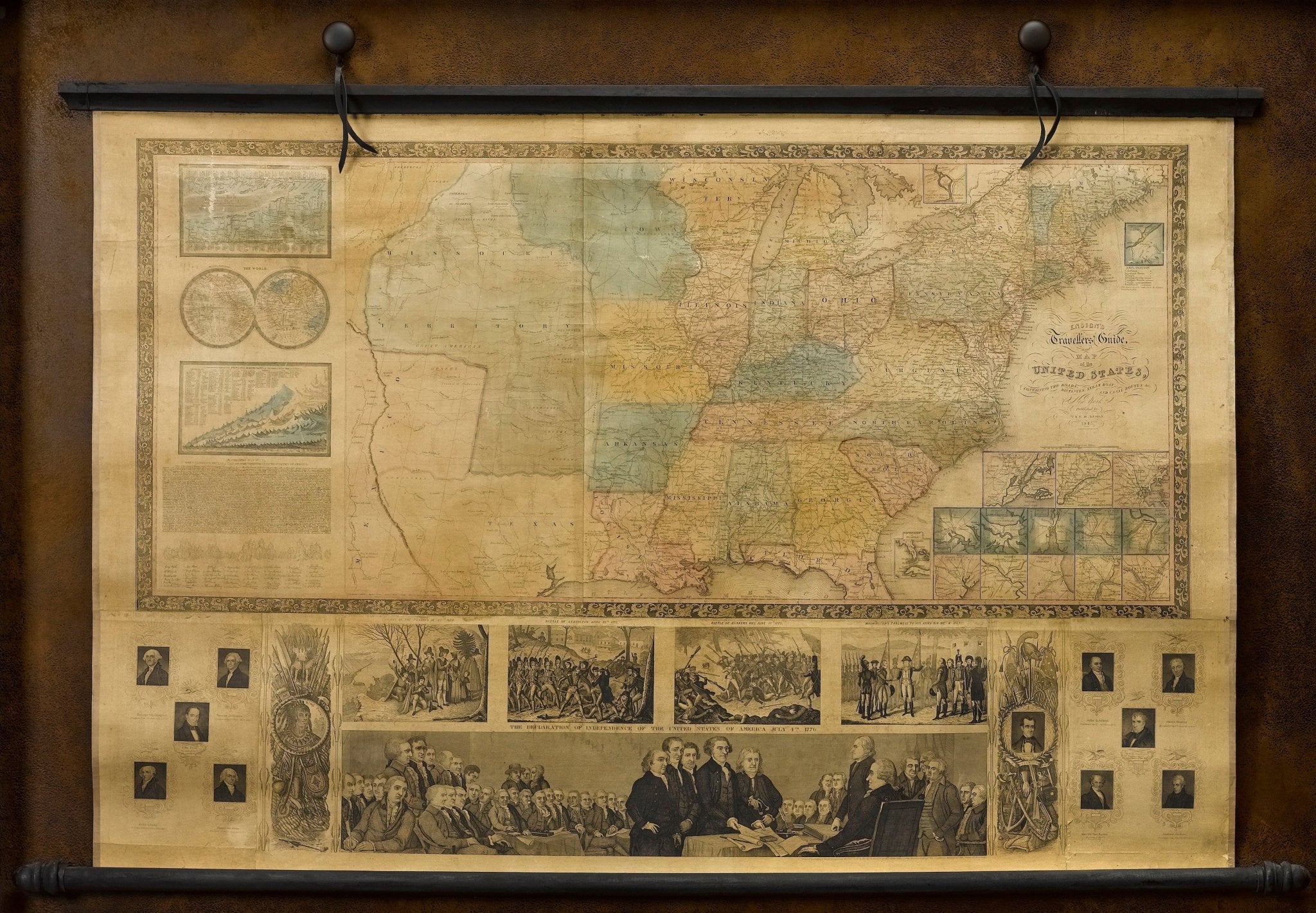
1861 "The Empire State" Wall Map by Ensign, Bridgman & Fanning
Sale price$7,950.00
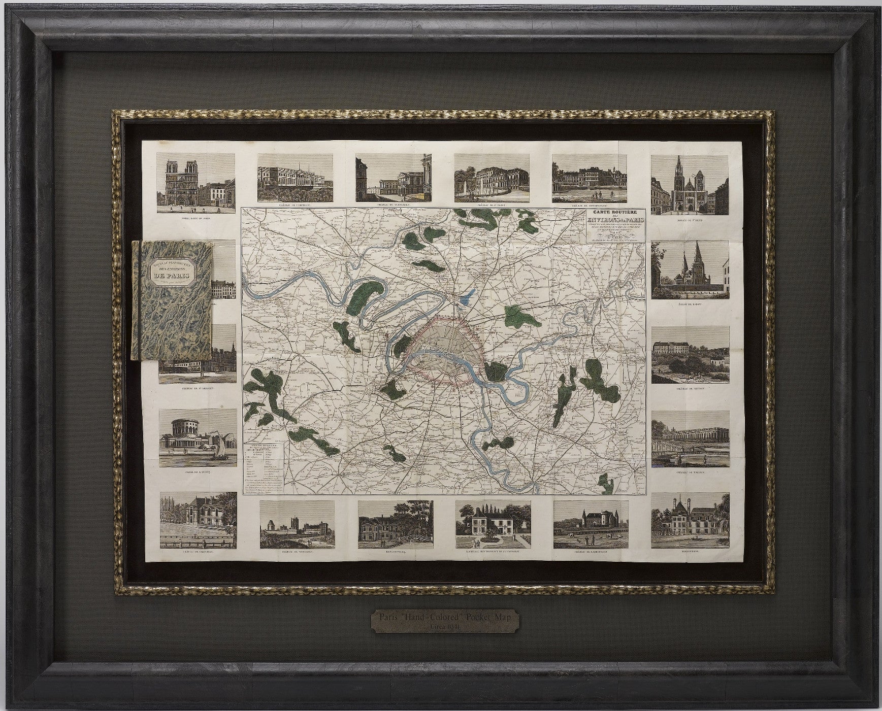
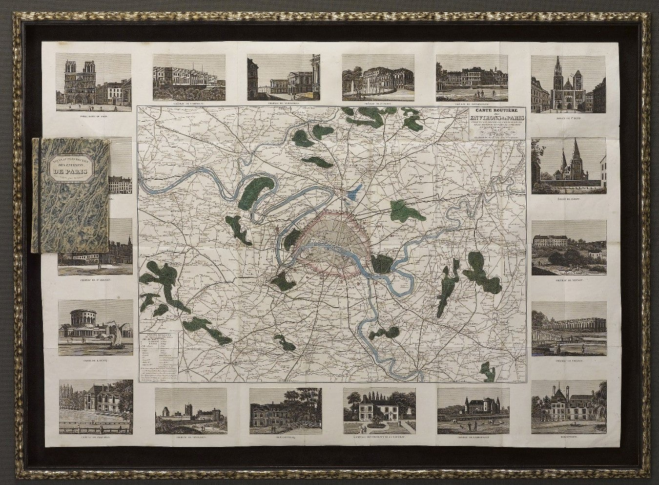
1841 "Carte Routiere des Environs de Paris" Folding Pocket Map
Sale price$3,250.00
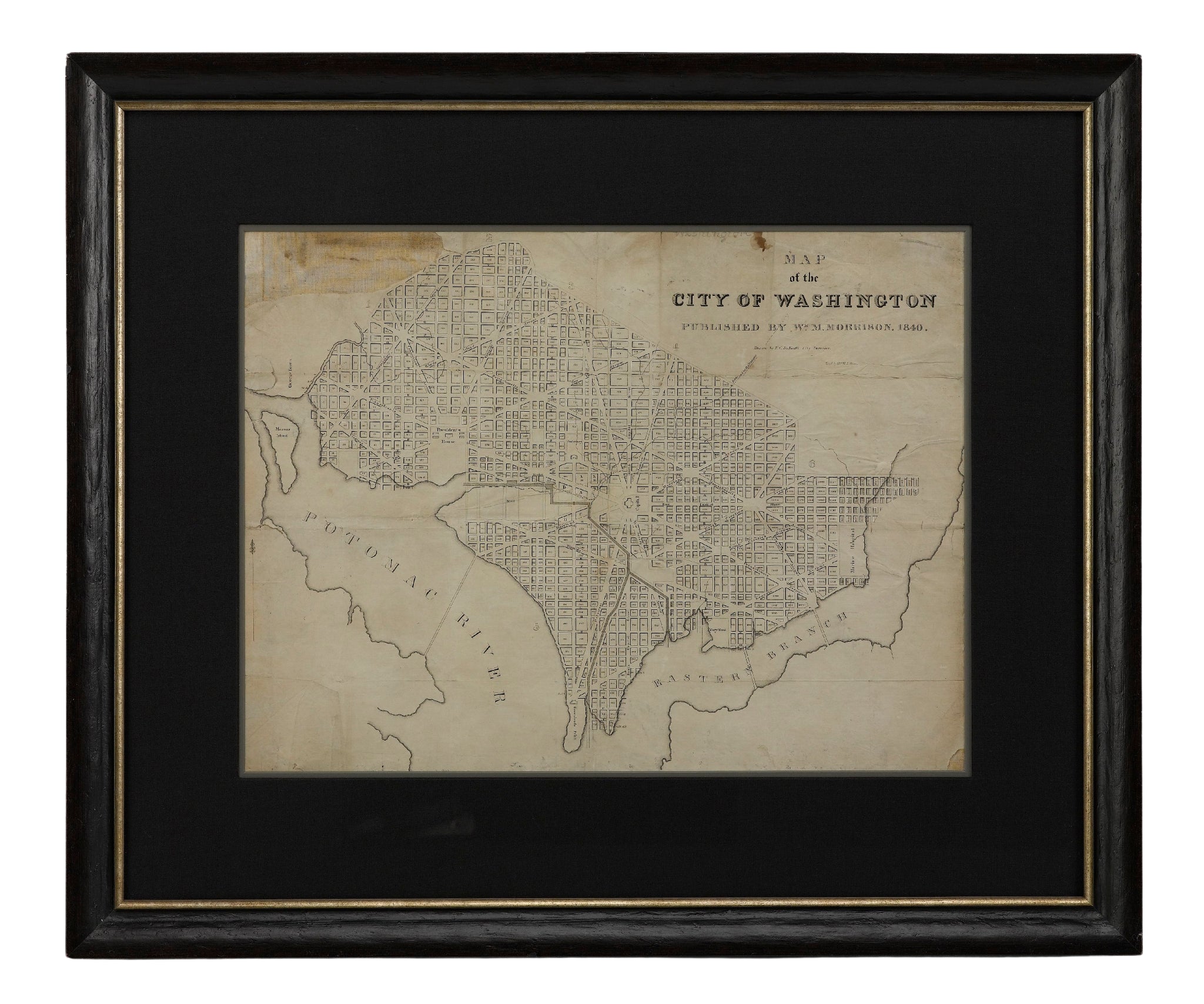
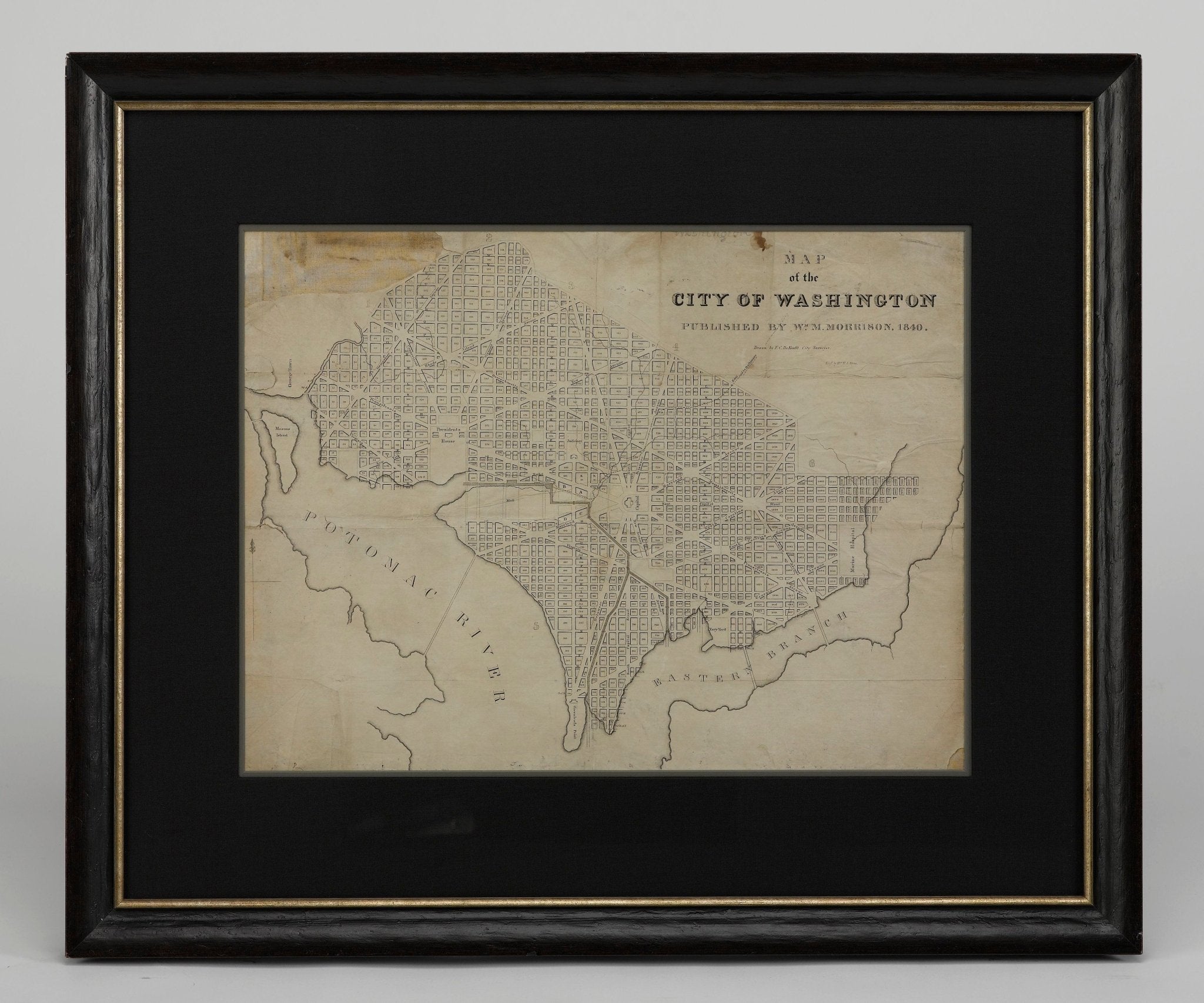
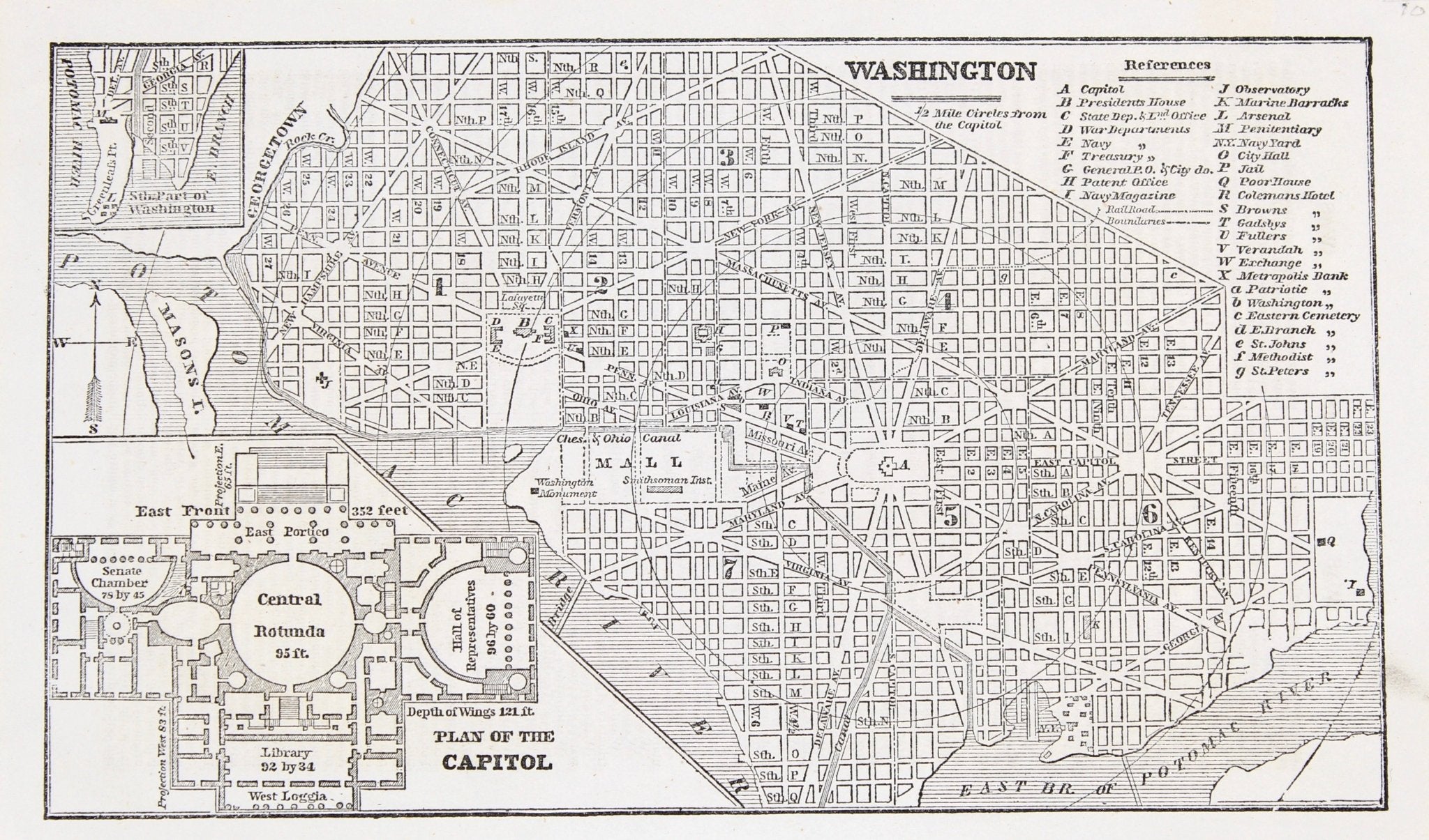
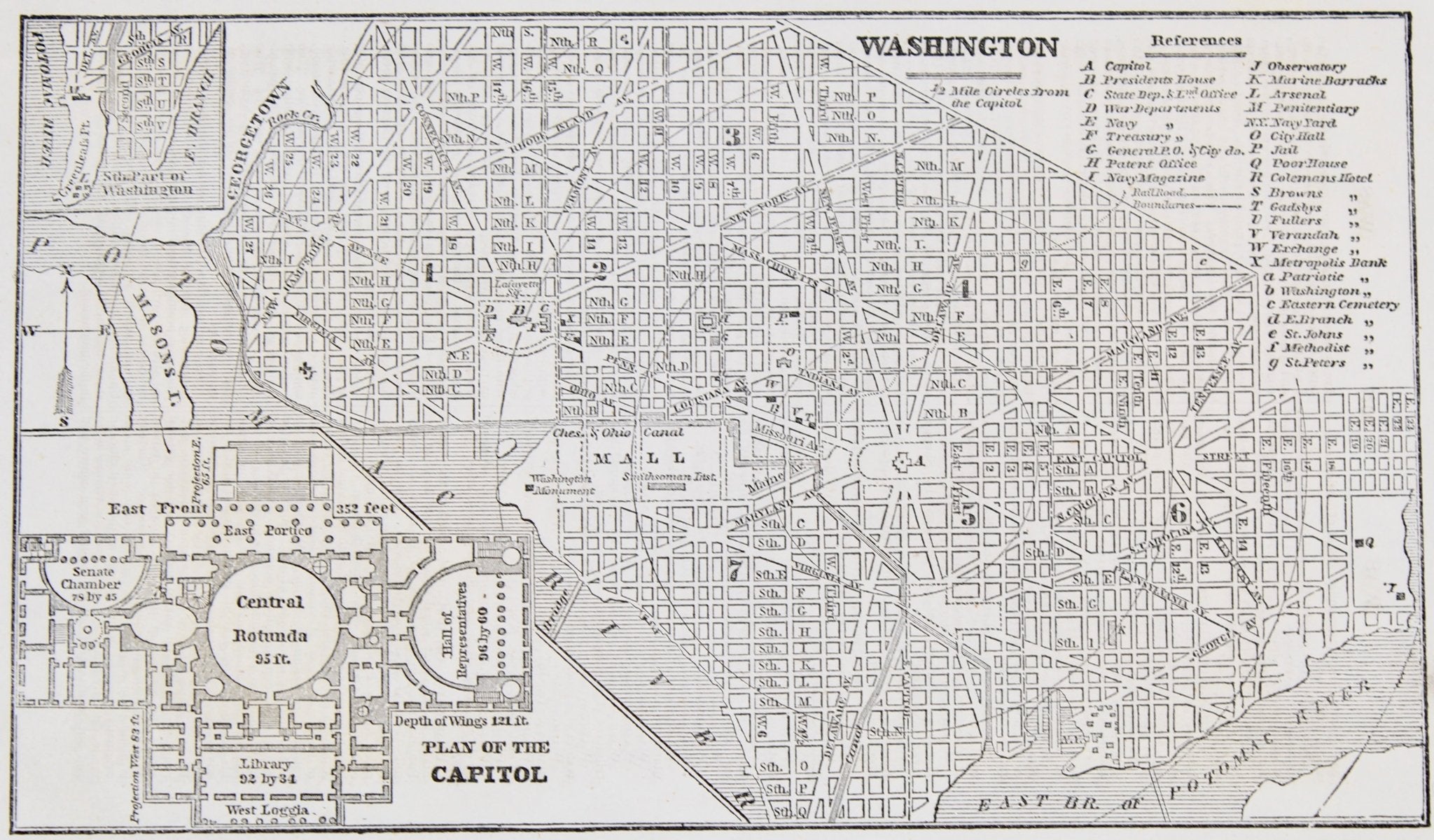
1840 "Map of the City of Washington" Published by William M. Morrison
Sale price$3,650.00
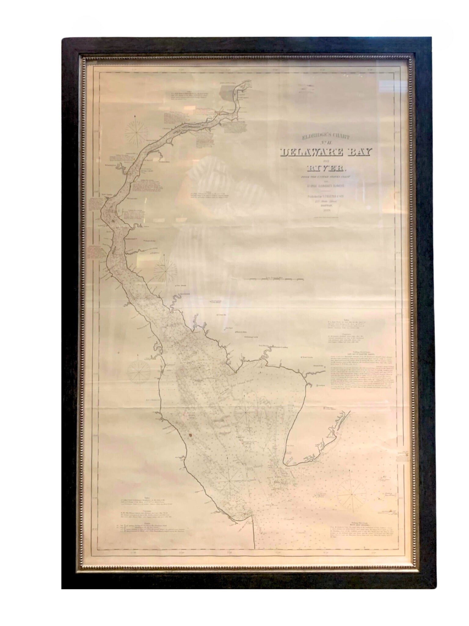
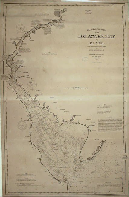
1889 Sea Chart Map of Delaware Bay by George Eldridge, Chart No. 11
Sale price$5,000.00