
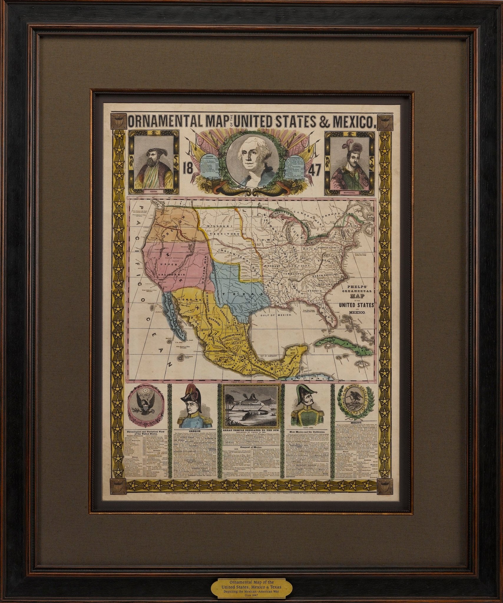
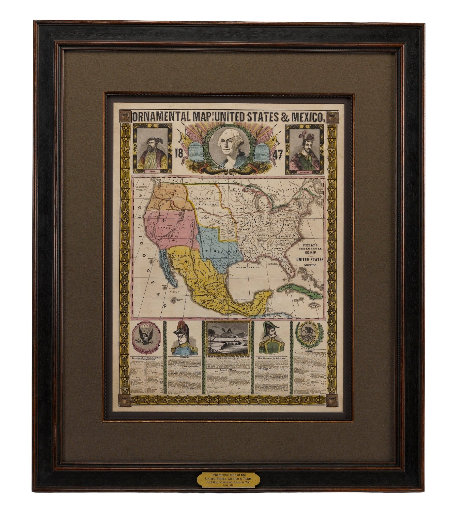
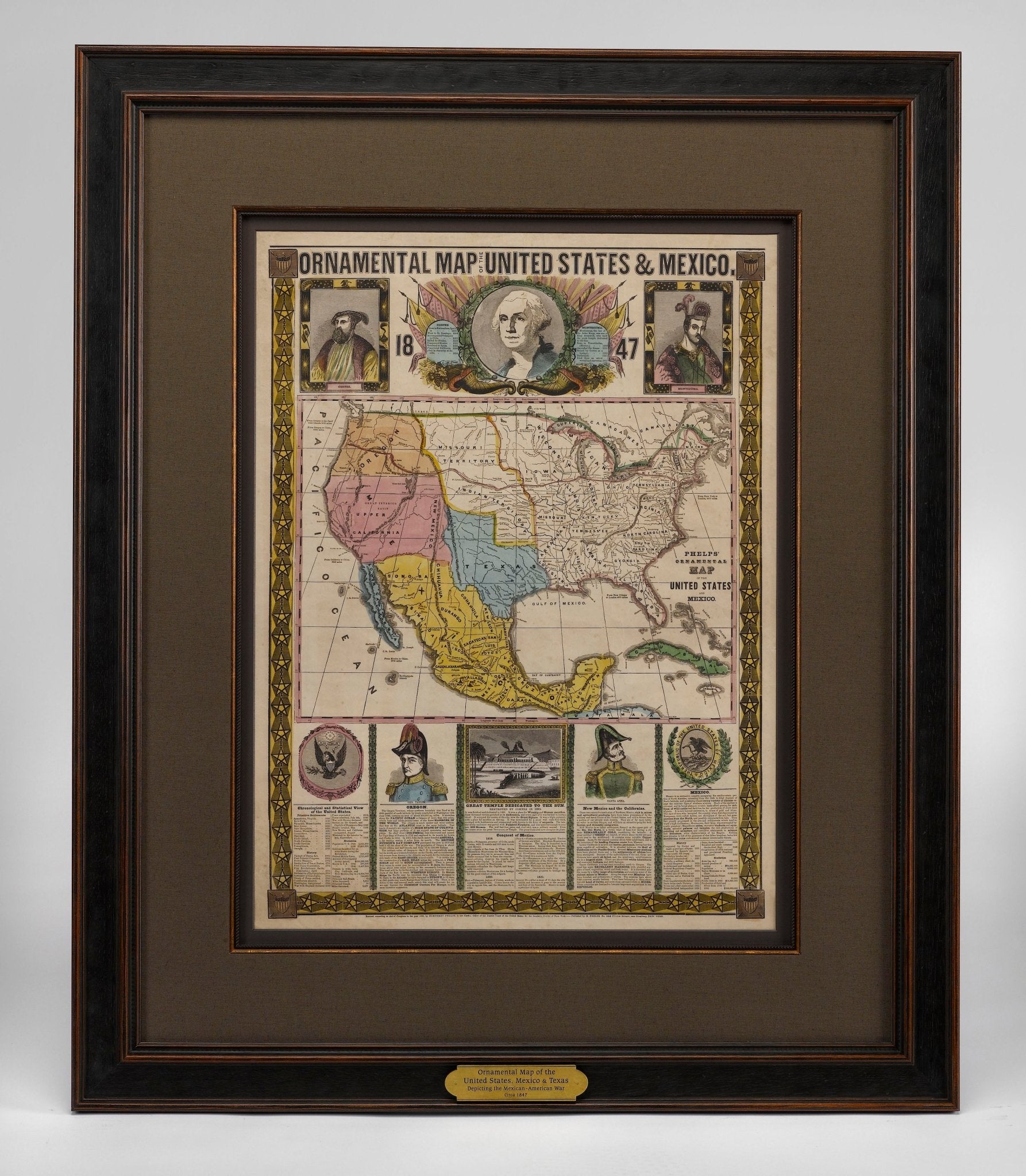

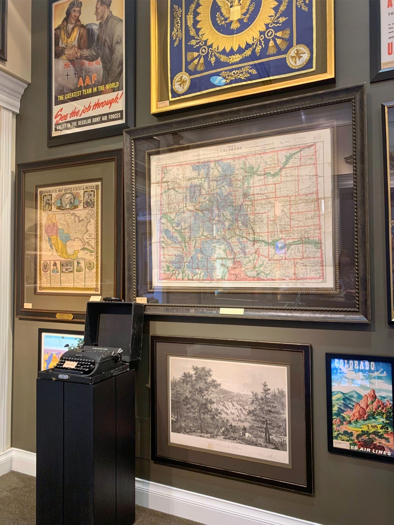
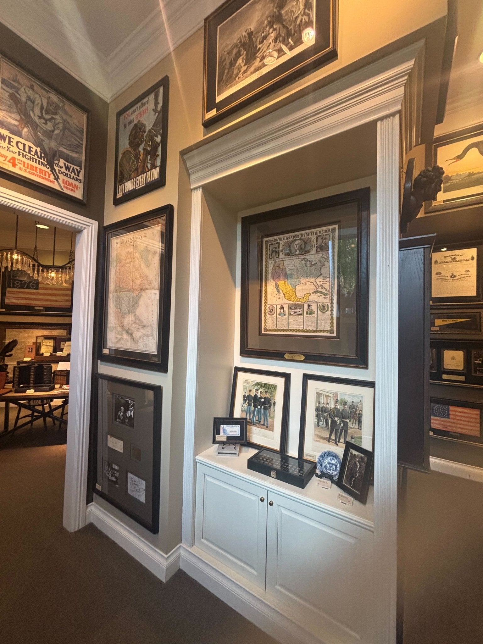
1847 "Ornamental Map of the United States & Mexico" by H. Phelps, Hand-Colored Broadside
Offered is an original 1847 ornamental map of the U.S. entitled "Ornamental Map of the United States & Mexico" by Humphrey Phelps. The map was first published by Humphrey Phelps, in New York in 1846. This is the second edition of the map, issued one year later in 1847. The broadside is elaborately hand-colored.
This is a very detailed and graphic propaganda map of the United States expressing U.S. dominance of the North American continent. The hand-colored map is a cartographic embodiment of Manifest Destiny, with the recent acquisition of Upper California, New Mexico, and Texas at the conclusion of the Mexican-American War. The newly acquired land is boldly colored, standing in stark contrast to the rest of the U.S. The map details a potential route for a railroad running from New York City, to Buffalo, to Chicago, then west along the Oregon Trail to Oregon City. This route anticipates the construction of the transcontinental railroad by nearly 20 years.
The map includes elaborately detailed renderings of George Washington, Hernan Cortez, and Montezuma at top to represent European expansion to the Americas. At bottom are four inset designs with text showing the following: a chronological history of the U.S. beginning from settlement to the U.S. victory in the Mexican-American war; an illustration of General Zachary Taylor with details on the Oregon Territory; an illustration of the Aztec Temple of the Sun in Tenochtitlan and a chronology of the Conquest of the Aztec Empire under Cortez; a portrait of General Antonio Lopez de Santa Anna with a description of the newly acquired New Mexico and California territories; and an illustration detailing “The Republic of the United States of Mexico” with a description of the accomplishments of the Aztec people with a history of the conquest of Mexico and statistics of silver mines.
This is the second edition of the map, the first having been issued one year earlier in 1846. The changes between the editions were minor, besides the addition of tables describing the population of Mexico by state and the distances in Mexico.
CONDITION:
Overall good condition for age. Bright hand-coloring intact. Fold lines and wear along margins. Scattered light foxing, a few small tears, and one small hole in the portrait of Washington that have all been archivally repaired on verso.
Map is framed according to conservation standards in a custom black wooden frame, UV archival glass, linen top mat, and custom plaque. Framed Dimensions: 44 ½” H x 37" W x 1 ¼” D.
Accompanied by our company's letter of authenticity.
Pickup available at Colorado
Usually ready in 4 hours
1847 "Ornamental Map of the United States & Mexico" by H. Phelps, Hand-Colored Broadside
Colorado
1 Lake Avenue
Colorado Springs CO 80906
United States
Choose options
Frequently Asked Questions
FAQs
Yes, all of our Antiques are certified authentic. Every antique comes with a signed Letter of Authenticity that details the item’s history, its current condition including any conservation, binding, or framing work, and the item’s provenance. The Letters of Authenticity are priced valuations by our authentication specialists, who assure that items are original and unconditionally guaranteed as genuine for life.
We pack and ship your items from our gallery in Colorado Springs. You may also choose to come pick up your order. Antique items are carefully packed and insured during shipping. The shipping price will be calculated at checkout.
We acquire from a variety of trusted sources all over the world, but mostly through auctions and private collections within the United States. All provenance information will be listed on the Letter of
Authenticity accompanying your purchase.