
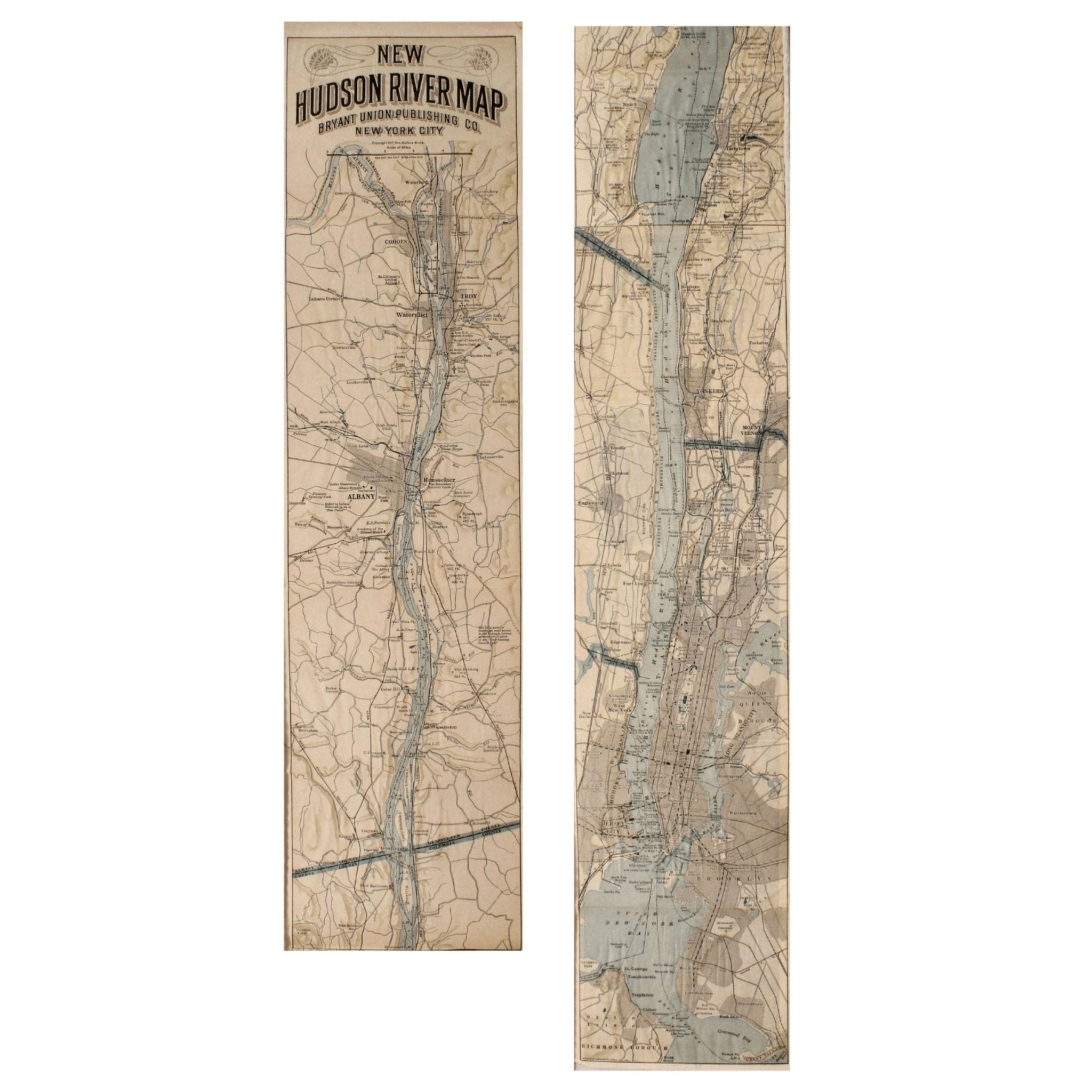
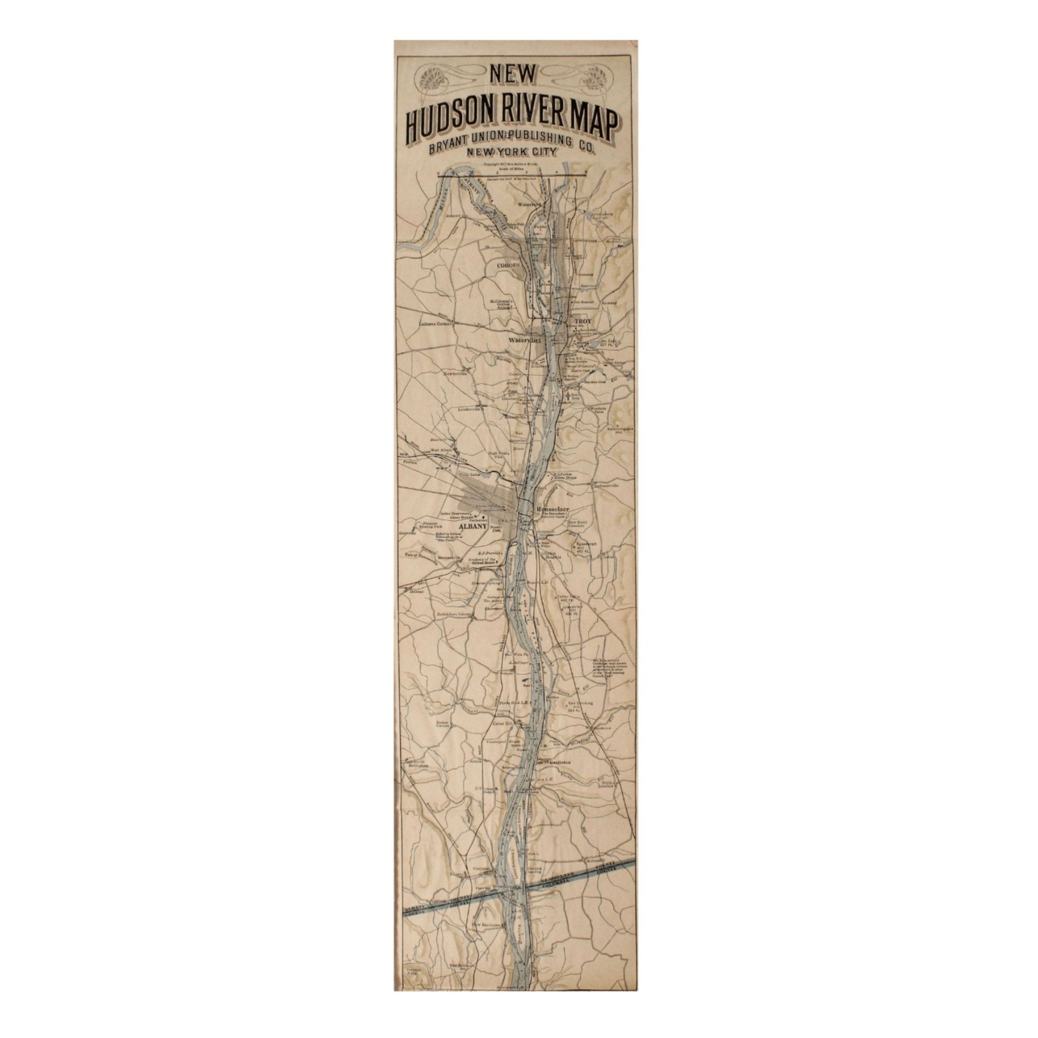
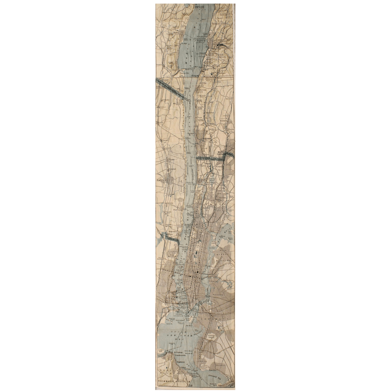
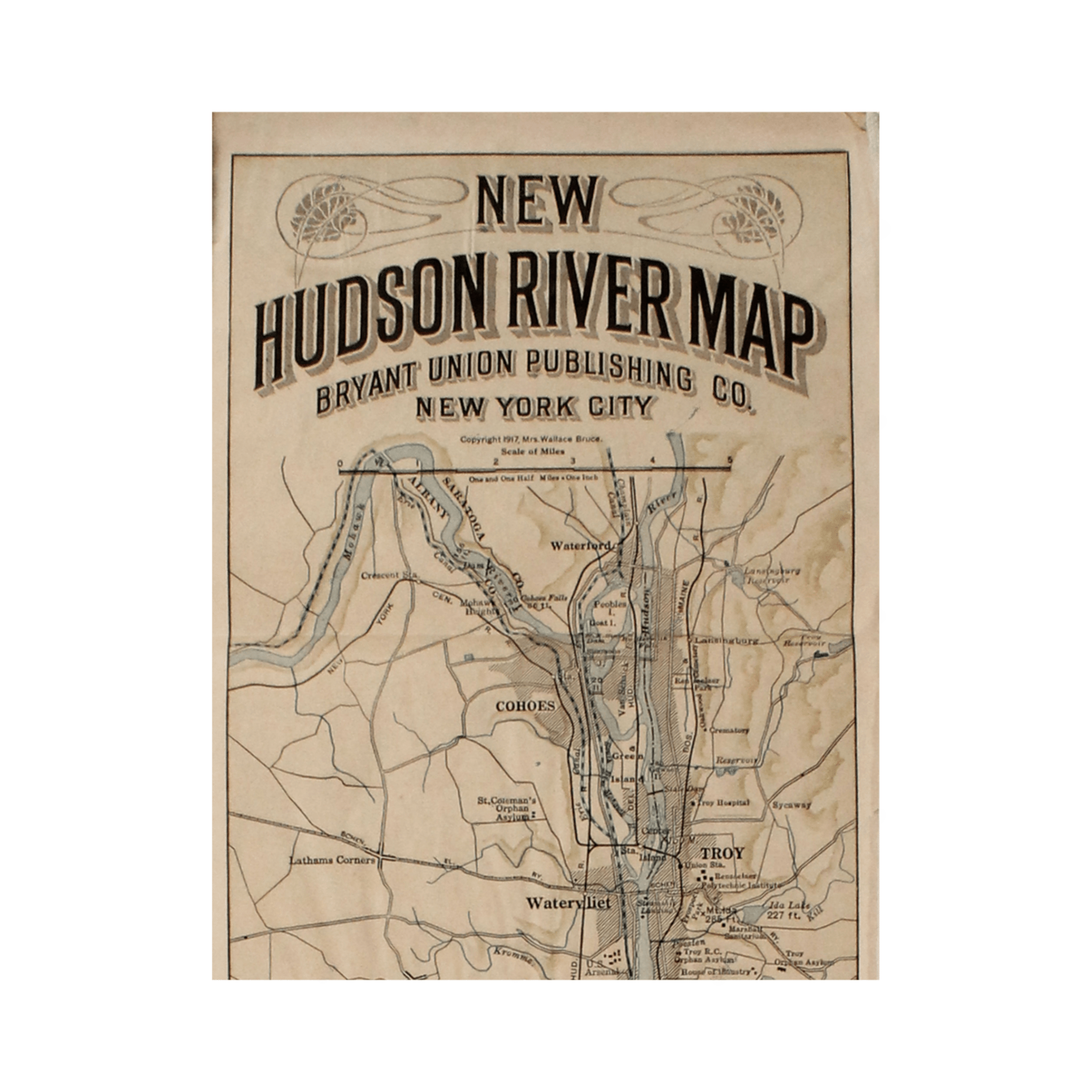
1917 "New Hudson River Map" by Wallace Bruce, Later Edition
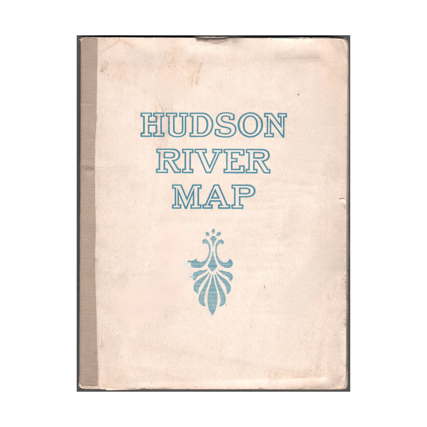
Presented is a 1917 printing of “New Hudson Map” by Wallace Bruce. The map was published by Bryant Union Publishing Co., in New York City. The map is a later edition, issued in a distinct strip-chart format that is over 100 inches long. The map includes amazing detail, compiled mostly from U.S. Coast Survey data. It is drawn on a scale of 1.5 miles per inch, allowing ample space for it to show historical landmarks, landings, islands, list prominent residents, and more. The verso is filled with related text and illustrations about the Hudson River valley. The map folds into cream paper wrappers, titled "Hudson River Map" in blue letters.
The Hudson River stretches approximately 315 miles from the Adirondack Mountains to New York Harbor and has played a crucial role in the history and development of the United States. Named after the English explorer Henry Hudson, who sailed its waters in 1609 while searching for a passage to Asia, the river quickly became a key artery for trade and exploration. Indigenous peoples, including the Mohicans, Mohawks, and Lenape, had long used the river for transportation and sustenance. During the colonial period, the Hudson served as a vital link between the interior of North America and the Atlantic Ocean. Its strategic importance was underscored during the Revolutionary War, when control of the river became a central military objective for both the British and American forces.
Later, the completion of the Erie Canal in 1825 connected the Hudson to the Great Lakes and transformed the river into a major commercial highway. This helped spur the growth of cities like Albany and New York. The scenic beauty of the river also inspired the Hudson River School, a distinctly American artistic movement that celebrated the natural landscape.
CONDITION:
Good condition overall. Folding map, as issued. Paper is clean and bright, with several small abrasions resulting in some minor loss of image. The map is enclosed in cream paper wrappers, with blue “Hudson River Map” printed title on the front. The wrapper has minor soiling. Map is sold unframed, as-is.
Map Dimensions: 107” H x 5 5/12” W.
Accompanied by the company's letter of authenticity.
Pickup available at Colorado
Usually ready in 4 hours
1917 "New Hudson River Map" by Wallace Bruce, Later Edition
Colorado
1 Lake Avenue
Colorado Springs CO 80906
United States
Choose options
Frequently Asked Questions
FAQs
Yes, all of our Antiques are certified authentic. Every antique comes with a signed Letter of Authenticity that details the item’s history, its current condition including any conservation, binding, or framing work, and the item’s provenance. The Letters of Authenticity are priced valuations by our authentication specialists, who assure that items are original and unconditionally guaranteed as genuine for life.
We pack and ship your items from our gallery in Colorado Springs. You may also choose to come pick up your order. Antique items are carefully packed and insured during shipping. The shipping price will be calculated at checkout.
We acquire from a variety of trusted sources all over the world, but mostly through auctions and private collections within the United States. All provenance information will be listed on the Letter of
Authenticity accompanying your purchase.