
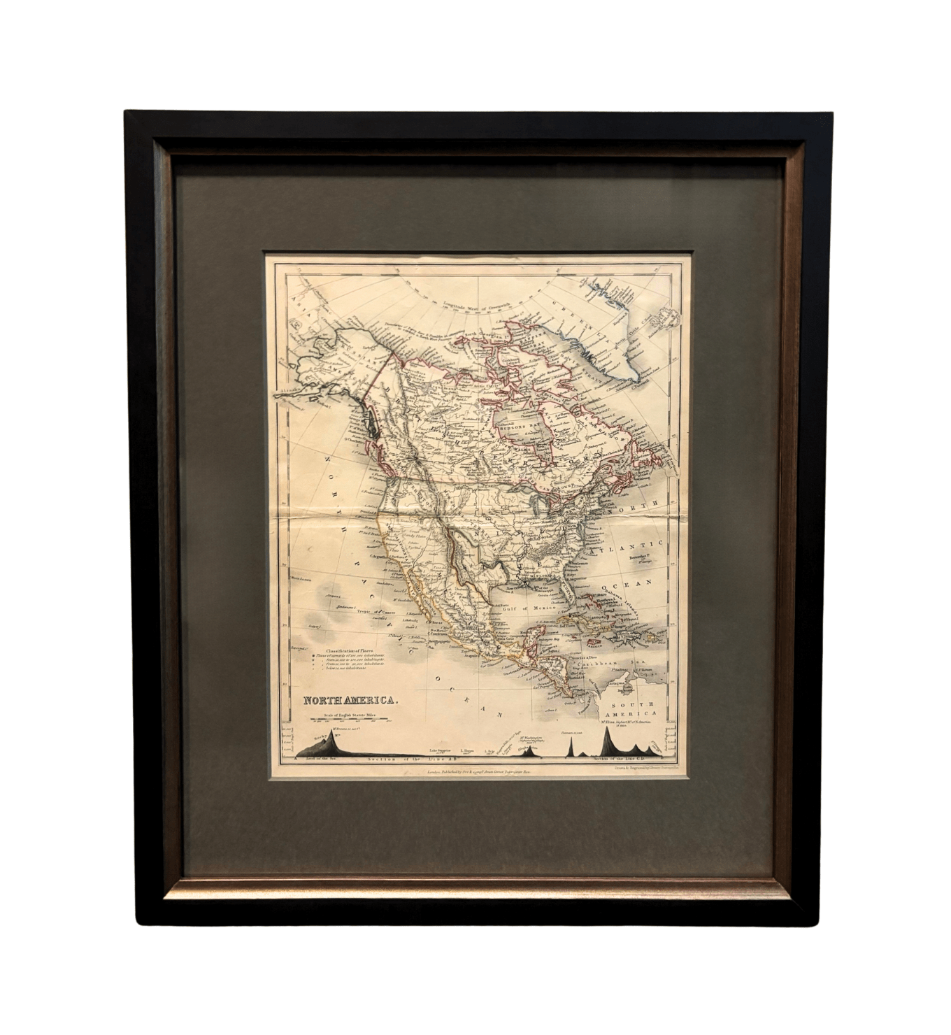
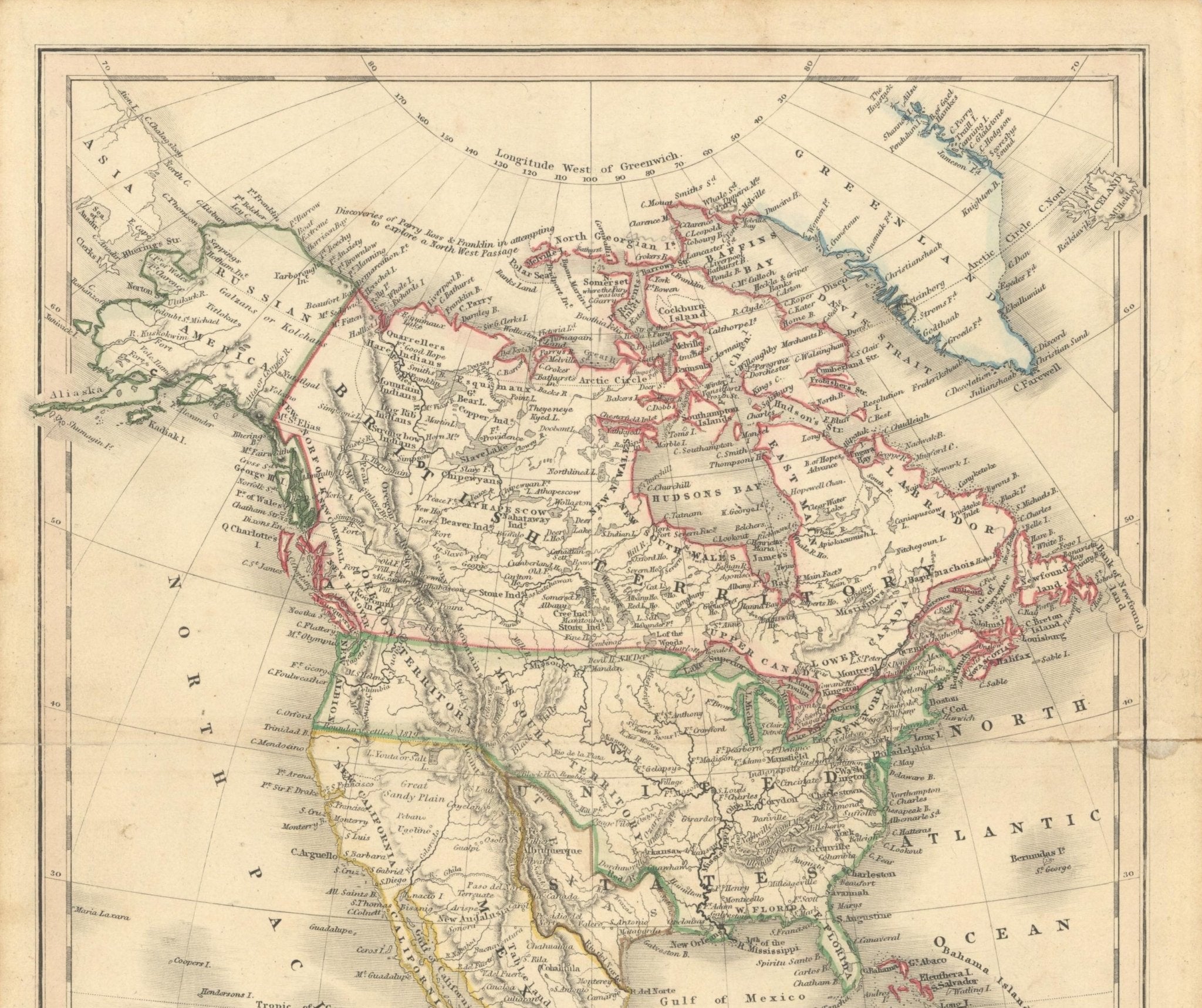
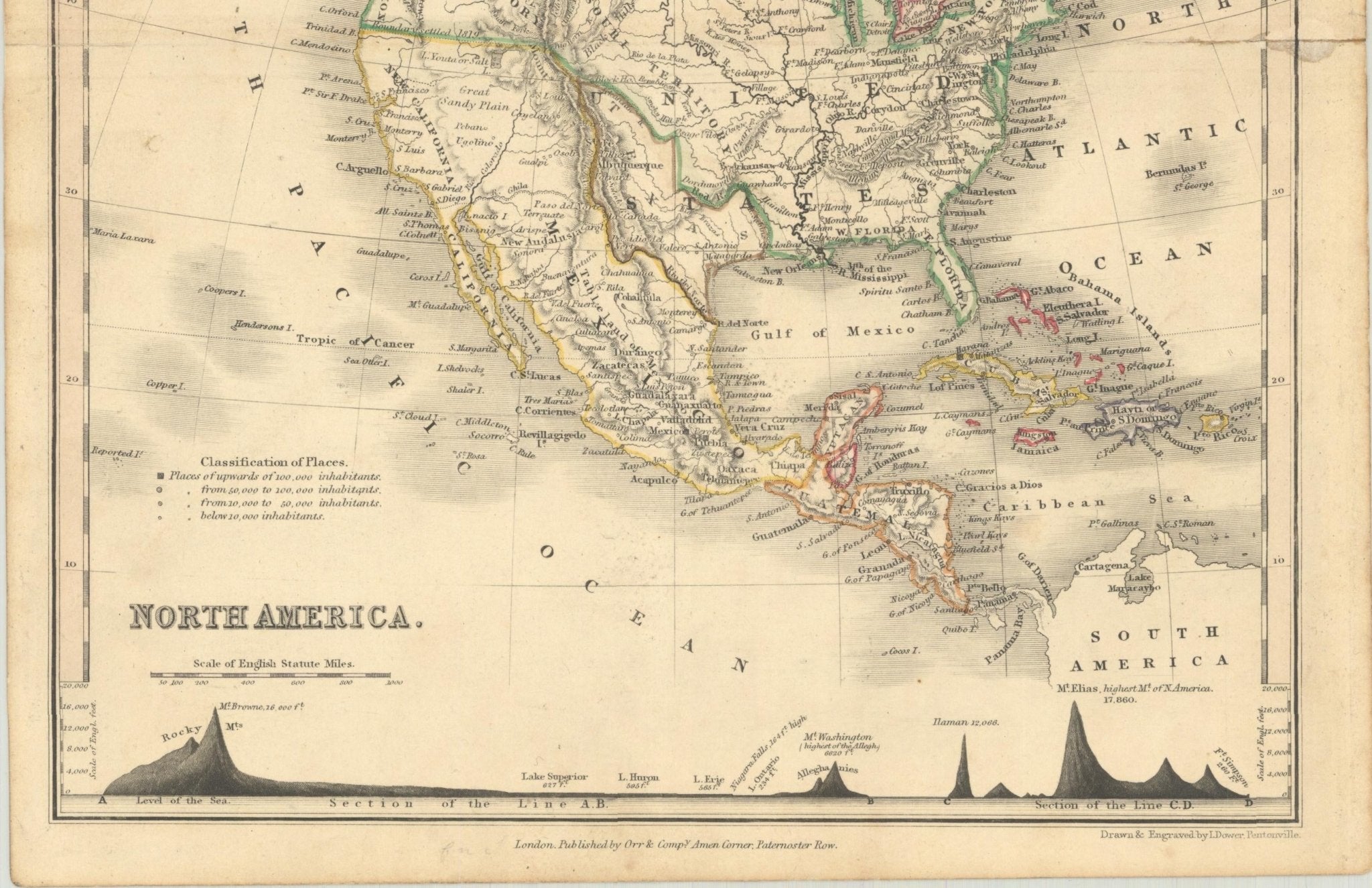
1846 "North America" Map, Engraved by I. Dower
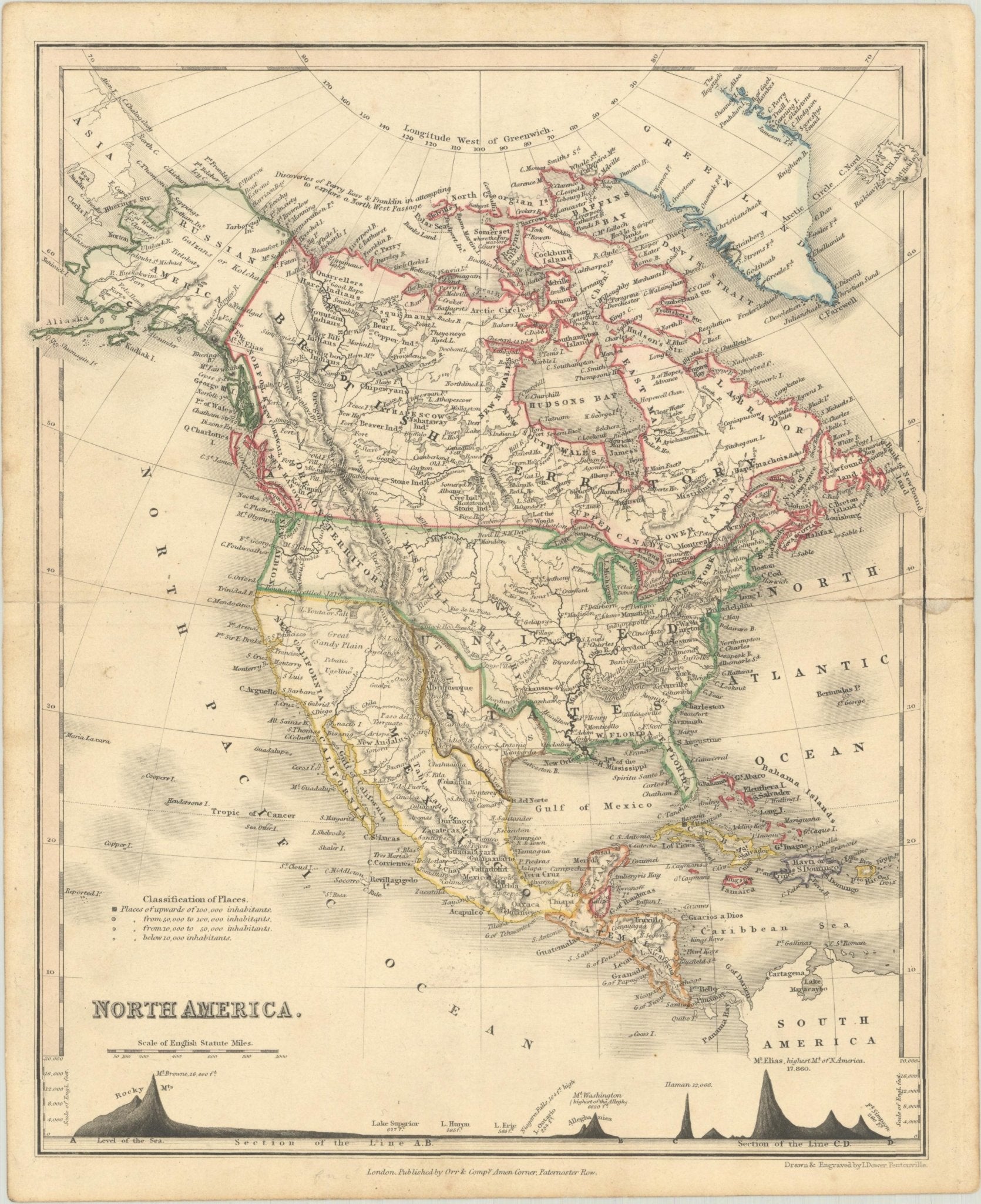
Presented is an original 1846 map of “North America.” The map was drawn and engraved by I. Dower and published in London by Orr & Company. The map depicts North America, to include Greenland, British Territory, Russian America, the United States, Texas, Mexico, Central America, and the islands of the West Indies.
Key rivers, mountain ranges, and populous cities are labeled throughout the map. A chart along the bottom margin of the map compares prominent mountain ranges and lakes by elevation, with Mount Saint Elias dominating at 17,860 ft. Country borders are delineated with a dashed line. The countries are outlined with hand coloring, with a light watercolor wash of pink, blue, yellow, and green.
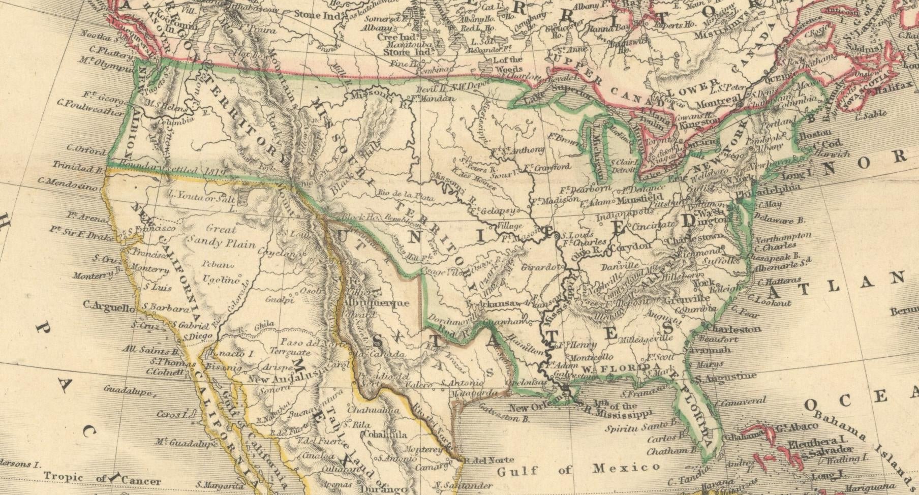
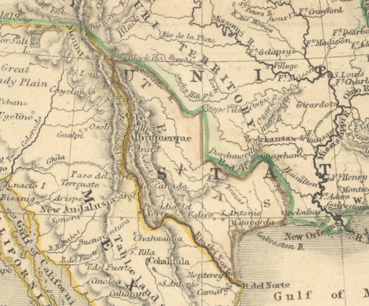
This attractive map of North America shows Texas in its large stovepipe orientation. While Texas is shown with its own borders, parts of the words "United States" overlap, indicating that Texas was transitioning to U.S. statehood. The border issue between the U.S. and Canada in the Pacific Northwest is marked as settled as of 1819. The West is called "New California," shown under Mexican control. Alaska is listed as Russian America, and Canada in its entirety is labeled British Territory. Interestingly, and quite uncommon for a map of North America of this time, the United States is shown without any state borders.
CONDITION:
Good condition overall. Contemporary outline hand-coloring. Paper has very light toning throughout. Archivally repaired centerfold separations at left (0.5") and right (1"). It is titled "North America" at bottom left cartouche. "London, Published by Orr & Compy., Amen Corner, Paternoster Row " at bottom center margin, "Drawn & Engraved by I. Dower, Pentonville" at bottom right margin. Map measures 10.3” H x 8.4” W.
The map is artfully framed to archival standard with acid-free backing, a dark gray top mat, UV Conservation Clear glass, and a custom black wooden frame.
Framed Dimensions: 16 1/4"H x 13 3/4"W x 3/4"D.
Accompanied by our company's letter of authenticity.
Pickup currently unavailable at Colorado
1846 "North America" Map, Engraved by I. Dower
Colorado
1 Lake Avenue
Colorado Springs CO 80906
United States
Choose options
Frequently Asked Questions
FAQs
Yes, all of our Antiques are certified authentic. Every antique comes with a signed Letter of Authenticity that details the item’s history, its current condition including any conservation, binding, or framing work, and the item’s provenance. The Letters of Authenticity are priced valuations by our authentication specialists, who assure that items are original and unconditionally guaranteed as genuine for life.
We pack and ship your items from our gallery in Colorado Springs. You may also choose to come pick up your order. Antique items are carefully packed and insured during shipping. The shipping price will be calculated at checkout.
We acquire from a variety of trusted sources all over the world, but mostly through auctions and private collections within the United States. All provenance information will be listed on the Letter of
Authenticity accompanying your purchase.