
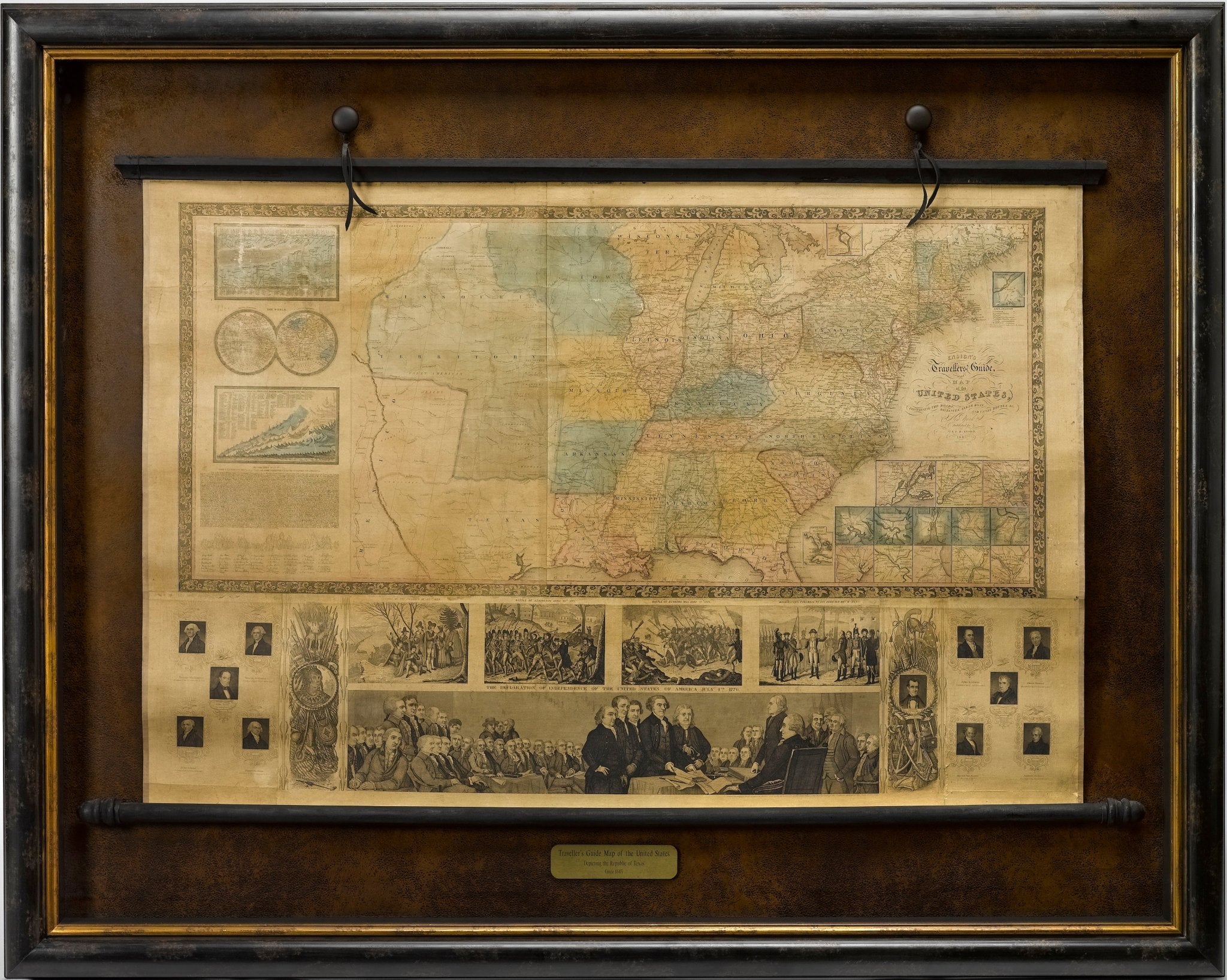
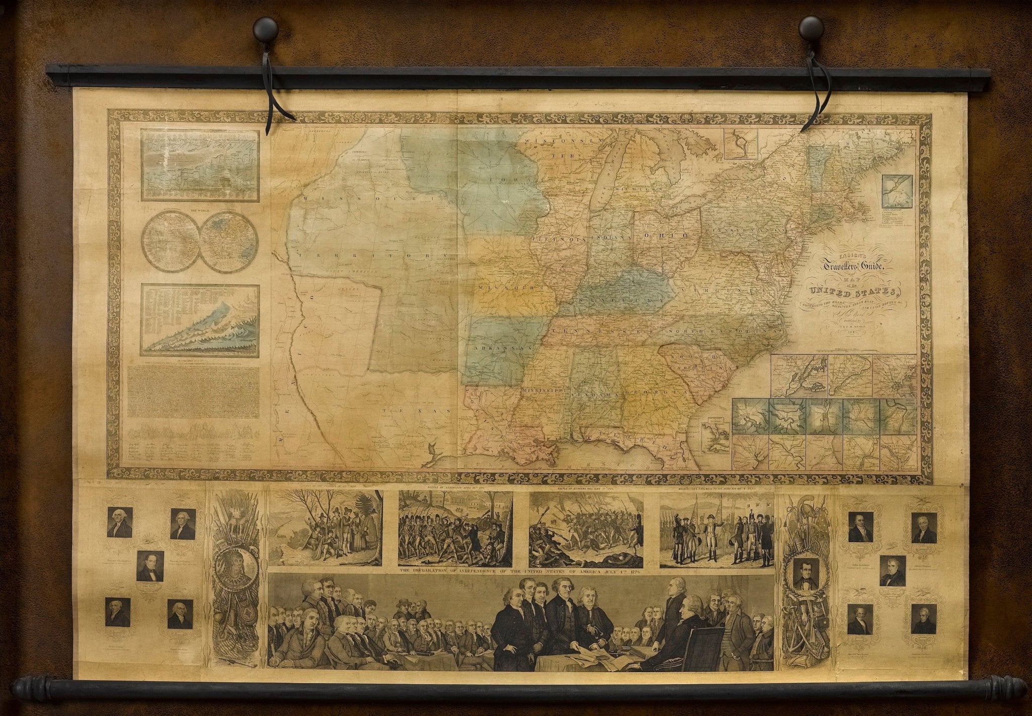
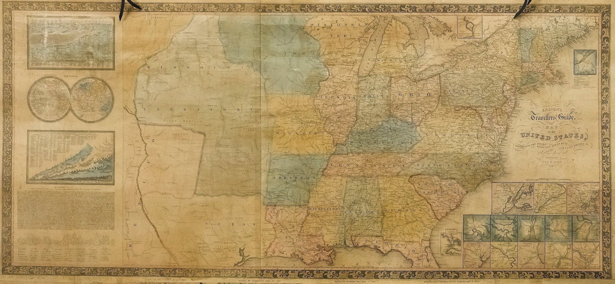
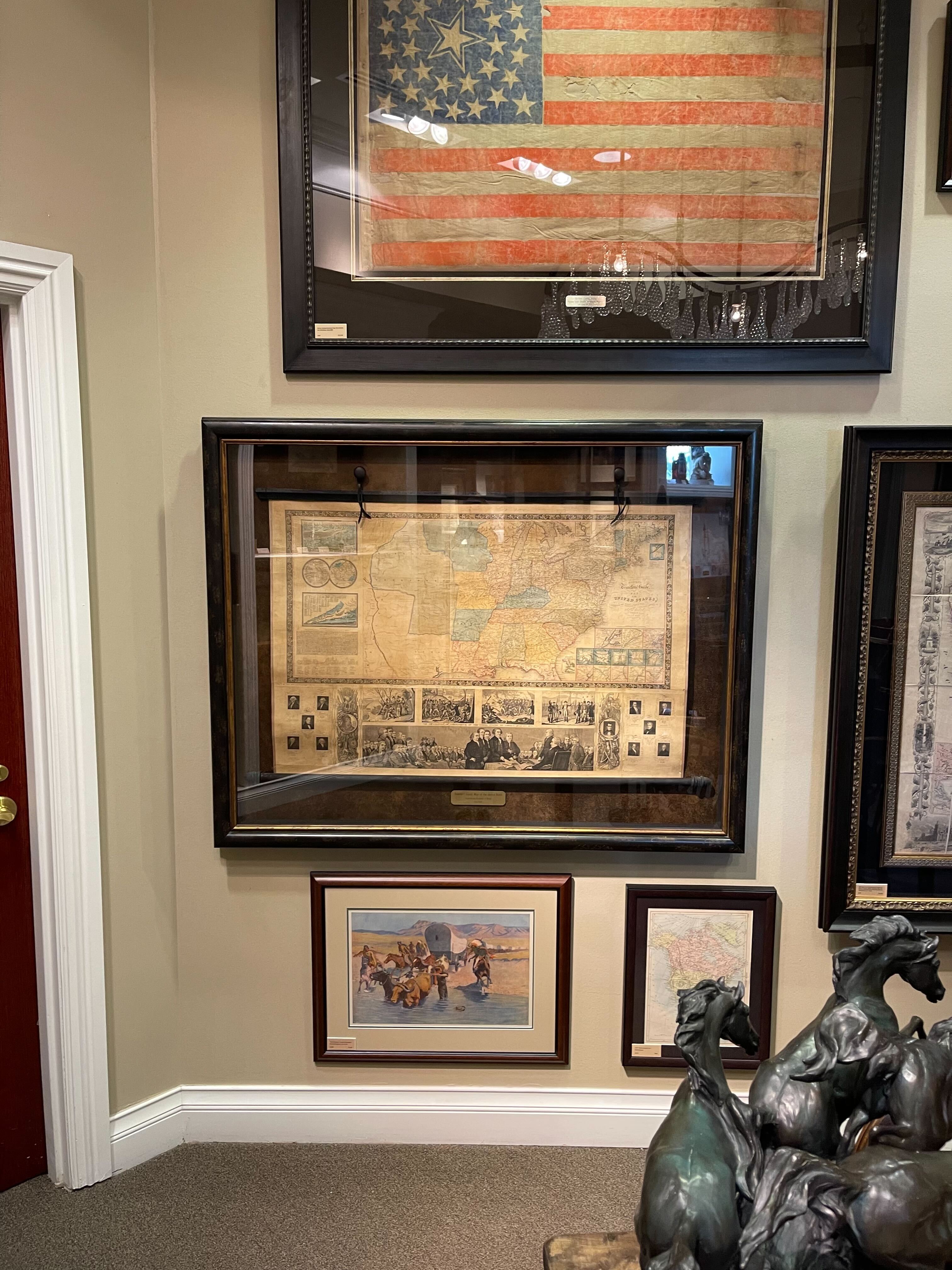

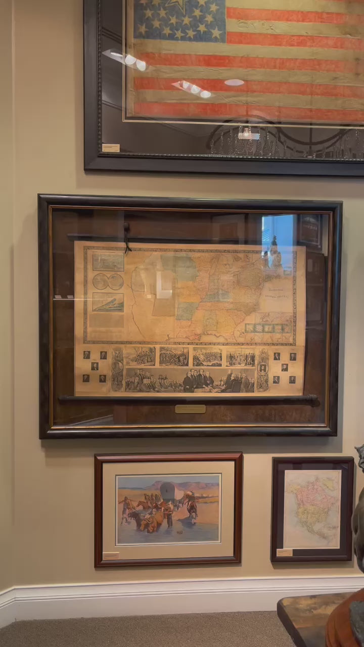
1845 "Ensign's Travellers' Guide and Map of the United States," Hand-Colored Wall Map
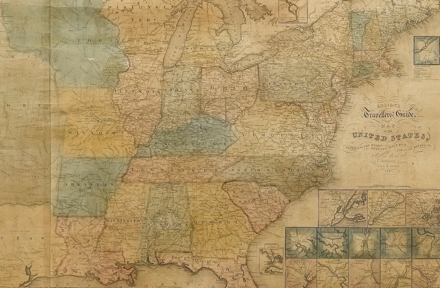
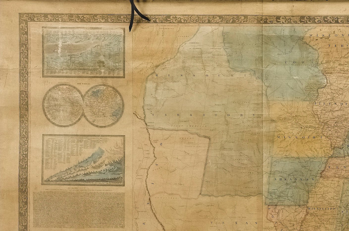
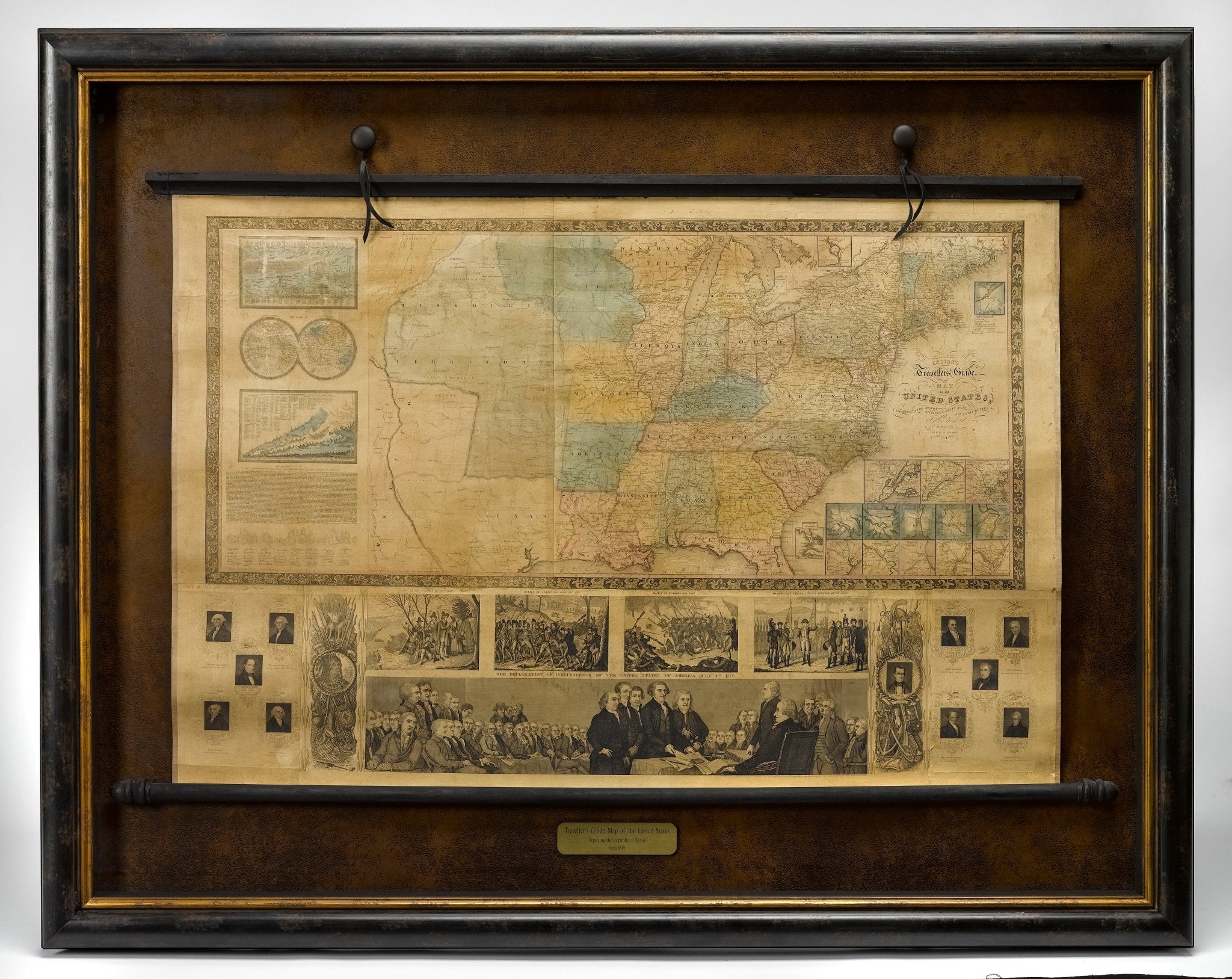
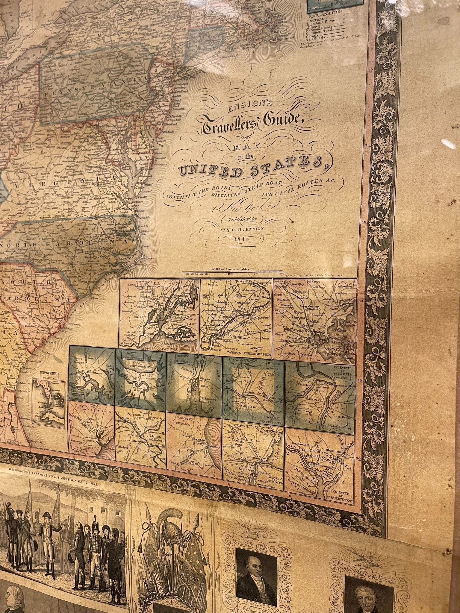
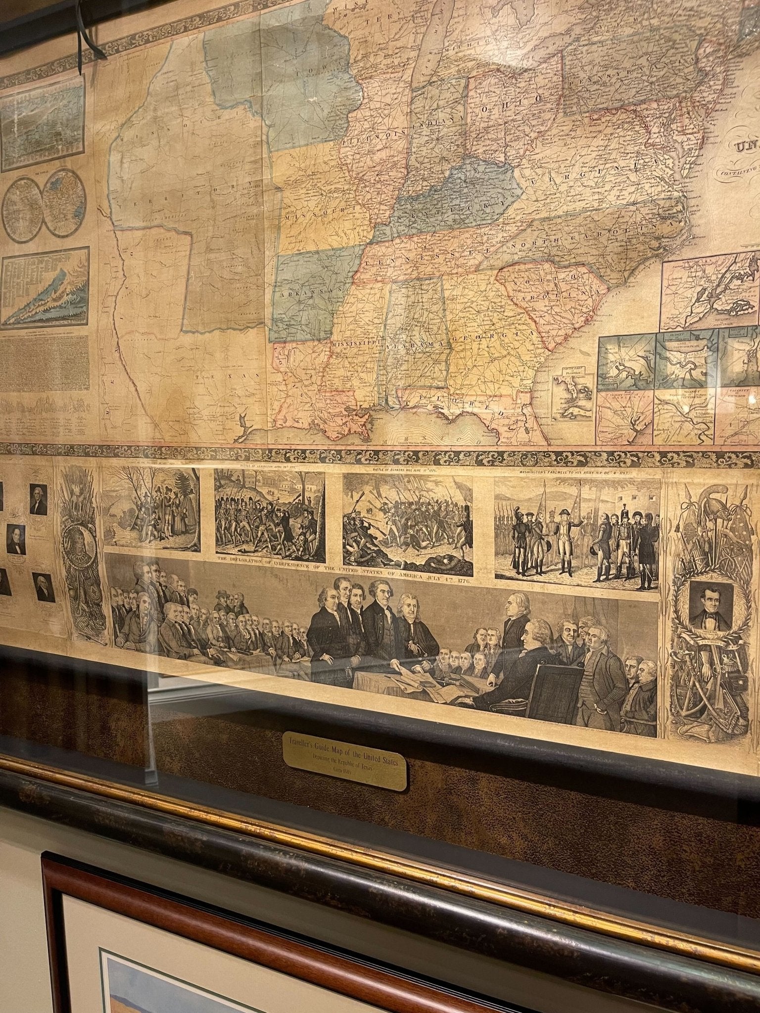
This is an exquisite and dramatic steel-engraved wall map of the United States, published by T. & E. H. Ensign in 1845. The map depicts the development and settlement of the United States, from the Atlantic, west to the Rio Grande. Most notably, this map includes the state of Texas, which was annexed to the United States in 1845. The map indicates principal cities, roads, steamboat and canal routes, and early railroads, as well as identifies several Native American settlements and U.S. military forts.
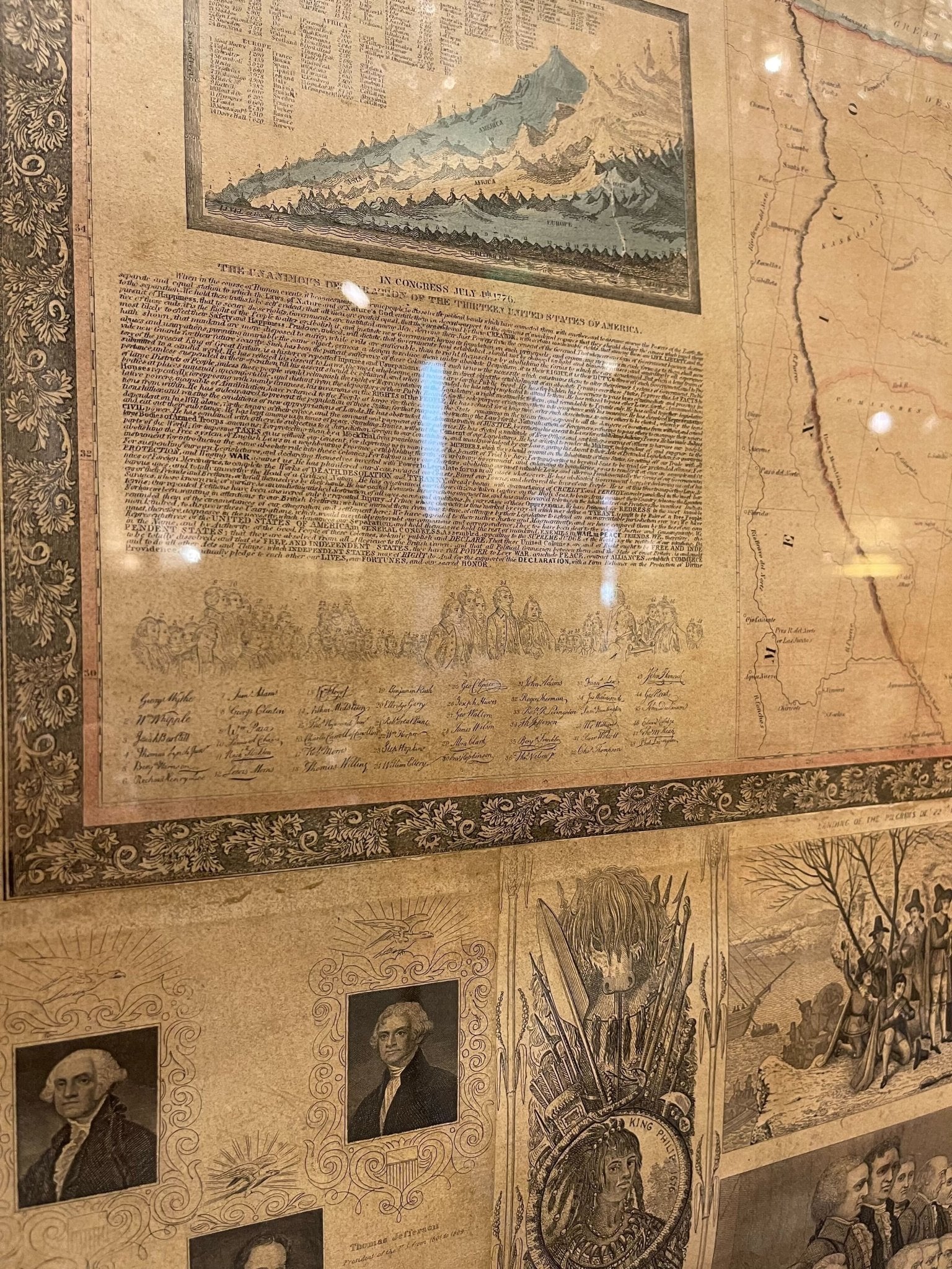
Below the beautifully engraved title are thirteen inset maps, showing the vicinities of New York City, Philadelphia, Boston, Baltimore, New Orleans, Mobile, Cincinnati, St. Louis, Charleston, Pittsburgh, Chicago, Detroit, as well as Washington, DC. This highly decorative and informative map also includes comparative charts of the chief rivers and principal mountains, inset with a map of the world in hemispheres.
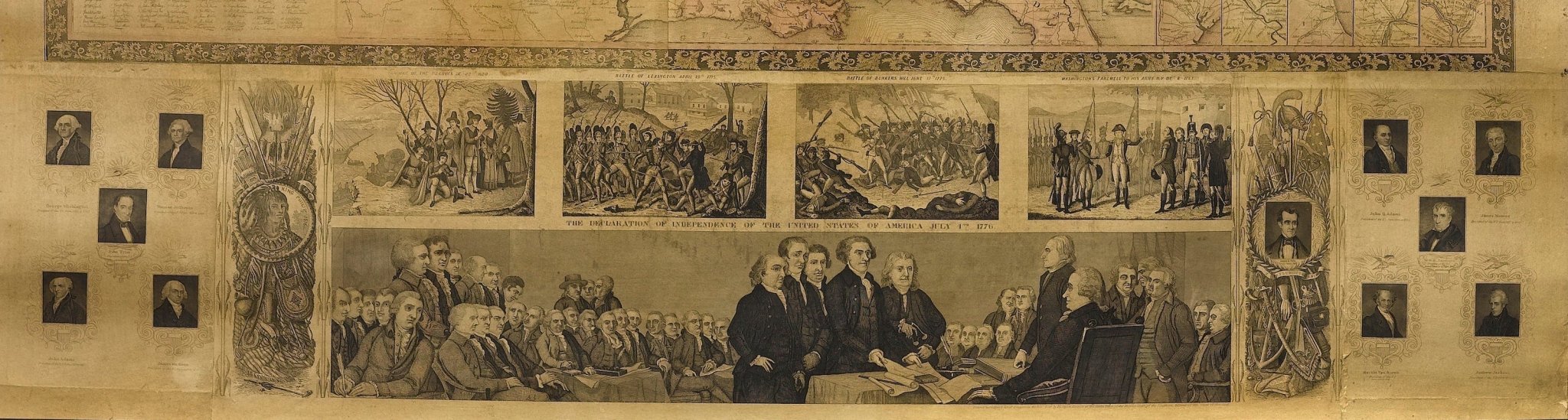
A copy of the text of the Declaration of Independence with facsimile signatures is included- a wonderful nod to the principal text of our nation. At bottom are portraits of eleven of the early U.S. Presidents. A large illustration of “The Signing of the Declaration of Independence” is topped with smaller engravings of “The Landing of the Pilgrims on December 22, 1620,” “The Battle of Lexington, April 19th 1775,” “The Battle of Bunkers Hill, June 17, 1775,” and “Washington's Farewell to his army, December 4, 1783.”
T & E. H. Ensign published throughout much of the nineteenth century, issuing maps like the one shown, usually in conjunction with others, including Phelps, Thayer, Bridgman and Fanning. Ensign would issue “The Traveller’s Guide” in both pocket book form and wall map form, this being a beautiful example of the latter.
CONDITION:
Very good + condition. Steel engraving. Hand colored, with light watercolor wash. Title of this hand-colored map reads "Ensign's Travellers' Guide and Map of the United States, Containing the roads, distances, steam boat and canal routes, &c. New York. Published by T. A. E. H. Ensign, 1845." Paper with wrinkling on edges, general and consistent toning. Repaired edge wear tears, cracking, and chipping along margins. Map has been professionally linen-back and restored.
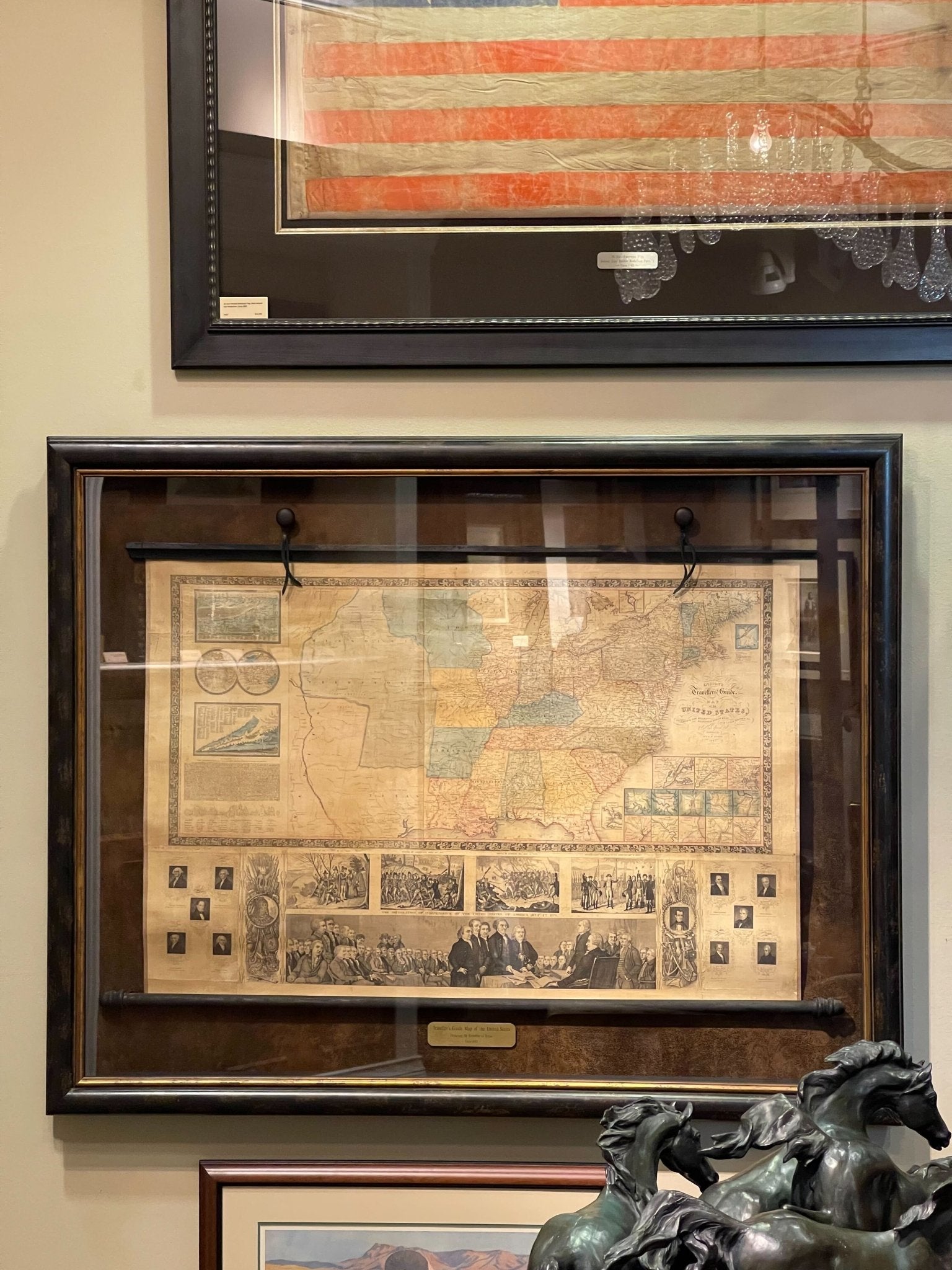
This impression is presented hanging, on a wooden rod, and has been mounted and framed to conservation standards, with archival suede mat, in a custom black and gold frame, with UV plexiglass. Framed dimensions: 41.5” H x 52.5” W x 4” D.
Accompanied by our company's letter of authenticity.
Pickup available at Colorado
Usually ready in 4 hours
1845 "Ensign's Travellers' Guide and Map of the United States," Hand-Colored Wall Map
Colorado
1 Lake Avenue
Colorado Springs CO 80906
United States
Choose options
Frequently Asked Questions
FAQs
Yes, all of our Antiques are certified authentic. Every antique comes with a signed Letter of Authenticity that details the item’s history, its current condition including any conservation, binding, or framing work, and the item’s provenance. The Letters of Authenticity are priced valuations by our authentication specialists, who assure that items are original and unconditionally guaranteed as genuine for life.
We pack and ship your items from our gallery in Colorado Springs. You may also choose to come pick up your order. Antique items are carefully packed and insured during shipping. The shipping price will be calculated at checkout.
We acquire from a variety of trusted sources all over the world, but mostly through auctions and private collections within the United States. All provenance information will be listed on the Letter of
Authenticity accompanying your purchase.