
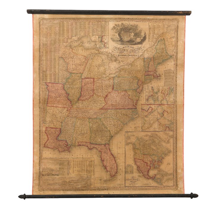
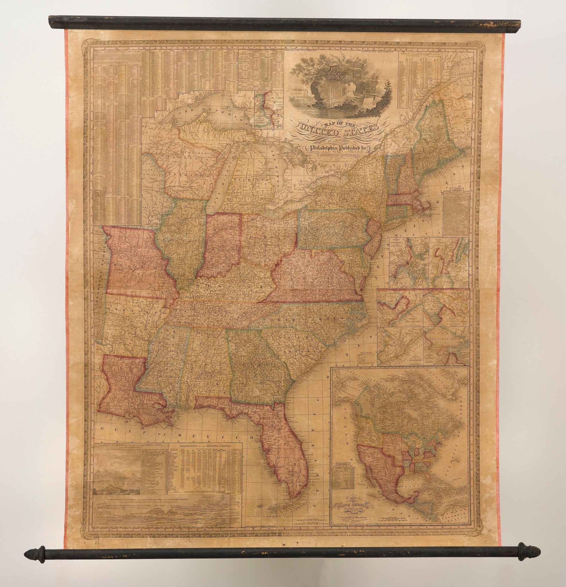
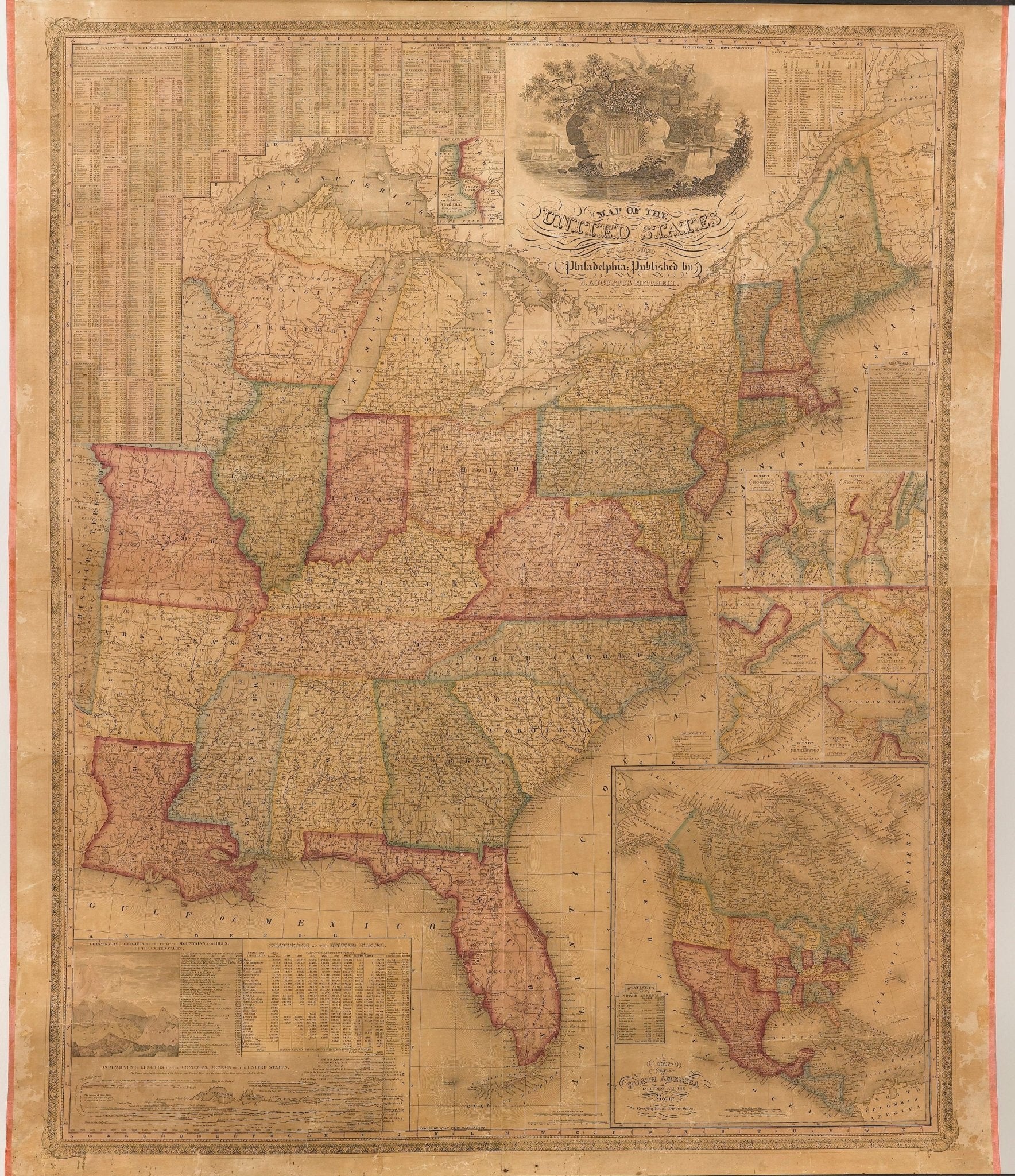
1842 Wall Map of United States, Engraved by J. H. Young, Published by S. A. Mitchell
Presented is an 1842 hanging “Map of the United States,” engraved by J. H. Young and published by Samuel Augustus Mitchell, Philadelphia. This is a beautiful example of the rare 1842 edition of Mitchell's map of the United States, that was first issued in 1831. This 1842 edition has been updated, with Arkansas and Michigan depicted as states. The depiction of Florida also is very interesting, with only the earliest counties present.
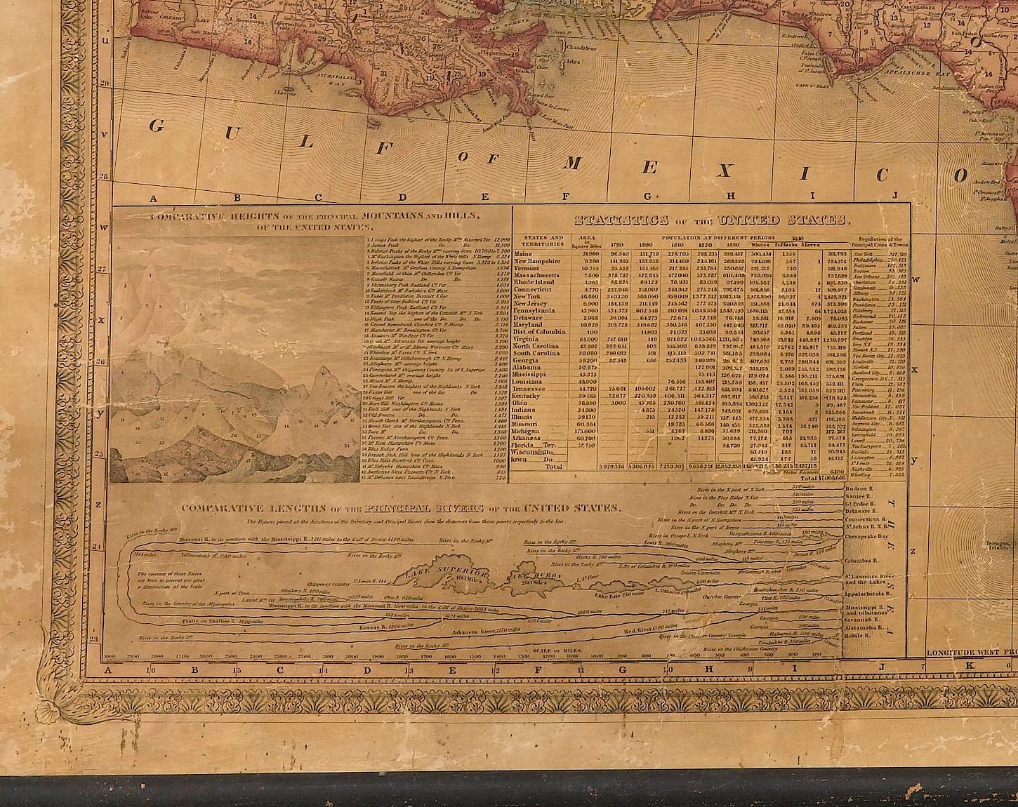
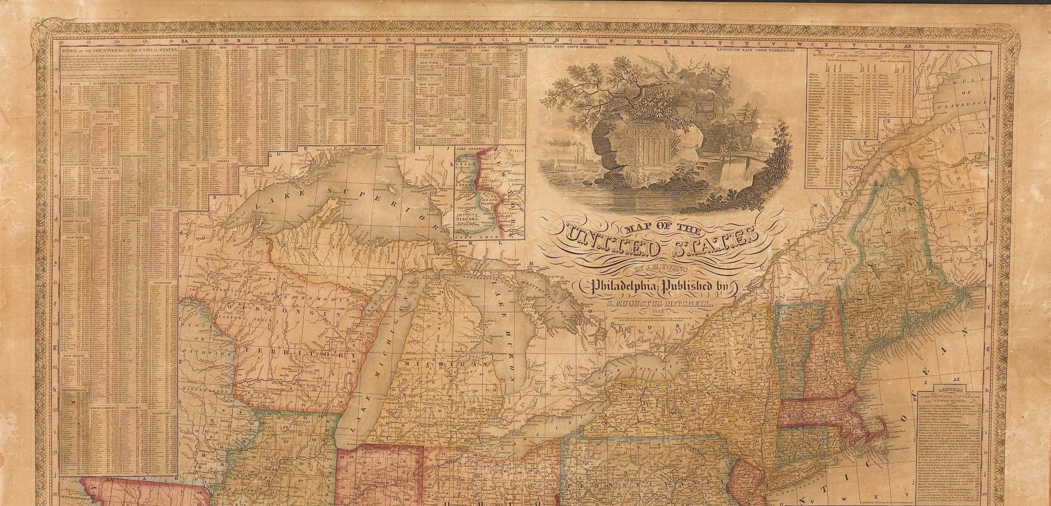
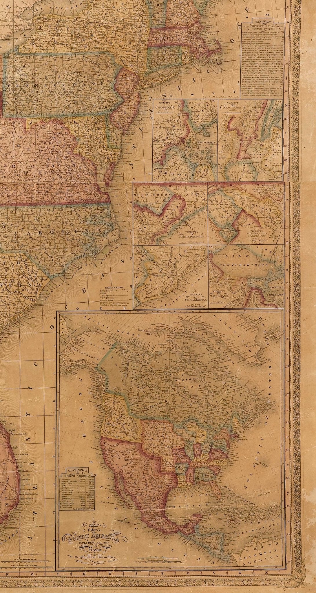
Elaborately detailed, the hanging wall map includes a large inset "Map of North America, including all the recent geographical discoveries'' at bottom right, as well as seven city map insets of the vicinities around Boston, New York, Philadelphia, Baltimore and Washington, Charleston, New Orleans, and Niagara. A distance table for the Erie and Champlain canals, an index of the counties of the United States, illustrated diagrams of comparative heights and lengths of United States mountains and rivers, and state population and area statistical tables fill the map’s border.
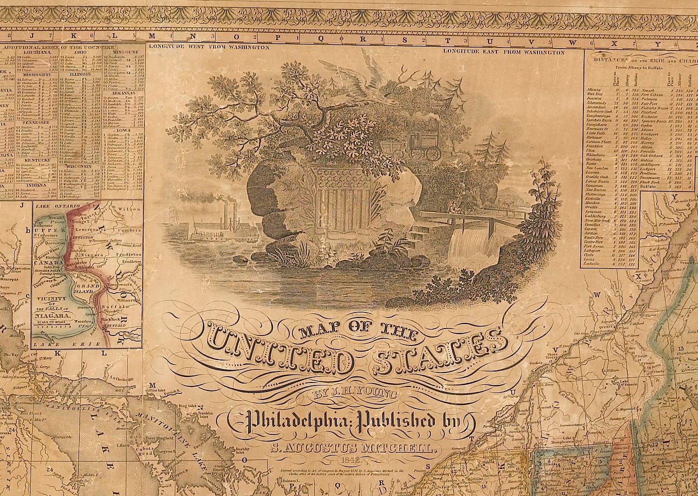
At top is an allegorical vignette, celebrating the then dramatic advances in transportation. Young engraved a steam boat at left, a canal lock being operated at right, and, faintly visible cutting through the forest at center, a very early locomotive. All of this surrounds the crest of the United States set into a rock with a spread eagle flying over these symbols of American technological ingenuity.
When this map was first issued in 1831, it was Mitchell's first wall map as well as his first, original cartographic publication. Mitchell published other maps and an atlas in 1831, but these were all re-issues of works by Anthony Finley. This very skillful and information-filled wall map launched the Mitchell firm to a position of dominance in cartographic publishing, one that it would hold for over two decades. This map was also very likely the first, large-scale map to have been steel plate-engraved.
CONDITION:
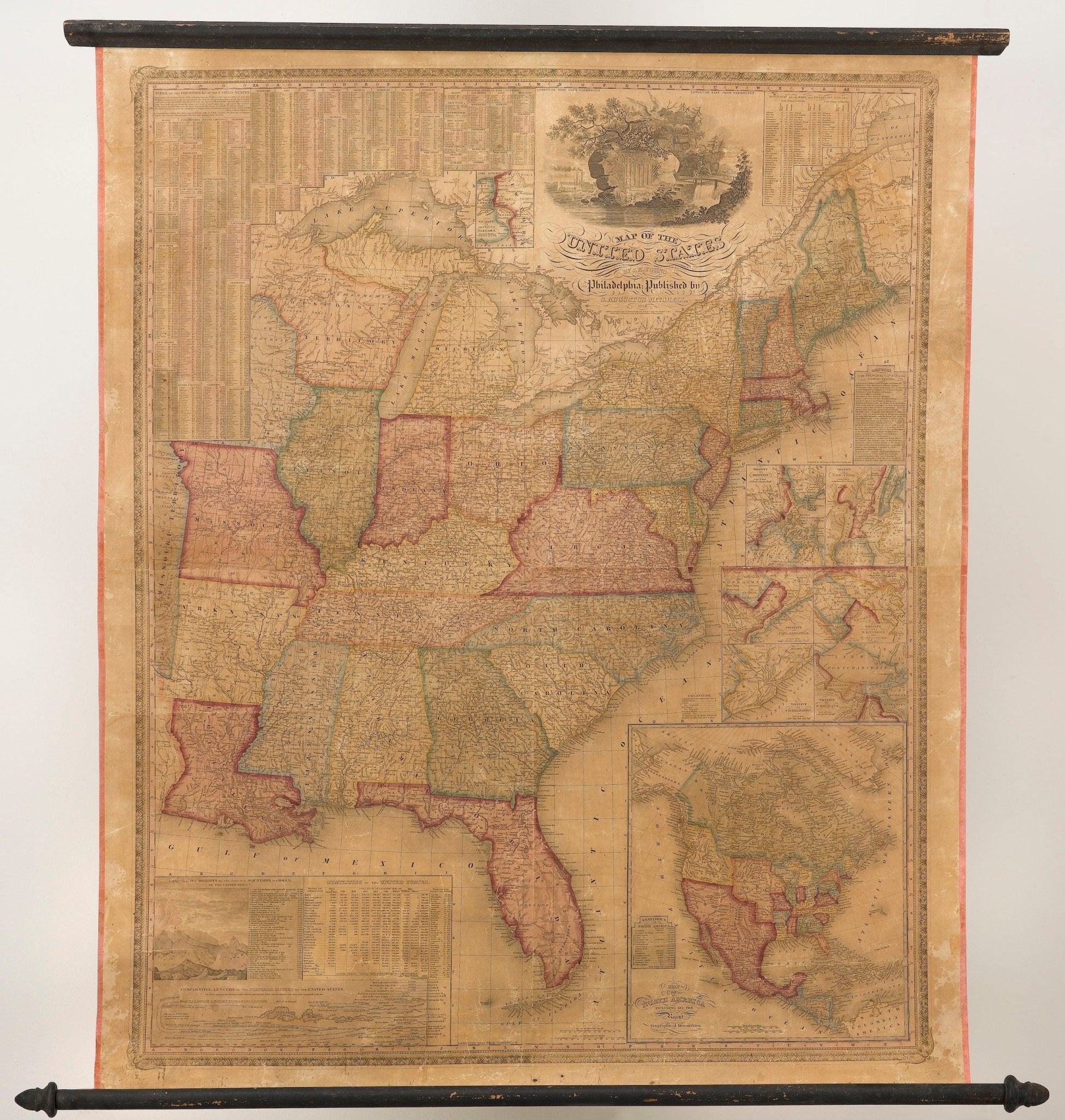
Very good condition, considering age and past use. Hanging wall map, engraved and printed onto 4 sheets, joined. Original hand coloring. On wooden rollers. Several splits and cracks and small losses from past use and rolling. Toning and small areas of foxing and stains, mostly in margins. Map has since been stabilized and backed with new archival linen. Unframed dimensions: 45" H x 38" W.
Accompanied by our company's letter of authenticity.
Pickup available at Colorado
Usually ready in 4 hours
1842 Wall Map of United States, Engraved by J. H. Young, Published by S. A. Mitchell
Colorado
1 Lake Avenue
Colorado Springs CO 80906
United States
Choose options
Frequently Asked Questions
FAQs
Yes, all of our Antiques are certified authentic. Every antique comes with a signed Letter of Authenticity that details the item’s history, its current condition including any conservation, binding, or framing work, and the item’s provenance. The Letters of Authenticity are priced valuations by our authentication specialists, who assure that items are original and unconditionally guaranteed as genuine for life.
We pack and ship your items from our gallery in Colorado Springs. You may also choose to come pick up your order. Antique items are carefully packed and insured during shipping. The shipping price will be calculated at checkout.
We acquire from a variety of trusted sources all over the world, but mostly through auctions and private collections within the United States. All provenance information will be listed on the Letter of
Authenticity accompanying your purchase.