
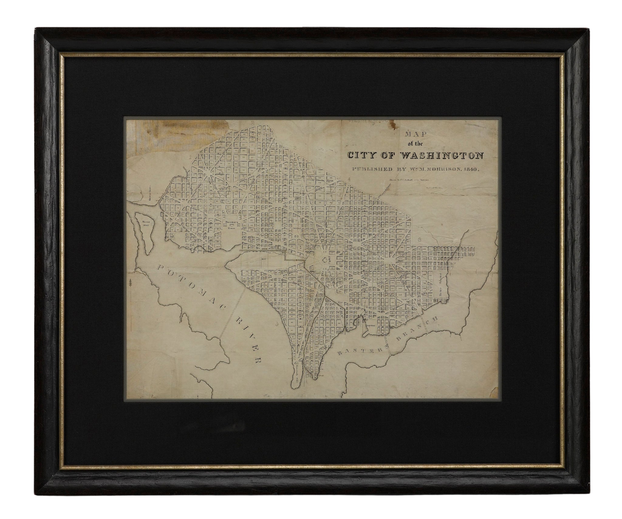
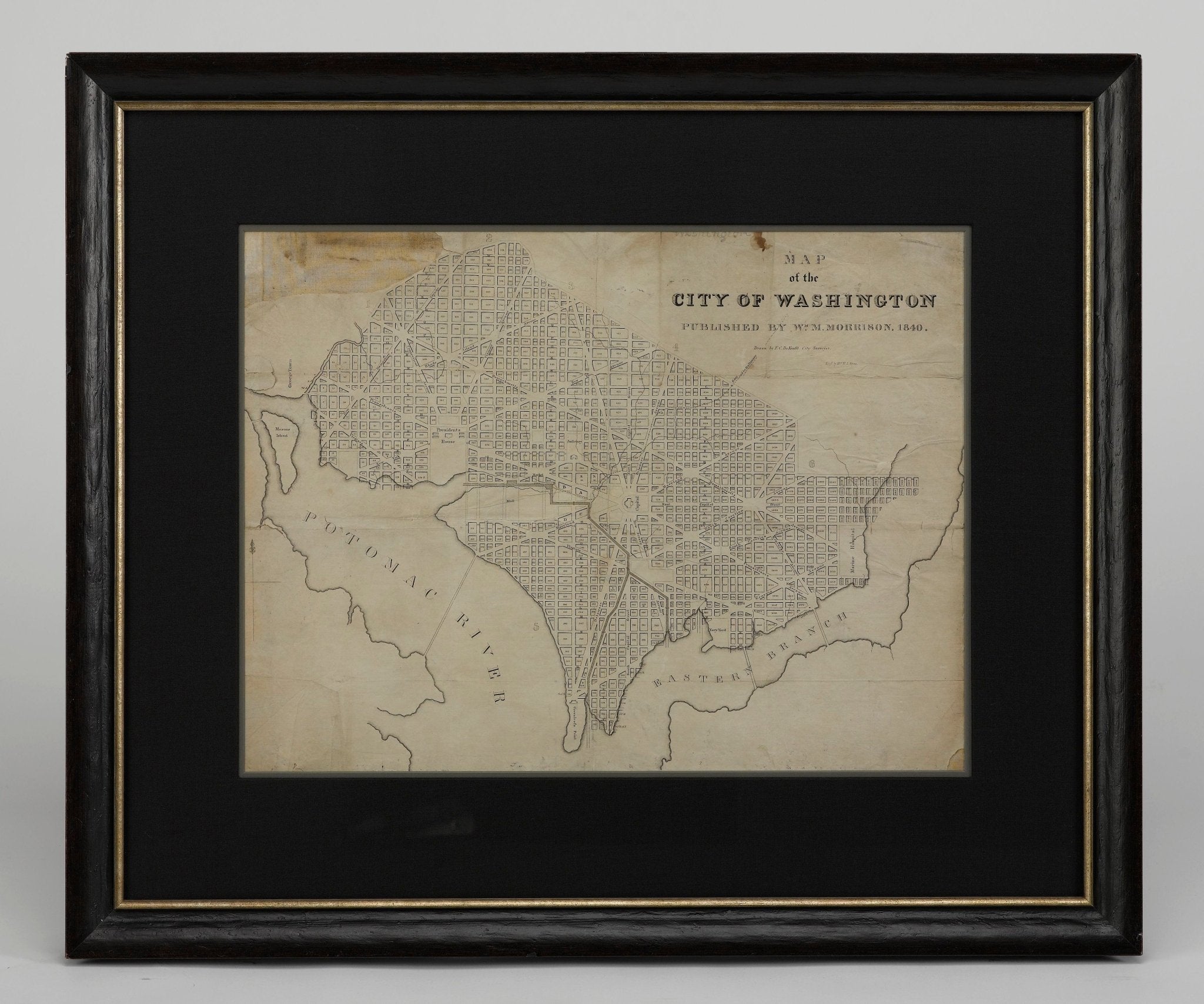
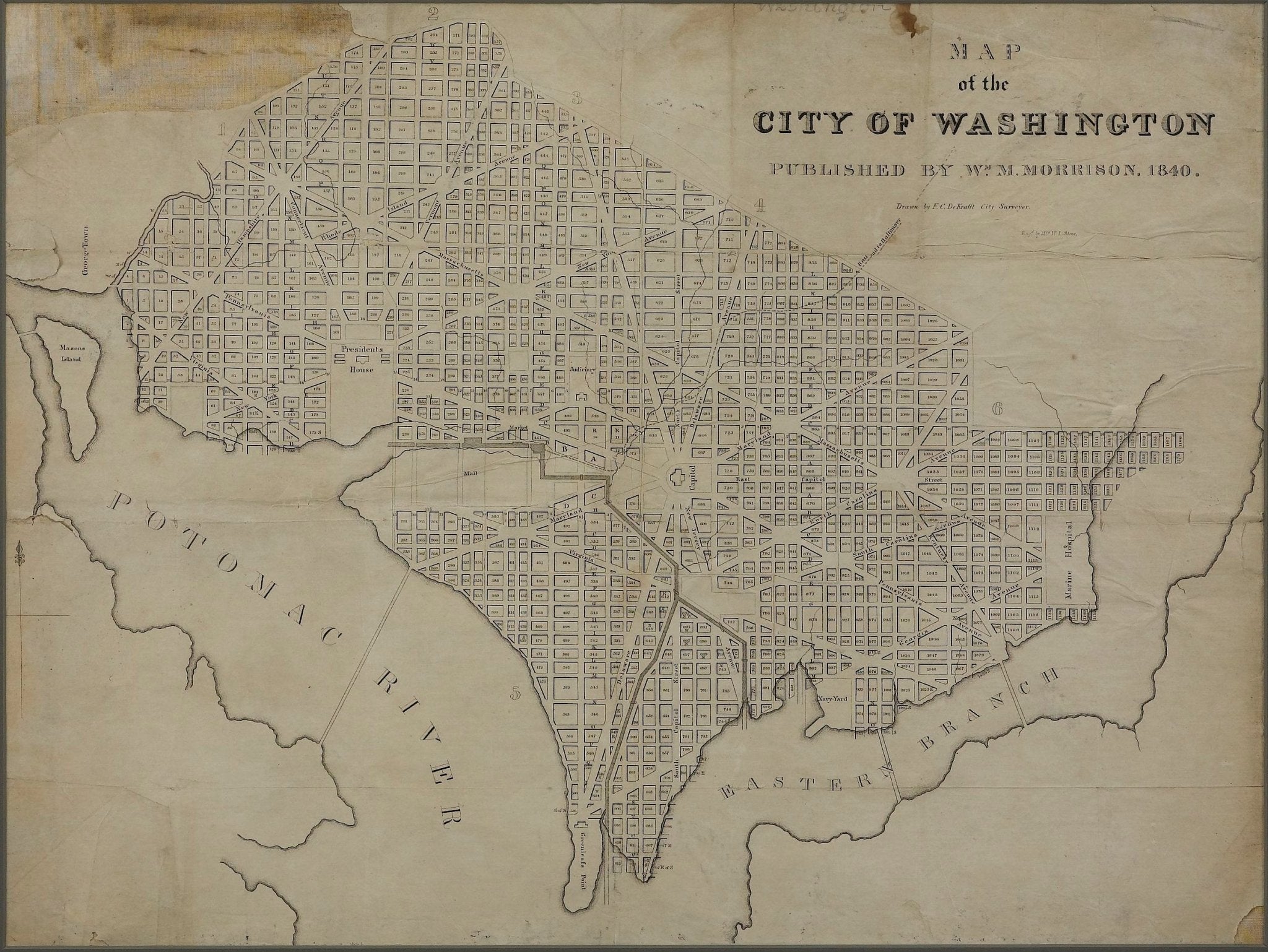
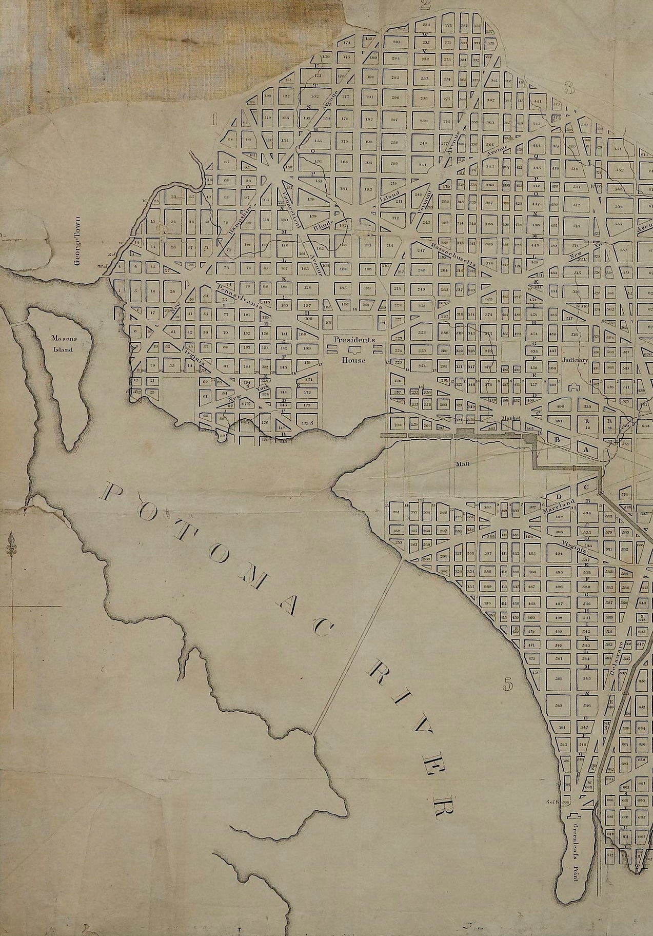
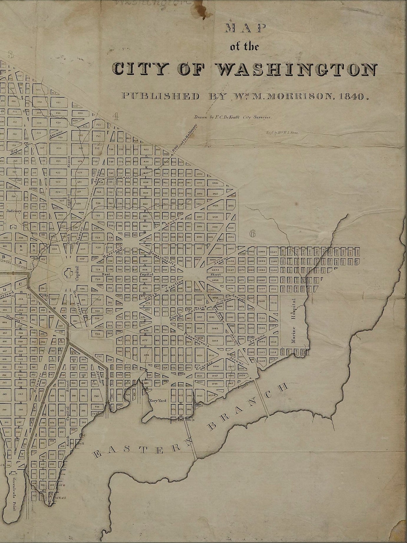
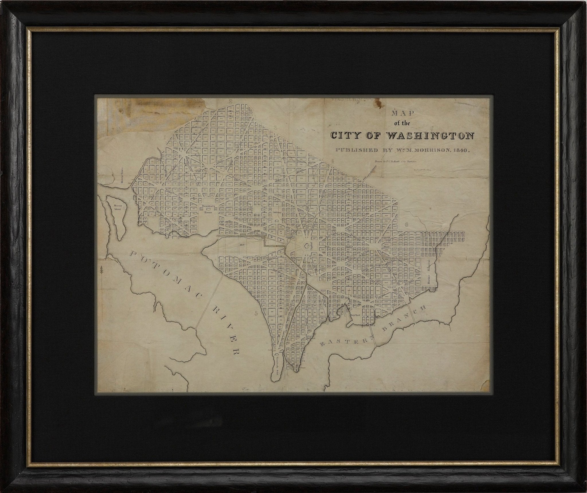
1840 "Map of the City of Washington" Published by William M. Morrison
This map, printed in 1840, is a detailed representation of Washington, D.C. in the mid-19th century. The map shows block numbers, wards, and government buildings as well as details of the city that have since changed. The map was published by William M. Morrison, drawn by F. C. De Kraft, the City Surveyor, and engraved by "Mrs. W. L. Stone.”
With the Capitol Building at the center, this map closely resembles the 1792 Plan of D.C. by Ellicott. Different from later maps, this work does not include Georgetown or Georgetown College and refers to the Anacostia River only as the “Eastern Branch.” In the middle of a massive construction push, the area was rapidly changing as the young city attempted to not only establish capitol-worthy structures, but also reconstruct what the British had destroyed in the recent War of 1812. The southwest edge of the city looks very different from today. Most notably, this 1840 map was printed before the plans for the harbor improvement plans were made, leaving the Potomac River edge coming right up near the White House. Additionally, at the time of publishing, the canals running from the mall and flowing through the city to end at the Green Leaf Terminus or the Navy Yard Terminus were still functional. It wasn’t until the 1870s when the destruction of these canals began.
Based on the design by L’Enfant and Ellicott, the plan for the city of Washington was closely adhered to once their plan was put into place. This map shows the city as it was only 40 years after the presidents first began living in the city. With the broad avenues and large public squares, the grandiosity of the young country’s capital reflected its hopes for the future.
CONDITION:
The map is wrinkled and creased with small tears throughout from use. The top left corner of the map has a small loss, but no parts of the city are missing and the map has been backed with canvas. The 1840 map has a few stains from old age and has “Washington” written at the top in pencil from a previous owner.
"Map of the City of Washington" Published by William M. Morrison, 1840. Drawn by F. C. De Kraft, City Surveyer. Engraved by "Mrs. W. L. Stone.”
The frame is archival quality and includes UV protective glass. Framed Dimensions: 24.75” H x 29.5” W x 1.5” D.
Accompanied by our company's letter of authenticity.
Pickup available at Colorado
Usually ready in 4 hours
1840 "Map of the City of Washington" Published by William M. Morrison
Colorado
1 Lake Avenue
Colorado Springs CO 80906
United States
Choose options
Frequently Asked Questions
FAQs
Yes, all of our Antiques are certified authentic. Every antique comes with a signed Letter of Authenticity that details the item’s history, its current condition including any conservation, binding, or framing work, and the item’s provenance. The Letters of Authenticity are priced valuations by our authentication specialists, who assure that items are original and unconditionally guaranteed as genuine for life.
We pack and ship your items from our gallery in Colorado Springs. You may also choose to come pick up your order. Antique items are carefully packed and insured during shipping. The shipping price will be calculated at checkout.
We acquire from a variety of trusted sources all over the world, but mostly through auctions and private collections within the United States. All provenance information will be listed on the Letter of
Authenticity accompanying your purchase.