
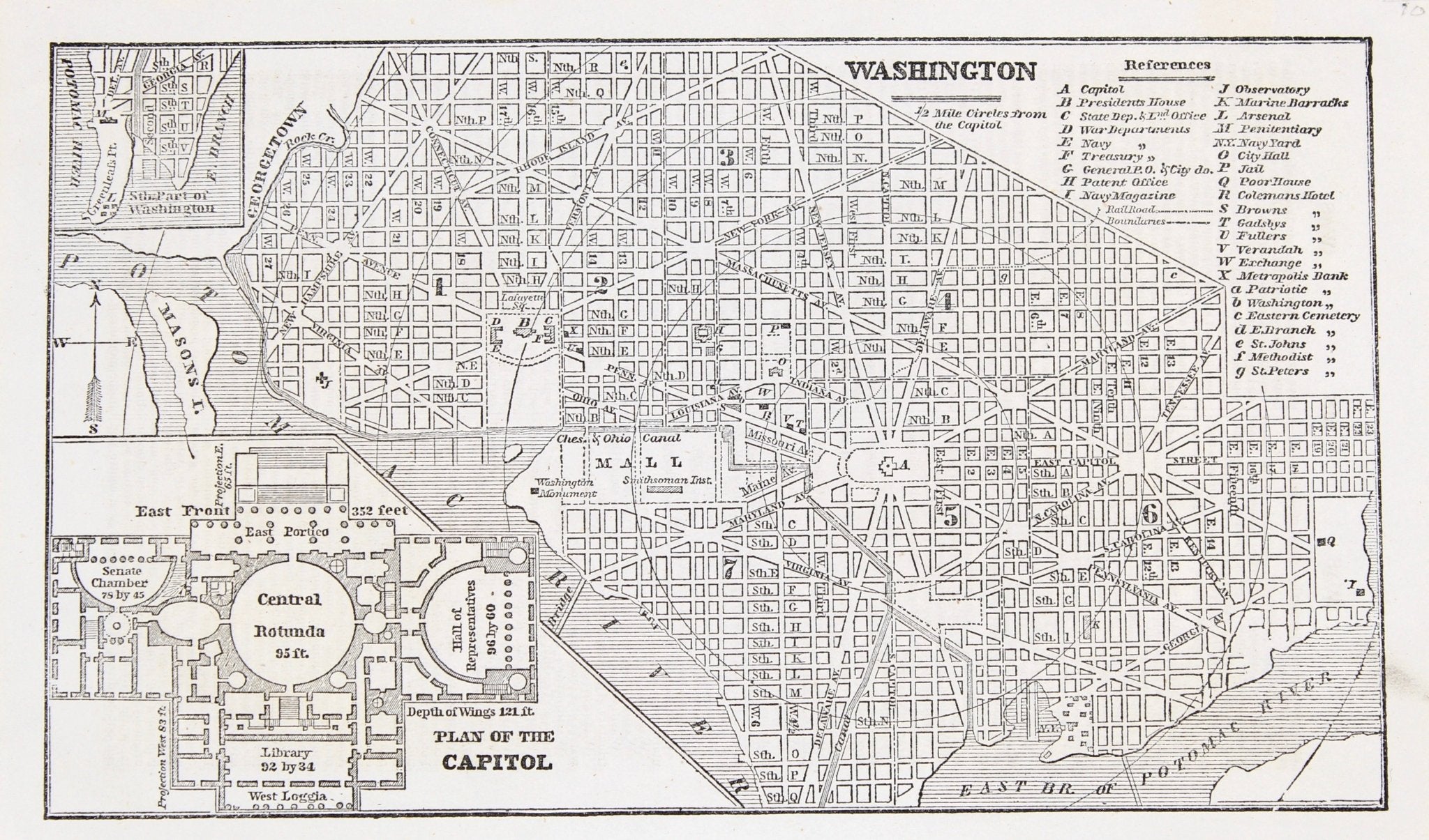
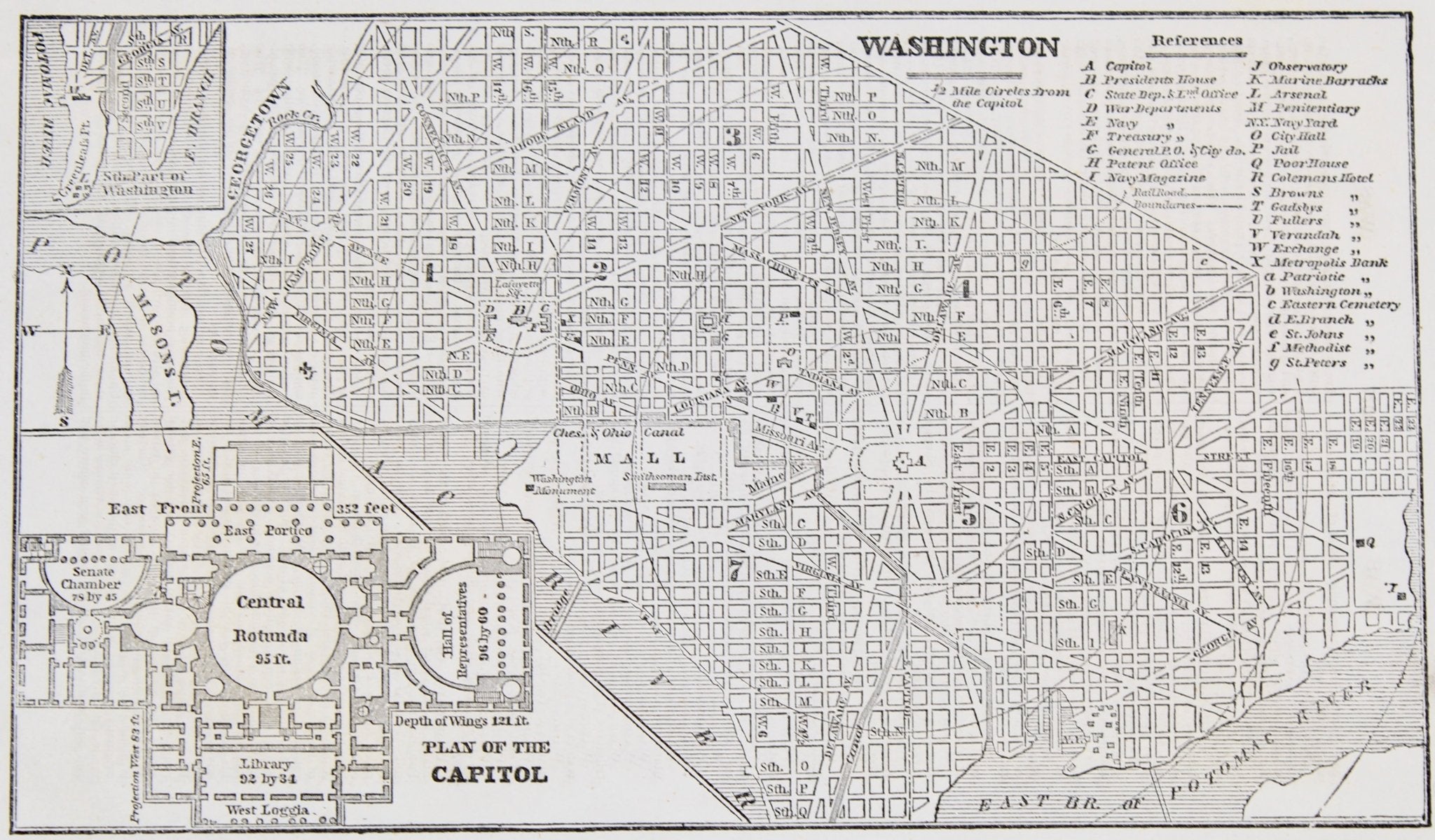
1853 “ Washington” Engraved Map from Fanning's Illustrated Gazetteer of the United States
Presented is an original engraved map of Washington, DC, from 1853. The map was published in Fanning’s Illustrated Gazetteer of the United States. A compendium of maps, statistics, written descriptions, and histories, the Gazetteer was published by Phelps, Fanning and Company, in New York, and updated every so often with new territorial acquisitions, census data, and the like.
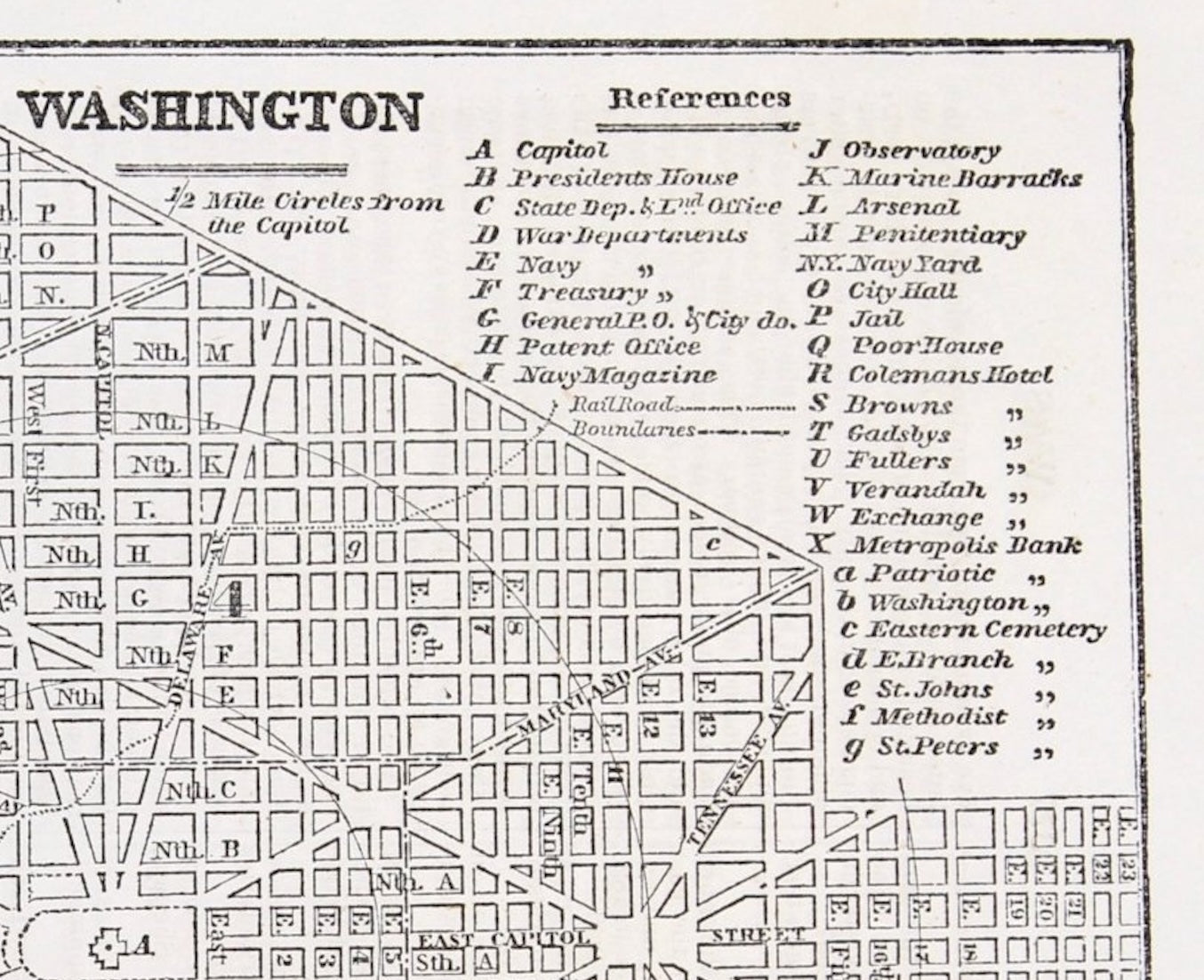
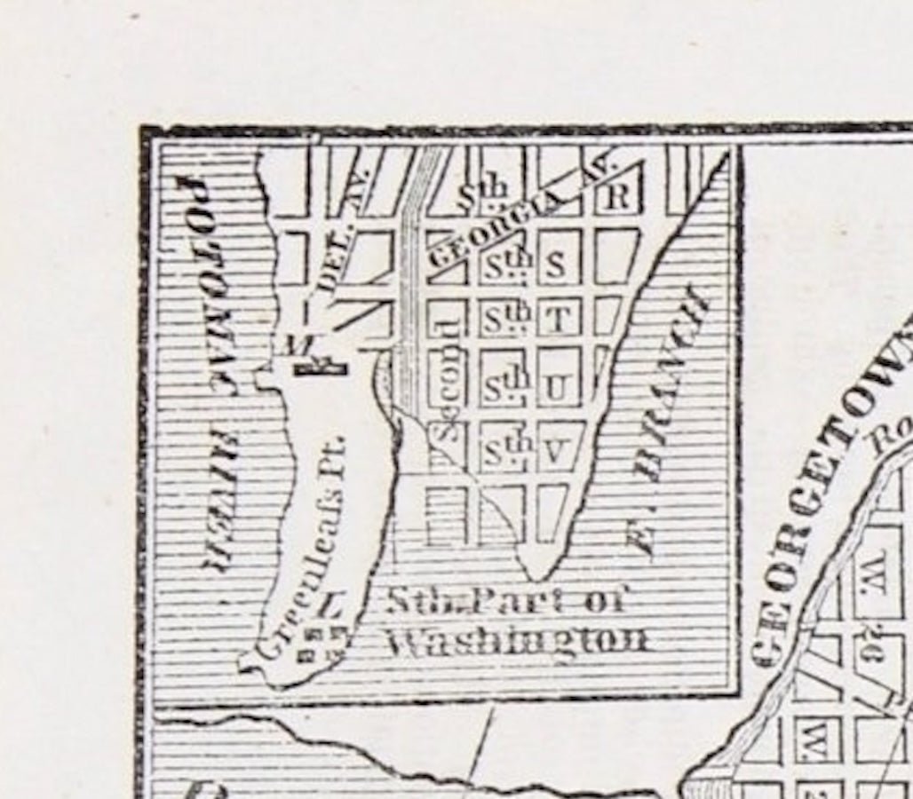
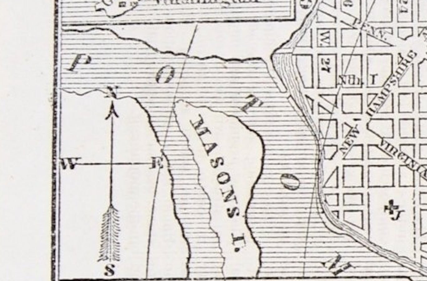
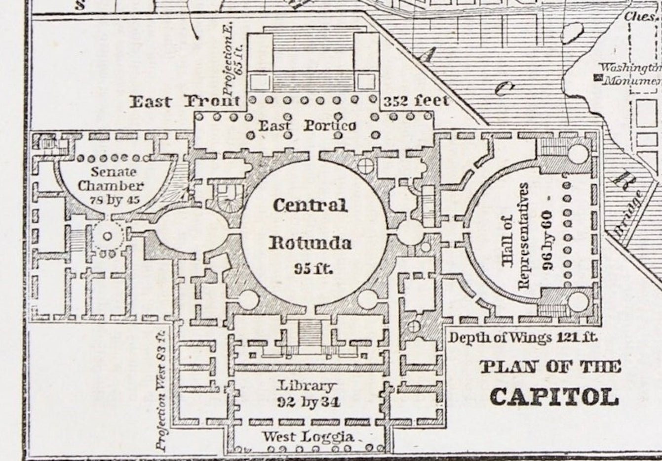
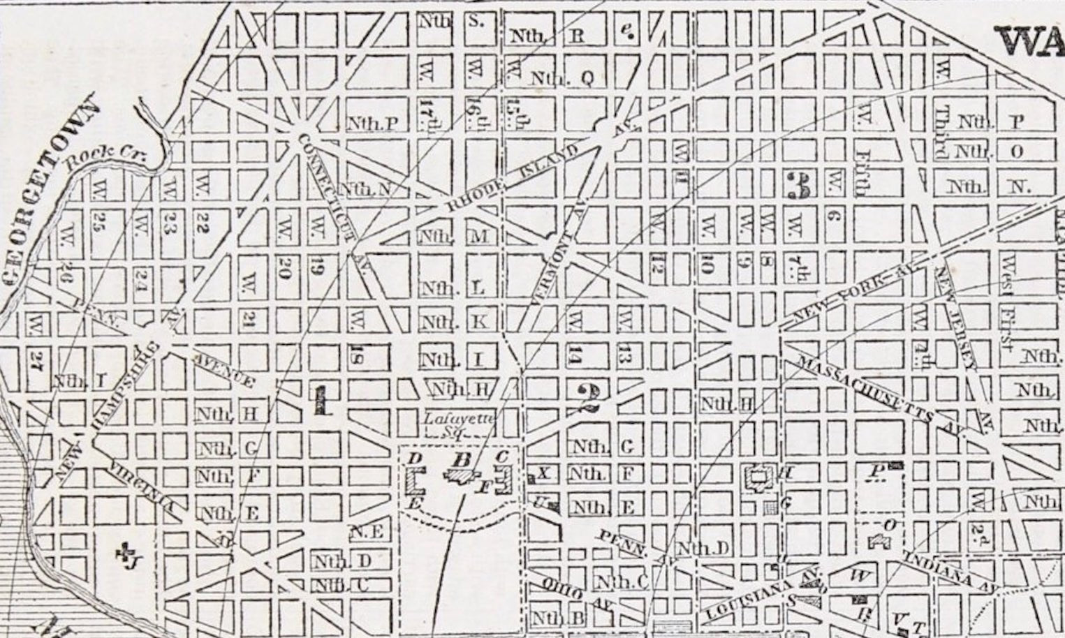
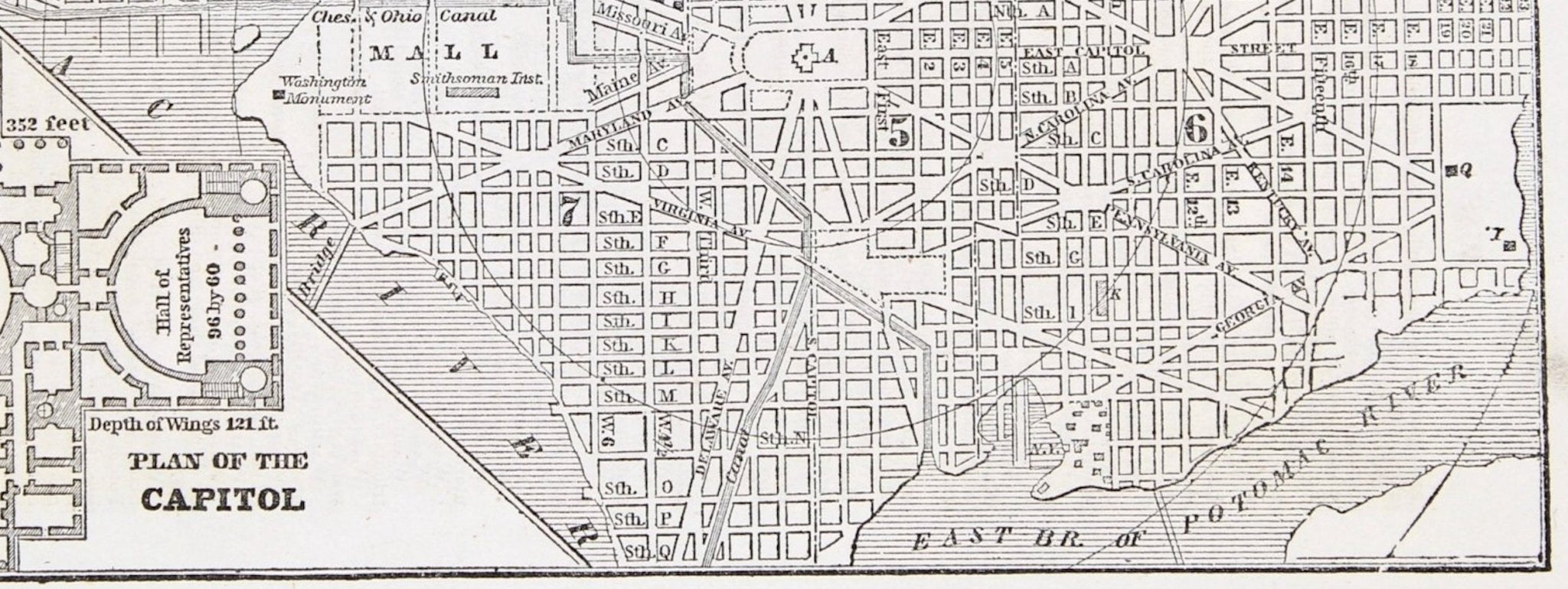
The map shows radial distances from the Capitol and includes an index to points of interest, including the President’s house, Post Office, Patent Office, Banks, Churches, and Federal department buildings. An inset of "Sth. part of Washington" and "Plan of the Capitol" are included at top and bottom right, respectively.
CONDITION:
Near fine condition. Strong printing. Engraving, black and white as issued. Full margins, paper is healthy. Text on verso and page no. on verso: 377. Matted with a cream acid-free top mat and protective Mylar. Dimensions: 4 ¾” 8 ⅛” W (image).
Accompanied by our company's letter of authenticity.
Pickup available at Colorado
Usually ready in 4 hours
1853 “ Washington” Engraved Map from Fanning's Illustrated Gazetteer of the United States
Colorado
1 Lake Avenue
Colorado Springs CO 80906
United States
Choose options
Frequently Asked Questions
FAQs
Yes, all of our Antiques are certified authentic. Every antique comes with a signed Letter of Authenticity that details the item’s history, its current condition including any conservation, binding, or framing work, and the item’s provenance. The Letters of Authenticity are priced valuations by our authentication specialists, who assure that items are original and unconditionally guaranteed as genuine for life.
We pack and ship your items from our gallery in Colorado Springs. You may also choose to come pick up your order. Antique items are carefully packed and insured during shipping. The shipping price will be calculated at checkout.
We acquire from a variety of trusted sources all over the world, but mostly through auctions and private collections within the United States. All provenance information will be listed on the Letter of
Authenticity accompanying your purchase.