
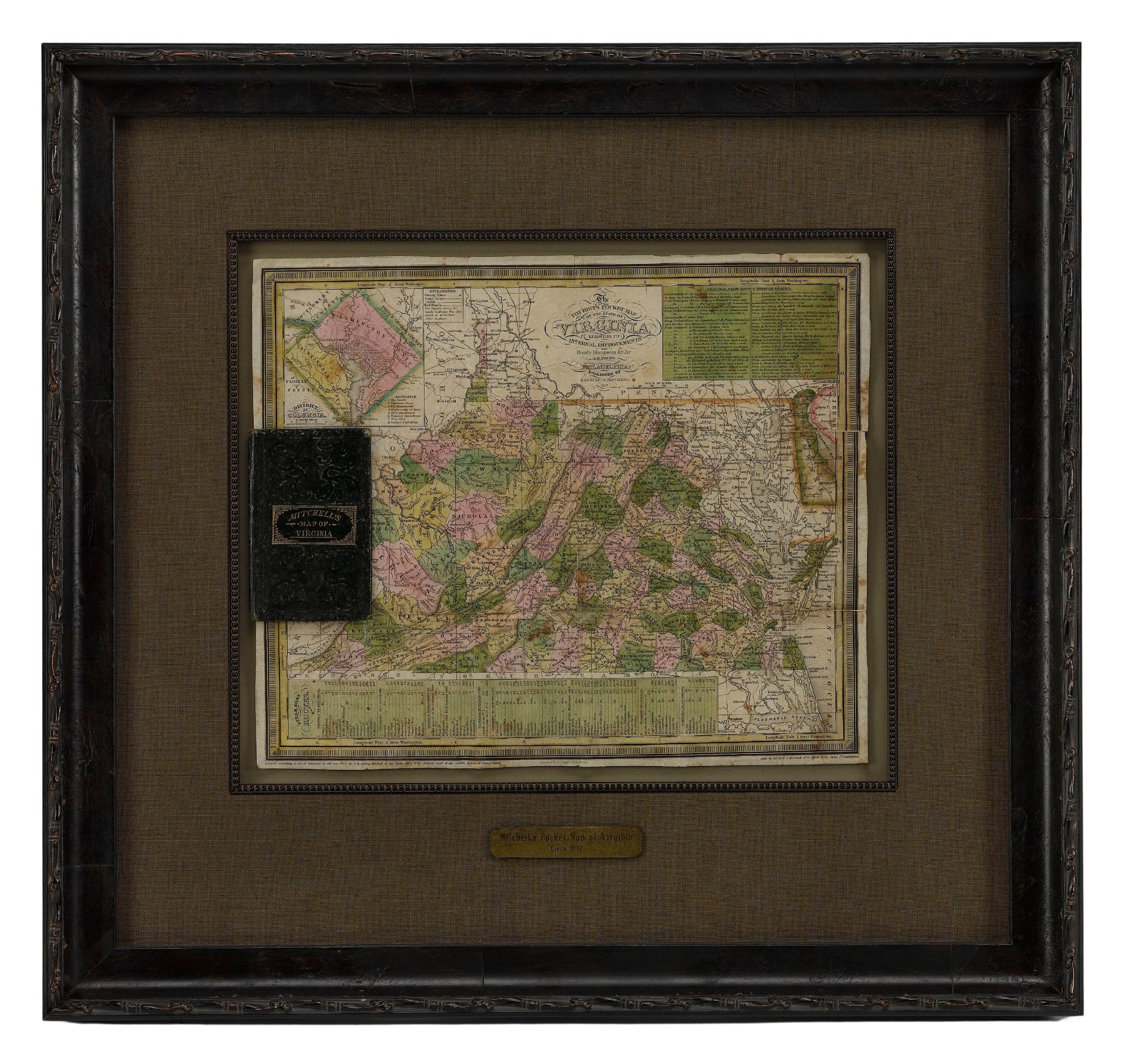
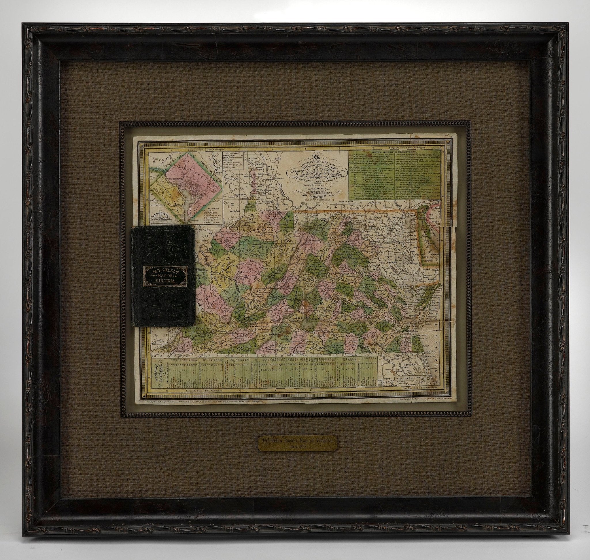
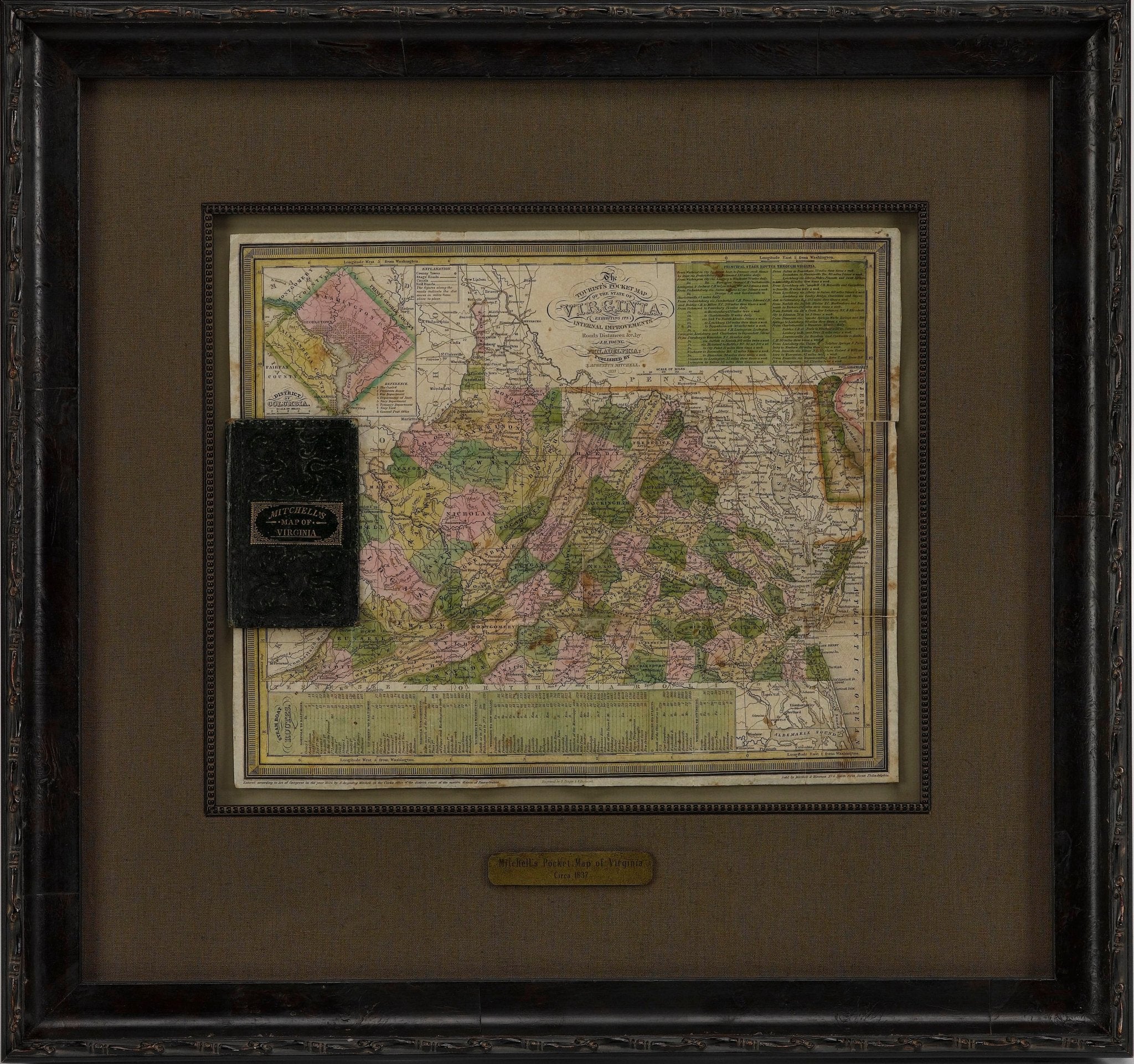
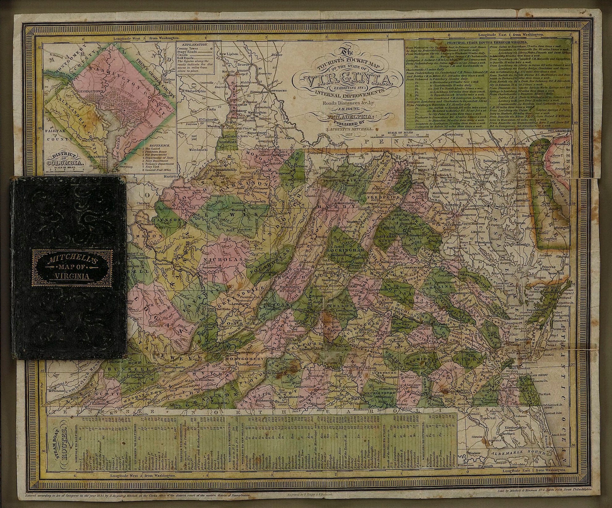
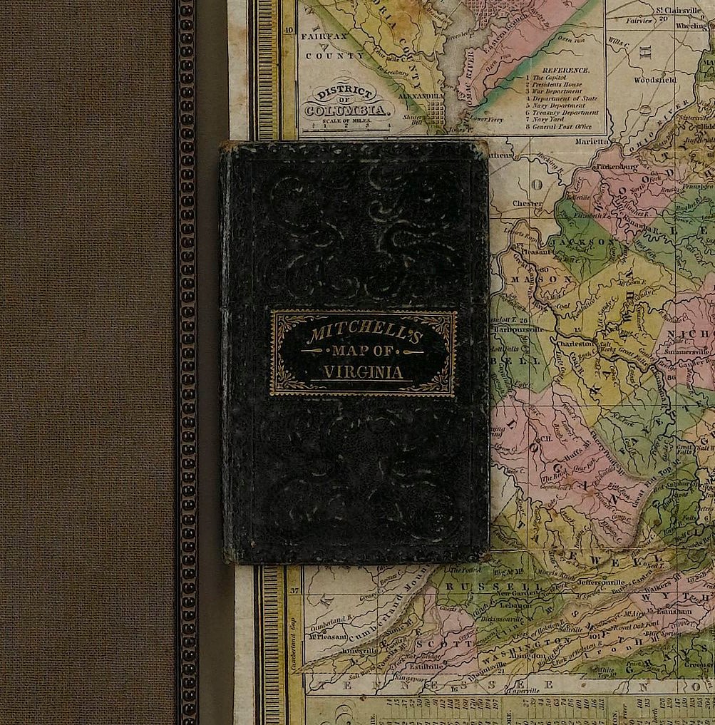
1837 Mitchell's "Tourist's Pocket Map of the State of Virginia" by J.H. Young
This is J. H. Young's pocket map of the Virginia, which shows county development current to 1835. The map was engraved by E. Yeager and F. Dankworth and published by S. A. Mitchell. Issued as a folding map and marketed towards travelers and tourists of the region, the map folds into a green cloth and gilt-tooled booklet for easy storage.
The map offers good detail of topography, rivers, towns and settlements of pre-Civil War Virginia. Only four railroads are shown at this time: Winchester to Harper's Ferry, Fredericksburg to Richmond, Petersburg to North Carolina, and Portsmouth to North Carolina.
The map includes an inset of the District of Columbia and Alexandria at upper left. The DC map is oriented and colored in its diamond configuration, prior to the 1846 retrocession of land back to Virginia. Eight significant landmarks, including the President's House and the Capitol, are identified and listed on the inset map. Tables showing steam boat routes and stage routes through Virginia are presented along the bottom and top right margins.
CONDITION:
The map was originally issued folding, so original fold lines are present. Several fold separations have been stabilized on verso with archival tape. Light scattered foxing throughout. Two small areas of loss (Campbell County and Delaware) have been repaired on both recto and verso with archival tape. Map measures 12 3/8" H x 15"W.
Map has been archivally presented attached to its original booklet. Booklet has green cloth boards and gilt tooling of title, " Mitchell's Map of Virginia," on front cover. Map is framed with acid-free mats, UV glass, and a custom-built wooden frame.
Framed Dimensions: 24 1/4" H x 25 3/4" W x 1 3/4" D
Accompanied by our company's letter of authenticity.
Pickup available at Colorado
Usually ready in 4 hours
1837 Mitchell's "Tourist's Pocket Map of the State of Virginia" by J.H. Young
Colorado
1 Lake Avenue
Colorado Springs CO 80906
United States
Choose options
Frequently Asked Questions
FAQs
Yes, all of our Antiques are certified authentic. Every antique comes with a signed Letter of Authenticity that details the item’s history, its current condition including any conservation, binding, or framing work, and the item’s provenance. The Letters of Authenticity are priced valuations by our authentication specialists, who assure that items are original and unconditionally guaranteed as genuine for life.
We pack and ship your items from our gallery in Colorado Springs. You may also choose to come pick up your order. Antique items are carefully packed and insured during shipping. The shipping price will be calculated at checkout.
We acquire from a variety of trusted sources all over the world, but mostly through auctions and private collections within the United States. All provenance information will be listed on the Letter of
Authenticity accompanying your purchase.