
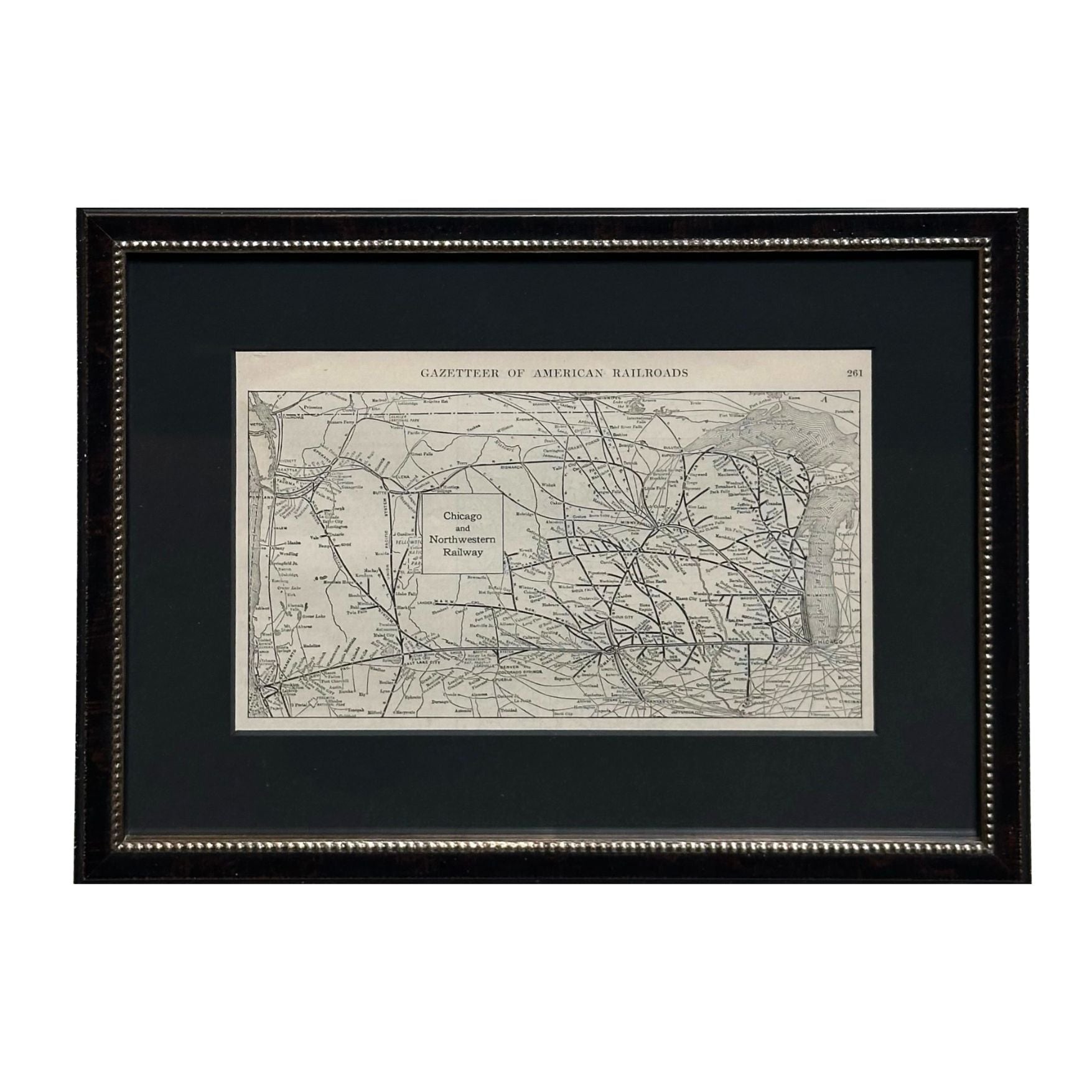
1919 "Chicago and Northwestern Railway" Map by P. F. Collier & Son
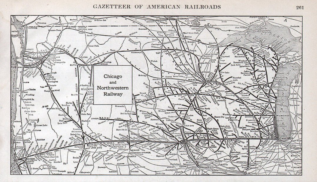
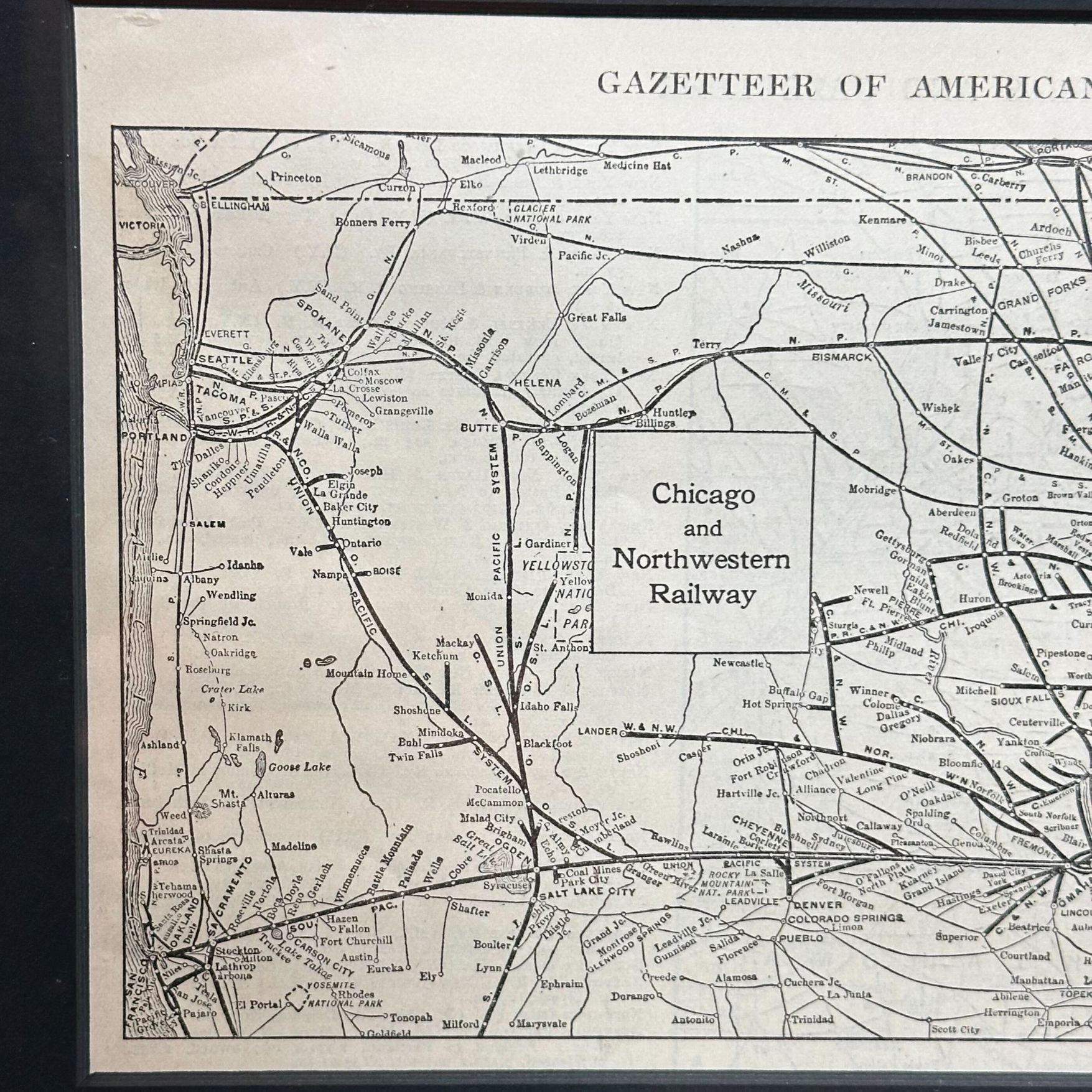
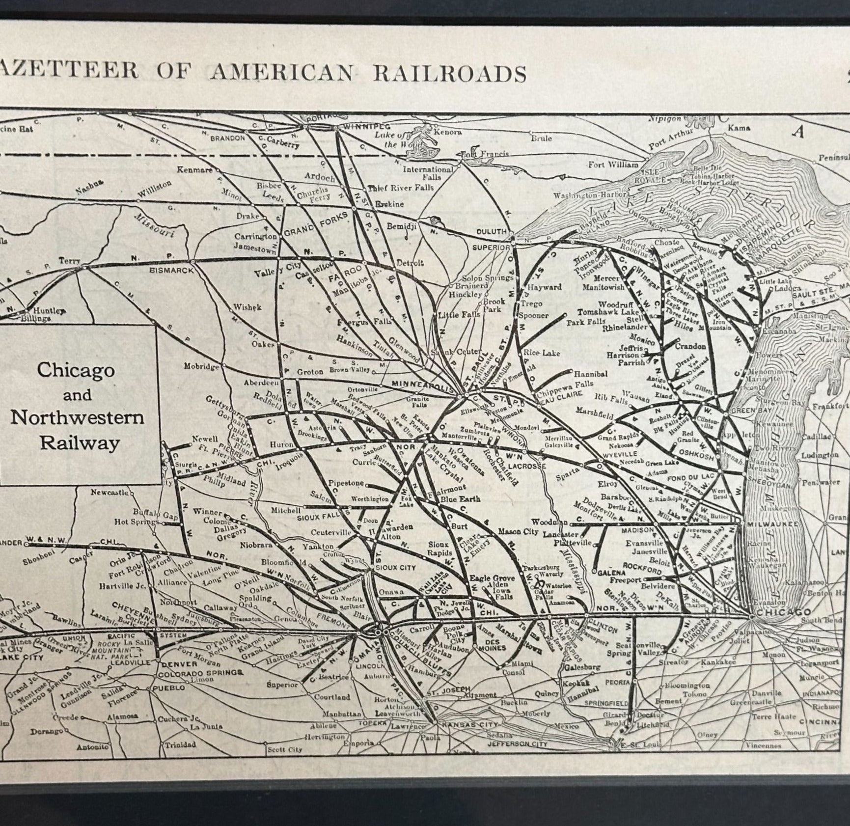
Presented is an antique “Chicago and Northwestern Railway” map from 1919. This small map is from "The Gazetteer of American Railroads" section of Collier’s “New World Atlas and Gazetteer.” The atlas was published by P. F. Collier & Son, in New York. The map extends from Chicago and Milwalkee in the east, across the west to Bellingham and Seattle in the northwest and San Francisco in the southwest. Criss-crossing across the vast area are the prominent railway routes of the time. The focus is mostly on the Chicago and North Western Railway routes, and the other smaller connecting lines in the midwest. However, the Northern Pacific and Southern Pacific lines are also shown. Although no state borders are printed on the map, cities and towns that are key railroad hubs are listed. Major lakes, including Lake Superior, Lake Michigan, Lake of the Woods, Great Salt Lake, and Goose Lake, are drawn on the map. Yellowstone National Park and Yosemite National Park are also outlined and identified.
The Chicago and North Western Railway (C&NW) played a vital role in the expansion of the American Midwest. Chartered on June 7, 1859, through the merger of several small railroads in Illinois and Wisconsin, it was initially led by William B. Ogden, Chicago’s first mayor. Under the leadership of Marvin Hughitt from 1872 to 1910, the network expanded rapidly from about 1,400 to nearly 10,000 miles of track, primarily serving Illinois, Wisconsin, Iowa, and Minnesota. By the early 20th century, C&NW had become a major transportation artery, connecting Chicago with agricultural and industrial hubs across the upper Midwest.
From 1910 to 1920, the railway played a crucial role in supporting industrial growth, transporting grain, livestock, and manufactured goods while driving labor migration and urban development. Its importance grew further during World War I, when the U.S. government temporarily nationalized railroads under the United States Railroad Administration in 1917. C&NW trains helped move troops, equipment, and supplies across the country. After returning to private control in 1920, the C&NW emerged stronger and more efficient.
CONDITION:
Small map. Paper is healthy, save light stains in the margins. Original atlas page number (261) and “Gazetteer of American Railroads" printed in top margin. Printed with black ink, no color.
Archivally framed with an acid-free mat, UV glass, and custom-built wooden frame.
Framed Dimensions: 10 1/8" H x 14 3/8" W x 5/8" D.
Accompanied by our company's letter of authenticity.
Pickup available at Colorado
Usually ready in 4 hours
1919 "Chicago and Northwestern Railway" Map by P. F. Collier & Son
Colorado
1 Lake Avenue
Colorado Springs CO 80906
United States
Choose options
Frequently Asked Questions
FAQs
Yes, all of our Antiques are certified authentic. Every antique comes with a signed Letter of Authenticity that details the item’s history, its current condition including any conservation, binding, or framing work, and the item’s provenance. The Letters of Authenticity are priced valuations by our authentication specialists, who assure that items are original and unconditionally guaranteed as genuine for life.
We pack and ship your items from our gallery in Colorado Springs. You may also choose to come pick up your order. Antique items are carefully packed and insured during shipping. The shipping price will be calculated at checkout.
We acquire from a variety of trusted sources all over the world, but mostly through auctions and private collections within the United States. All provenance information will be listed on the Letter of
Authenticity accompanying your purchase.