
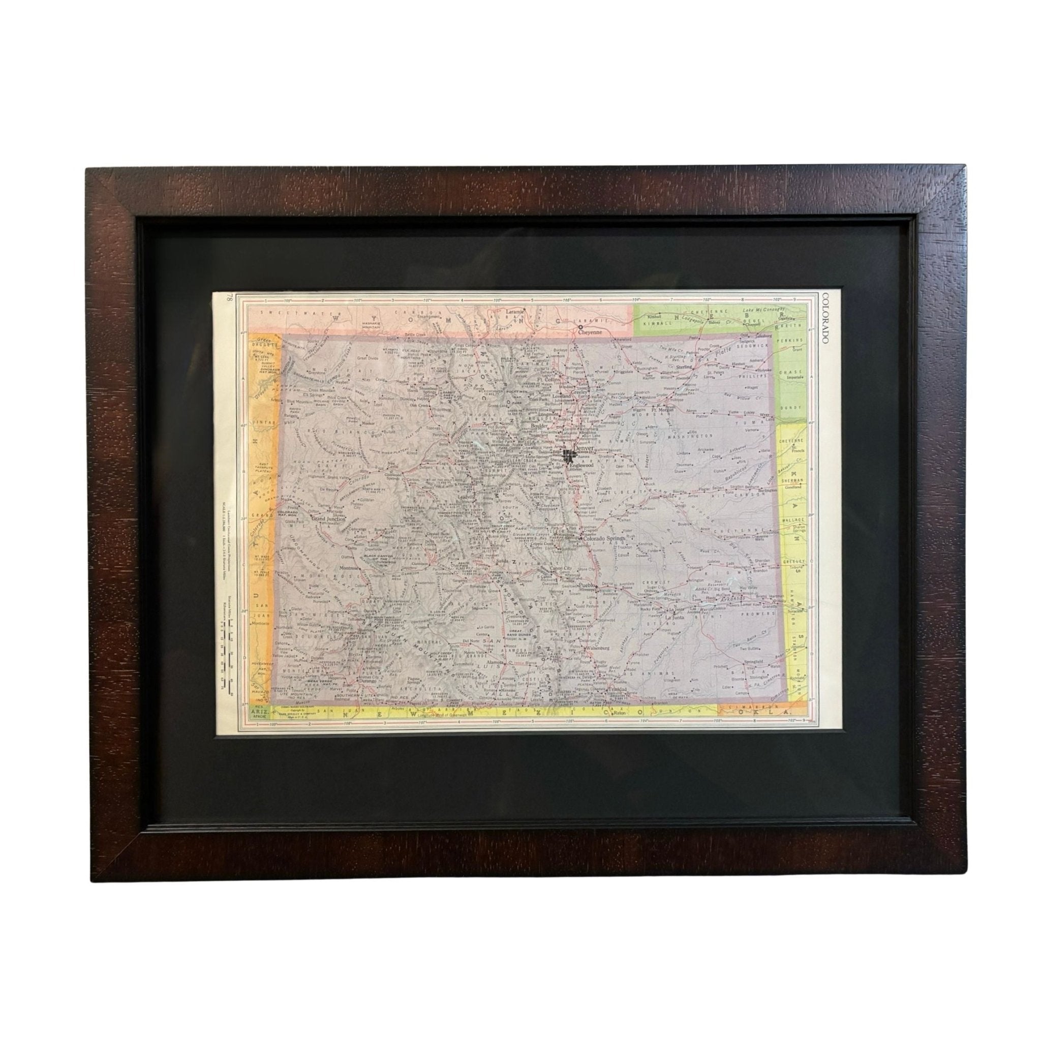
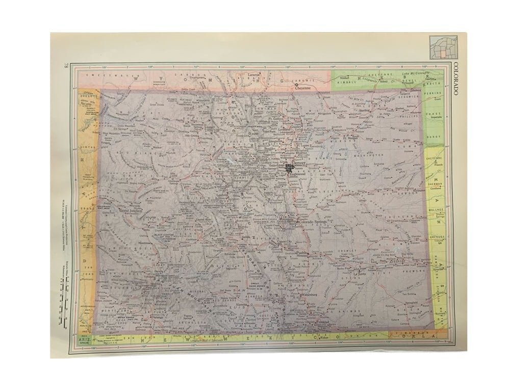
"Colorado" Map by Rand McNally & Co., circa 1960s
This is a detailed antique map of Colorado from the 1960s. The map was originally published as page 78 in the "Rand McNally Cosmopolitan World Atlas." The map is vividly colored in purple, with the bordering states colored in pink, orange, green, and yellow. Mountains are well depicted in hachures, with significant peaks labeled by elevation in ft. Criss-crossing throughout the state are the prominent railroad routes, identified in red. Iconic lines like the Denver and Rio Grande Western Railroad, Atchison, Topeka and Santa Fe Railway, Colorado and Southern Railway, Union Pacific, Chicago Rock Island and Pacific Railroad, and more are labeled.
Prior to 1858, Colorado was mostly a stopping point for travelers on their way to California and Oregon. However, in the 1860s Colorado experienced its own gold rush shortly followed by a silver rush in the 1870s and 1880s. The sudden increase in population and introduction of railroads led to a boom in the area. President Ulysses S. Grant signed Proclamation 230 admitting the state of Colorado to the Union as the 38th state on August 1, 1876. Gold, silver, and especially coal mining continued in the state, and the population kept expanding. Colorado had a recorded population of 539,700 in 1900, 799,024 in 1910, and 939,629 in 1920.
Colorado in the 1940s, 50s, and 60s was a period of significant growth and change, marked by World War II, post-war expansion, and the rise of tourism. The war spurred industrial development, while the influx of new residents after the war led to suburban expansion and a boom in construction.
The publisher Rand McNally began in 1856 printing train directories, travel guides, and newspapers. In 1872, the company printed its first map and soon earned significant fame for their annual atlases. Alongside atlases and newspapers, Rand McNally also produced folding guidebooks and pocketmaps. Rand McNally printed their first full-color road atlas in 1960 and was the first major publisher to use a numbering system for highways and put up road signs. The company is still in operation today and produces many modern maps and traveling resources.
CONDITION:
Very good condition overall. The paper is healthy, without tears or marks. Original printed color, vibrant and without fading. Page number 78. California map printed on the verso. Archival framing in a custom wooden frame with UV glass and acid-free mats.
Framed Dimensions: 15" H x 18 1/2" W x 3/4" D.
Accompanied by our company's letter of authenticity.
Pickup available at Colorado
Usually ready in 4 hours
"Colorado" Map by Rand McNally & Co., circa 1960s
Colorado
1 Lake Avenue
Colorado Springs CO 80906
United States
Choose options
Frequently Asked Questions
FAQs
Yes, all of our Antiques are certified authentic. Every antique comes with a signed Letter of Authenticity that details the item’s history, its current condition including any conservation, binding, or framing work, and the item’s provenance. The Letters of Authenticity are priced valuations by our authentication specialists, who assure that items are original and unconditionally guaranteed as genuine for life.
We pack and ship your items from our gallery in Colorado Springs. You may also choose to come pick up your order. Antique items are carefully packed and insured during shipping. The shipping price will be calculated at checkout.
We acquire from a variety of trusted sources all over the world, but mostly through auctions and private collections within the United States. All provenance information will be listed on the Letter of
Authenticity accompanying your purchase.