
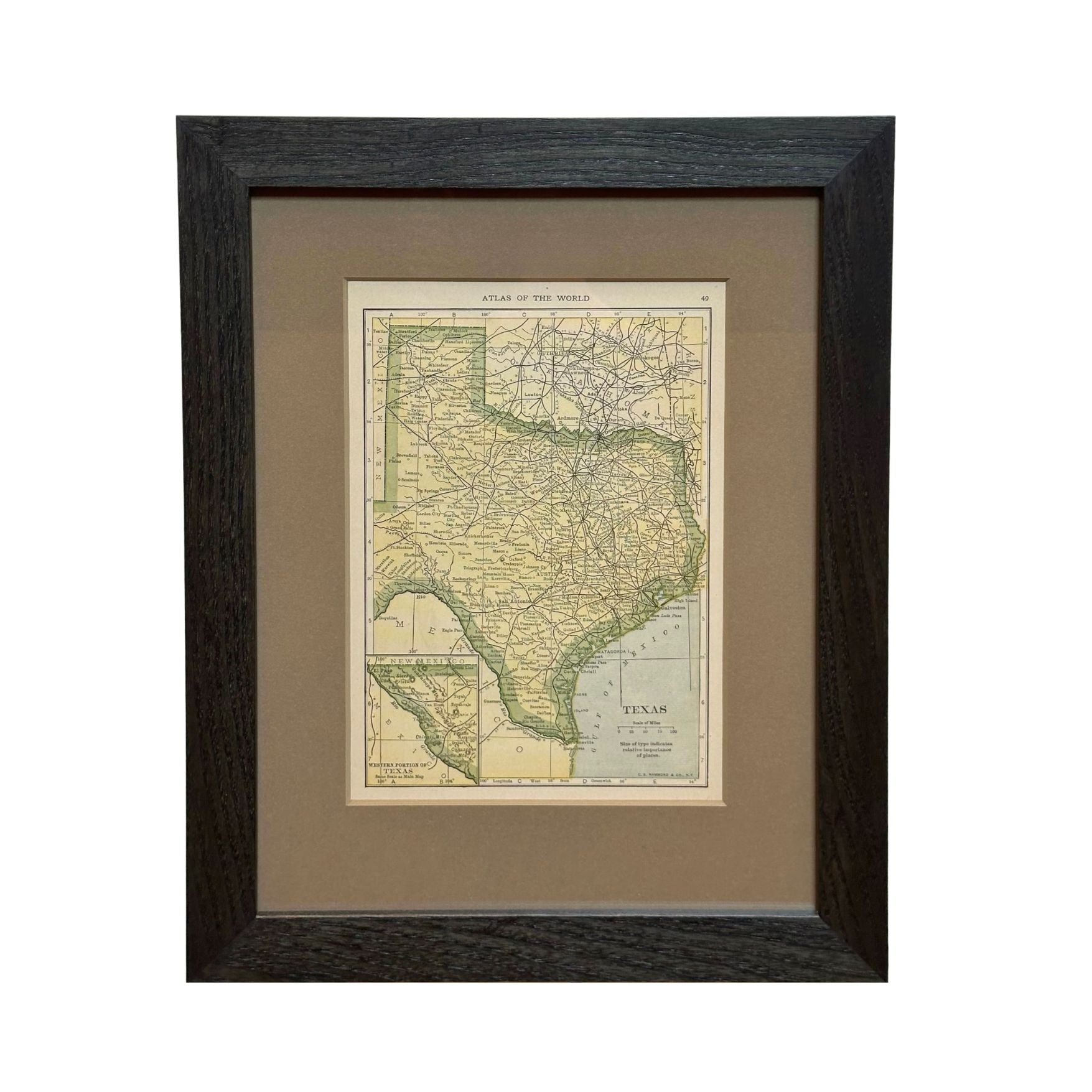
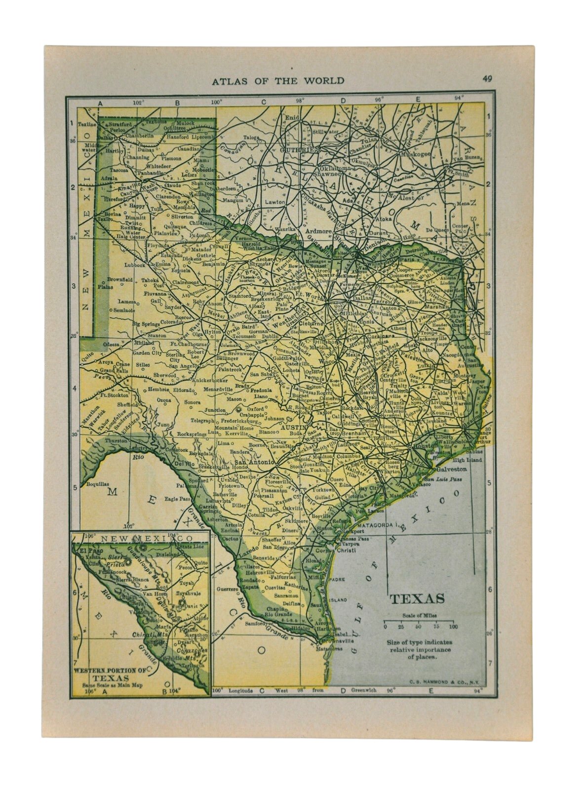
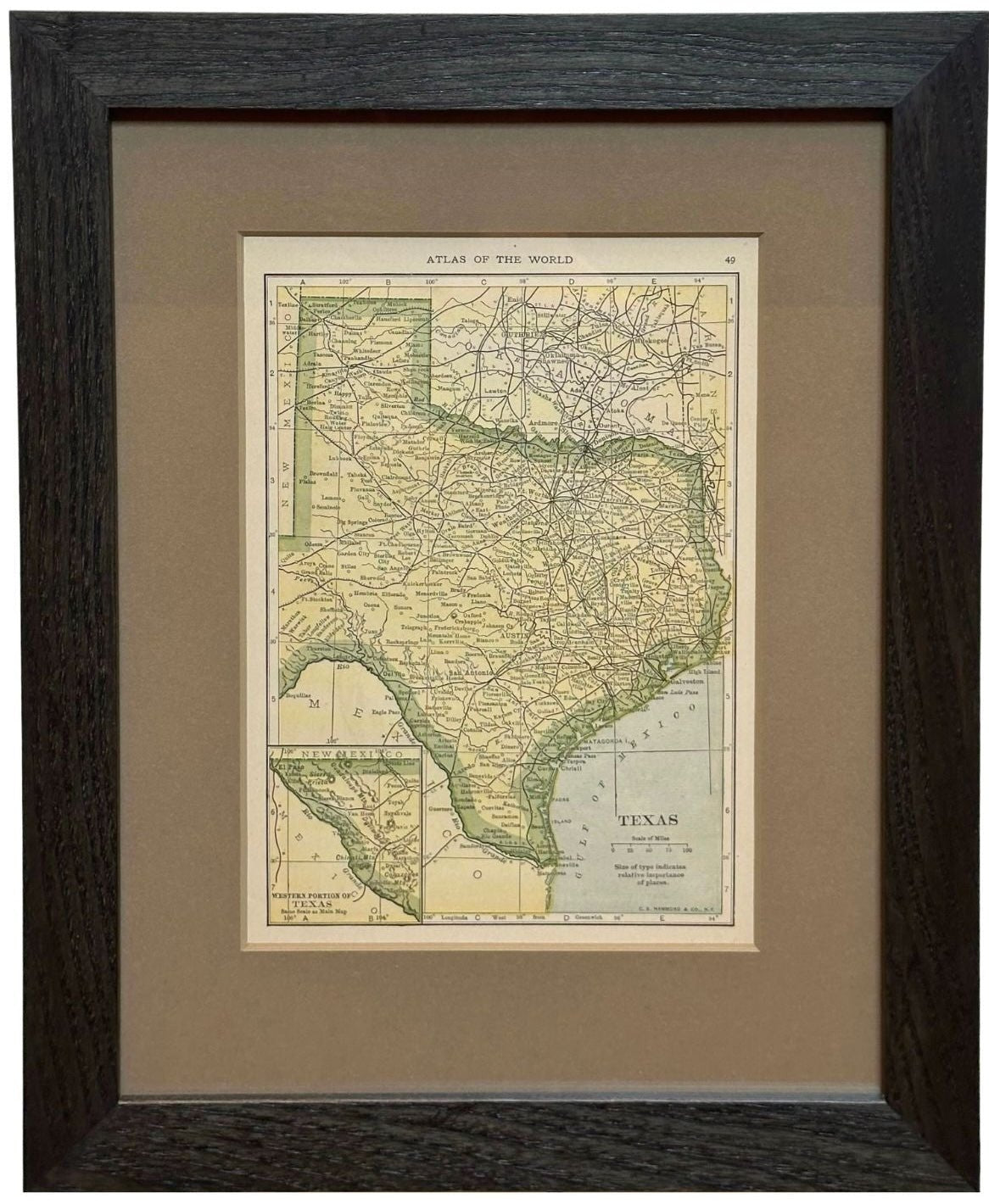
1927 "Texas" Map by C.S. Hammond
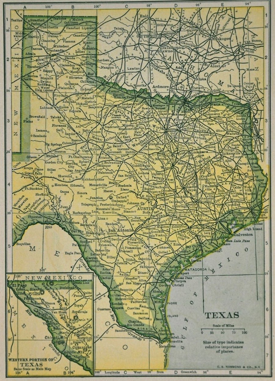
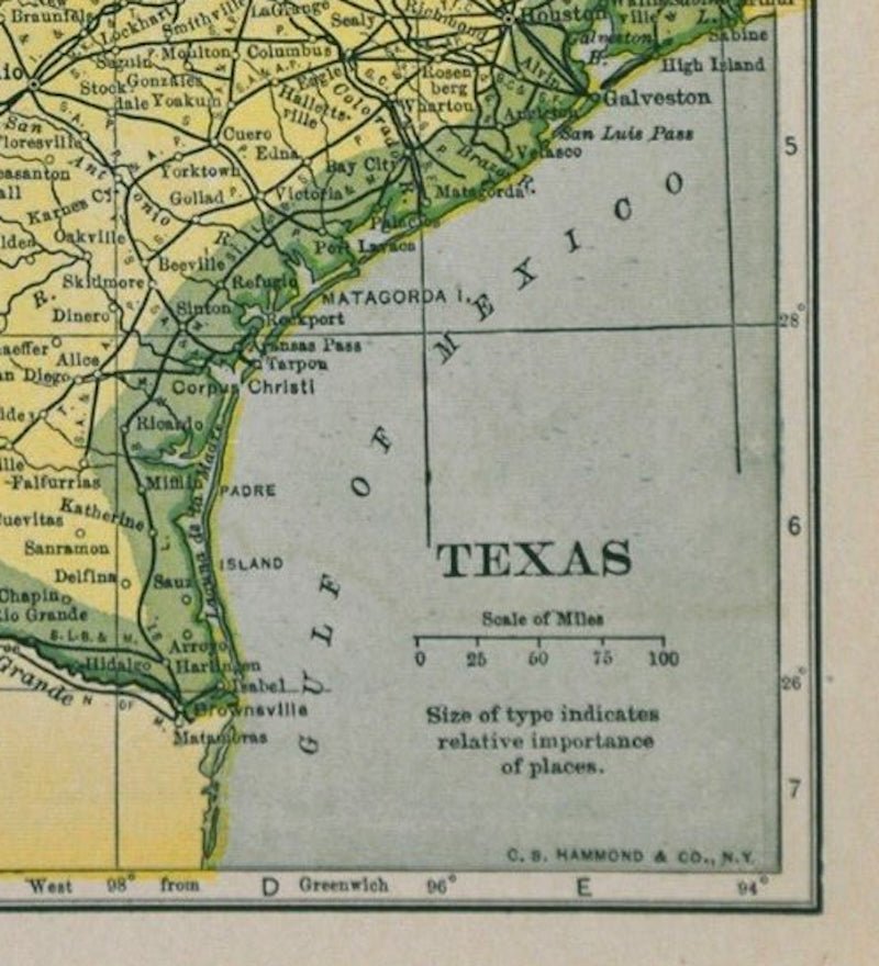
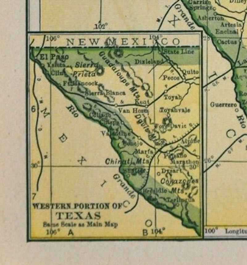
Presented is a very detailed map of Texas, printed in 1927. The map was featured in The Literary Digest Atlas of the World and Gazetteer, published by Funk & Wagnalls. The map is small but comprehensive, colored in yellow and outlined in green. The map shows the rivers, cities, towns, and settlements throughout Texas. It also details the roads and completed railroads that cross through the area. An inset map of the western portion of Texas appears on the lower left corner.
The population of Texas grew rapidly at the end of the 19th century into the early 20th century, from 1,591,749 in 1880 to 2,235,527 by 1890, 3,048,710 in 1900 and reached approximately 5,577,000 in 1927, when this map was published. The expanding population spread westward to complete settlement of the state by establishing communities on the South Plains, in the Panhandle, and beyond the Pecos River. The growth was stimulated by the development of ranching and commercial farming, which was aided by the new network of railroads criss-crossing the state.
Looking at the county configurations is very telling of the burgeoning development in Texas at the time. For example, Tom Green County, once larger than the state of Massachusetts and Connecticut combined, is shown fully divided into much smaller counties like Loving, Winkler, Ector, Ward, Crane, Upton, Midland, and Glasscock, Coke, and Sterling. Smaller towns and cities now fill in the panhandle of Texas and railroads continue all the way to El Paso, with many stops along the way. This map also shows bordering Oklahoma as a state, rather than Indian Territory.
CONDITION:
Very good condition. Printed color. Clean and bright paper, with narrow margins. Issued originally in an atlas.
Framed Dimensions: 12 1/2"H x 10"W x 3/4"D.
Accompanied by our company's letter of authenticity.
Pickup available at Colorado
Usually ready in 4 hours
1927 "Texas" Map by C.S. Hammond
Colorado
1 Lake Avenue
Colorado Springs CO 80906
United States
Choose options
Frequently Asked Questions
FAQs
Yes, all of our Antiques are certified authentic. Every antique comes with a signed Letter of Authenticity that details the item’s history, its current condition including any conservation, binding, or framing work, and the item’s provenance. The Letters of Authenticity are priced valuations by our authentication specialists, who assure that items are original and unconditionally guaranteed as genuine for life.
We pack and ship your items from our gallery in Colorado Springs. You may also choose to come pick up your order. Antique items are carefully packed and insured during shipping. The shipping price will be calculated at checkout.
We acquire from a variety of trusted sources all over the world, but mostly through auctions and private collections within the United States. All provenance information will be listed on the Letter of
Authenticity accompanying your purchase.