
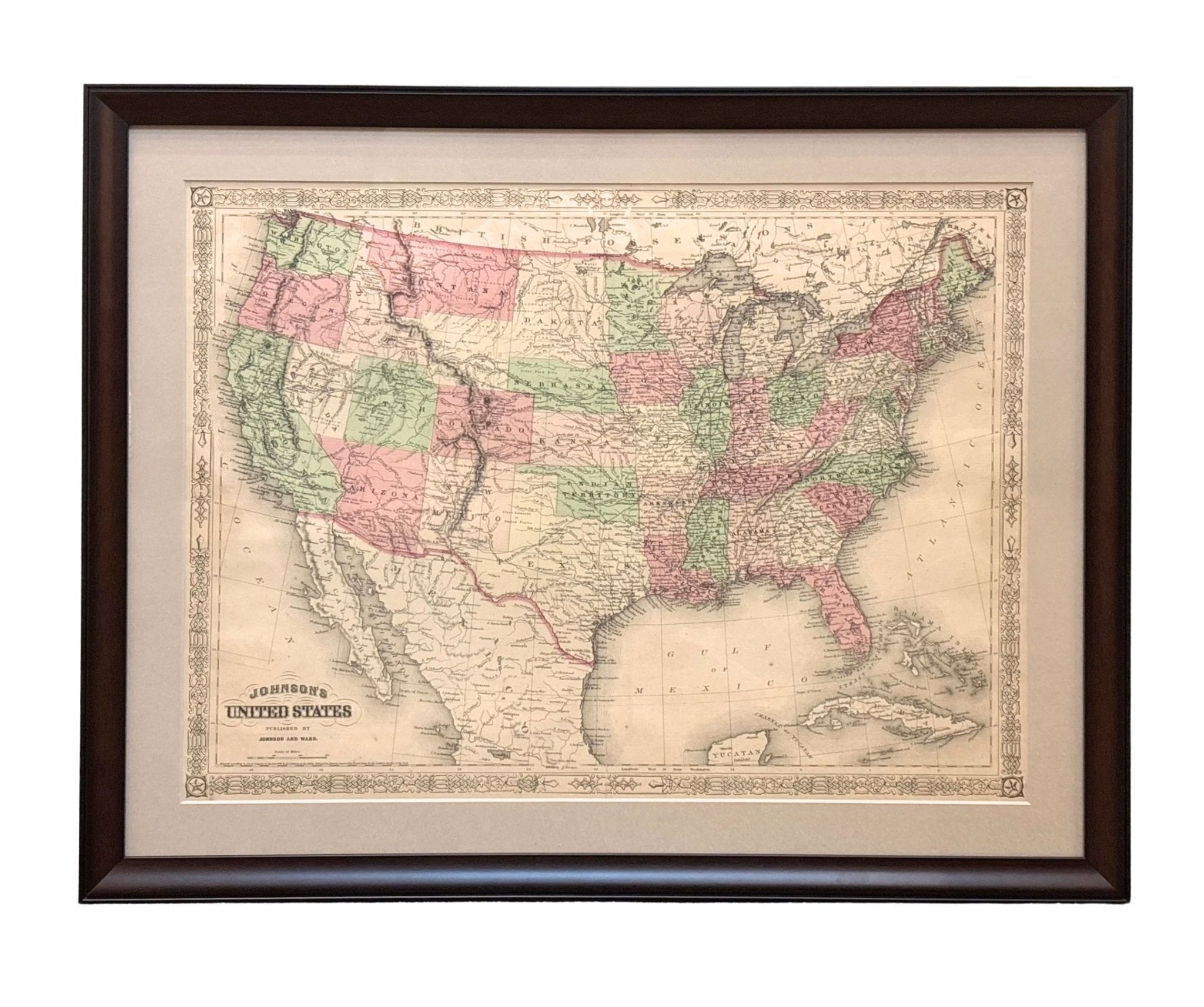
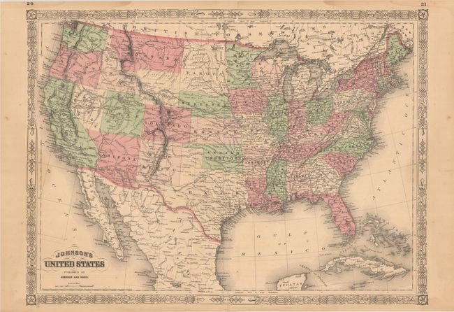
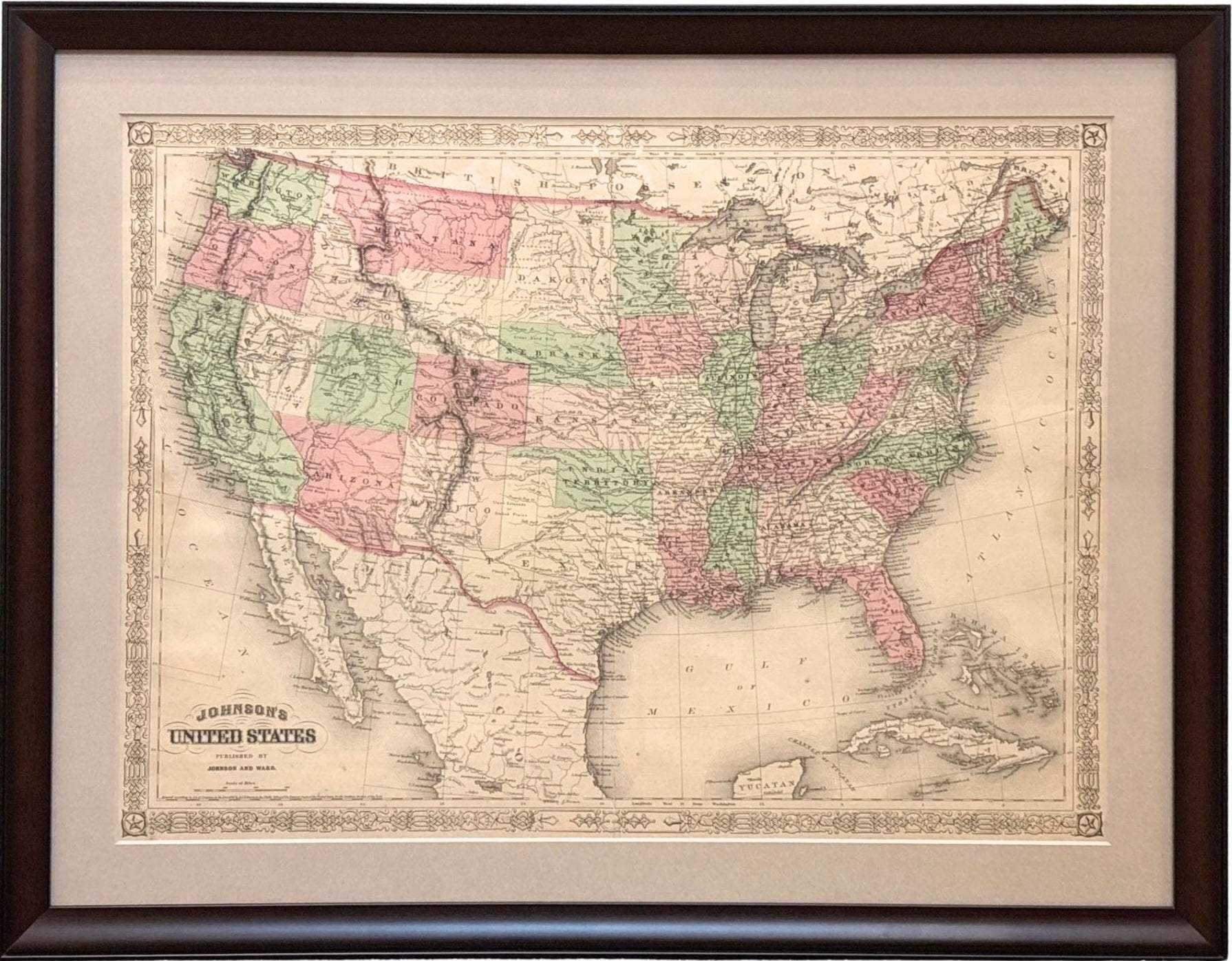
1866 "Johnson's United States" Map, Published by Johnson and Ward
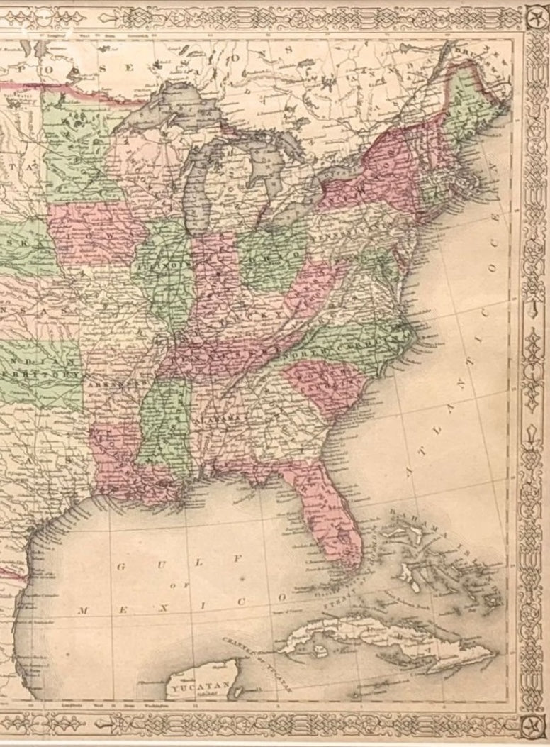
Presented is a detailed map of the United States by A. J. Johnson. Spanning the whole of the continental United States, as well as adjacent parts of Canada and Mexico, the map reflects the country just after the end of the Civil War. This map, although copyrighted to 1864, was published as page numbers 20 and 21 in the 1866 edition of “Johnson’s New Illustrated (Steel Plate) Family Atlas.” It was published by Johnson and Ward in New York.
The map is incredibly detailed, with towns, cities, railroads, topography, and forts all labelled and depicted. It is surrounded by an intricate fretwork border, found on all Johnson atlas maps from 1863 to 1869. The map is hand colored, with a light watercolor wash, in shades of pink, green, and yellow.
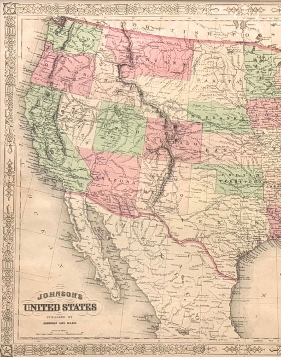
Looking west from the Mississippi River, many of the Western states are still in early configurations or shown with their territory borders. The Dakotas are a single large territory. Oklahoma is named the “Indian Territory.” Wyoming is labeled in outline text only, as it did not become a territory until 1868. Wyoming's northwest boundary juts out into Idaho, while Idaho extends into parts of present-day southwestern Wyoming, including Jackson Hole and the Grand Tetons. In the Southwest, Arizona includes the southern tip of Nevada.
Several important transcontinental routes are noted on the map. All four of the proposed routes for the Pacific Railroad are shown, including Governor Stevens’ route or the Northern Pacific Route, the Central Pacific Route, the Union Pacific Route, and the Southern Pacific Route. The map also notes the course of the Santa Fe Trail, the Pony Express or U.S. Mail Route, and the tracks of Fremont and Marcy.
CONDITION:
Good condition overall. Contemporary color with light toning and minor dampstains that enter the image at left and right. There are archival repairs to a short edge tear at top and a 6" centerfold separation at bottom, since stabilized. Map Dimensions: 17.1”H x 23.3” W. Archival framing in a custom-built wooden frame with UV glass and acid-free mats.
Framed Dimensions: 22 5/8" H x 28 3/4" W x 1" D.
Accompanied by our company's letter of authenticity.
Pickup available at Colorado
Usually ready in 4 hours
1866 "Johnson's United States" Map, Published by Johnson and Ward
Colorado
1 Lake Avenue
Colorado Springs CO 80906
United States
Choose options
Frequently Asked Questions
FAQs
Yes, all of our Antiques are certified authentic. Every antique comes with a signed Letter of Authenticity that details the item’s history, its current condition including any conservation, binding, or framing work, and the item’s provenance. The Letters of Authenticity are priced valuations by our authentication specialists, who assure that items are original and unconditionally guaranteed as genuine for life.
We pack and ship your items from our gallery in Colorado Springs. You may also choose to come pick up your order. Antique items are carefully packed and insured during shipping. The shipping price will be calculated at checkout.
We acquire from a variety of trusted sources all over the world, but mostly through auctions and private collections within the United States. All provenance information will be listed on the Letter of
Authenticity accompanying your purchase.