1943 "Colorado Railroads" Map by Linn Westcott
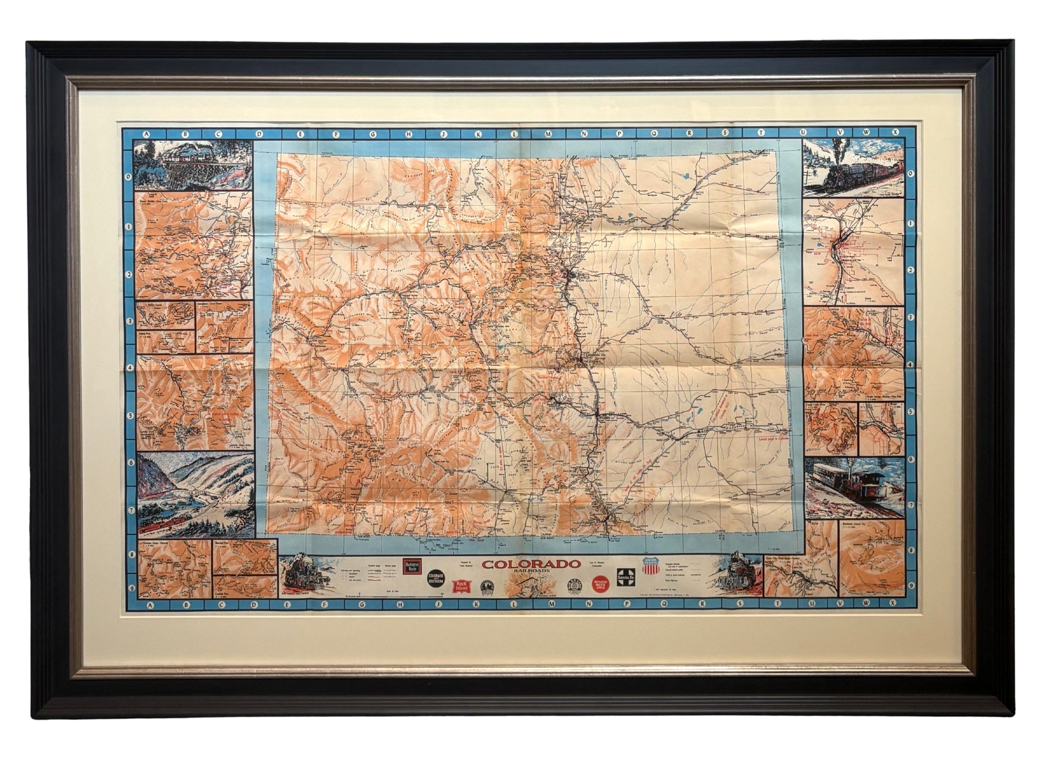
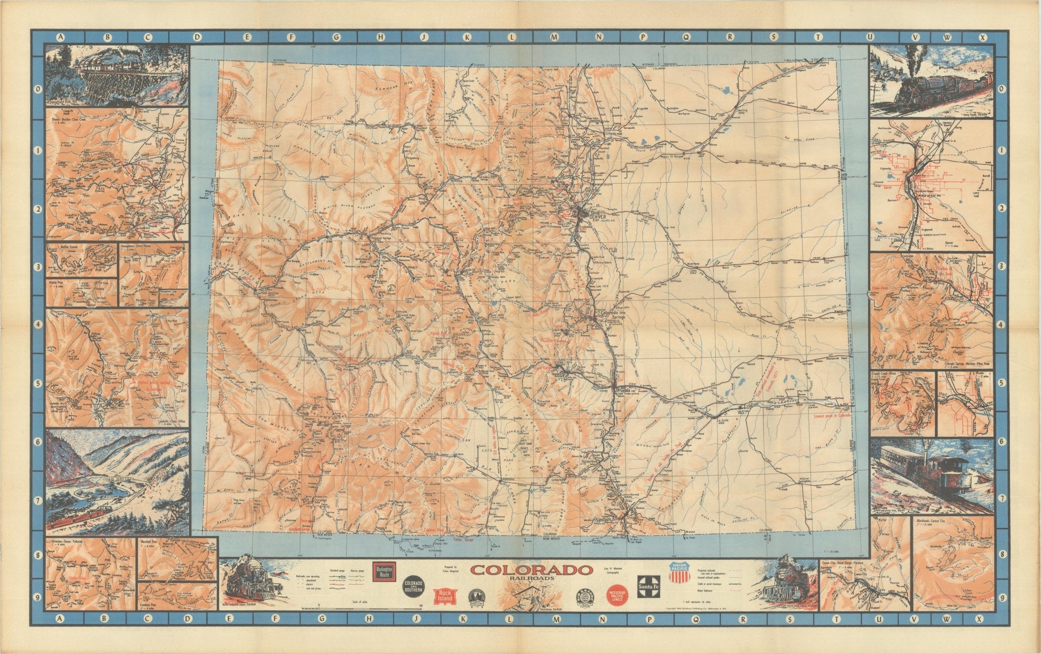
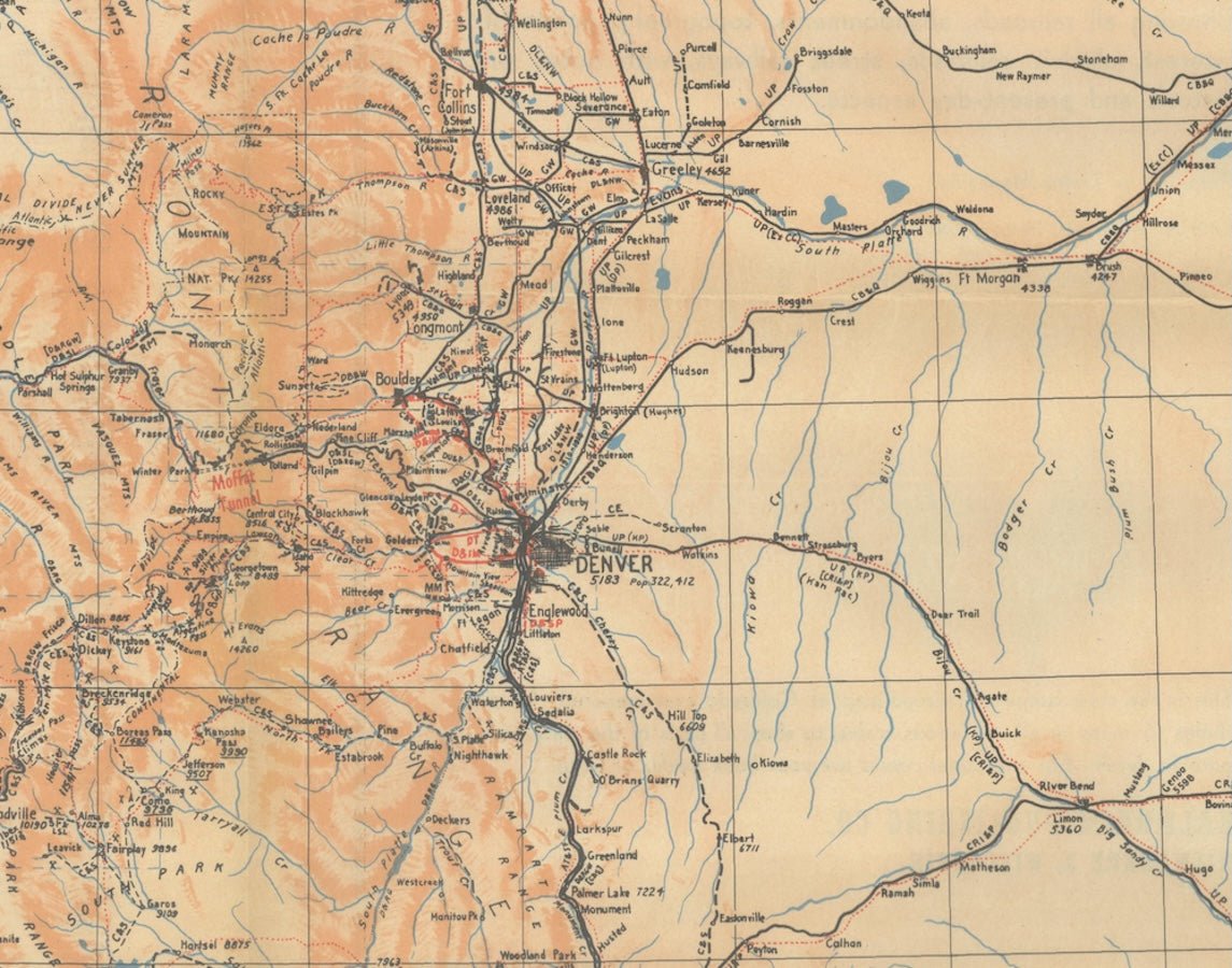
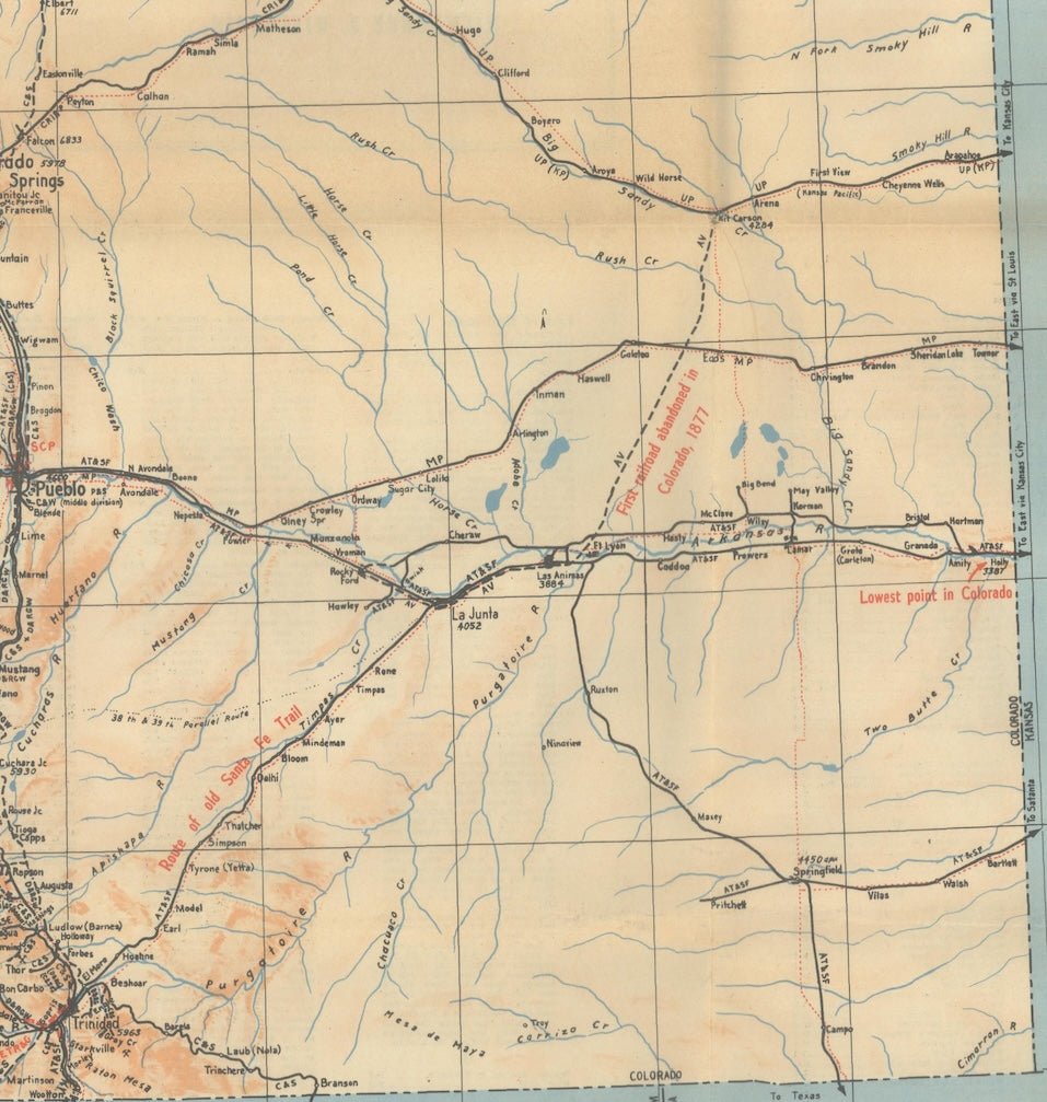
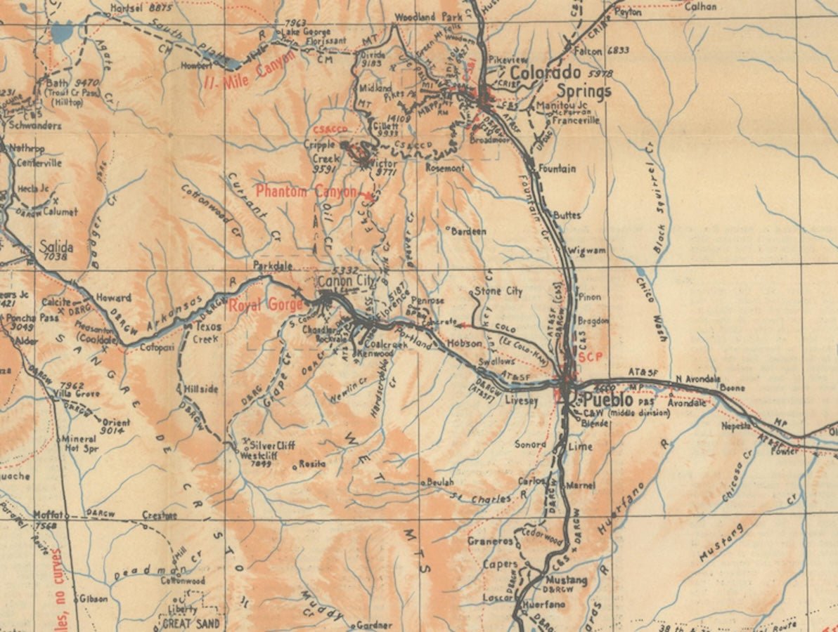
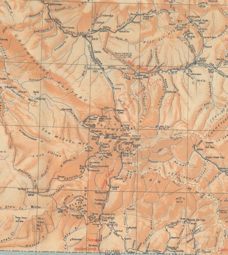
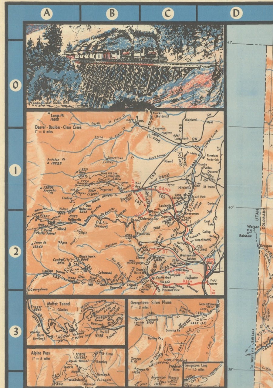
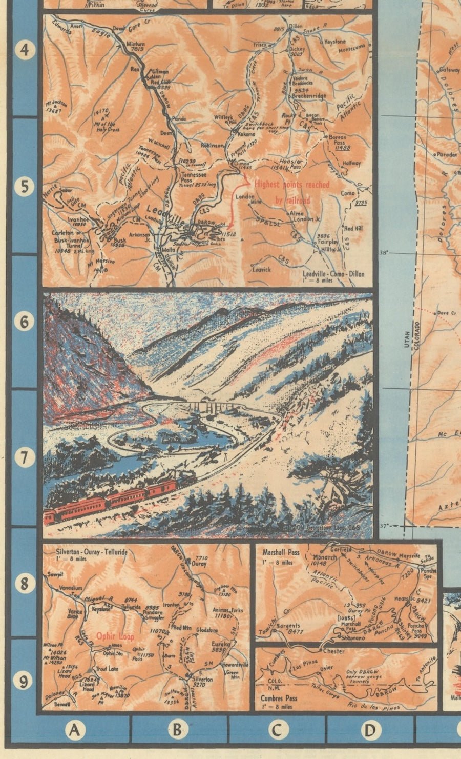
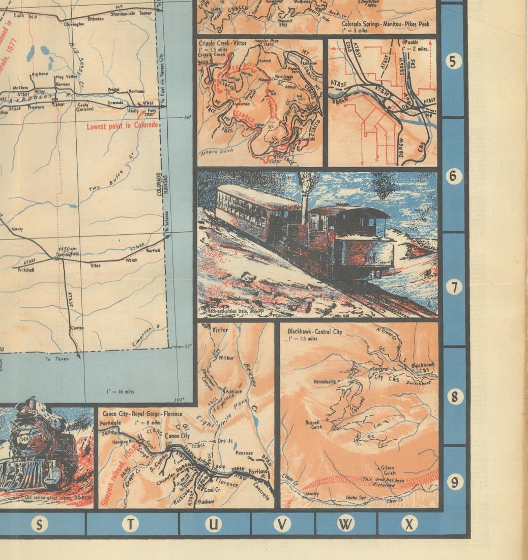
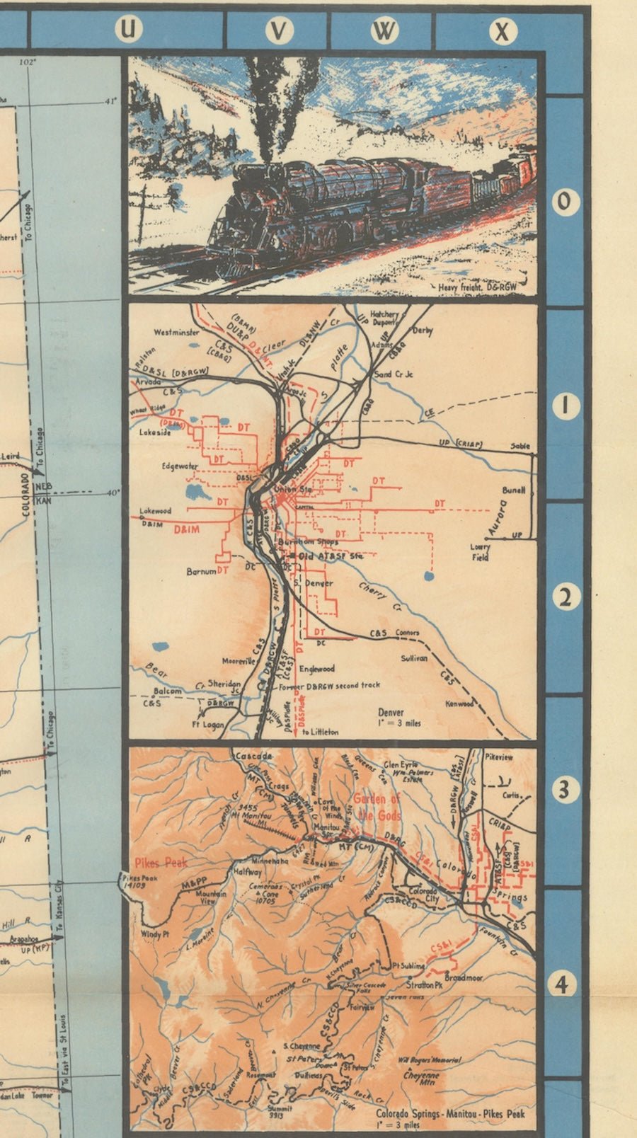
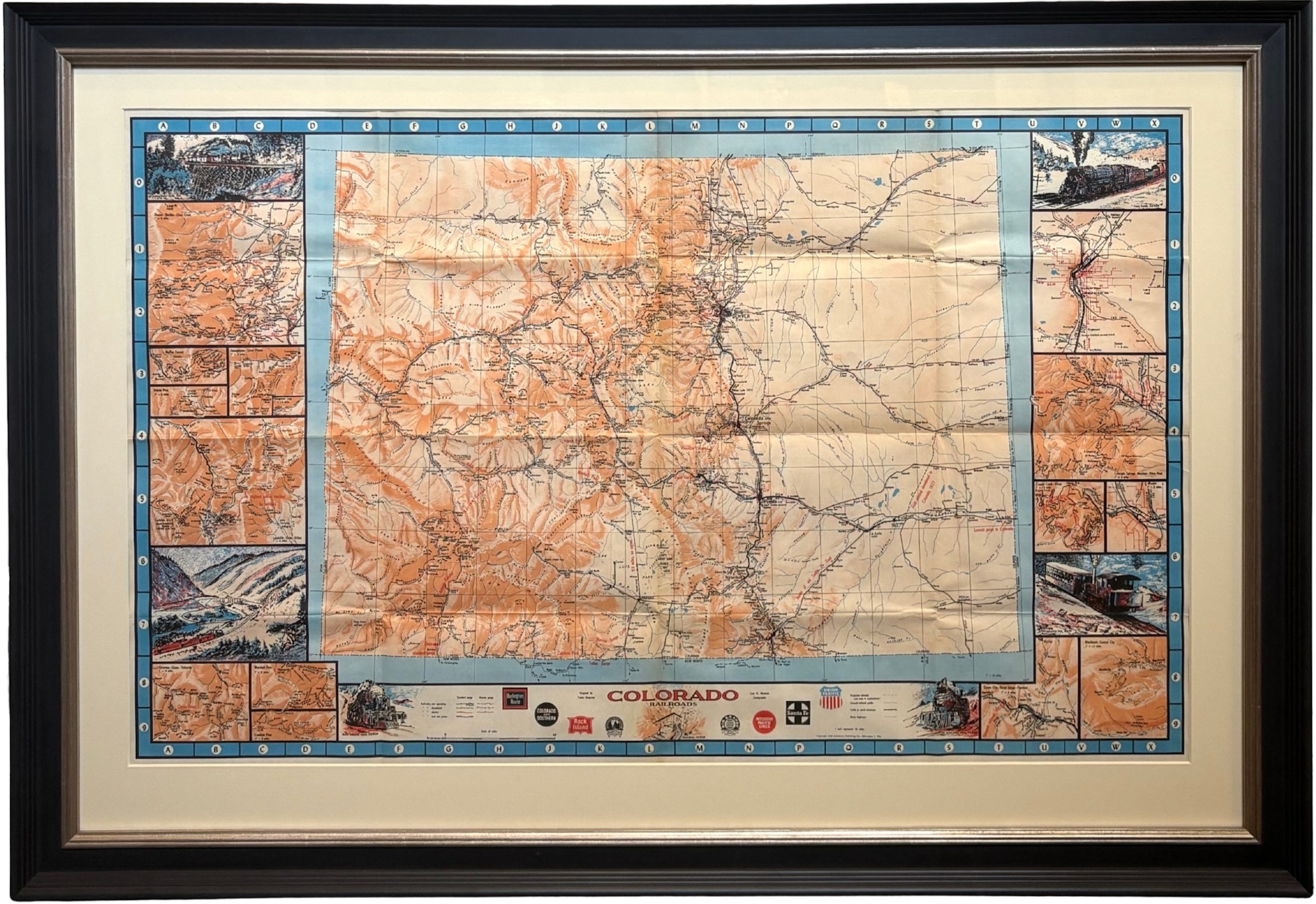
Presented is an original 1943 "Colorado Railroads" Map, drawn by Linn Westcott for Trains Magazine. It was issued by Kalmbach Publishing Co., who boasted on the map’s original cover that "this is the most complete railroad map of Colorado ever prepared." A combination of meticulous cartography detail with historical annotation and illustration, this map is one of most comprehensive railroad maps of the state ever created.
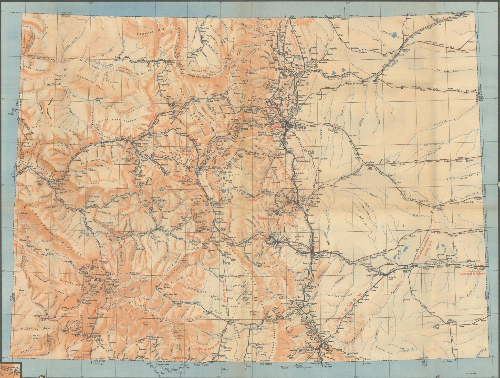
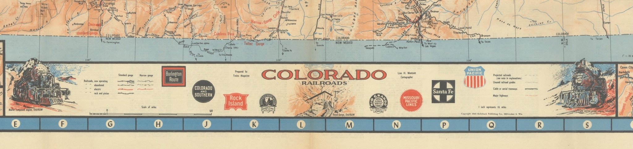
This highly detailed map presents a remarkable view of the extensive railroad network in the state of Colorado, with a legend at bottom identifying all railroads as in current operation, since abandoned, or projected, as well as by railroad type, including electric, rack and pinion, and narrow gauge. The different types of track illustrate the extraordinary diversity of rail transportation that developed to overcome Colorado's rugged mountain terrain. Throughout the map, red overprinted notes provide extra historical or engineering commentary, identifying rail passes, gorges, and offering descriptions of the track routes, like "first railroad abandoned in Colorado, 1877," "53 miles, no curves," and "lowest point in Colorado." Cartographically, the map also presents an excellent view of the river systems and mountainous terrain of the state, through orange shading and blue waterways.
Surrounding the main map are seven vignette illustrations of various locomotives and fifteen smaller regional maps. The illustrations are “Climbing Dallas Divide, RGS,” “Old Georgetown Loop, C&S,” “Mallet compound engine, D&RGW,” “Royal Gorge, D&RGW,” “Old narrow-gauge engine, D&RGW,” “Rack and pinion train, M&PP,” and “Heavy freight, D&RGW.” The smaller maps include areas around Denver, Colorado Springs, Leadville, Georgetown, Alpine Pass and Moffat Tunnel, Cripple Creek, Pueblo, Central City, Florence, and more. The inset maps allow for the opportunity for detailed examination of some of the state's most complex rail junctions.
The map was drawn by Linn Hanson Westcott (1913–1980), one of the foremost railroad historians, editors, and model railroad authorities of the twentieth century. After studying engineering, he joined Kalmbach Publishing Company, where he became an editor for Model Railroader magazine in 1938. Following service during the Second World War, he returned to the magazine and served as its editor from 1946 until his retirement in 1978, transforming it into the leading publication for model railroad enthusiasts in North America. Westcott also authored numerous books on railroads, including The Model Railroader's Handbook, Track Planning for Realistic Operation, and 101 Track Plans, works that remain standard references today.
CONDITION:
Fine condition. A bright, colorful example, issued folding on paper watermarked with "A Masterline Paper." There are tiny separations at fold intersections and minor toning that is only visible in the margins. Extensive index on verso.
Archivally framed in a custom black wooden frame with brushed silver fillet, acid-free mats, and UV plexiglas.
Framed Dimensions: 30 1/4" H x 43 7/8" W x 1 1/2" D.
Accompanied by our company's letter of authenticity.
Pickup available at Colorado
Usually ready in 4 hours
1943 "Colorado Railroads" Map by Linn Westcott
Colorado
1 Lake Avenue
Colorado Springs CO 80906
United States
Choose options
Frequently Asked Questions
FAQs
Yes, all of our Antiques are certified authentic. Every antique comes with a signed Letter of Authenticity that details the item’s history, its current condition including any conservation, binding, or framing work, and the item’s provenance. The Letters of Authenticity are priced valuations by our authentication specialists, who assure that items are original and unconditionally guaranteed as genuine for life.
We pack and ship your items from our gallery in Colorado Springs. You may also choose to come pick up your order. Antique items are carefully packed and insured during shipping. The shipping price will be calculated at checkout.
We acquire from a variety of trusted sources all over the world, but mostly through auctions and private collections within the United States. All provenance information will be listed on the Letter of
Authenticity accompanying your purchase.