
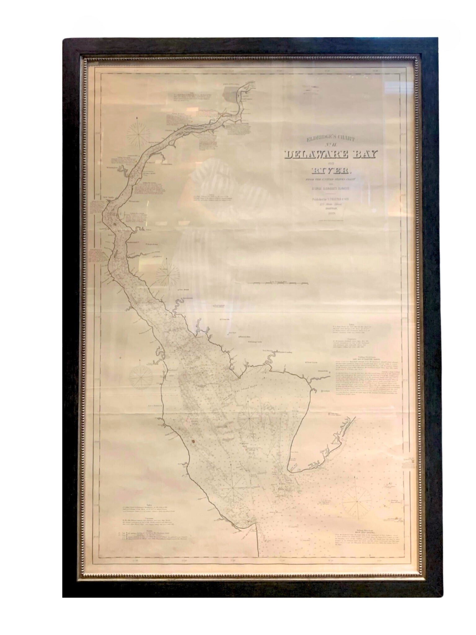
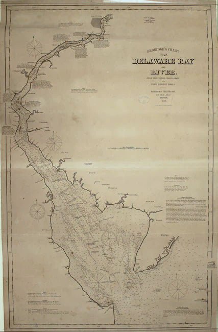
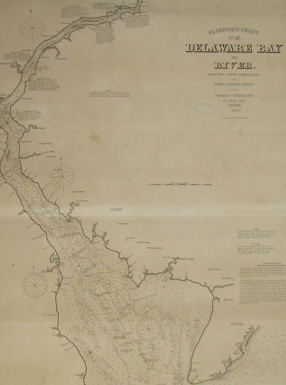
1889 Sea Chart Map of Delaware Bay by George Eldridge, Chart No. 11
Presented is an original Eldridge's Chart No. 11, Delaware Bay and River, from The United States Coast and George Eldridge's Surveys, published in 1889. The sea chart shows the Delaware Bay from its mouth up to just north of Philadelphia.
The sea chart is dense with hydrographical information, including soundings, shoals, lighthouses, buoys, compass roses, and shoals. It also offers sailing directions and notes on tides and currents. Dotted lines on the chart give sailors the distance and sailing directions between ports and numerous buoys or other intersections. Some towns and cities appear inland as block plans, among them Philadelphia, Wilmington, Delaware City, and Greenwich.
The map was published by S. Thaxter & Son, whose stamp appears on the chart, dated 1889. Another vintage stamp, for Charles A. Harriman, a dealer of charts and other nautical goods based in Maine, is located in an un-engraved area at top.
Large-scale nautical charts are generally rare on the market today due to the fact that they were used in a damp, rough environment and generally discarded as updated versions became available.
CONDITION:
Map is in good condition overall, despite some rippling to paper, overall toning, and scattered foxing, all due to past use. Select areas of damp-staining. Map has been backed onto new archival linen, for stability. Map is presented framed in a custom-built black and gold beaded frame.
Framed Dimensions: 52 5/8" H x 35 1/4" W x 7/8" D.
Accompanied by our company's letter of authenticity.
Pickup available at Colorado
Usually ready in 4 hours
1889 Sea Chart Map of Delaware Bay by George Eldridge, Chart No. 11
Colorado
1 Lake Avenue
Colorado Springs CO 80906
United States
Choose options
Frequently Asked Questions
FAQs
Yes, all of our Antiques are certified authentic. Every antique comes with a signed Letter of Authenticity that details the item’s history, its current condition including any conservation, binding, or framing work, and the item’s provenance. The Letters of Authenticity are priced valuations by our authentication specialists, who assure that items are original and unconditionally guaranteed as genuine for life.
We pack and ship your items from our gallery in Colorado Springs. You may also choose to come pick up your order. Antique items are carefully packed and insured during shipping. The shipping price will be calculated at checkout.
We acquire from a variety of trusted sources all over the world, but mostly through auctions and private collections within the United States. All provenance information will be listed on the Letter of
Authenticity accompanying your purchase.