1886 "County and Township Map of the States of Kansas and Nebraska" by S. Augustus Mitchell
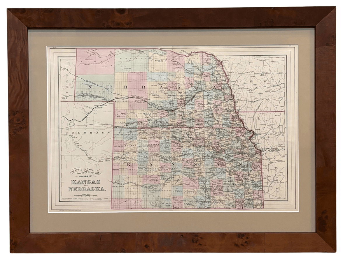
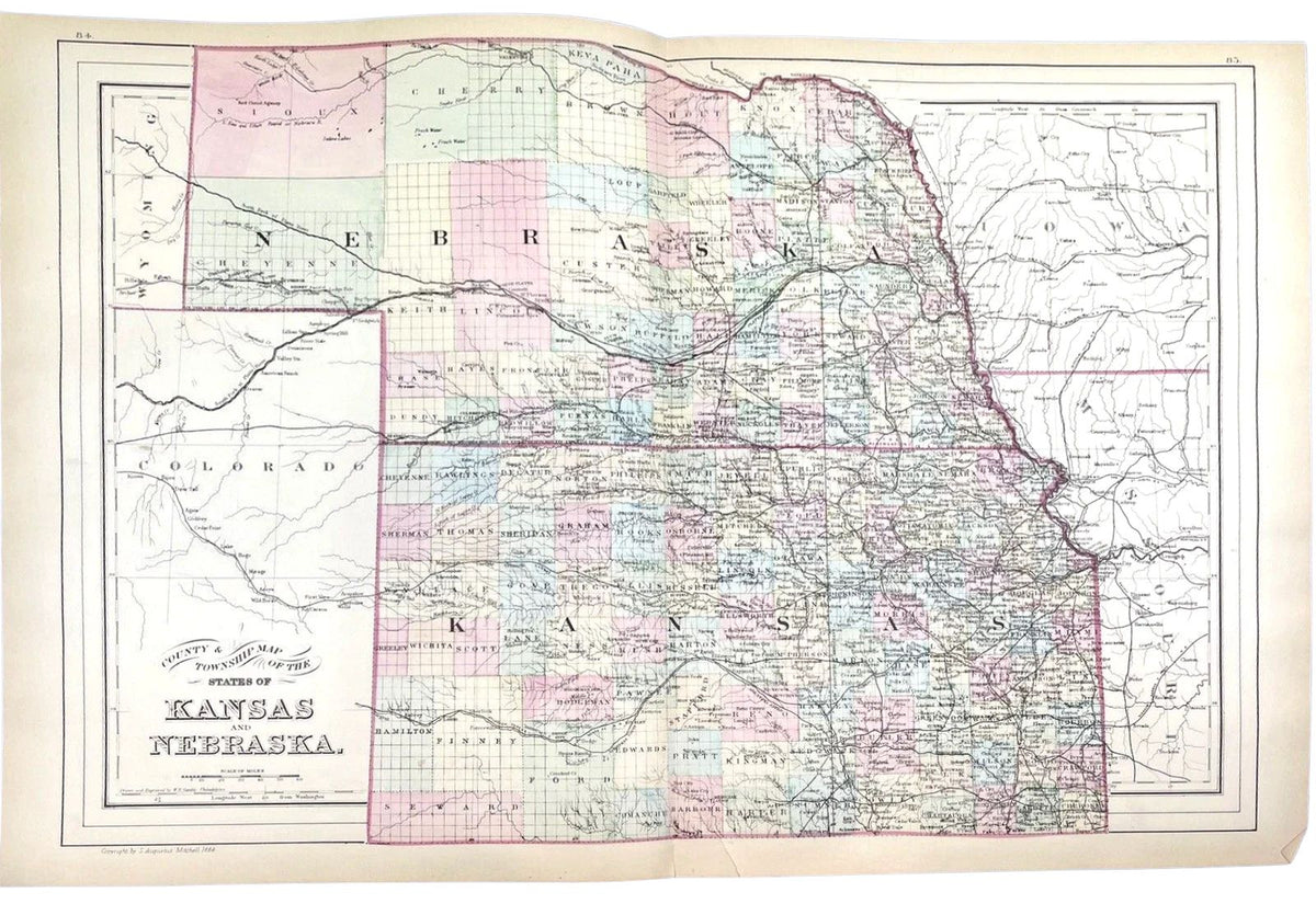
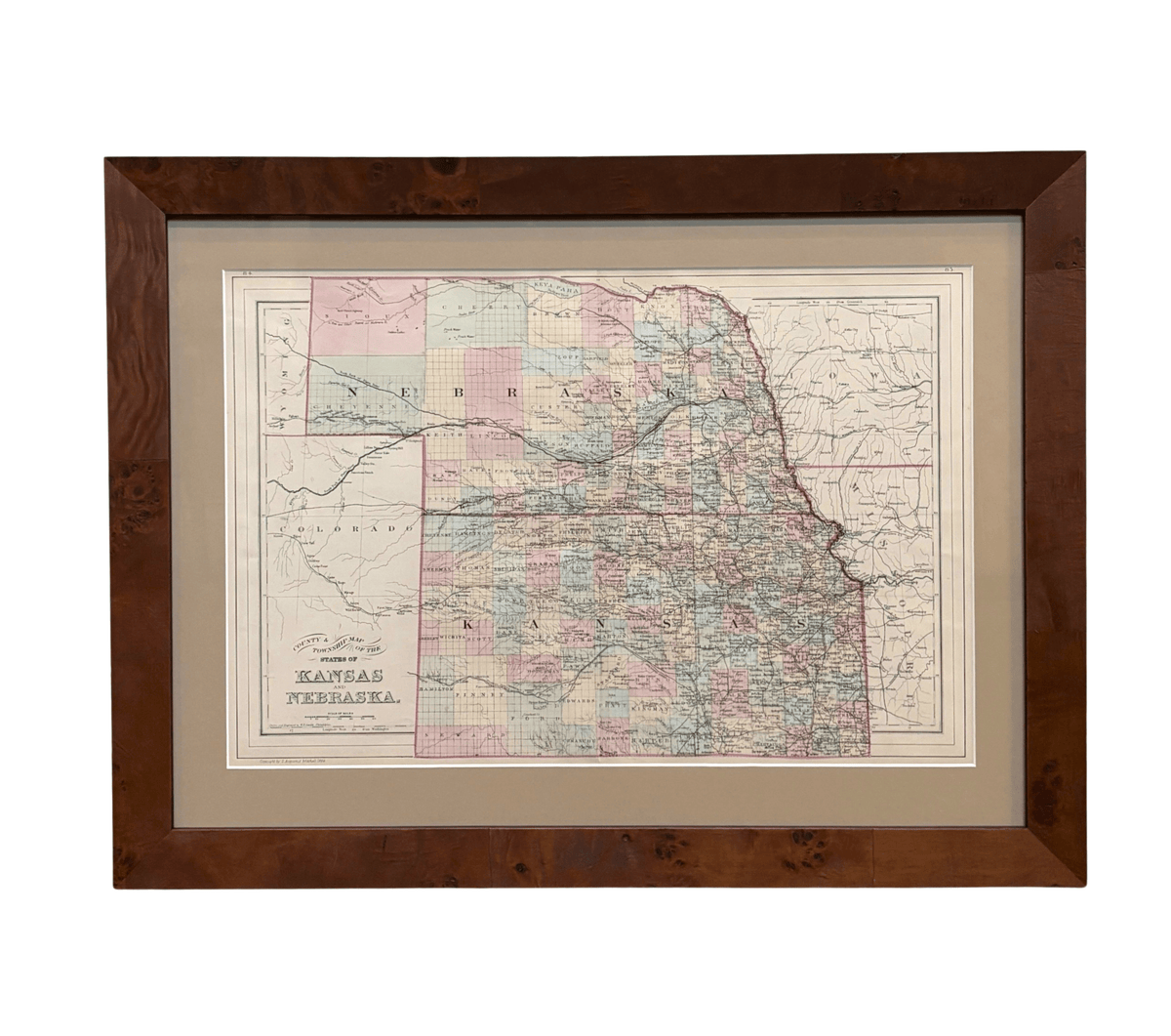
Presented is an original 1886 "County and Township Map of the States of Kansas and Nebraska" by S. Augustus Mitchell Jr. This map was issued as pages 84 and 85 in "Mitchell's New General Atlas" engraved by W. H. Gamble and published by Wm. M. Bradley & Bro., in Philadelphia. The map is copyrighted as 1884, but was from the 1886 reissue of the “New General Atlas.” The map is engraved, with attractive hand coloring and a decorative ruled border. Kansas and Nebraska are both labeled, outlined in pink, and colored by county. Partially depicted but not colored are the neighboring states and territories of Iowa, Missouri, Wyoming, and Colorado. The map is beautifully detailed, with rivers, creeks, and important forts and towns all marked.
This map is a lovely snapshot of the western states and territories during a time of exponential population growth. The passage of the Homestead Act and completion of the first transcontinental railroad meant that, by 1870, the possibility of western migration was opened to more Americans than ever before. Mining, agriculture and especially large-scale ranching, and the development of towns and cities around railroad hubs attracted large numbers of settlers to the West. Nearly 400,000 settlers made the trek westward during the height of the 1870s. Between 1867 and 1879, Congress also authorized and funded four significant surveys, in effort to learn more about the area west of the Mississippi River.
Kansas gained statehood in January of 1861, during the Civil War. Kansas is depicted here with its final state borders, north to south from 40th parallel north to 37th parallel north, following the irregular Missouri border along the Missouri River and the meridian from the mouth of the Kansas River along the east and shifted east to the 102nd meridian west, no longer including the western mountain region of Colorado Territory.
The Nebraska Territory was established by the Kansas-Nebraska Act on May 30, 1854, extending from the Missouri River west to the Rocky Mountains and north to the 49th parallel. Between 1861 and 1863, Congress dramatically reduced the territory as Colorado Territory, Dakota Territory, and Idaho Territory were organized from its western and northern lands. Nebraska was admitted as the 37th state on March 1, 1867, with boundaries broadly corresponding to those of the present state. In 1882, Congress authorized the extension of Nebraska’s northern boundary to the 43rd parallel, reclaiming territory between the 43rd parallel, the Keya Paha and Niobrara Rivers, and the Missouri River. These border changes are visible on this map.
Samuel Augustus Mitchell Sr. (1792 - 1868) began his map-publishing career in the early 1830s. Having worked as a schoolteacher, Mitchell was frustrated with the low quality and inaccuracy of school texts of the period. His first maps were an attempt to rectify this problem. In the next 20 years Mitchell would become the most prominent American map publisher of the mid-19th century. Mitchell worked with prominent engravers J. H. Young, H. S. Tanner, and H. N. Burroughs before attaining the full copyright on his maps in 1847.
In 1849, Mitchell teamed up with printer Cowperthwait & Company to produce "Mitchell's Universal Atlas" and "Mitchell's General Atlas." In the late 1850s most of the Mitchell copyrights were bought by Desilver and Co., who continued to publish his maps, many with modified borders and color schemes, until Mitchell's son, Samuel Augustus Mitchell Jr., entered the picture. S. A. Mitchell Jr. purchased most of the copyrights back from Desilver and, from 1860 on, published his own "New General Atlas." The younger Mitchell became as prominent as his father and published atlases well into the late 19th century when most of the copyrights were again sold and the Mitchell firm closed its doors for the final time.
CONDITION:
Fine condition overall. Engraved, with original hand coloring. Pages 84 and 85 from "Mitchell's New General Atlas." Ruled line border. Colored in Kansas and Nebraska, uncolored for bordering states and territories. Light toning to paper.
Archivally framed with acid-free mats, UV Conservation Clear glass, and a custom built wooden frame.
Framed Dimensions: 21 1/4" H x 28" W x 1 1/8" D.
Accompanied by our company's letter of authenticity.
Pickup currently unavailable at Colorado
1886 "County and Township Map of the States of Kansas and Nebraska" by S. Augustus Mitchell
Colorado
1 Lake Avenue
Colorado Springs CO 80906
United States
Choose options
Frequently Asked Questions
FAQs
Yes, all of our Antiques are certified authentic. Every antique comes with a signed Letter of Authenticity that details the item’s history, its current condition including any conservation, binding, or framing work, and the item’s provenance. The Letters of Authenticity are priced valuations by our authentication specialists, who assure that items are original and unconditionally guaranteed as genuine for life.
We pack and ship your items from our gallery in Colorado Springs. You may also choose to come pick up your order. Antique items are carefully packed and insured during shipping. The shipping price will be calculated at checkout.
We acquire from a variety of trusted sources all over the world, but mostly through auctions and private collections within the United States. All provenance information will be listed on the Letter of
Authenticity accompanying your purchase.