
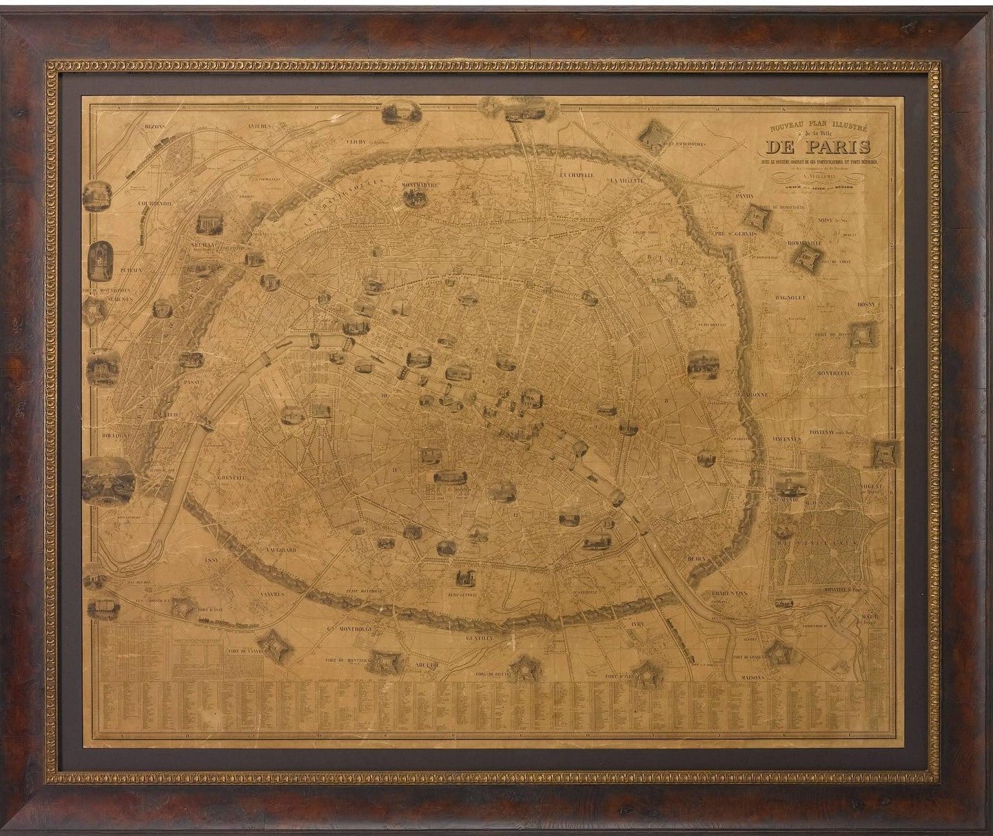
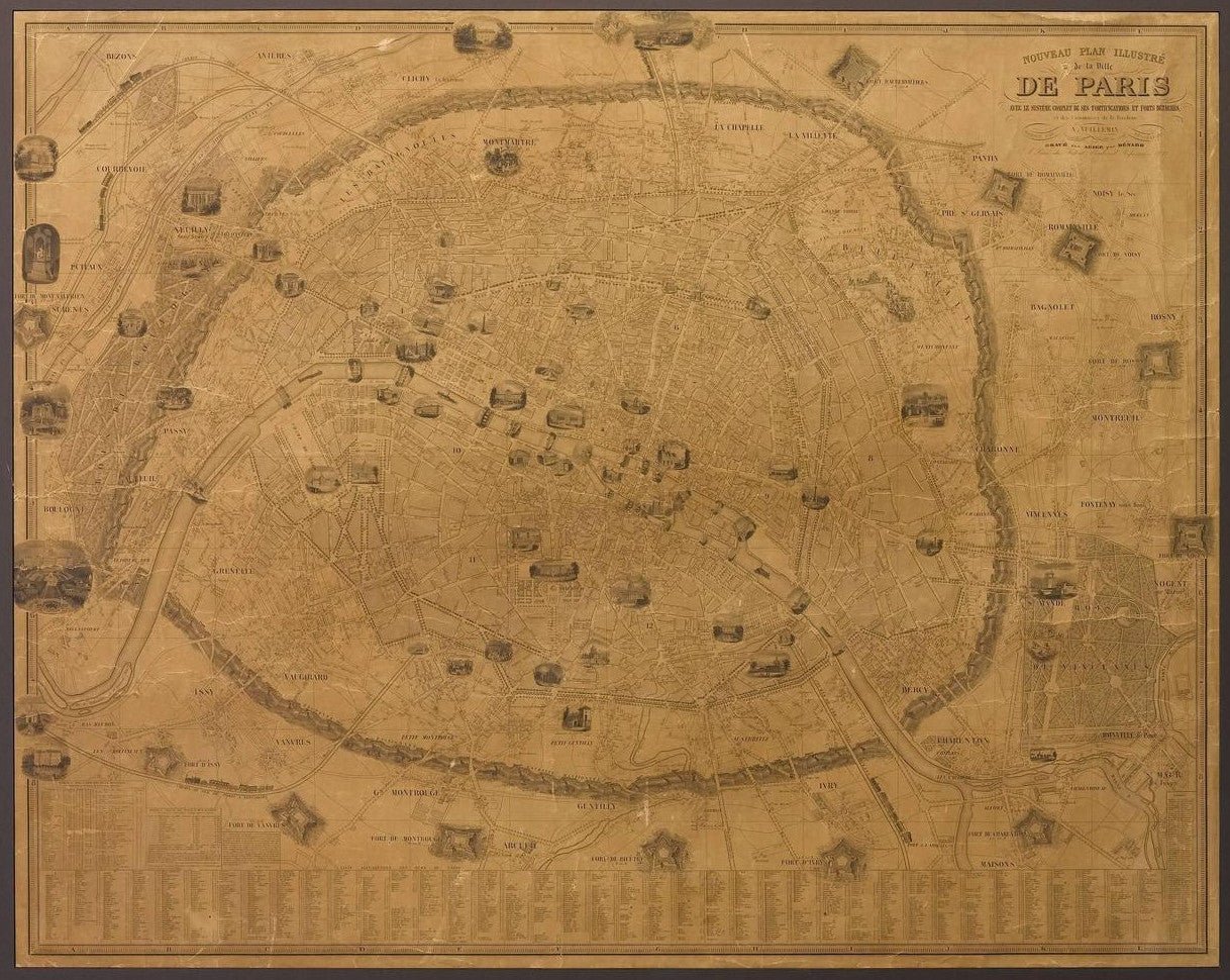
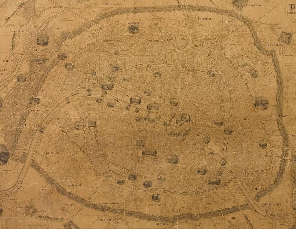
1845 Nouveau Plan Illustre de la Ville de Paris by A. Vuillemin
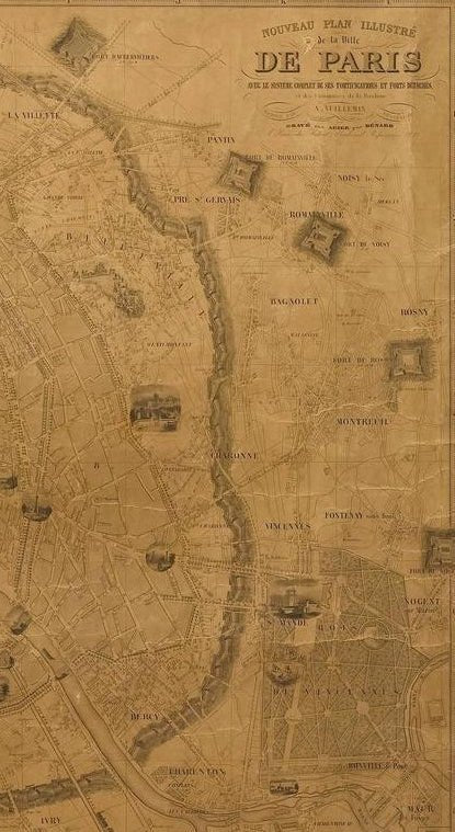
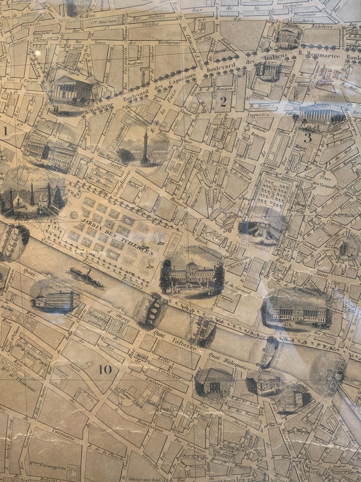
This large and detailed plan of Paris was published by Alexandre Vuillemin in 1845. The map conveys a wonderful amount of information and is decorated throughout with pictorial vignettes of major buildings, bridges, trains, and monuments.
It also includes a table with an alphabetized street index; a list of suburbs with distances to Paris, population and festival days; a table listing forts surrounding Paris with distances to the center of the city; and a list of passages located throughout the city.
Alexandre Vuillemin (1812-1880) was a leading 19th century French cartographer and editor. He studied under French cartographer Auguste Dufour and set up shop in Paris. Vuillemin produced over ten different atlases during his career; many of which were so popular they went through multiple editions. His maps are noted for the frequent use of extensive margin illustrations – vignettes, portraits of famous people, and inset birds-eye views of cities.
CONDITION:
This is a nice impression, with age appropriate toning to the paper. The map has been backed onto linen. It is displayed in a custom archival wood frame with a gold beaded border. Framed dimensions: 42 3/8" H x 51 1/4" W x 1 1/4" D
Accompanied by our company's letter of authenticity.
Pickup available at Colorado
Usually ready in 4 hours
1845 Nouveau Plan Illustre de la Ville de Paris by A. Vuillemin
Colorado
1 Lake Avenue
Colorado Springs CO 80906
United States
Choose options
Frequently Asked Questions
FAQs
Yes, all of our Antiques are certified authentic. Every antique comes with a signed Letter of Authenticity that details the item’s history, its current condition including any conservation, binding, or framing work, and the item’s provenance. The Letters of Authenticity are priced valuations by our authentication specialists, who assure that items are original and unconditionally guaranteed as genuine for life.
We pack and ship your items from our gallery in Colorado Springs. You may also choose to come pick up your order. Antique items are carefully packed and insured during shipping. The shipping price will be calculated at checkout.
We acquire from a variety of trusted sources all over the world, but mostly through auctions and private collections within the United States. All provenance information will be listed on the Letter of
Authenticity accompanying your purchase.