

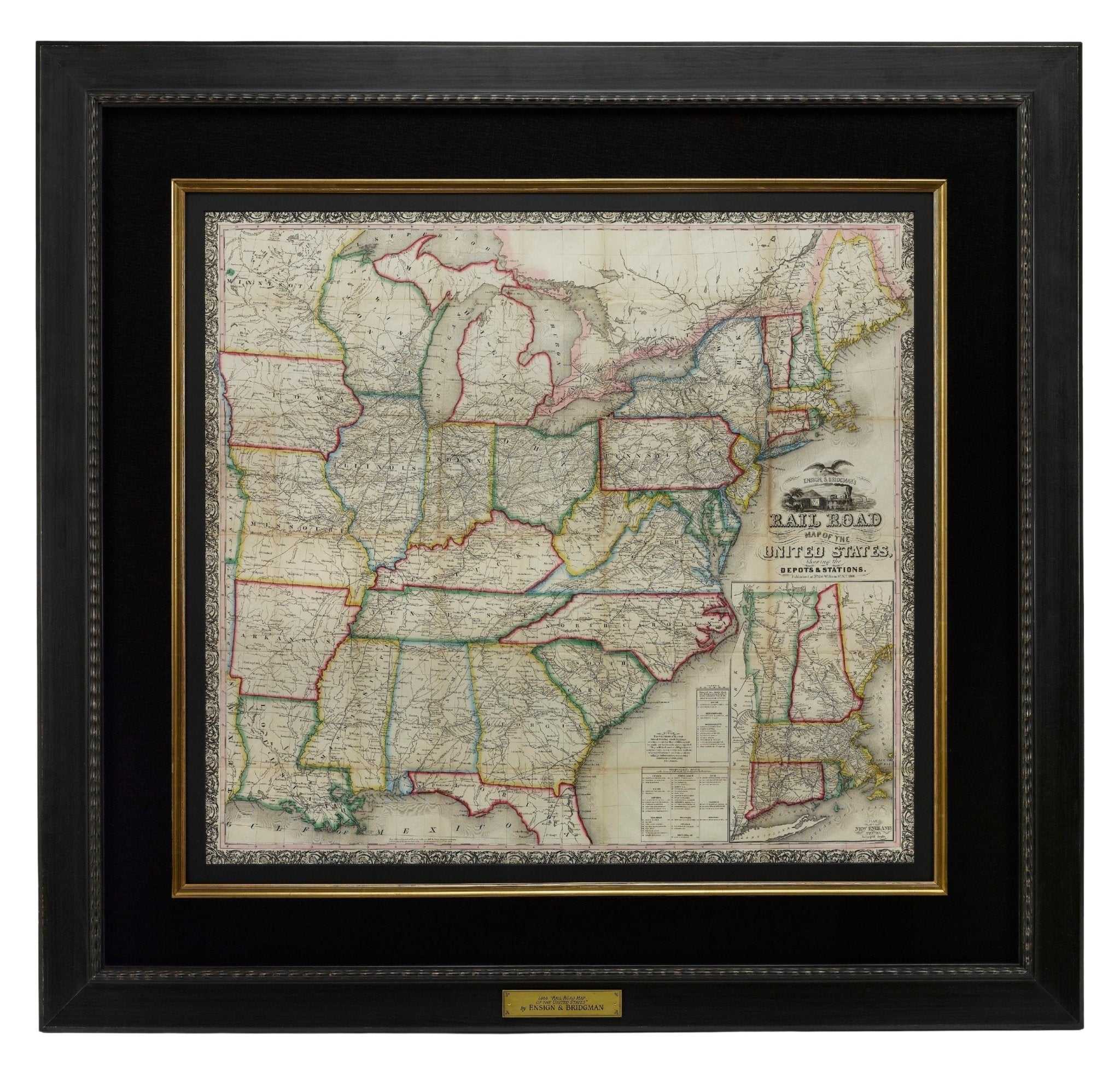

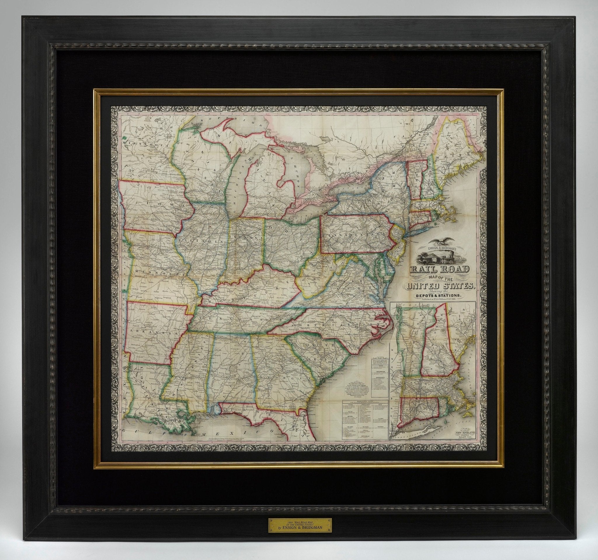
1866 "Ensign & Bridgman's Rail Road Map of the United States, showing Depots & Stations"
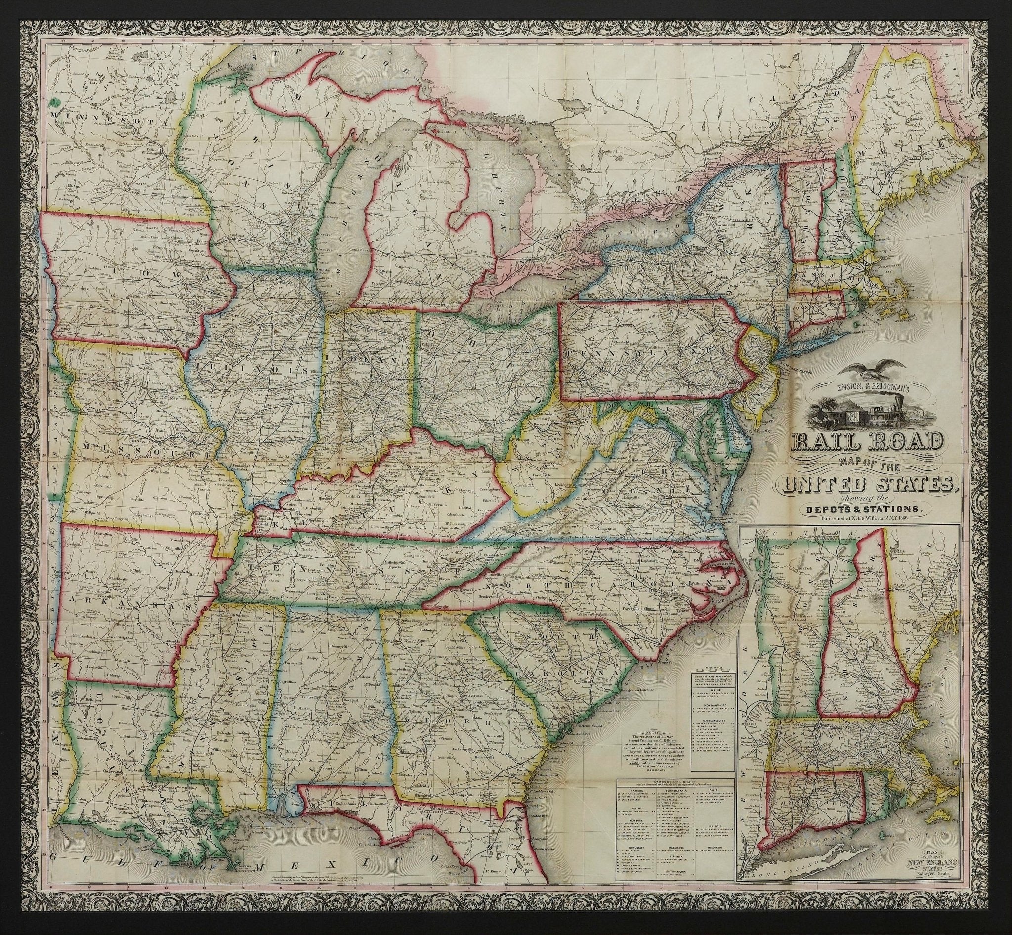
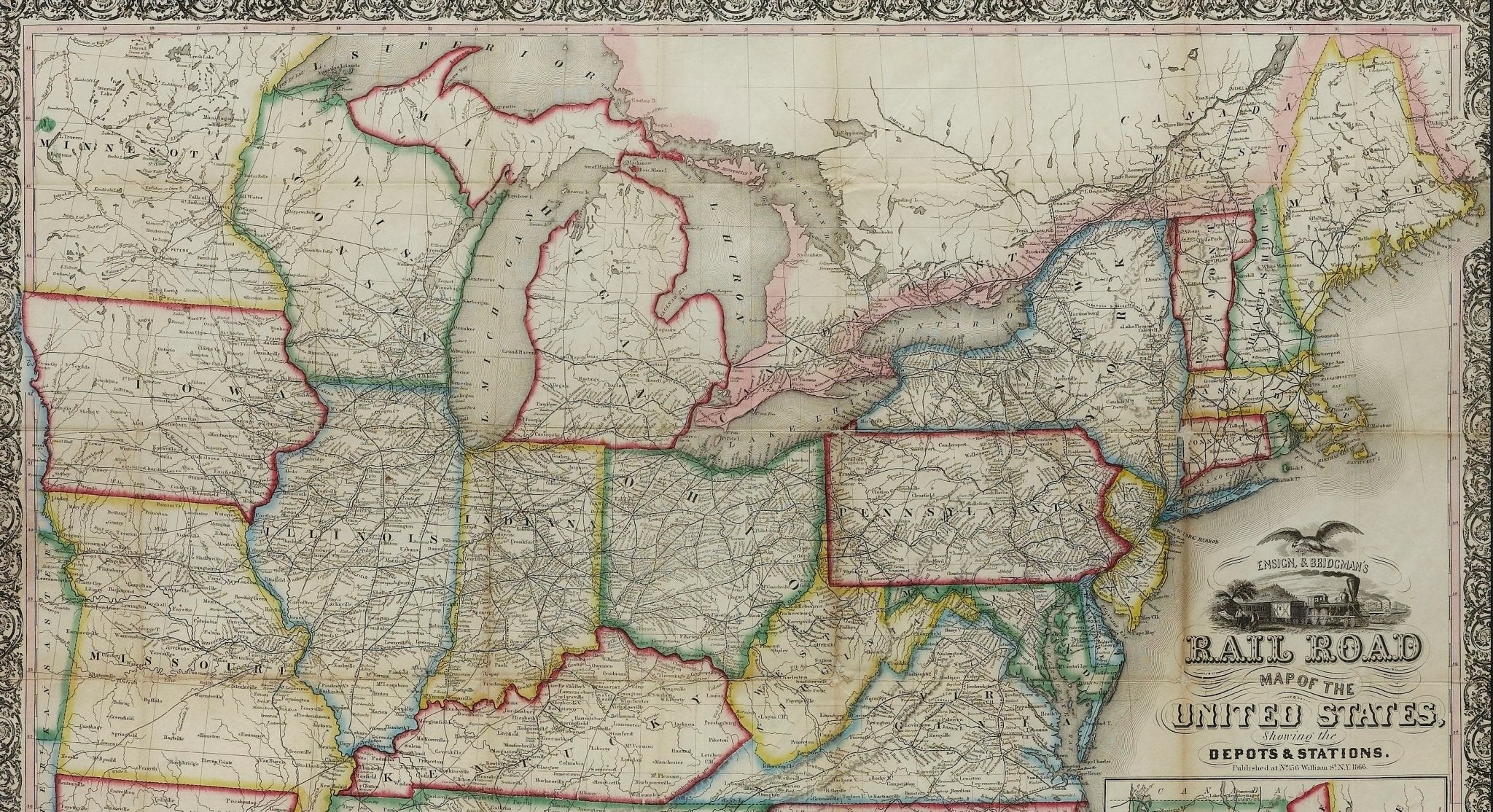
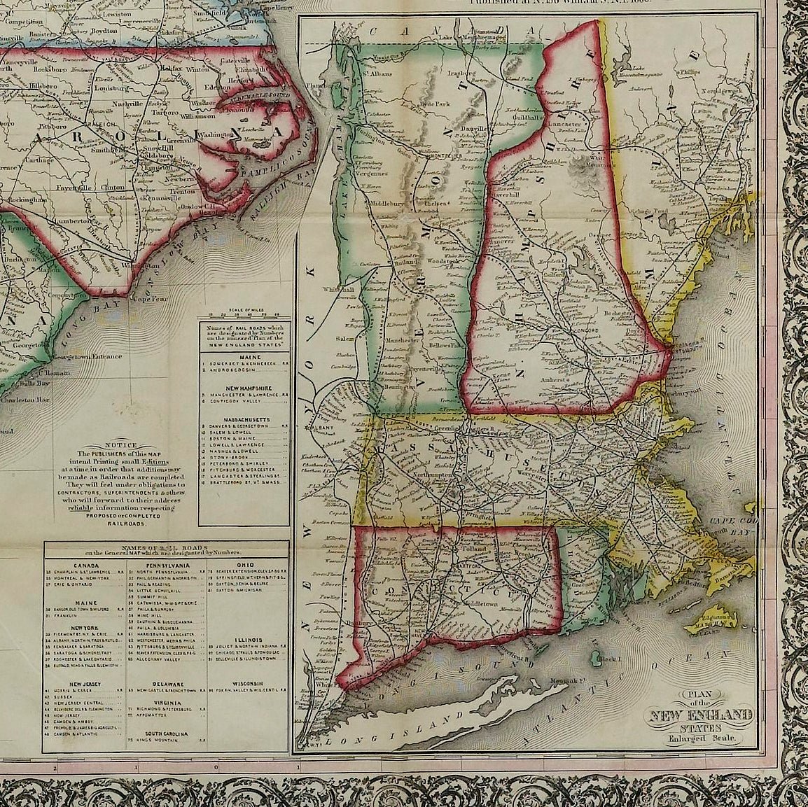
Presented is an 1866 issue of “Ensign & Bridgeman’s Rail Road Map of the United States, showing Depots & Stations.” First published in 1856, this is the third edition, following another issued in 1859. It is an expansive and impressive 19th century map depicting the eastern half of the United States, just after the end of the Civil War. Starting on the eastern coast, the map extends to the western borders of Minnesota, Iowa, Missouri, Arkansas, and Louisiana. As alluded to in its title, the map highlights existing railroads and railroad depots, as well as proposed lines. State boundaries, county boundaries, cities, and major towns are all labeled, along with some rivers and larger lakes. At the bottom of the map is an inset map “Plan of the New England States.” A decorative title block includes a railroad racing a steam boat, topped with a large spread wing eagle. The whole is enclosed within a wide ornamental border.
The map captures the burgeoning American railway infrastructure and documents the industrial ambition of this era. In the mid-1900s railroads were transforming the landscape of North America, revolutionizing transportation, industry, and shifting populations seemingly overnight. This map reflects this transformation by illustrating the extensive railway system, including key routes west and the criss-crossing routes one can take to travel between cities and new rail hubs.
Many names of railroads appear along the cross-hatched lines, while others are numbered to a key list of lines at the bottom right. A small notice states that the publishers were going to print small editions at a time so that reliable railroad information could be added or updated. They continue on to state that “They will feel under obligations to Contractors, Superintendents, & others, who will forward to their address reliable information respecting Proposed or Completed railroads.” The inset map focuses on the railways and depots throughout New England, where early American rail travel first flourished.
CONDITION:
Engraved map. Hand coloring to outlines. Fold lines, as originally issued. Toning along fold lines. Trimmed close to margins.
Map is archivally framed with acid-free mats, UV glass, and a custom-built wooden frame. Framed Dimensions: 45 3/4" H x 48 1/4" W x 1 1/2" D.
Accompanied by our company's letter of authenticity.
Pickup available at Colorado
Usually ready in 4 hours
1866 "Ensign & Bridgman's Rail Road Map of the United States, showing Depots & Stations"
Colorado
1 Lake Avenue
Colorado Springs CO 80906
United States
Choose options
Frequently Asked Questions
FAQs
Yes, all of our Antiques are certified authentic. Every antique comes with a signed Letter of Authenticity that details the item’s history, its current condition including any conservation, binding, or framing work, and the item’s provenance. The Letters of Authenticity are priced valuations by our authentication specialists, who assure that items are original and unconditionally guaranteed as genuine for life.
We pack and ship your items from our gallery in Colorado Springs. You may also choose to come pick up your order. Antique items are carefully packed and insured during shipping. The shipping price will be calculated at checkout.
We acquire from a variety of trusted sources all over the world, but mostly through auctions and private collections within the United States. All provenance information will be listed on the Letter of
Authenticity accompanying your purchase.