
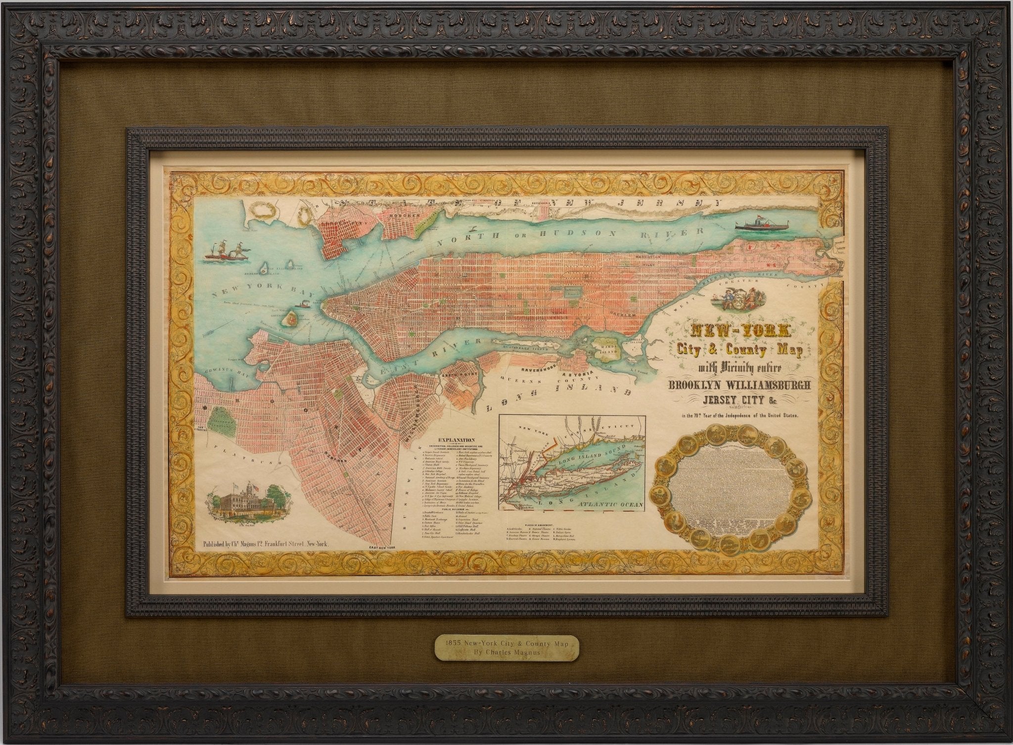
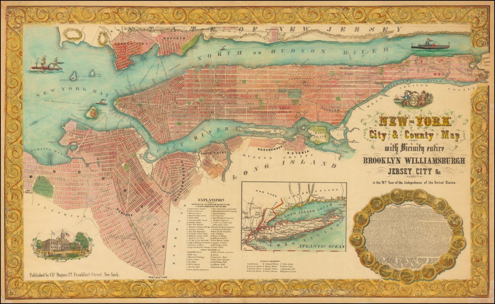
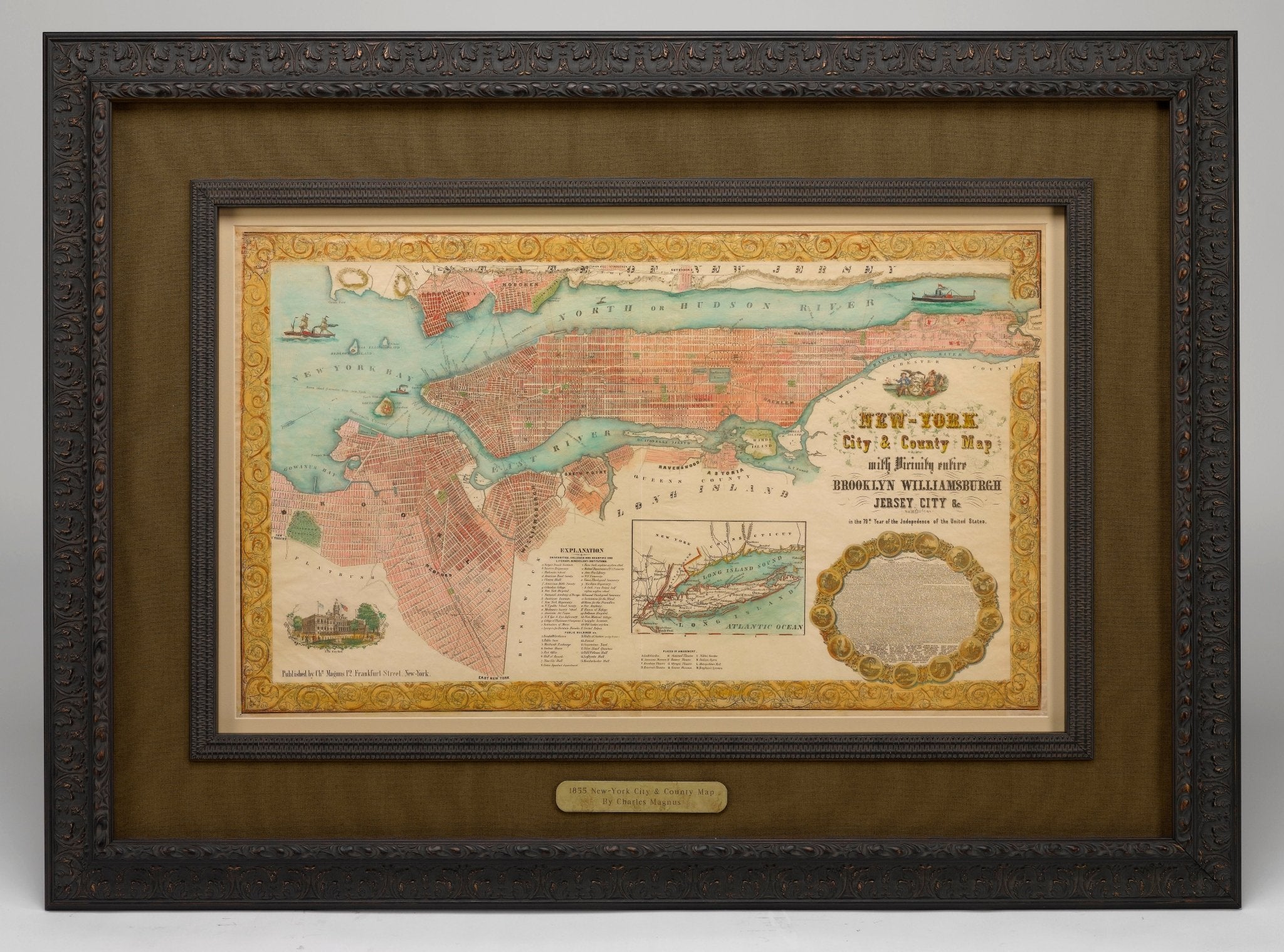
1855 "New-York City & County Map with Vicinity entire Brooklyn Wiliamsburgh Jersey City &c." Map by Charles Magnus
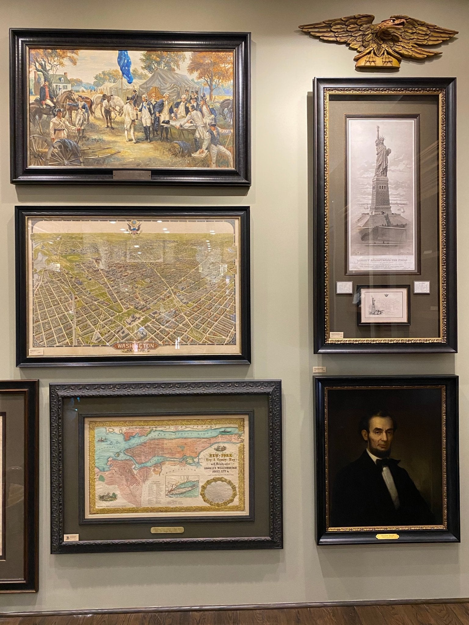
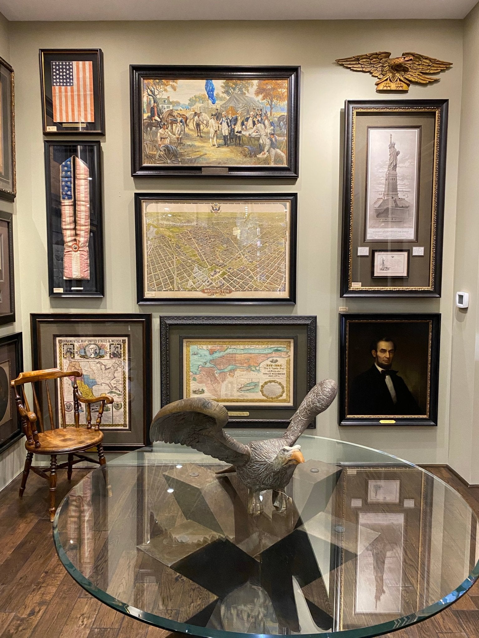
This is a beautiful hand-colored map titled “New York City & County Map with Vicinity entire Brooklyn, Williamsburgh, Jersey City &c.” The work was published in 1855 by Charles Magnus and is presented in a wooden archival frame.
Published by one of the best known and most prosperous printers in the mid to late 19th century, this map is wonderfully detailed. Turned clockwise so that cardinal west is at the top of the map, this is an unusual and attractive depiction of the city. The map shows the entirety of Manhattan as well as nearby neighborhoods. The map lends special attention to individual streets, blocks, parks and even important buildings. Magnus shows important ferry crossings, canals, and railroads as well with steamships navigating the Hudson River.
Centered on Manhattan, the map identifies additional districts including Manhattanville, Yorkville, and Harlem. Several areas have changed since the 1855 map was completed and some of the planned landfill is visible around Hoboken and Jersey City. Other sites have notably changed such as New York Lunatic Asylum that is in place of the modern site of Columbia University. At the bottom center of the map an alphanumerically keyed legend notes 'Universities, Colleges and Scientific and Literary, Benevolent-Institutions,' 'Public Buildings' and 'Places of Amusement.' An illustration of the New York City Hall adorns the bottom left of the map and is balanced by the full text of the Declaration of Independence surrounded by an elaborate medallion at the bottom right. The map is beautifully decorated with acanthus leaf motif border. Overall, this map is an appealing example of Magnus' printing and New York City in the mid-19th century.
CONDITION:
Overall good condition. The map has some foxing throughout from age and mild color loss. One crease runs down the middle of the once-folded map. Otherwise, the colors are still vibrant and the map is free of any tears. A publisher's mark, Charles Magnus 12, is visible at the bottom left corner as well as directly underneath the text of the Declaration of Independence. The map is framed according to archival standards and sits behind UV protective glass.
Framed dimensions: 36” H x 49” W x 2.5” D.
Accompanied by our company's letter of authenticity.
Pickup available at Colorado
Usually ready in 4 hours
1855 "New-York City & County Map with Vicinity entire Brooklyn Wiliamsburgh Jersey City &c." Map by Charles Magnus
Colorado
1 Lake Avenue
Colorado Springs CO 80906
United States
Choose options
Frequently Asked Questions
FAQs
Yes, all of our Antiques are certified authentic. Every antique comes with a signed Letter of Authenticity that details the item’s history, its current condition including any conservation, binding, or framing work, and the item’s provenance. The Letters of Authenticity are priced valuations by our authentication specialists, who assure that items are original and unconditionally guaranteed as genuine for life.
We pack and ship your items from our gallery in Colorado Springs. You may also choose to come pick up your order. Antique items are carefully packed and insured during shipping. The shipping price will be calculated at checkout.
We acquire from a variety of trusted sources all over the world, but mostly through auctions and private collections within the United States. All provenance information will be listed on the Letter of
Authenticity accompanying your purchase.