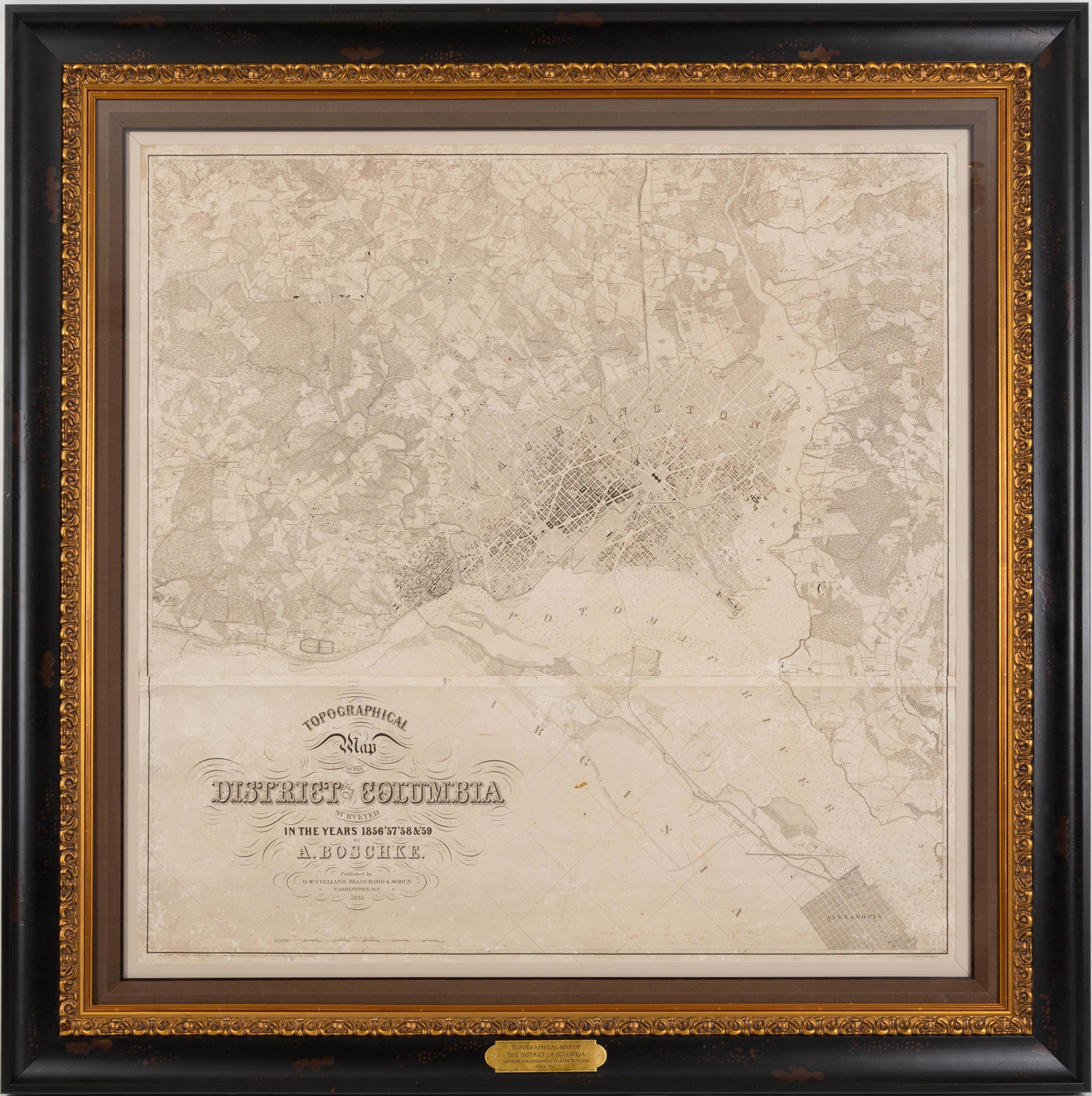
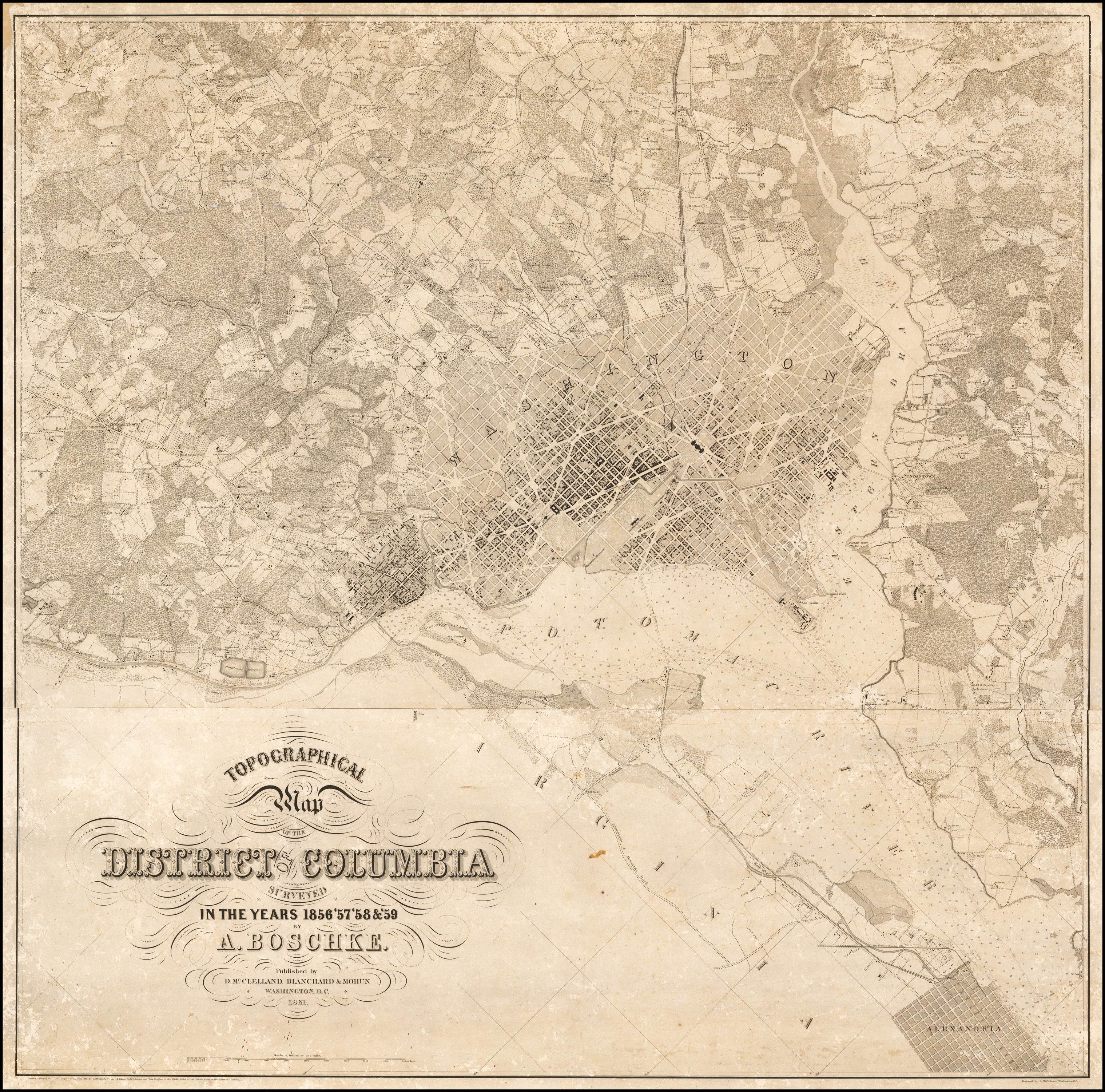
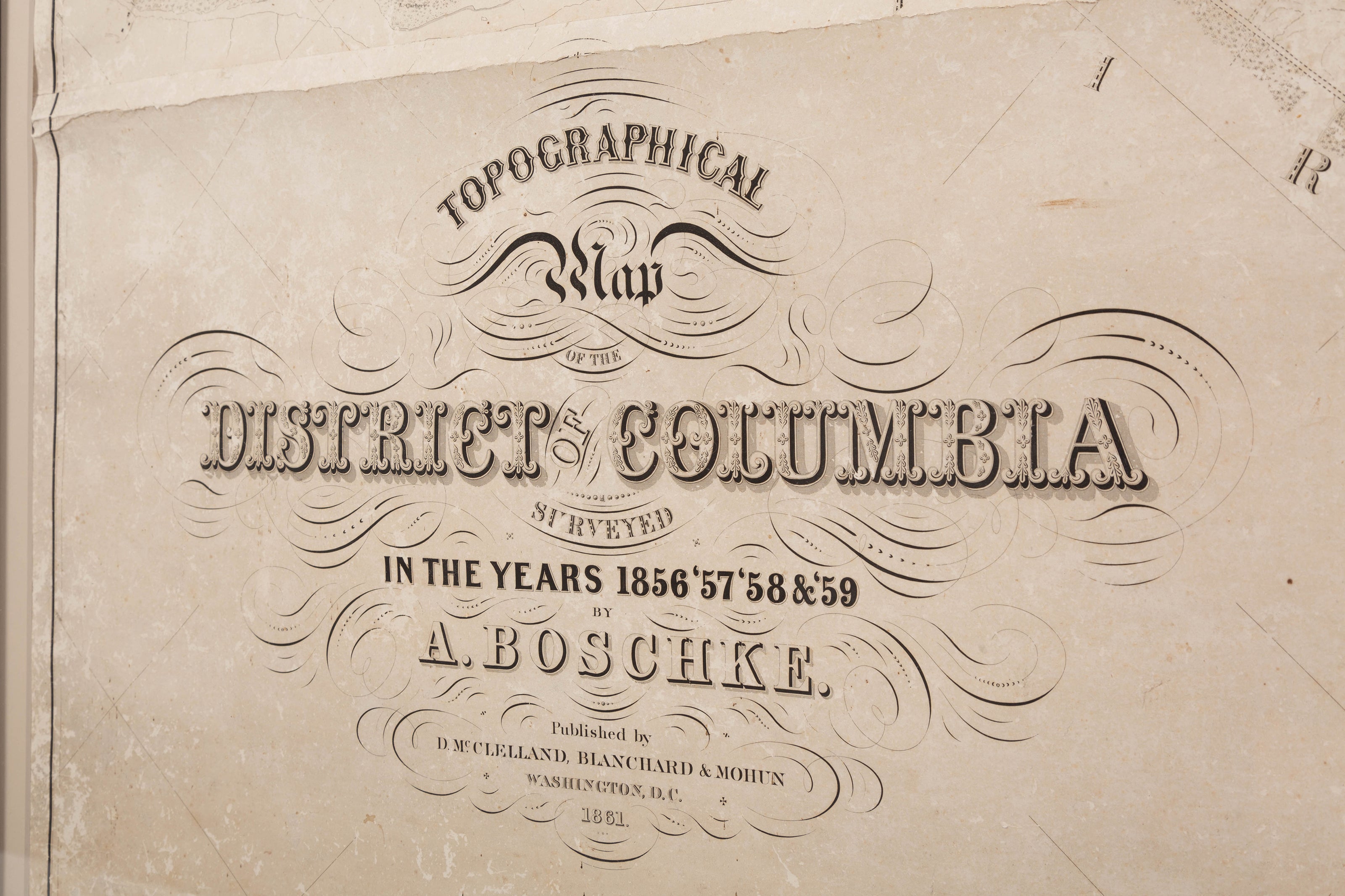
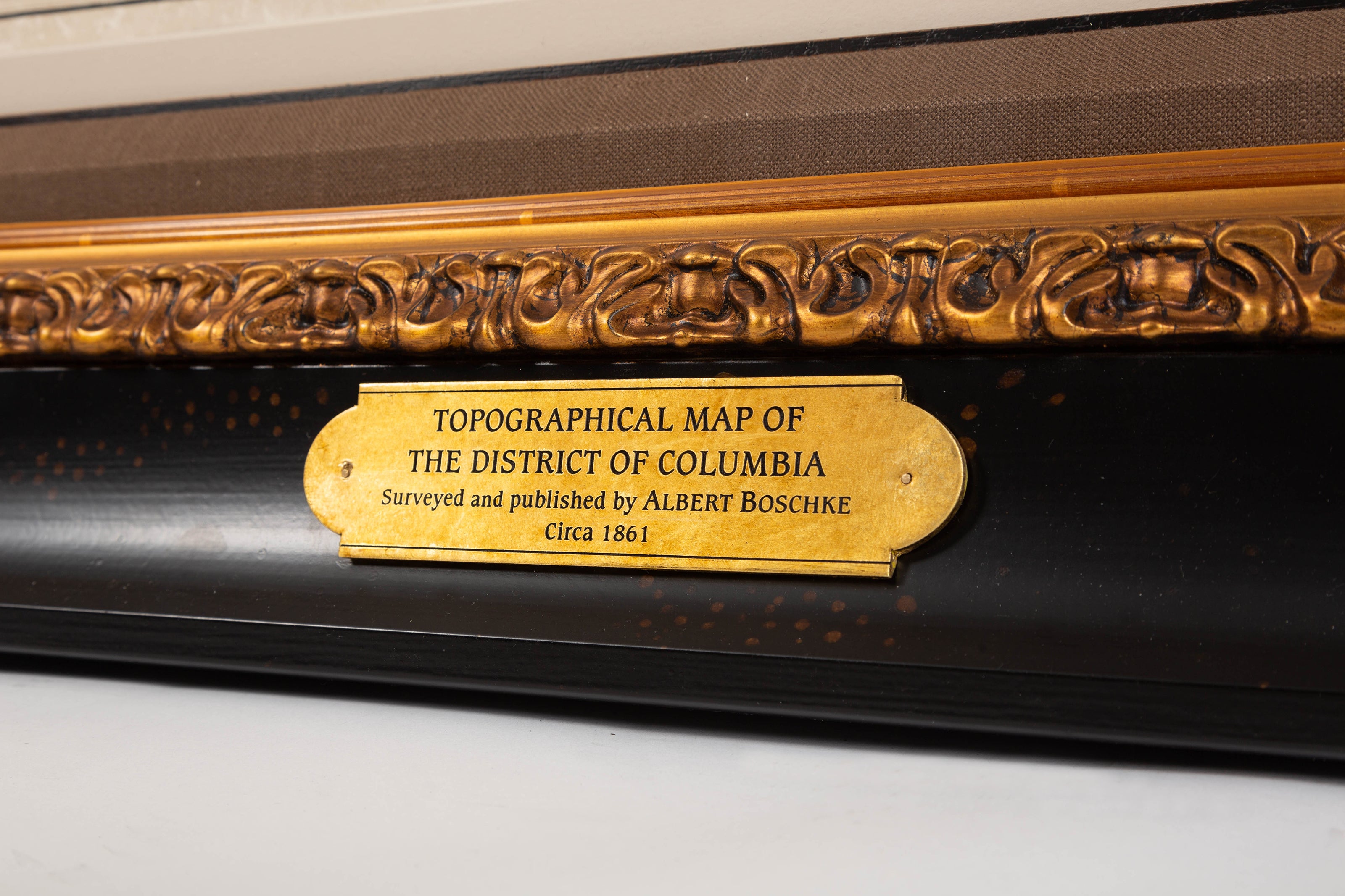
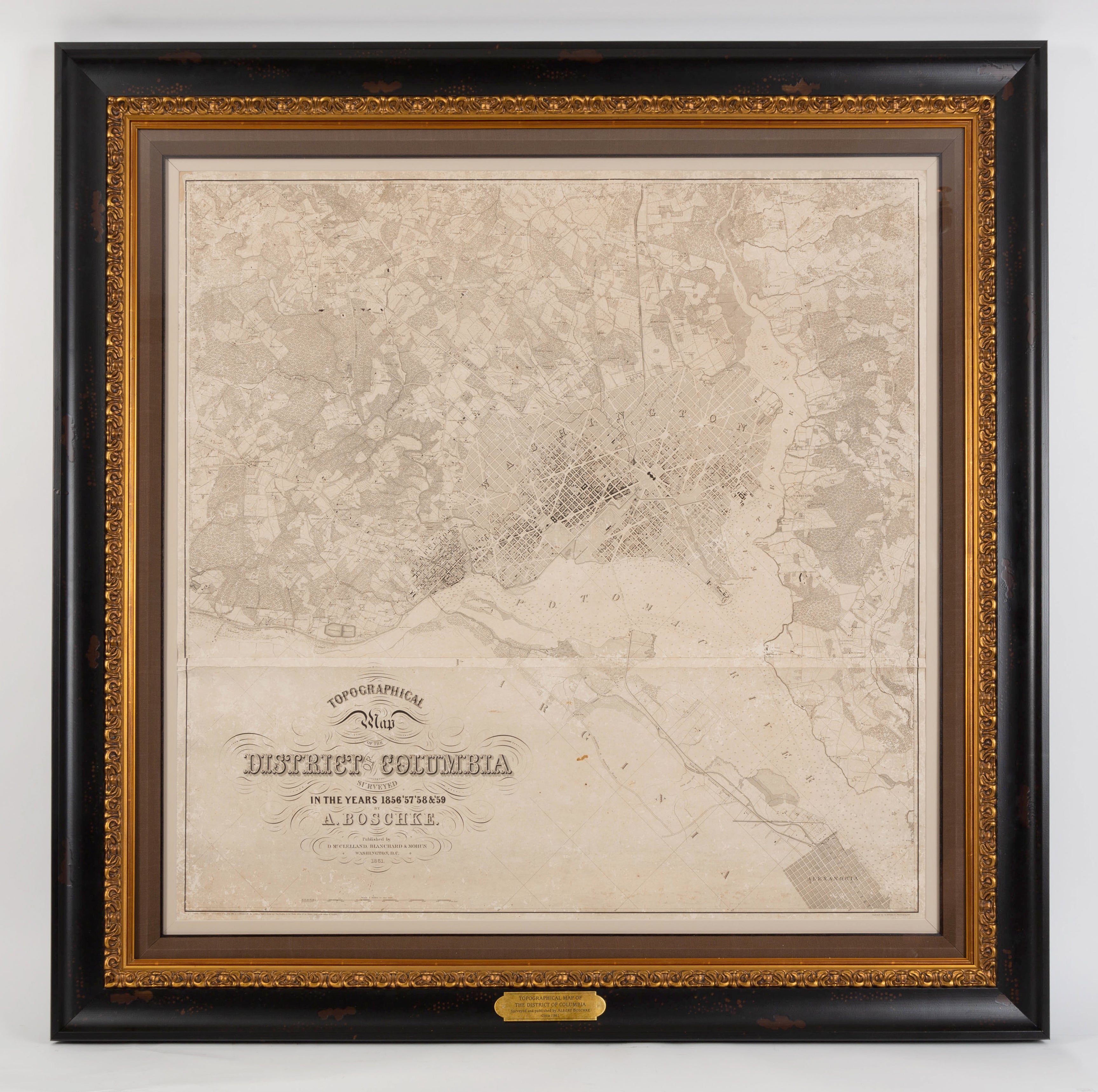
1861 "Topographical Map of the District of Columbia Surveyed in the Years 1856 '57 '58 & '59" by Albert Boschke
$40,000.00 $45,000.00
Presented is Albert Boschke's extremely sought-after "Topographical Map of the District of Columbia Surveyed in the Years 1856 '57 '58 & '59" from 1861. The map was published out of Washington D.C. by D. McClelland, Blanchard and Mohun. Boschke’s map is known for its highly accurate details. Drawn on a scale of four inches to a mile, the map documented the location of all buildings in the city, both private and public, with each structure drawn from tape-line measurements that had been made in the field. The roads were measured by two parties, one with transit and chain, the other with a level. Roads, rivers, creeks, farm and wooded lands are named on the map, along with property lines and landowner names. The map also includes accurate topographical details. The map was drawn and engraved in the style of the charts issued by the U.S. Coast and Geodetic Survey.
Albert Boschke was a civil engineer who worked for the U.S. Coast and Geodetic Survey in Washington, D.C. His name began to appear on official surveys that he had produced by the early to mid-1850s. Boschke conceived of the idea of making a highly accurate map of Washington and of the District of Columbia with the hope of selling it to the government. At his own expense, Boschke organized and employed surveyors to do the fieldwork for the survey. This project eventually cost him his job at the Coast Survey. After 5 years, the project yielded two maps, a large four sheet map of the city in 1857 and this highly detailed map of the whole District of Columbia in 1861.
At the outbreak of the Civil War, Boschke’s survey was the only topographic map to exist of the District of Columbia in its entirety. Boschke sold his interest in the map to engravers. McClelland engraved the Boschke map and executed the work on two plates. The elaborate details and large size of the map meant that the work was painstaking and lengthy. Upon completion, McClelland pitched the survey to the United States government for $20,000. Secretary Stanton, not estimating the extensive labor and expense involved in completing the map, offered to purchase it for a mere $500. McClelland and his partners counter-offered the copper-plates and manuscript to the government for $4,000, on condition that the plates with the copyright should be returned to them at the close of the war. This offer was also refused.
After such disagreements, the U.S. Secretary of War ordered the seizing of all material relating to this map. The war was still going on and the necessity for a detailed topographical survey of the area was apparent. However, before the materials were seized, McClelland ordered for further conference to discuss a reasonable price. Secretary Stanton suggested a payment of $8,500 and the offer was ultimately accepted.
The complexities of Boschke's map and the story of its seizure has rendered it very scarce on the market. Original examples are very rare and highly sought-after among collectors.
CONDITION:
Overall very good condition considering age. Significant crease in center where sheets are joined, scattered holes and light staining, but overall a very stable and clear example. Framed according to the highest conservation standards.
Framed dimensions: 53.25" H X 53.75" W x 3.5" D.
Accompanied by our company's letter of authenticity.
Related Items


© 2024 The Great Republic. All Right Reserved.