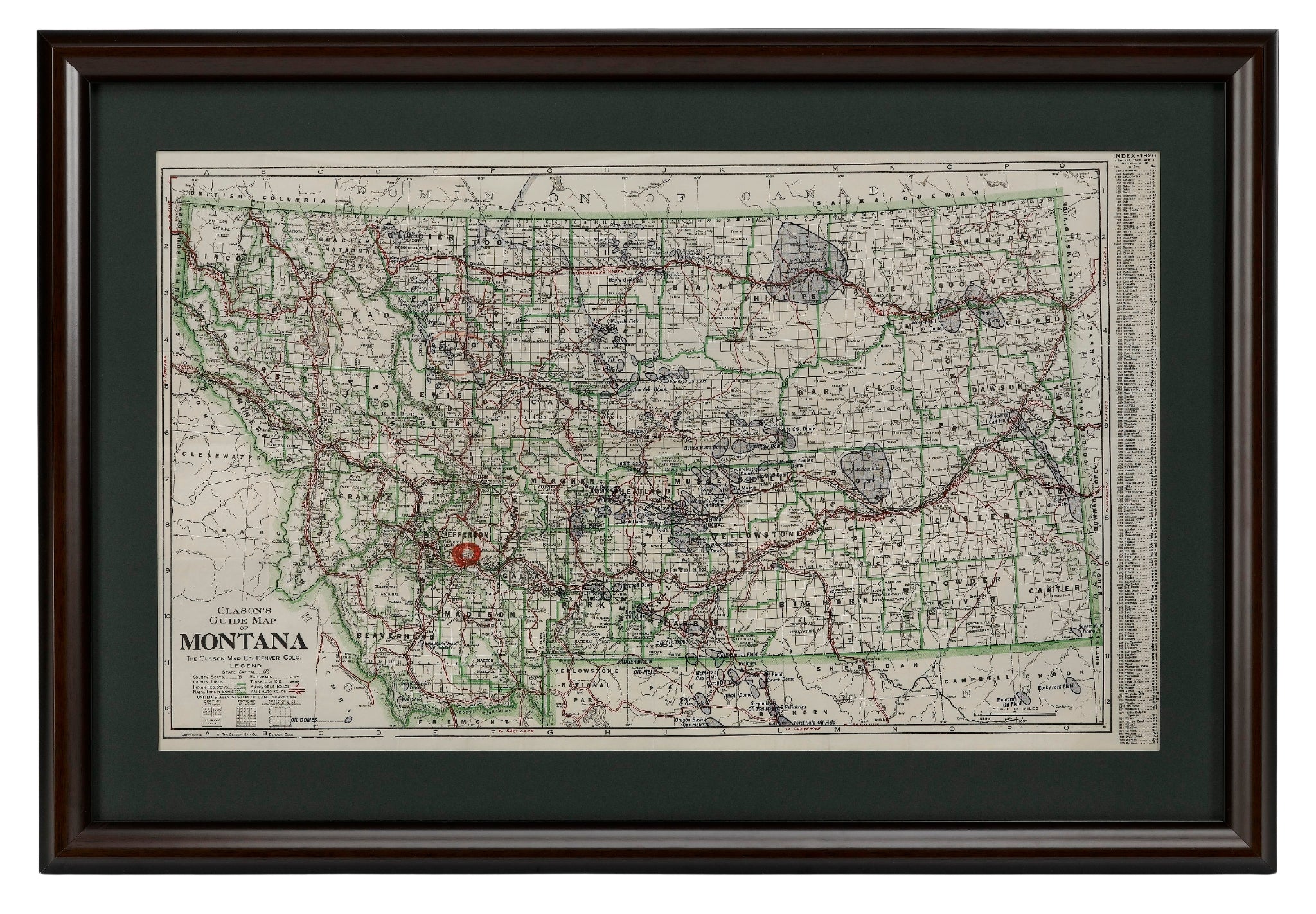
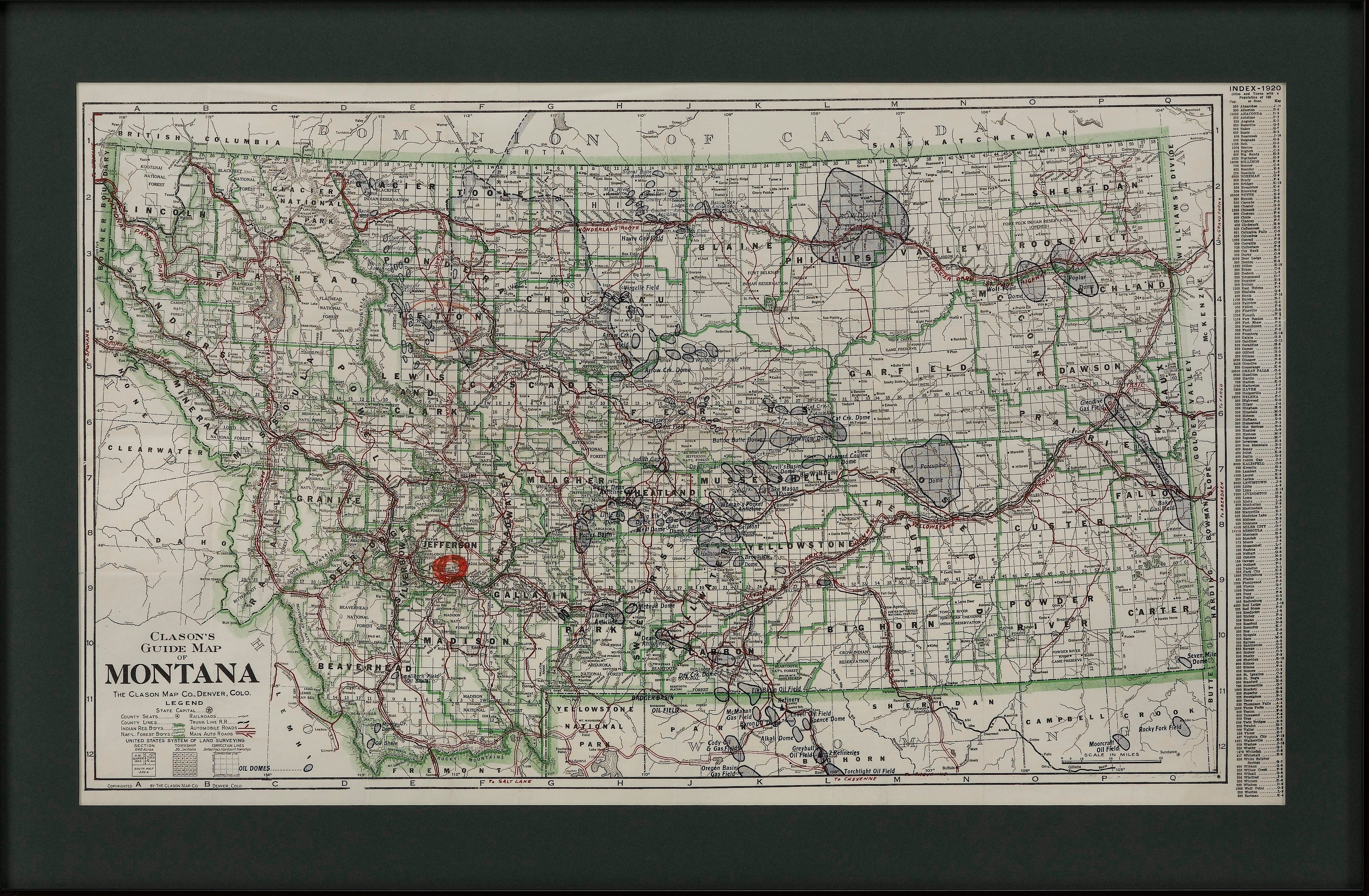
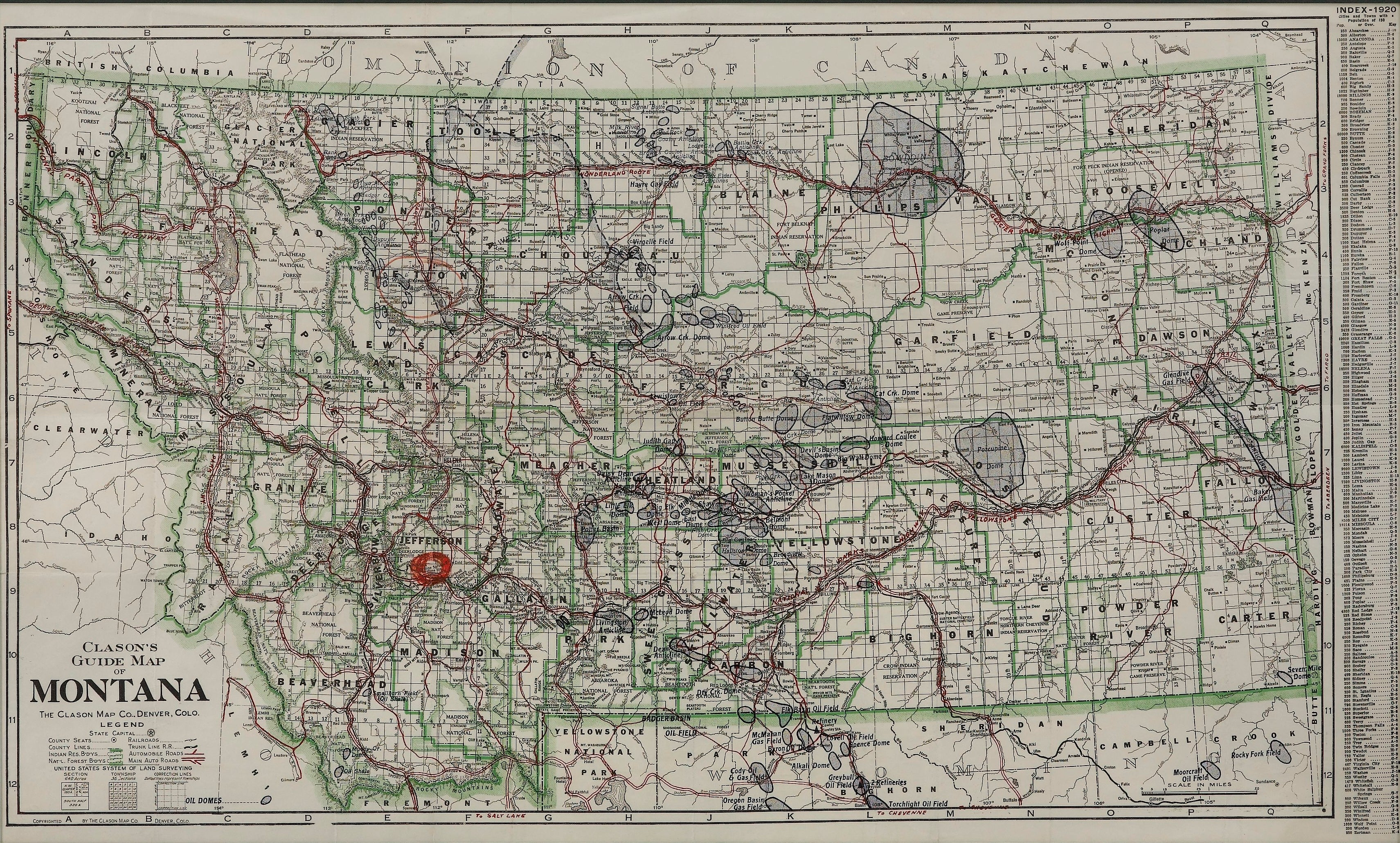
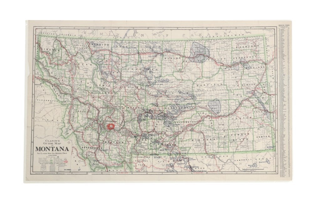
"Clason's Guide Map of Montana" by The Clason Map Company, Circa 1920s
$1,650.00
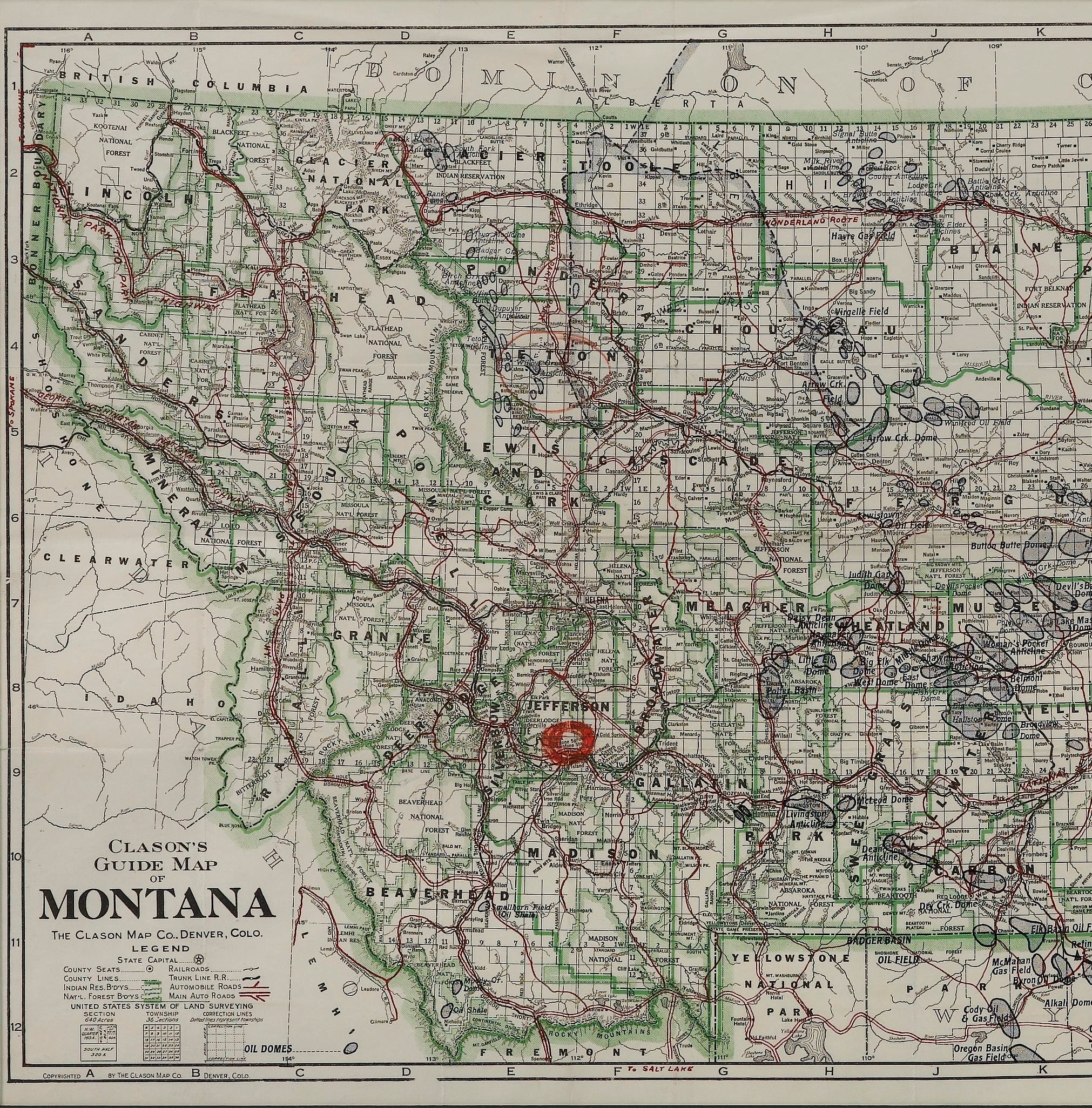
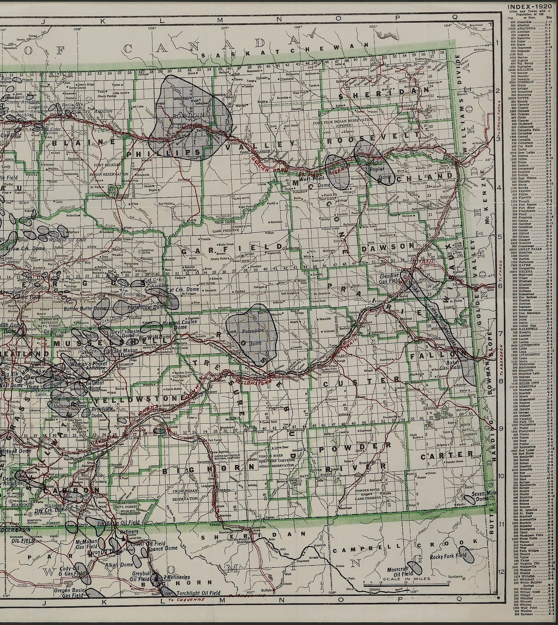
Presented is “Clason's Guide Map of Montana,” published in the early 1920s by the Clason Map Company. Issued as a folding map, this map identifies county boundaries, county seats, Native American reservation borders, national forest boundaries, railroads, and roads. Popular “auto roads” and “main auto roads” are identified in red snaking lines across the state. The map also shows various oil dome locations throughout Montana, each circled in navy. On the right hand side of the map is a large index, to help viewers find towns on the map. It also provides population data by town, for any town with a population of 150 people or more.
The Homestead Act of 1862, the 1877 Desert Land Act, and finally, the Enlarged Homestead Act of 1909 drew many settlers to Montana, enticing those hoping to make a living on 320 acres per homestead. Railroad companies played a major role in the state’s population boom as well. They launched massive advertising campaigns encouraging settlement with pamphlets and posters that praised the state’s fertile soil. More than 80,000 homesteaders moved into Montana between 1909 and the early 1920s. At its peak in 1918, 14,178 homestead claims were filed on 3.2 million acres.
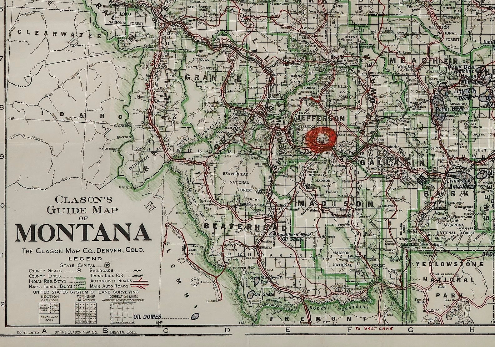
As homesteaders moved to Montana, folding maps just like this one would have been necessary to navigate the large state. This particular map has a large red circle around the town of Whitehall, possibly indicating the original owner’s intent to visit or move there. Located in the Jefferson valley, Whitehall began as a rail depot created by the Northern Pacific and Montana Railroad in September of 1889. A year later, the Jefferson County Commissioners accepted and filed for the Townsite of Whitehall. The index on this map indicates Whitehall had a population of 417 at the time of printing.
The Clason Map Company was founded by George Samuel Clason in Denver, Colorado in 1905. Capitalizing on the bounty of the Nevada and Colorado mining industry, Clason’s first published maps were mining and mineral maps of the region. Later on, he transitioned to railroad and city maps of the local area. In the 1920’s, as cars became more commonplace, the Clason Map Company was the first to publish a modern road atlas of the United States. Their success allowed Clason to open a satellite office in Chicago and later Los Angeles.
CONDITION:
Very good condition overall, with only slight marginal wear and creases present. Color map, color is printed and original to the map. Paper is healthy. Fold lines present, as issued. The town of Whitehall is circled in red ink or wax crayon.
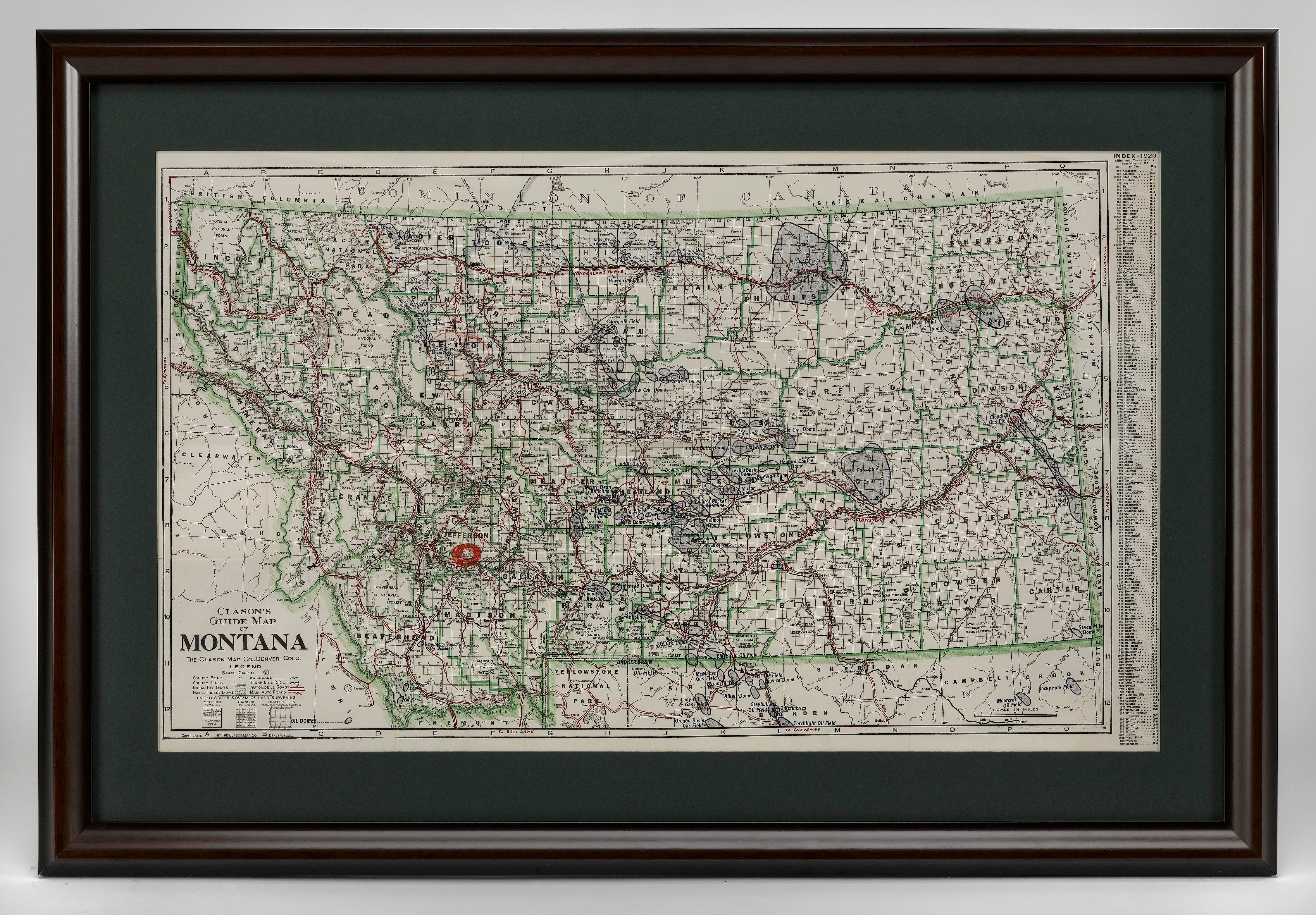
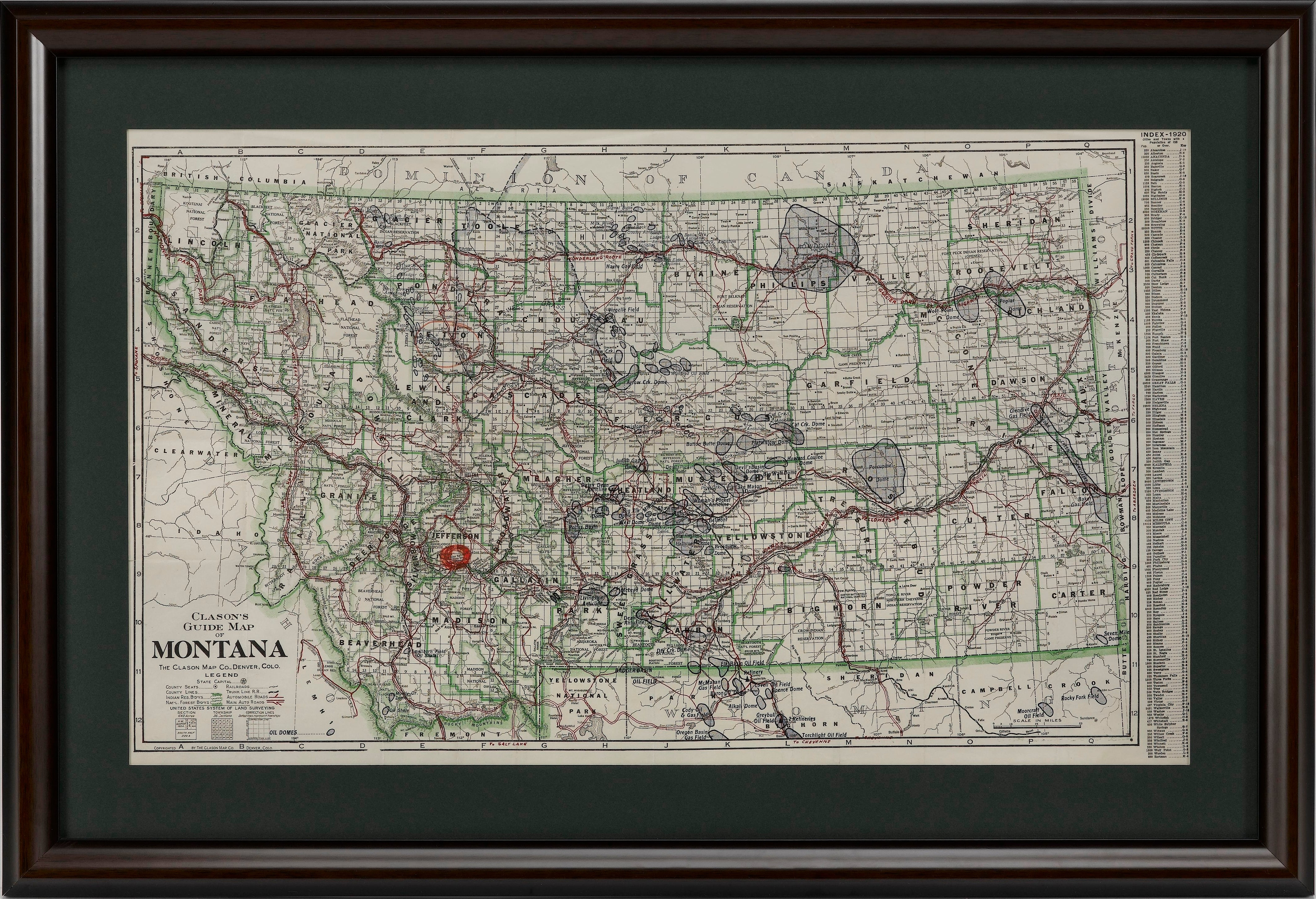
Map is archivally framed in a new, custom wooden frame with acid-free mats and UV conservation glass.
Framed Dimensions: 23 1/8" H x 33 7/8" W x 1 1/2" D.Related Items


© 2024 The Great Republic. All Right Reserved.