


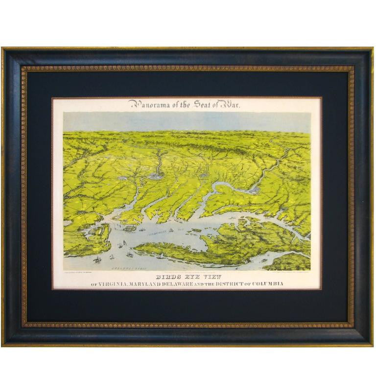
1859 "Colton's New Map of the State of Texas Compiled from De Cordova's Large Map" by Johnson & Browning
$3,500.00
Presented is "Colton's New Map of the State of Texas Compiled from De Cordova's Large Map", published in Alivin J. Johnson’s “New Illustrated Family Atlas.” The map was published in 1859, despite a plate date of 1855. This double-page map shows extensive detail throughout the settled part of the state of Texas. The western third comprises the large unsettled areas of Presidio, El Paso, Bexar, and the Staked Plain.
The map offers exceptional detail, and locates railroads, forts, post offices, roads, springs, and topographical information. Three inset maps populate the map, “Plan of the Northern Part of Texas,” “Plan of Galveston Bay from the U.S. Coast Survey,” and “Plan of Sabine Lake.” The map is surrounded by Colton's decorative scroll borders.
Alvin J. Johnson came to New York City in 1857 and worked for J. H. Colton as a book canvasser, selling maps and atlases for the well-known map and atlas publisher. In 1859, Colton’s “General Atlas” was published by the firm of Johnson & Browning, and within the year, Johnson published the first edition of his own atlas, titled “Johnson’s New Illustrated (Steel Plate) Family Atlas, With Descriptions Geographical, Statistical and Historical.” The early editions of the “Family Atlas” were comprised of maps developed by the Colton firm, and their title pages announce that the publishers, Johnson & Browning, are “formerly successors to J.H. Colton and Company.” However, rather than successor, Johnson became a competitor of the Colton firm, and the “Family Atlas” became a competitor to the atlases of both Colton and S. Augustus Mitchell.
CONDITION:
Very good condition. Full later color, still vibrant and bright. A 7" centerfold separation at the bottom has been closed on verso with archival paper tape. There is light scattered foxing and a couple of short edge tears confined to the side margins that have been closed on verso with archival tape by the previous owner.
Map has been artfully and archival presented with acid-free matting and backing, a brushed gold beaded spandrel, an olive linen top mat, UV Conservation Clear glass, and a custom-built black and brushed gold wooden frame.
Framed Dimensions: 27 3/4" H x 38 1/2" W x 1 3/8" D.
Related Items


© 2024 The Great Republic. All Right Reserved.